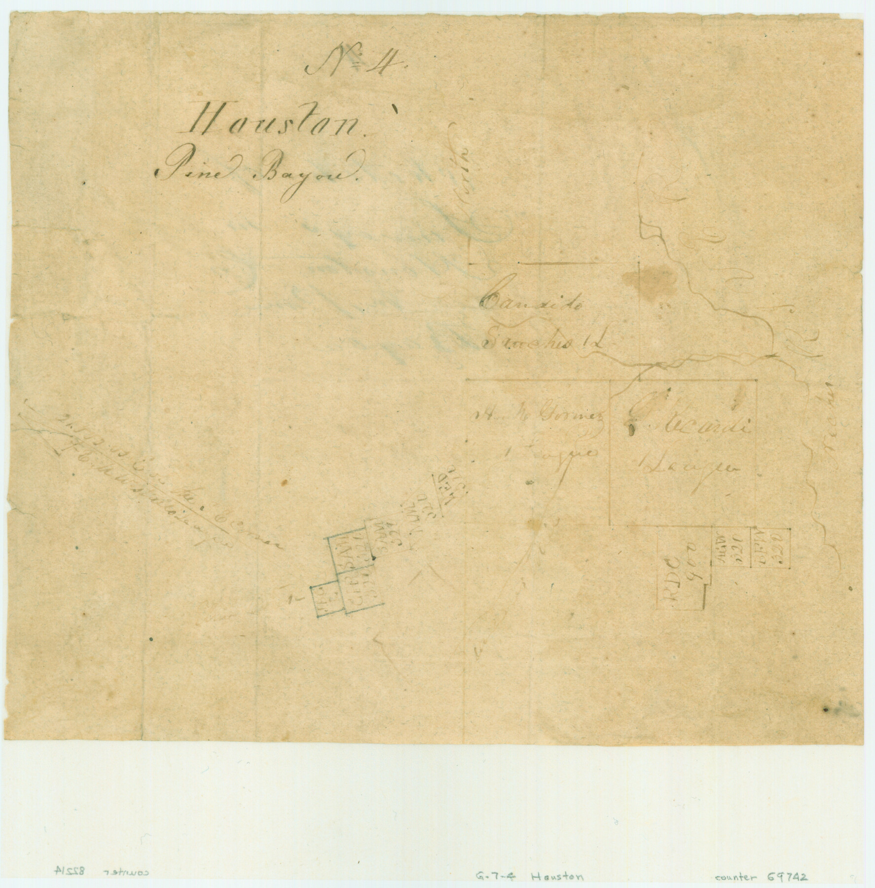
Sketch of surveys in Houston Co. on Pine Bayou
Atlas G, Page 7, Sketch 4 (G-7-4)
G-7-4
-
Map/Doc
69742
-
Collection
General Map Collection
-
Counties
Trinity
-
Subjects
Atlas
-
Height x Width
7.7 x 7.6 inches
19.6 x 19.3 cm
-
Medium
paper, manuscript
-
Comments
Conserved in 2004.
-
Features
Neches River
Cedar Creek
[Hackberry Creek]
Part of: General Map Collection
Edwards County Working Sketch 34

Print $20.00
- Digital $50.00
Edwards County Working Sketch 34
1948
Size 39.2 x 23.3 inches
Map/Doc 68910
Pecos County Rolled Sketch 27

Print $20.00
- Digital $50.00
Pecos County Rolled Sketch 27
1890
Size 32.3 x 28.3 inches
Map/Doc 7212
Jones County Working Sketch Graphic Index

Print $20.00
- Digital $50.00
Jones County Working Sketch Graphic Index
1921
Size 39.5 x 38.6 inches
Map/Doc 76599
Galveston County Rolled Sketch CCW

Print $20.00
- Digital $50.00
Galveston County Rolled Sketch CCW
1938
Size 38.4 x 39.7 inches
Map/Doc 9084
Reeves County Rolled Sketch 34

Print $20.00
- Digital $50.00
Reeves County Rolled Sketch 34
Size 35.4 x 24.1 inches
Map/Doc 78490
Duval County Sketch File 62

Print $40.00
- Digital $50.00
Duval County Sketch File 62
1941
Size 14.0 x 12.5 inches
Map/Doc 21434
San Patricio County Sketch File 20

Print $14.00
San Patricio County Sketch File 20
1868
Size 9.2 x 8.5 inches
Map/Doc 36069
Flight Mission No. BRA-7M, Frame 198, Jefferson County

Print $20.00
- Digital $50.00
Flight Mission No. BRA-7M, Frame 198, Jefferson County
1953
Size 18.7 x 22.4 inches
Map/Doc 85566

Flight Mission No. BRA-8M, Frame 24, Jefferson County

Print $20.00
- Digital $50.00
Flight Mission No. BRA-8M, Frame 24, Jefferson County
1953
Size 18.7 x 22.3 inches
Map/Doc 85579
Anderson County Sketch File 19

Print $40.00
- Digital $50.00
Anderson County Sketch File 19
Size 18.2 x 15.9 inches
Map/Doc 10802
Dépt. des Ardennes

Print $20.00
- Digital $50.00
Dépt. des Ardennes
Size 14.5 x 20.5 inches
Map/Doc 94448
You may also like
Eastland County Working Sketch 9

Print $20.00
- Digital $50.00
Eastland County Working Sketch 9
1919
Size 33.0 x 30.6 inches
Map/Doc 68790
Sketches of Surveys in Montgomery Co.

Print $2.00
- Digital $50.00
Sketches of Surveys in Montgomery Co.
1845
Size 10.2 x 8.0 inches
Map/Doc 69731
[Preliminary Drawing of School Leagues]
![89932, [Preliminary Drawing of School Leagues], Twichell Survey Records](https://historictexasmaps.com/wmedia_w700/maps/89932-1.tif.jpg)
Print $40.00
- Digital $50.00
[Preliminary Drawing of School Leagues]
Size 38.3 x 66.8 inches
Map/Doc 89932
Runnels County Working Sketch 9

Print $40.00
- Digital $50.00
Runnels County Working Sketch 9
1948
Size 48.8 x 30.1 inches
Map/Doc 69712
Nueces County Rolled Sketch 54

Print $67.00
- Digital $50.00
Nueces County Rolled Sketch 54
1978
Size 9.8 x 15.0 inches
Map/Doc 47875
Tahoka Heights Addition to Tahoka Located on the SE Quarter of Section 568

Print $20.00
- Digital $50.00
Tahoka Heights Addition to Tahoka Located on the SE Quarter of Section 568
Size 18.1 x 18.5 inches
Map/Doc 92939
Guadalupe County Sketch File 5

Print $4.00
- Digital $50.00
Guadalupe County Sketch File 5
1871
Size 8.1 x 10.0 inches
Map/Doc 24659
Plat in Pecos County, Texas

Print $20.00
- Digital $50.00
Plat in Pecos County, Texas
Size 38.7 x 37.5 inches
Map/Doc 89834

Wonderland, Randolph Place, and Deer Wood

Print $20.00
- Digital $50.00
Wonderland, Randolph Place, and Deer Wood
Size 18.9 x 24.8 inches
Map/Doc 92742
Jefferson Co.

Print $40.00
- Digital $50.00
Jefferson Co.
1978
Size 49.3 x 43.5 inches
Map/Doc 95546
El Paso County Working Sketch 13

Print $20.00
- Digital $50.00
El Paso County Working Sketch 13
1956
Size 33.4 x 39.7 inches
Map/Doc 69035