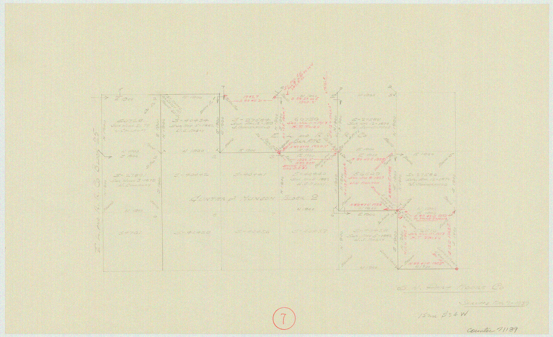
Moore County Working Sketch 7
-
Map/Doc
71189
-
Collection
General Map Collection
-
Object Dates
1939 (Creation Date)
-
People and Organizations
William Shirriffs (Draftsman)
-
Counties
Moore
-
Subjects
Surveying Working Sketch
-
Height x Width
10.8 x 17.8 inches
27.4 x 45.2 cm
Part of: General Map Collection
Pecos County Rolled Sketch 30

Print $20.00
- Digital $50.00
Pecos County Rolled Sketch 30
1890
Size 39.2 x 30.7 inches
Map/Doc 9691
Edwards County Working Sketch 63

Print $20.00
- Digital $50.00
Edwards County Working Sketch 63
1955
Size 32.5 x 46.4 inches
Map/Doc 68939
Outer Continental Shelf Leasing Maps (Louisiana Offshore Operations)

Print $20.00
- Digital $50.00
Outer Continental Shelf Leasing Maps (Louisiana Offshore Operations)
1954
Size 22.2 x 12.0 inches
Map/Doc 76096
Matagorda County Boundary File 1a

Print $8.00
- Digital $50.00
Matagorda County Boundary File 1a
Size 14.2 x 8.6 inches
Map/Doc 56889
Sutton County Rolled Sketch 55
Print $40.00
- Digital $50.00
Sutton County Rolled Sketch 55
1954
Size 37.5 x 59.0 inches
Map/Doc 9976
Flight Mission No. CRE-2R, Frame 166, Jackson County

Print $20.00
- Digital $50.00
Flight Mission No. CRE-2R, Frame 166, Jackson County
1956
Size 18.5 x 22.2 inches
Map/Doc 85376
Cherokee County Sketch File 34

Print $12.00
- Digital $50.00
Cherokee County Sketch File 34
1954
Size 11.2 x 8.9 inches
Map/Doc 18198
Culberson County Sketch File 42

Print $14.00
- Digital $50.00
Culberson County Sketch File 42
1966
Size 14.2 x 8.7 inches
Map/Doc 20322
Flight Mission No. CGI-3N, Frame 42, Cameron County

Print $20.00
- Digital $50.00
Flight Mission No. CGI-3N, Frame 42, Cameron County
1954
Size 18.5 x 22.1 inches
Map/Doc 84548
Hutchinson County Rolled Sketch 38

Print $40.00
- Digital $50.00
Hutchinson County Rolled Sketch 38
1955
Size 43.6 x 67.7 inches
Map/Doc 9248
Crockett County Sketch File A

Print $40.00
- Digital $50.00
Crockett County Sketch File A
Size 21.9 x 7.5 inches
Map/Doc 19624
Mason County Sketch File 20

Print $12.00
- Digital $50.00
Mason County Sketch File 20
1901
Size 14.0 x 8.6 inches
Map/Doc 30711
You may also like
[Sketch of Unknown Area in New Mexico]
![89816, [Sketch of Unknown Area in New Mexico], Twichell Survey Records](https://historictexasmaps.com/wmedia_w700/maps/89816-1.tif.jpg)
Print $20.00
- Digital $50.00
[Sketch of Unknown Area in New Mexico]
Size 47.2 x 37.4 inches
Map/Doc 89816
Colorado County Sketch File 6

Print $8.00
- Digital $50.00
Colorado County Sketch File 6
1860
Size 8.4 x 7.0 inches
Map/Doc 18921
Atascosa County Working Sketch 37

Print $20.00
- Digital $50.00
Atascosa County Working Sketch 37
2004
Size 23.2 x 24.1 inches
Map/Doc 89049
Flight Mission No. DQO-3K, Frame 40, Galveston County

Print $20.00
- Digital $50.00
Flight Mission No. DQO-3K, Frame 40, Galveston County
1952
Size 18.8 x 22.4 inches
Map/Doc 85081
Brewster County Rolled Sketch 101

Print $40.00
- Digital $50.00
Brewster County Rolled Sketch 101
1927
Size 74.4 x 42.4 inches
Map/Doc 9196
Matagorda Bay and Approaches

Print $20.00
- Digital $50.00
Matagorda Bay and Approaches
1976
Size 35.8 x 45.2 inches
Map/Doc 73387
Shelby County Sketch File 34

Print $3.00
- Digital $50.00
Shelby County Sketch File 34
1847
Size 10.1 x 15.7 inches
Map/Doc 36674
Hopkins County

Print $20.00
- Digital $50.00
Hopkins County
1942
Size 39.6 x 37.6 inches
Map/Doc 77315
Morris County Rolled Sketch 2A

Print $20.00
- Digital $50.00
Morris County Rolled Sketch 2A
Size 24.2 x 19.1 inches
Map/Doc 10267
La Salle County Sketch File 23

Print $40.00
- Digital $50.00
La Salle County Sketch File 23
Size 14.2 x 17.3 inches
Map/Doc 29530
Flight Mission No. DIX-7P, Frame 22, Aransas County

Print $20.00
- Digital $50.00
Flight Mission No. DIX-7P, Frame 22, Aransas County
1956
Size 18.7 x 22.5 inches
Map/Doc 83874
Smith County Working Sketch 16

Print $20.00
- Digital $50.00
Smith County Working Sketch 16
1988
Size 33.6 x 44.9 inches
Map/Doc 63901