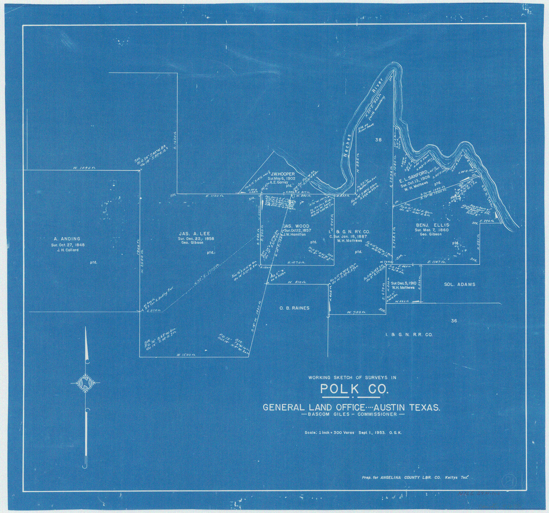
Polk County Working Sketch 21
-
Map/Doc
71636
-
Collection
General Map Collection
-
Object Dates
9/1/1953 (Creation Date)
-
People and Organizations
Otto G. Kurio (Draftsman)
-
Counties
Polk
-
Subjects
Surveying Working Sketch
-
Height x Width
22.6 x 24.2 inches
57.4 x 61.5 cm
-
Scale
1" = 300 varas
Part of: General Map Collection

Township No. 1 South Range No. 20 West of the Indian Meridian

Print $20.00
- Digital $50.00
Township No. 1 South Range No. 20 West of the Indian Meridian
1875
Size 19.3 x 24.4 inches
Map/Doc 75179
Map showing location of Texas Prison Farms surveyed for the Texas Prison System

Print $20.00
- Digital $50.00
Map showing location of Texas Prison Farms surveyed for the Texas Prison System
1934
Size 15.6 x 12.3 inches
Map/Doc 94277
Eastland County Sketch File 10

Print $42.00
- Digital $50.00
Eastland County Sketch File 10
Size 7.0 x 7.8 inches
Map/Doc 21582
El Paso County Boundary File 19

Print $9.00
- Digital $50.00
El Paso County Boundary File 19
Size 13.6 x 8.7 inches
Map/Doc 53206
Delta County Working Sketch 3

Print $20.00
- Digital $50.00
Delta County Working Sketch 3
1963
Size 24.9 x 24.4 inches
Map/Doc 68640
Coleman County Sketch File 3

Print $4.00
- Digital $50.00
Coleman County Sketch File 3
1857
Size 9.5 x 8.1 inches
Map/Doc 18670
Map of Wichita County Young Land District, formerly Fannin Land District

Print $20.00
- Digital $50.00
Map of Wichita County Young Land District, formerly Fannin Land District
1859
Size 22.4 x 20.5 inches
Map/Doc 4141
Plat Showing Theoretical Original City Limits of Corpus Christi

Print $20.00
- Digital $50.00
Plat Showing Theoretical Original City Limits of Corpus Christi
Size 41.3 x 41.7 inches
Map/Doc 4838
Schleicher County Rolled Sketch 12

Print $20.00
- Digital $50.00
Schleicher County Rolled Sketch 12
1952
Size 28.8 x 29.0 inches
Map/Doc 7755
Mineral Plats - El Paso to Ward Co. and River Beds

Mineral Plats - El Paso to Ward Co. and River Beds
Map/Doc 81746
Liberty County Rolled Sketch 15

Print $20.00
- Digital $50.00
Liberty County Rolled Sketch 15
2015
Size 36.1 x 24.3 inches
Map/Doc 94022
You may also like
Pecos County Working Sketch 39

Print $20.00
- Digital $50.00
Pecos County Working Sketch 39
1940
Size 37.5 x 37.6 inches
Map/Doc 71511
Gray County Boundary File 2

Print $8.00
- Digital $50.00
Gray County Boundary File 2
Size 14.2 x 8.6 inches
Map/Doc 53850
Harrison County Rolled Sketch 4

Print $20.00
- Digital $50.00
Harrison County Rolled Sketch 4
1938
Size 28.2 x 34.9 inches
Map/Doc 6150
Plat Showing Survey for Harvest Queen Mills in Sec. 2 Blk. A & Sec. 4 Blk. O Lubbock County, Texas

Print $20.00
- Digital $50.00
Plat Showing Survey for Harvest Queen Mills in Sec. 2 Blk. A & Sec. 4 Blk. O Lubbock County, Texas
1956
Size 36.9 x 39.5 inches
Map/Doc 89893
Nueces County Rolled Sketch 129 A-C

Print $6.00
- Digital $50.00
Nueces County Rolled Sketch 129 A-C
1998
Size 11.2 x 8.8 inches
Map/Doc 41616
Jackson County Aerial Photograph Index Sheet 6

Print $20.00
- Digital $50.00
Jackson County Aerial Photograph Index Sheet 6
1956
Size 21.2 x 15.7 inches
Map/Doc 83705
Pecos County Rolled Sketch 62

Print $20.00
- Digital $50.00
Pecos County Rolled Sketch 62
1927
Size 44.2 x 39.4 inches
Map/Doc 9698
Adrian Heights Adition (sic) to Adrian Located in Section 16, Block K11

Print $2.00
- Digital $50.00
Adrian Heights Adition (sic) to Adrian Located in Section 16, Block K11
Size 15.6 x 7.6 inches
Map/Doc 92097
Kendall County

Print $20.00
- Digital $50.00
Kendall County
1946
Size 40.8 x 35.4 inches
Map/Doc 73203
Flight Mission No. DQO-11K, Frame 15, Galveston County

Print $20.00
- Digital $50.00
Flight Mission No. DQO-11K, Frame 15, Galveston County
1952
Size 18.7 x 22.3 inches
Map/Doc 85208
Culberson County Sketch File 43

Print $4.00
- Digital $50.00
Culberson County Sketch File 43
1931
Size 8.9 x 11.1 inches
Map/Doc 20329
Kinney County Working Sketch 40

Print $20.00
- Digital $50.00
Kinney County Working Sketch 40
1972
Size 30.7 x 34.1 inches
Map/Doc 70222