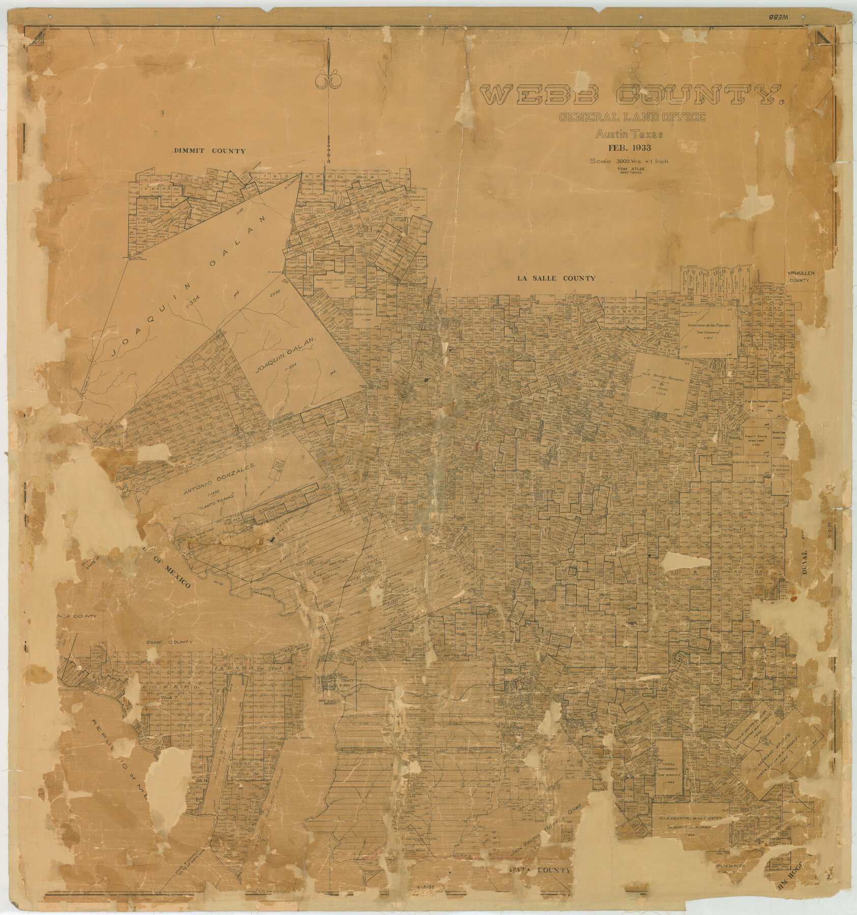
Webb County
K-5-35
-
Map/Doc
78443
-
Collection
General Map Collection
-
Object Dates
1933 (Creation Date)
-
People and Organizations
Texas General Land Office (Publisher)
Tom G. Atlee (Compiler)
Tom G. Atlee (Draftsman)
-
Counties
Webb
-
Subjects
County
-
Height x Width
55.0 x 51.5 inches
139.7 x 130.8 cm
-
Comments
Note on back: Replaced by copy Sept. 8, 1947".
Help Save Texas History - Adopt Me! -
Features
San Casimiro Creek
Los Cristales Creek
El Venado Creek
Abra Bonita Creek
La Espada Creek
Serrito Prieto
San Pedro Hill
La Moca Creek
Serrita Chequita Creek
Callaghan
Cactus
Rancherias Creek
La Volanta Creek
Salado Creek
El Suisache Creek
Tanquecillos Creek
Webb
Tordillo Creek
Tejones Creek
Santa Isabel Creek
Zacatosa Creek
Santo Tomas
Cannel Darwin Post Office
Dolores
Ortagilla Creek
Branch of Charco Escondido
El Gato Creek
Arroyo Abra de Vela
Orvil
Sanchez Hill Spur
Rio Grande
Sada
El Chacon Creek
Arroyo de San Ignacio
Carrecitos Creek
Sanchez
Davis
Nye
Love
Chapadera Creek
Ambrosia Creek
San Pedro Creek
Laredo
Zocata Creek
Torrecillas
Oilton
San Juanito Creek
Loma Alta Mountain
Bruni
Arroyo de Los Angelos
El Lobo Creek
Derrymadero del Carba Creek
Arroyo Serrito Prieto
Agua Azul Creek
Las Meritas Creek
Lakoya Creek
El Sauz Creek
Becerra Creek
Rio Grande City Railroad
El Espejo Creek
San Cerildo Creek
La Posada Creek
Pilotes Creek
Canada de San Andres Creek
El Saez Creek
Las Blancas Creek
Laguna de Hilario
Laguna Zacatan
El Amuc
El Piloncillo
Las Raices Creek
Los Dos Hermanos
Nueces River
Charamusco Creek
Prieto Creek
Palito Blanco Creek
Encinal
Jaboncillos Creek
Vidales
Los Olmos Creek
Magueyitos Creek
Magueyitos Hill
Cochipa Creek
La Parida Creek
Baranquitas Creek
Las Pintas Creek
Rodriguez
Tinaja Escondido Creek
Buena Vista Creek
Ramberias Creek
Alamito Creek
Carrizitos Creek
Llave Creek
Saucillo Creek
Santo Tomas Creek
Charco
Ventura Creek
Navajo Creek
[ ] Pato Creek
Arroyo del Relacion
El Salado Creek
San Isabel
Leyendecker
Telitas
Simon
Joyce Post Office
Jacalon Hill
Petscadito
Reiser
Arroyo del Guarmito
Lorenz Creek
Arroyo Jobero
Laguna del Javali
Arroyo Becerrit
La Bibora [Creek]
Dolores Creek
Part of: General Map Collection
Goliad County Sketch File 8

Print $4.00
- Digital $50.00
Goliad County Sketch File 8
1848
Size 9.0 x 11.1 inches
Map/Doc 24221
Current Miscellaneous File 4

Print $8.00
- Digital $50.00
Current Miscellaneous File 4
1947
Size 11.5 x 9.1 inches
Map/Doc 73723
Hardeman County

Print $20.00
- Digital $50.00
Hardeman County
1935
Size 44.4 x 41.4 inches
Map/Doc 73170

Upton County Working Sketch 60

Print $20.00
- Digital $50.00
Upton County Working Sketch 60
2012
Size 34.2 x 32.1 inches
Map/Doc 93387
Dimmit County Rolled Sketch 10

Print $20.00
- Digital $50.00
Dimmit County Rolled Sketch 10
1941
Size 29.2 x 32.1 inches
Map/Doc 5719
Howard County Sketch File A

Print $44.00
- Digital $50.00
Howard County Sketch File A
Size 7.2 x 7.6 inches
Map/Doc 26837
Gaines County Working Sketch 34

Print $20.00
- Digital $50.00
Gaines County Working Sketch 34
1990
Size 21.0 x 20.2 inches
Map/Doc 69334
Culberson County Working Sketch 36

Print $20.00
- Digital $50.00
Culberson County Working Sketch 36
1964
Size 20.8 x 24.4 inches
Map/Doc 68489
Midland County Sketch File 13

Print $4.00
- Digital $50.00
Midland County Sketch File 13
1940
Size 11.2 x 8.7 inches
Map/Doc 31576
Liberty County Sketch File 11

Print $6.00
- Digital $50.00
Liberty County Sketch File 11
1858
Size 11.8 x 10.0 inches
Map/Doc 29905
Brewster County Sketch File N-23

Print $6.00
- Digital $50.00
Brewster County Sketch File N-23
1951
Size 14.4 x 9.0 inches
Map/Doc 15697
You may also like
Tarrant County Working Sketch 11

Print $20.00
- Digital $50.00
Tarrant County Working Sketch 11
1986
Size 42.5 x 32.6 inches
Map/Doc 62428
Runnels County Working Sketch 15

Print $20.00
- Digital $50.00
Runnels County Working Sketch 15
1950
Size 22.8 x 18.5 inches
Map/Doc 63611
Right of Way and Track Map, International & Gt. Northern Ry. operated by the International & Gt. Northern Ry. Co. Gulf Division, Mineola Branch

Print $40.00
- Digital $50.00
Right of Way and Track Map, International & Gt. Northern Ry. operated by the International & Gt. Northern Ry. Co. Gulf Division, Mineola Branch
1917
Size 27.8 x 118.1 inches
Map/Doc 64704
Runnels County

Print $20.00
- Digital $50.00
Runnels County
1948
Size 46.5 x 36.4 inches
Map/Doc 77411
Concho County Working Sketch 21

Print $20.00
- Digital $50.00
Concho County Working Sketch 21
1957
Size 36.4 x 36.0 inches
Map/Doc 68203
Deaf Smith County Sketch File 1b

Print $24.00
- Digital $50.00
Deaf Smith County Sketch File 1b
1902
Size 11.3 x 8.9 inches
Map/Doc 20627
Concho County Sketch File 39

Print $8.00
- Digital $50.00
Concho County Sketch File 39
1949
Size 11.3 x 8.8 inches
Map/Doc 19190
Plat of the Resubdivision of the Abandoned Townsite of Eschiti, Oklahoma

Print $4.00
- Digital $50.00
Plat of the Resubdivision of the Abandoned Townsite of Eschiti, Oklahoma
1907
Size 18.1 x 24.3 inches
Map/Doc 75150
[Sketch for Mineral Application 26543 - Sabine River, D. H. Sanford]
![65678, [Sketch for Mineral Application 26543 - Sabine River, D. H. Sanford], General Map Collection](https://historictexasmaps.com/wmedia_w700/maps/65678.tif.jpg)
Print $40.00
- Digital $50.00
[Sketch for Mineral Application 26543 - Sabine River, D. H. Sanford]
1931
Size 73.0 x 30.3 inches
Map/Doc 65678
Current Miscellaneous File 85

Print $10.00
- Digital $50.00
Current Miscellaneous File 85
Size 11.3 x 8.8 inches
Map/Doc 74235
San Jacinto County Boundary File 1

Print $6.00
- Digital $50.00
San Jacinto County Boundary File 1
Size 9.6 x 8.4 inches
Map/Doc 58548
Floyd County Sketch File 8

Print $40.00
- Digital $50.00
Floyd County Sketch File 8
1878
Map/Doc 93784