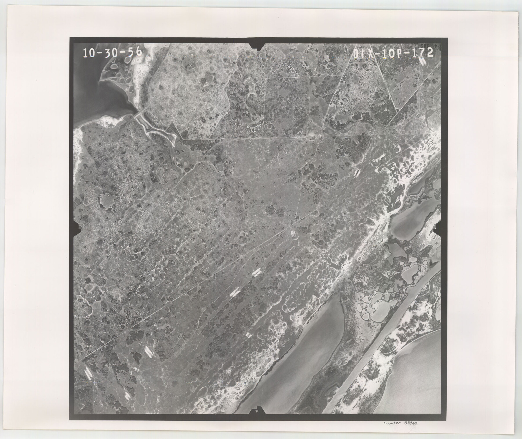
Flight Mission No. DIX-10P, Frame 172, Aransas County
DIX-10P-172
- 
                          Map/Doc83962
- 
                            CollectionGeneral Map Collection
- 
                            Object Dates1956/10/30 (Creation Date)
- 
                            People and OrganizationsU. S. Department of Agriculture (Publisher)
- 
                            CountiesAransas
- 
                            SubjectsAerial Photograph
- 
                            Height x Width18.8 x 22.3 inches47.8 x 56.6 cm
- 
                            CommentsFlown by V. L. Beavers and Associates of San Antonio, Texas.
Part of: General Map Collection
            Brewster County Rolled Sketch 114


                                            Print $20.00                    
                                             -                         Digital $50.00                                    
                Brewster County Rolled Sketch 114
1964
Size 11.7 x 17.7 inches
                                Map/Doc 5281
            
            Nacogdoches County Sketch File 5


                                            Print $4.00                    
                                             -                         Digital $50.00                                    
                Nacogdoches County Sketch File 5
1859
Size 12.6 x 8.1 inches
                                Map/Doc 32243
            
            Fisher County Sketch File 11


                                            Print $20.00                    
                                             -                         Digital $50.00                                    
                Fisher County Sketch File 11
Size 22.8 x 20.4 inches
                                Map/Doc 11478
            
            Duval County Working Sketch 24


                                            Print $20.00                    
                                             -                         Digital $50.00                                    
                Duval County Working Sketch 24
1944
Size 40.0 x 27.3 inches
                                Map/Doc 68748
            
            Jackson County Rolled Sketch 6


                                            Print $20.00                    
                                             -                         Digital $50.00                                    
                Jackson County Rolled Sketch 6
1914
Size 23.6 x 26.6 inches
                                Map/Doc 6341
            
            Brazoria County Sketch File 46


                                            Print $48.00                    
                                             -                         Digital $50.00                                    
                Brazoria County Sketch File 46
1925
Size 14.3 x 8.8 inches
                                Map/Doc 15082
            
            1988 Land Use - El Paso, Ciudad Juarez and Vicinity


                                            Print $20.00                    
                                             -                         Digital $50.00                                    
                1988 Land Use - El Paso, Ciudad Juarez and Vicinity
1988
Size 34.1 x 25.0 inches
                                Map/Doc 87370
            
            Castro County Sketch File 13


                                            Print $4.00                    
                                             -                         Digital $50.00                                    
                Castro County Sketch File 13
1962
Size 14.1 x 8.6 inches
                                Map/Doc 17509
            
            Coke County Rolled Sketch 19


                                            Print $20.00                    
                                             -                         Digital $50.00                                    
                Coke County Rolled Sketch 19
1954
Size 18.5 x 25.8 inches
                                Map/Doc 5519
            
            Travis County Working Sketch Graphic Index - north part


                                            Print $40.00                    
                                             -                         Digital $50.00                                    
                Travis County Working Sketch Graphic Index - north part
1936
Size 43.0 x 53.2 inches
                                Map/Doc 76717
            
            [Sketch for Mineral Application 26501 - Sabine River, T. A. Oldhausen]
            
                                    ![2836, [Sketch for Mineral Application 26501 - Sabine River, T. A. Oldhausen], General Map Collection](https://historictexasmaps.com/wmedia_w700/maps/2836.tif.jpg) 


    ![2836, [Sketch for Mineral Application 26501 - Sabine River, T. A. Oldhausen], General Map Collection](https://historictexasmaps.com/wmedia_w700/maps/2836.tif.jpg) 
                                
            
                                            Print $20.00                    
                                             -                         Digital $50.00                                    
                [Sketch for Mineral Application 26501 - Sabine River, T. A. Oldhausen]
1931
Size 24.4 x 36.5 inches
                                Map/Doc 2836
            
            Jasper County Rolled Sketch 5


                                            Print $20.00                    
                                             -                         Digital $50.00                                    
                Jasper County Rolled Sketch 5
1948
Size 29.0 x 24.4 inches
                                Map/Doc 6352
            You may also like
            Atascosa County Working Sketch 32


                                            Print $20.00                    
                                             -                         Digital $50.00                                    
                Atascosa County Working Sketch 32
1981
Size 12.9 x 11.8 inches
                                Map/Doc 67228
            
            [Area to the West and North of the Abraham Winfrey survey 11]
            
                                    ![90228, [Area to the West and North of the Abraham Winfrey survey 11], Twichell Survey Records](https://historictexasmaps.com/wmedia_w700/maps/90228-1.tif.jpg) 


    ![90228, [Area to the West and North of the Abraham Winfrey survey 11], Twichell Survey Records](https://historictexasmaps.com/wmedia_w700/maps/90228-1.tif.jpg) 
                                
            
                                            Print $20.00                    
                                             -                         Digital $50.00                                    
                [Area to the West and North of the Abraham Winfrey survey 11]
1920
Size 23.2 x 24.1 inches
                                Map/Doc 90228
            
            [Sketch showing parts of H. & G. N. RR. Co. Blocks 7 and 8, K. Aycock Block 4, G. H. & H. RR. Co. Block 5 and various surveys west]
            
                                    ![90871, [Sketch showing parts of H. & G. N. RR. Co. Blocks 7 and 8, K. Aycock Block 4, G. H. & H. RR. Co. Block 5 and various surveys west], Twichell Survey Records](https://historictexasmaps.com/wmedia_w700/maps/90871-2.tif.jpg) 


    ![90871, [Sketch showing parts of H. & G. N. RR. Co. Blocks 7 and 8, K. Aycock Block 4, G. H. & H. RR. Co. Block 5 and various surveys west], Twichell Survey Records](https://historictexasmaps.com/wmedia_w700/maps/90871-2.tif.jpg) 
                                
            
                                            Print $20.00                    
                                             -                         Digital $50.00                                    
                [Sketch showing parts of H. & G. N. RR. Co. Blocks 7 and 8, K. Aycock Block 4, G. H. & H. RR. Co. Block 5 and various surveys west]
1902
Size 25.5 x 17.3 inches
                                Map/Doc 90871
            
            Tyler County Working Sketch 19


                                            Print $20.00                    
                                             -                         Digital $50.00                                    
                Tyler County Working Sketch 19
1967
Size 47.8 x 42.9 inches
                                Map/Doc 69489
            
            Provincias internas del Reyno de Nuevo España


                                            Print $20.00                    
                                    
                Provincias internas del Reyno de Nuevo España
1790
Size 31.0 x 24.0 inches
                                Map/Doc 95313
            
            Pecos County Sketch File 108


                                            Print $4.00                    
                                             -                         Digital $50.00                                    
                Pecos County Sketch File 108
1974
Size 14.3 x 8.6 inches
                                Map/Doc 34037
            
            Anderson County Sketch File 11a


                                            Print $6.00                    
                                             -                         Digital $50.00                                    
                Anderson County Sketch File 11a
1854
Size 8.2 x 8.2 inches
                                Map/Doc 12768
            
            Parker County Sketch File 8


                                            Print $6.00                    
                                             -                         Digital $50.00                                    
                Parker County Sketch File 8
1859
Size 11.0 x 11.5 inches
                                Map/Doc 33536
            
            Lynn County Sketch File 18


                                            Print $4.00                    
                                             -                         Digital $50.00                                    
                Lynn County Sketch File 18
1940
Size 11.2 x 8.8 inches
                                Map/Doc 30514
            
            Burnet County Rolled Sketch 2


                                            Print $20.00                    
                                             -                         Digital $50.00                                    
                Burnet County Rolled Sketch 2
1948
Size 15.5 x 30.5 inches
                                Map/Doc 5354
            
            [Leagues 11 and 22]
            
                                    ![91111, [Leagues 11 and 22], Twichell Survey Records](https://historictexasmaps.com/wmedia_w700/maps/91111-1.tif.jpg) 


    ![91111, [Leagues 11 and 22], Twichell Survey Records](https://historictexasmaps.com/wmedia_w700/maps/91111-1.tif.jpg) 
                                
            
                                            Print $20.00                    
                                             -                         Digital $50.00                                    
                [Leagues 11 and 22]
1925
Size 14.0 x 13.6 inches
                                Map/Doc 91111
            
            DeWitt County Rolled Sketch 3


                                            Print $20.00                    
                                             -                         Digital $50.00                                    
                DeWitt County Rolled Sketch 3
1950
Size 19.9 x 37.8 inches
                                Map/Doc 5703
            