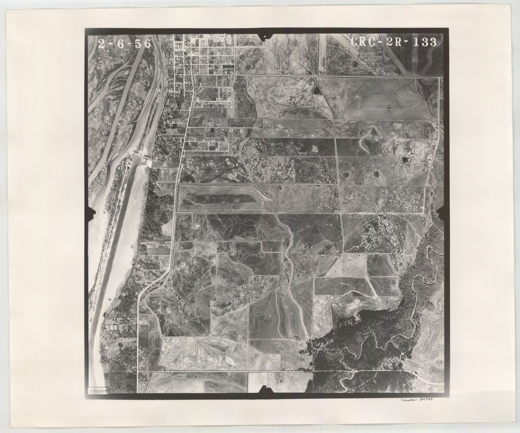
Flight Mission No. CRC-2R, Frame 133, Chambers County
CRC-2R-133
-
Map/Doc
84749
-
Collection
General Map Collection
-
Object Dates
1956/2/6 (Creation Date)
-
People and Organizations
U. S. Department of Agriculture (Publisher)
-
Counties
Chambers
-
Subjects
Aerial Photograph
-
Height x Width
18.7 x 22.5 inches
47.5 x 57.2 cm
-
Comments
Flown by Jack Ammann Photogrammetric Engineers, Inc. of San Antonio, Texas.
Part of: General Map Collection
Trinity County Sketch File 34

Print $20.00
- Digital $50.00
Trinity County Sketch File 34
Size 15.9 x 20.3 inches
Map/Doc 12491
Flight Mission No. DQN-1K, Frame 134, Calhoun County

Print $20.00
- Digital $50.00
Flight Mission No. DQN-1K, Frame 134, Calhoun County
1953
Size 18.5 x 22.2 inches
Map/Doc 84197
Val Verde County Working Sketch 120

Print $40.00
- Digital $50.00
Val Verde County Working Sketch 120
2005
Size 30.7 x 50.0 inches
Map/Doc 83589
Erath County Sketch File 32

Print $8.00
- Digital $50.00
Erath County Sketch File 32
1936
Size 11.5 x 8.8 inches
Map/Doc 22311
Reeves County Working Sketch 45

Print $20.00
- Digital $50.00
Reeves County Working Sketch 45
1974
Size 46.9 x 32.3 inches
Map/Doc 63488
Parmer County

Print $20.00
- Digital $50.00
Parmer County
1926
Size 43.9 x 35.4 inches
Map/Doc 73259
Presidio County Rolled Sketch 65

Print $20.00
- Digital $50.00
Presidio County Rolled Sketch 65
Size 23.1 x 28.3 inches
Map/Doc 7356
Kinney County Rolled Sketch 3

Print $20.00
- Digital $50.00
Kinney County Rolled Sketch 3
Size 31.4 x 23.2 inches
Map/Doc 6535
McMullen County Working Sketch 53

Print $20.00
- Digital $50.00
McMullen County Working Sketch 53
1983
Size 18.1 x 18.7 inches
Map/Doc 70754
Gregg County Rolled Sketch 15

Print $40.00
- Digital $50.00
Gregg County Rolled Sketch 15
1941
Size 42.7 x 57.1 inches
Map/Doc 9066
Flight Mission No. DQN-7K, Frame 32, Calhoun County

Print $20.00
- Digital $50.00
Flight Mission No. DQN-7K, Frame 32, Calhoun County
1953
Size 18.6 x 22.2 inches
Map/Doc 84470

You may also like
Coryell County Sketch File 8

Print $6.00
- Digital $50.00
Coryell County Sketch File 8
1853
Size 16.0 x 10.2 inches
Map/Doc 19357
Jack County Sketch File 16

Print $4.00
- Digital $50.00
Jack County Sketch File 16
1877
Size 7.9 x 12.8 inches
Map/Doc 27549
[Right of Way & Track Map, The Texas & Pacific Ry. Co. Main Line]
![64676, [Right of Way & Track Map, The Texas & Pacific Ry. Co. Main Line], General Map Collection](https://historictexasmaps.com/wmedia_w700/maps/64676.tif.jpg)
Print $20.00
- Digital $50.00
[Right of Way & Track Map, The Texas & Pacific Ry. Co. Main Line]
Size 11.0 x 18.6 inches
Map/Doc 64676
Bell County Working Sketch 16

Print $20.00
- Digital $50.00
Bell County Working Sketch 16
1983
Size 46.5 x 35.4 inches
Map/Doc 67356
Palo Pinto County Boundary File 4

Print $17.00
- Digital $50.00
Palo Pinto County Boundary File 4
Size 9.0 x 8.4 inches
Map/Doc 57811
San Jacinto County Rolled Sketch 12

Print $20.00
- Digital $50.00
San Jacinto County Rolled Sketch 12
1948
Size 24.2 x 32.5 inches
Map/Doc 7561
Jefferson County Rolled Sketch 46

Print $3.00
- Digital $50.00
Jefferson County Rolled Sketch 46
Size 15.7 x 10.0 inches
Map/Doc 9304
Map of Garza County, Texas

Print $20.00
- Digital $50.00
Map of Garza County, Texas
1936
Size 28.8 x 36.5 inches
Map/Doc 92650
Presidio County Working Sketch 127

Print $20.00
- Digital $50.00
Presidio County Working Sketch 127
1987
Size 42.8 x 29.5 inches
Map/Doc 71805
Runnels County Sketch File 36

Print $20.00
Runnels County Sketch File 36
1889
Size 20.9 x 19.6 inches
Map/Doc 12267
Sutton County Working Sketch Graphic Index, Sheet 2 (Sketches 25 to Most Recent)

Print $40.00
- Digital $50.00
Sutton County Working Sketch Graphic Index, Sheet 2 (Sketches 25 to Most Recent)
1941
Size 41.2 x 55.2 inches
Map/Doc 76706
Jackson County Working Sketch 12

Print $20.00
- Digital $50.00
Jackson County Working Sketch 12
Size 31.2 x 33.0 inches
Map/Doc 66460