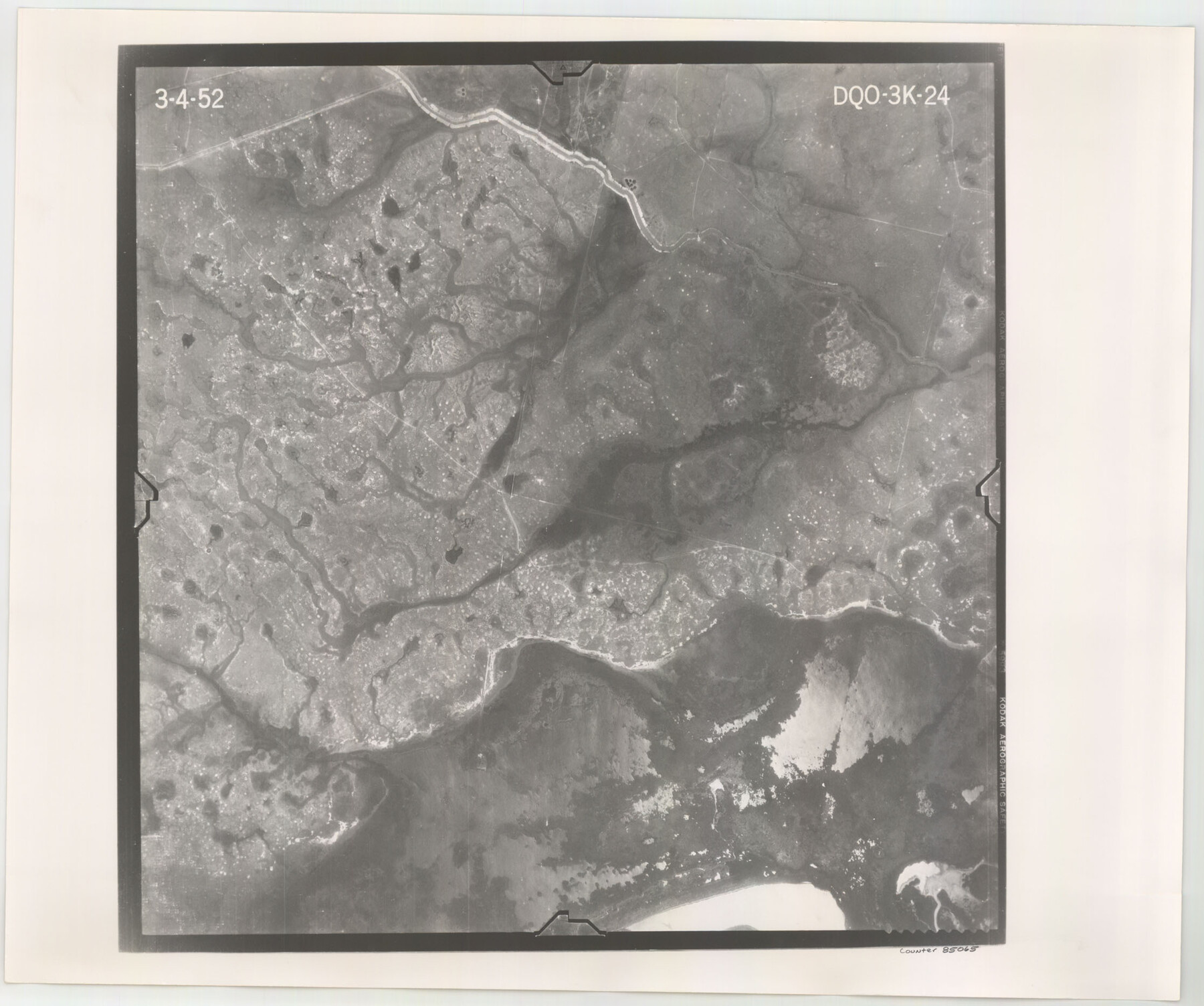
Flight Mission No. DQO-3K, Frame 24, Galveston County
DQO-3K-24
-
Map/Doc
85065
-
Collection
General Map Collection
-
Object Dates
1952/3/4 (Creation Date)
-
People and Organizations
U. S. Department of Agriculture (Publisher)
-
Counties
Galveston
-
Subjects
Aerial Photograph
-
Height x Width
18.7 x 22.4 inches
47.5 x 56.9 cm
-
Comments
Flown by Aero Exploration Company of Tulsa, Oklahoma.
Part of: General Map Collection
Baylor County Boundary File 2

Print $44.00
- Digital $50.00
Baylor County Boundary File 2
Size 8.9 x 25.9 inches
Map/Doc 50359
Map showing lands acquired for reservoir purposes in connection with Lake Worth and the boundary of territory annexed to the City of Fort Worth, Texas

Print $40.00
- Digital $50.00
Map showing lands acquired for reservoir purposes in connection with Lake Worth and the boundary of territory annexed to the City of Fort Worth, Texas
Size 46.4 x 58.9 inches
Map/Doc 62209
Titus County Sketch File 14

Print $4.00
- Digital $50.00
Titus County Sketch File 14
Size 9.7 x 8.3 inches
Map/Doc 38157
Go Turnpike! Dallas-Fort Worth Turnpike (Recto)

Go Turnpike! Dallas-Fort Worth Turnpike (Recto)
1963
Size 11.2 x 17.2 inches
Map/Doc 94177
A Map of the Indian Territory, Northern Texas and New Mexico Showing the Great Western Prairies

Print $20.00
- Digital $50.00
A Map of the Indian Territory, Northern Texas and New Mexico Showing the Great Western Prairies
1844
Size 14.0 x 17.6 inches
Map/Doc 95700
Live Oak County Sketch File 24

Print $20.00
- Digital $50.00
Live Oak County Sketch File 24
1912
Size 20.0 x 19.6 inches
Map/Doc 12010
Atascosa County Working Sketch 9

Print $20.00
- Digital $50.00
Atascosa County Working Sketch 9
1914
Size 16.5 x 14.6 inches
Map/Doc 67205
Wilson County Sketch File 8

Print $8.00
- Digital $50.00
Wilson County Sketch File 8
1879
Size 10.4 x 8.2 inches
Map/Doc 40413
Gregg County Rolled Sketch 20

Print $20.00
- Digital $50.00
Gregg County Rolled Sketch 20
1957
Size 34.0 x 44.4 inches
Map/Doc 9070
Pecos County Sketch File 29b

Print $12.00
- Digital $50.00
Pecos County Sketch File 29b
1929
Size 14.3 x 8.8 inches
Map/Doc 33692
Map of Baylor County Young Land District, formely Fannin District

Print $20.00
- Digital $50.00
Map of Baylor County Young Land District, formely Fannin District
1859
Size 25.8 x 20.0 inches
Map/Doc 3281
Lampasas County Rolled Sketch 3

Print $20.00
- Digital $50.00
Lampasas County Rolled Sketch 3
Size 43.8 x 33.9 inches
Map/Doc 9554
You may also like
Eastland County Working Sketch 40

Print $20.00
- Digital $50.00
Eastland County Working Sketch 40
1970
Size 27.9 x 26.0 inches
Map/Doc 68821
Texas Intracoastal Waterway - Matagorda Bay, Cedar Lakes to Oyster Lake

Print $20.00
- Digital $50.00
Texas Intracoastal Waterway - Matagorda Bay, Cedar Lakes to Oyster Lake
1956
Size 27.3 x 38.9 inches
Map/Doc 73367
Kinney County Rolled Sketch 4

Print $20.00
- Digital $50.00
Kinney County Rolled Sketch 4
Size 20.8 x 25.0 inches
Map/Doc 7723
Ward County Sketch File L

Print $20.00
- Digital $50.00
Ward County Sketch File L
Size 23.8 x 29.6 inches
Map/Doc 12601
Flight Mission No. DQN-2K, Frame 115, Calhoun County

Print $20.00
- Digital $50.00
Flight Mission No. DQN-2K, Frame 115, Calhoun County
1953
Size 18.6 x 22.3 inches
Map/Doc 84291
San Patricio County Working Sketch 2

Print $20.00
- Digital $50.00
San Patricio County Working Sketch 2
1911
Size 18.6 x 15.1 inches
Map/Doc 63764
Cameron County Rolled Sketch 18

Print $64.00
- Digital $50.00
Cameron County Rolled Sketch 18
1970
Size 48.9 x 57.1 inches
Map/Doc 8571
Falls County Sketch File 14

Print $40.00
- Digital $50.00
Falls County Sketch File 14
Size 15.9 x 12.9 inches
Map/Doc 22370
Working Sketch in Randall and Swisher Cos.

Print $20.00
- Digital $50.00
Working Sketch in Randall and Swisher Cos.
1917
Size 14.6 x 36.3 inches
Map/Doc 93048
Amistad International Reservoir on Rio Grande 72a

Print $20.00
- Digital $50.00
Amistad International Reservoir on Rio Grande 72a
1949
Size 28.3 x 39.6 inches
Map/Doc 73361
Castro County Sketch File 4g

Print $4.00
- Digital $50.00
Castro County Sketch File 4g
Size 12.0 x 8.9 inches
Map/Doc 17477
Part of Garza, Crosby, Lynn, and Lubbock Counties

Print $20.00
- Digital $50.00
Part of Garza, Crosby, Lynn, and Lubbock Counties
1912
Size 39.6 x 26.0 inches
Map/Doc 92560