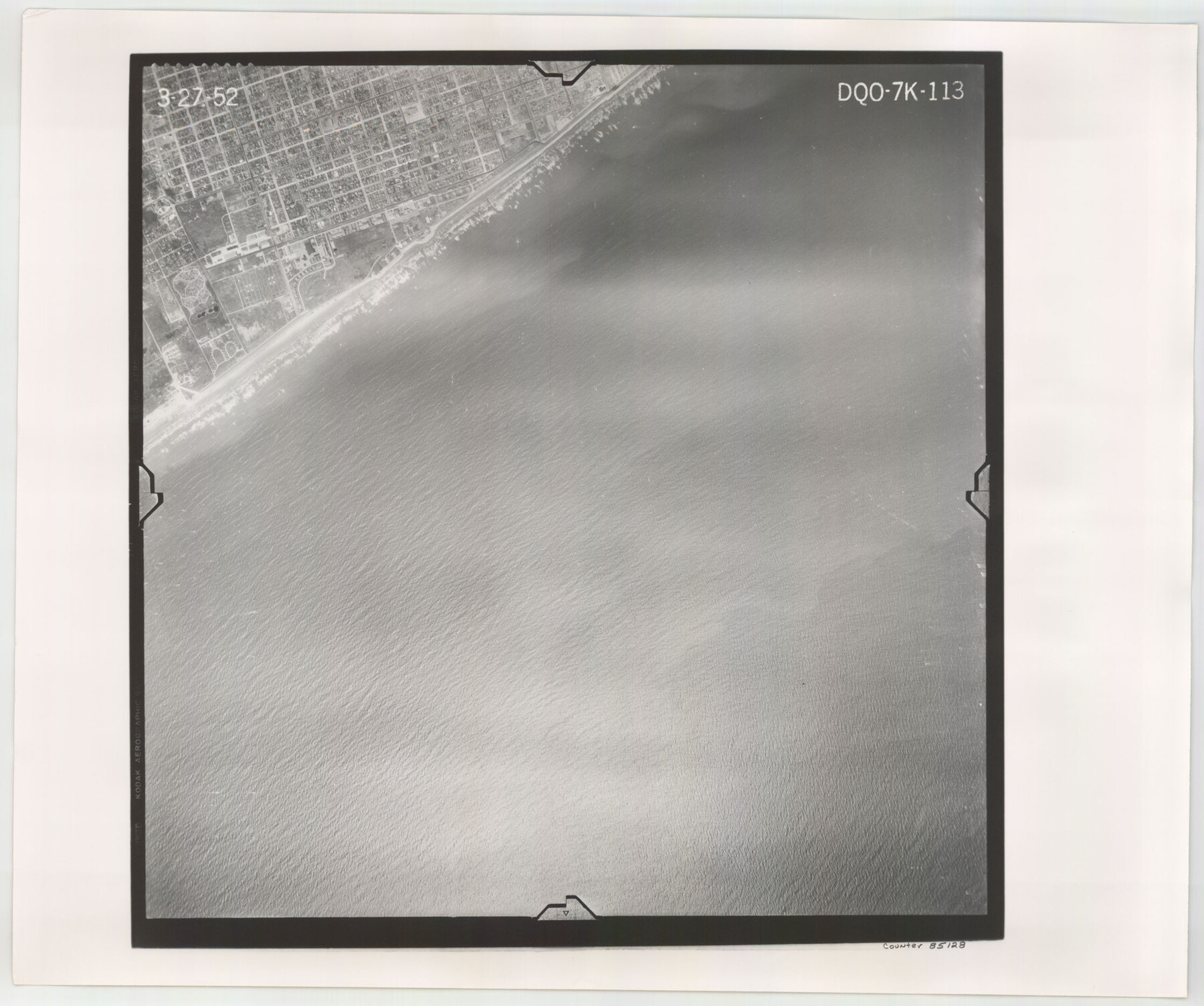
Flight Mission No. DQO-7K, Frame 113, Galveston County
DQO-7K-113
-
Map/Doc
85128
-
Collection
General Map Collection
-
Object Dates
1952/3/27 (Creation Date)
-
People and Organizations
U. S. Department of Agriculture (Publisher)
-
Counties
Galveston
-
Subjects
Aerial Photograph
-
Height x Width
18.7 x 22.3 inches
47.5 x 56.6 cm
-
Comments
Flown by Aero Exploration Company of Tulsa, Oklahoma.
Part of: General Map Collection
Brewster County Working Sketch 57
![67658, Brewster County Working Sketch 57, General Map Collection](https://historictexasmaps.com/wmedia_w700/maps/67658.tif.jpg)
Print $20.00
- Digital $50.00
Brewster County Working Sketch 57
Size 19.6 x 20.8 inches
Map/Doc 67658
New Map of Greater San Antonio
![95954, New Map of Greater San Antonio, General Map Collection - 1](https://historictexasmaps.com/wmedia_w700/maps/95954.tif.jpg)
Print $20.00
- Digital $50.00
New Map of Greater San Antonio
1941
Size 24.5 x 19.7 inches
Map/Doc 95954
United States - Gulf Coast - Padre I. and Laguna Madre Lat. 27° 12' to Lat. 26° 33' Texas
![72818, United States - Gulf Coast - Padre I. and Laguna Madre Lat. 27° 12' to Lat. 26° 33' Texas, General Map Collection](https://historictexasmaps.com/wmedia_w700/maps/72818.tif.jpg)
Print $20.00
- Digital $50.00
United States - Gulf Coast - Padre I. and Laguna Madre Lat. 27° 12' to Lat. 26° 33' Texas
1913
Size 27.1 x 18.3 inches
Map/Doc 72818
Pecos County Sketch File 90
![12183, Pecos County Sketch File 90, General Map Collection](https://historictexasmaps.com/wmedia_w700/pdf_converted_jpg/qi_pdf_thumbnail_8520.jpg)
Print $20.00
- Digital $50.00
Pecos County Sketch File 90
1935
Size 17.7 x 22.4 inches
Map/Doc 12183
Dickens County Working Sketch 7
![68655, Dickens County Working Sketch 7, General Map Collection](https://historictexasmaps.com/wmedia_w700/maps/68655.tif.jpg)
Print $20.00
- Digital $50.00
Dickens County Working Sketch 7
Size 26.1 x 31.1 inches
Map/Doc 68655
Kerr County Working Sketch 18
![70049, Kerr County Working Sketch 18, General Map Collection](https://historictexasmaps.com/wmedia_w700/maps/70049.tif.jpg)
Print $20.00
- Digital $50.00
Kerr County Working Sketch 18
Size 25.4 x 29.3 inches
Map/Doc 70049
Harris County Rolled Sketch 42
![6100, Harris County Rolled Sketch 42, General Map Collection](https://historictexasmaps.com/wmedia_w700/maps/6100.tif.jpg)
Print $20.00
- Digital $50.00
Harris County Rolled Sketch 42
1919
Size 15.7 x 19.5 inches
Map/Doc 6100
Webb County Sketch File 50
![12648, Webb County Sketch File 50, General Map Collection](https://historictexasmaps.com/wmedia_w700/pdf_converted_jpg/qi_pdf_thumbnail_8918.jpg)
Print $20.00
- Digital $50.00
Webb County Sketch File 50
1939
Size 27.4 x 18.6 inches
Map/Doc 12648
Sabine County Working Sketch 5
![63676, Sabine County Working Sketch 5, General Map Collection](https://historictexasmaps.com/wmedia_w700/maps/63676.tif.jpg)
Print $20.00
- Digital $50.00
Sabine County Working Sketch 5
Size 17.3 x 17.3 inches
Map/Doc 63676
Flight Mission No. DQO-12K, Frame 43, Galveston County
![85233, Flight Mission No. DQO-12K, Frame 43, Galveston County, General Map Collection](https://historictexasmaps.com/wmedia_w700/pdf_converted_jpg/qi_pdf_thumbnail_32441.jpg)
Print $20.00
- Digital $50.00
Flight Mission No. DQO-12K, Frame 43, Galveston County
1952
Size 18.6 x 22.4 inches
Map/Doc 85233
Dawson County Working Sketch 2
![68546, Dawson County Working Sketch 2, General Map Collection](https://historictexasmaps.com/wmedia_w700/maps/68546.tif.jpg)
Print $20.00
- Digital $50.00
Dawson County Working Sketch 2
Size 8.8 x 20.3 inches
Map/Doc 68546
Padre Island National Seashore
![60540, Padre Island National Seashore, General Map Collection](https://historictexasmaps.com/wmedia_w700/maps/60540.tif.jpg)
Print $4.00
- Digital $50.00
Padre Island National Seashore
Size 16.1 x 22.3 inches
Map/Doc 60540
You may also like
Flight Mission No. BRA-7M, Frame 206, Jefferson County
![85574, Flight Mission No. BRA-7M, Frame 206, Jefferson County, General Map Collection](https://historictexasmaps.com/wmedia_w700/pdf_converted_jpg/qi_pdf_thumbnail_32773.jpg)
Print $20.00
- Digital $50.00
Flight Mission No. BRA-7M, Frame 206, Jefferson County
1953
Size 18.6 x 22.2 inches
Map/Doc 85574
Harrison County Working Sketch 7
![66027, Harrison County Working Sketch 7, General Map Collection](https://historictexasmaps.com/wmedia_w700/maps/66027.tif.jpg)
Print $20.00
- Digital $50.00
Harrison County Working Sketch 7
Size 32.0 x 39.0 inches
Map/Doc 66027
Bosque County Sketch File 32
![10938, Bosque County Sketch File 32, General Map Collection](https://historictexasmaps.com/wmedia_w700/pdf_converted_jpg/qi_pdf_thumbnail_7516.jpg)
Print $42.00
- Digital $50.00
Bosque County Sketch File 32
1944
Size 19.6 x 18.6 inches
Map/Doc 10938
Flight Mission No. BRA-7M, Frame 130, Jefferson County
![85524, Flight Mission No. BRA-7M, Frame 130, Jefferson County, General Map Collection](https://historictexasmaps.com/wmedia_w700/pdf_converted_jpg/qi_pdf_thumbnail_32724.jpg)
Print $20.00
- Digital $50.00
Flight Mission No. BRA-7M, Frame 130, Jefferson County
1953
Size 16.2 x 16.0 inches
Map/Doc 85524
Liberty County Working Sketch 73
![70533, Liberty County Working Sketch 73, General Map Collection](https://historictexasmaps.com/wmedia_w700/maps/70533.tif.jpg)
Print $40.00
- Digital $50.00
Liberty County Working Sketch 73
Size 25.5 x 61.6 inches
Map/Doc 70533
[Field notes, sketch and legislation regarding the National Road from Dallas at the mouth of the Elm Fork of the Trinity to the mouth of Kiamechi on Red River]
![65469, [Field notes, sketch and legislation regarding the National Road from Dallas at the mouth of the Elm Fork of the Trinity to the mouth of Kiamechi on Red River], General Map Collection](https://historictexasmaps.com/wmedia_w700/pdf_converted_jpg/qi_pdf_thumbnail_19857.jpg)
Print $84.00
- Digital $50.00
[Field notes, sketch and legislation regarding the National Road from Dallas at the mouth of the Elm Fork of the Trinity to the mouth of Kiamechi on Red River]
1844
Size 6.8 x 11.2 inches
Map/Doc 65469
Stonewall County Working Sketch Graphic Index - sheet A
![76704, Stonewall County Working Sketch Graphic Index - sheet A, General Map Collection](https://historictexasmaps.com/wmedia_w700/maps/76704.tif.jpg)
Print $20.00
- Digital $50.00
Stonewall County Working Sketch Graphic Index - sheet A
1933
Size 43.3 x 36.2 inches
Map/Doc 76704
Matagorda County Working Sketch 1
![70859, Matagorda County Working Sketch 1, General Map Collection](https://historictexasmaps.com/wmedia_w700/maps/70859.tif.jpg)
Print $20.00
- Digital $50.00
Matagorda County Working Sketch 1
Size 24.1 x 17.1 inches
Map/Doc 70859
Polk County Sketch File 15
![34157, Polk County Sketch File 15, General Map Collection](https://historictexasmaps.com/wmedia_w700/pdf_converted_jpg/qi_pdf_thumbnail_13643.jpg)
Print $8.00
- Digital $50.00
Polk County Sketch File 15
Size 12.7 x 8.4 inches
Map/Doc 34157
Gillespie County Boundary File 3
![53736, Gillespie County Boundary File 3, General Map Collection](https://historictexasmaps.com/wmedia_w700/pdf_converted_jpg/qi_pdf_thumbnail_16075.jpg)
Print $34.00
- Digital $50.00
Gillespie County Boundary File 3
Size 14.3 x 8.8 inches
Map/Doc 53736
Map of the State of Texas from the latest authorities
![93761, Map of the State of Texas from the latest authorities, Rees-Jones Digital Map Collection](https://historictexasmaps.com/wmedia_w700/maps/93761.tif.jpg)
Print $20.00
- Digital $50.00
Map of the State of Texas from the latest authorities
1854
Size 13.2 x 16.3 inches
Map/Doc 93761
Crosby County Sketch File 35
![20106, Crosby County Sketch File 35, General Map Collection](https://historictexasmaps.com/wmedia_w700/pdf_converted_jpg/qi_pdf_thumbnail_10554.jpg)
Print $4.00
- Digital $50.00
Crosby County Sketch File 35
Size 8.5 x 12.1 inches
Map/Doc 20106