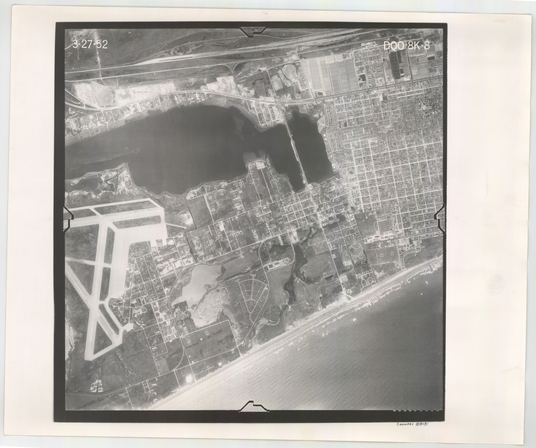
Flight Mission No. DQO-8K, Frame 8, Galveston County
DQO-8K-8
-
Map/Doc
85131
-
Collection
General Map Collection
-
Object Dates
1952/3/27 (Creation Date)
-
People and Organizations
U. S. Department of Agriculture (Publisher)
-
Counties
Galveston
-
Subjects
Aerial Photograph
-
Height x Width
18.8 x 22.5 inches
47.8 x 57.2 cm
-
Comments
Flown by Aero Exploration Company of Tulsa, Oklahoma.
Part of: General Map Collection
Irion County Working Sketch 12

Print $20.00
- Digital $50.00
Irion County Working Sketch 12
1968
Size 15.9 x 24.9 inches
Map/Doc 66421
Briscoe County Sketch File 11

Print $9.00
- Digital $50.00
Briscoe County Sketch File 11
Size 11.8 x 11.0 inches
Map/Doc 16422
San Patricio County Rolled Sketch 20

Print $20.00
- Digital $50.00
San Patricio County Rolled Sketch 20
1920
Size 27.7 x 31.9 inches
Map/Doc 7577
Stonewall County Sketch File 11

Print $6.00
- Digital $50.00
Stonewall County Sketch File 11
1900
Size 9.7 x 8.5 inches
Map/Doc 37237
Coryell County Sketch File 19

Print $20.00
- Digital $50.00
Coryell County Sketch File 19
Size 14.8 x 12.4 inches
Map/Doc 19380
Stephens County Sketch File 23

Print $12.00
- Digital $50.00
Stephens County Sketch File 23
1919
Size 11.1 x 8.8 inches
Map/Doc 37084
Schleicher County Working Sketch 5

Print $20.00
- Digital $50.00
Schleicher County Working Sketch 5
1917
Size 23.0 x 17.6 inches
Map/Doc 63807
Old Miscellaneous File 17

Print $24.00
- Digital $50.00
Old Miscellaneous File 17
1908
Size 14.2 x 8.6 inches
Map/Doc 75485
Live Oak County Boundary File 60c

Print $4.00
- Digital $50.00
Live Oak County Boundary File 60c
Size 14.0 x 8.7 inches
Map/Doc 56421
[Galveston, Harrisburg & San Antonio through El Paso County]
![64014, [Galveston, Harrisburg & San Antonio through El Paso County], General Map Collection](https://historictexasmaps.com/wmedia_w700/maps/64014.tif.jpg)
Print $20.00
- Digital $50.00
[Galveston, Harrisburg & San Antonio through El Paso County]
1906
Size 13.4 x 33.8 inches
Map/Doc 64014
Kinney County Sketch File 27

Print $42.00
- Digital $50.00
Kinney County Sketch File 27
1929
Size 32.4 x 13.2 inches
Map/Doc 11946
Map of the City of San Antonio, Bexar County, Texas including suburbs, north and south

Print $20.00
- Digital $50.00
Map of the City of San Antonio, Bexar County, Texas including suburbs, north and south
Size 39.6 x 26.6 inches
Map/Doc 96511
You may also like
Kimble County Working Sketch 31

Print $20.00
- Digital $50.00
Kimble County Working Sketch 31
1944
Size 34.8 x 34.6 inches
Map/Doc 70099
Flight Mission No. CGI-3N, Frame 121, Cameron County

Print $20.00
- Digital $50.00
Flight Mission No. CGI-3N, Frame 121, Cameron County
1954
Size 18.5 x 22.3 inches
Map/Doc 84594
Official Highway Map of Texas

Print $20.00
Official Highway Map of Texas
1926
Size 25.0 x 24.9 inches
Map/Doc 79744
Pecos County Working Sketch 12

Print $20.00
- Digital $50.00
Pecos County Working Sketch 12
1912
Size 21.3 x 30.0 inches
Map/Doc 71482
Map of the City of Corsicana (Navarro County) Texas

Print $40.00
- Digital $50.00
Map of the City of Corsicana (Navarro County) Texas
1963
Size 36.7 x 87.5 inches
Map/Doc 93675
Flight Mission No. DIX-7P, Frame 83, Aransas County

Print $20.00
- Digital $50.00
Flight Mission No. DIX-7P, Frame 83, Aransas County
1956
Size 18.8 x 22.5 inches
Map/Doc 83877
Eastland County Working Sketch 58

Print $20.00
- Digital $50.00
Eastland County Working Sketch 58
1985
Size 25.5 x 39.6 inches
Map/Doc 68839
Red River County Sketch File 2

Print $8.00
- Digital $50.00
Red River County Sketch File 2
1852
Size 12.9 x 8.5 inches
Map/Doc 35095
Jim Hogg County Sketch File 4

Print $8.00
- Digital $50.00
Jim Hogg County Sketch File 4
1926
Size 11.2 x 8.7 inches
Map/Doc 28404
Cochran County, Texas

Print $40.00
- Digital $50.00
Cochran County, Texas
Size 38.1 x 48.3 inches
Map/Doc 89870
Parker County Sketch File 3

Print $4.00
- Digital $50.00
Parker County Sketch File 3
1856
Size 12.2 x 7.9 inches
Map/Doc 33521
Floyd County Sketch File 6

Print $2.00
- Digital $50.00
Floyd County Sketch File 6
Size 9.1 x 14.4 inches
Map/Doc 22696