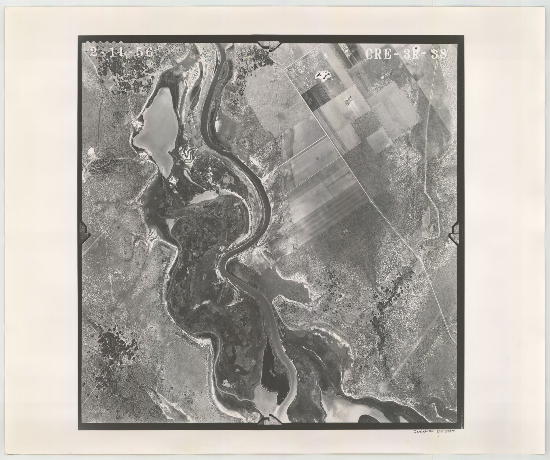
Flight Mission No. CRE-3R, Frame 38, Jackson County
CRE-3R-38
-
Map/Doc
85384
-
Collection
General Map Collection
-
Object Dates
1956/2/11 (Creation Date)
-
People and Organizations
U. S. Department of Agriculture (Publisher)
-
Counties
Jackson
-
Subjects
Aerial Photograph
-
Height x Width
18.6 x 22.2 inches
47.2 x 56.4 cm
-
Comments
Flown by Jack Ammann Photogrammetric Engineers of San Antonio, Texas.
Part of: General Map Collection
Flight Mission No. CUG-1P, Frame 69, Kleberg County

Print $20.00
- Digital $50.00
Flight Mission No. CUG-1P, Frame 69, Kleberg County
1956
Size 18.6 x 22.3 inches
Map/Doc 86134
Brewster County Sketch File N-10

Print $14.00
- Digital $50.00
Brewster County Sketch File N-10
1922
Size 11.2 x 8.7 inches
Map/Doc 15616
Kimble County Sketch File 29 and 30

Print $28.00
- Digital $50.00
Kimble County Sketch File 29 and 30
1936
Size 15.4 x 24.6 inches
Map/Doc 11928
Jefferson County Working Sketch 9

Print $20.00
- Digital $50.00
Jefferson County Working Sketch 9
1937
Size 19.5 x 22.0 inches
Map/Doc 66552
Gaines County

Print $40.00
- Digital $50.00
Gaines County
1901
Size 41.3 x 57.2 inches
Map/Doc 16833
Preliminary Chart of Galveston Bay, Texas

Print $20.00
- Digital $50.00
Preliminary Chart of Galveston Bay, Texas
1855
Size 22.5 x 18.4 inches
Map/Doc 69867
Montgomery County Rolled Sketch 18

Print $40.00
- Digital $50.00
Montgomery County Rolled Sketch 18
Size 51.4 x 25.3 inches
Map/Doc 9528
Mexico y sus Cercanias

Print $20.00
- Digital $50.00
Mexico y sus Cercanias
Size 26.1 x 34.2 inches
Map/Doc 96809
Geographical, Statistical, and Historical Map of Mexico

Print $20.00
- Digital $50.00
Geographical, Statistical, and Historical Map of Mexico
1822
Size 18.0 x 22.4 inches
Map/Doc 95694
Connected Map of Austin's Colony

Print $20.00
- Digital $50.00
Connected Map of Austin's Colony
1892
Size 46.9 x 43.5 inches
Map/Doc 76076
Tyler County Sketch File 25

Print $28.00
- Digital $50.00
Tyler County Sketch File 25
1953
Size 14.5 x 9.0 inches
Map/Doc 38689
Flight Mission No. DQN-1K, Frame 106, Calhoun County

Print $20.00
- Digital $50.00
Flight Mission No. DQN-1K, Frame 106, Calhoun County
1953
Size 18.8 x 22.3 inches
Map/Doc 84173
You may also like
[Surveys in Austin's Colony along New Year's Creek and the Navidad River]
![212, [Surveys in Austin's Colony along New Year's Creek and the Navidad River], General Map Collection](https://historictexasmaps.com/wmedia_w700/maps/212.tif.jpg)
Print $20.00
- Digital $50.00
[Surveys in Austin's Colony along New Year's Creek and the Navidad River]
Size 20.2 x 15.6 inches
Map/Doc 212
South Umbarger in Randall County, Texas

Print $20.00
- Digital $50.00
South Umbarger in Randall County, Texas
1905
Size 31.2 x 30.7 inches
Map/Doc 92153
Grimes County Working Sketch 11

Print $20.00
- Digital $50.00
Grimes County Working Sketch 11
1981
Size 22.7 x 22.6 inches
Map/Doc 63302
Flight Mission No. DIX-3P, Frame 171, Aransas County

Print $20.00
- Digital $50.00
Flight Mission No. DIX-3P, Frame 171, Aransas County
1956
Size 17.6 x 18.2 inches
Map/Doc 83777
Blanco County Working Sketch 5

Print $20.00
- Digital $50.00
Blanco County Working Sketch 5
1941
Size 38.3 x 28.4 inches
Map/Doc 67364


Henderson County Working Sketch 11

Print $20.00
- Digital $50.00
Henderson County Working Sketch 11
1914
Size 20.7 x 22.5 inches
Map/Doc 66144
Presidio County Rolled Sketch 105A

Print $40.00
- Digital $50.00
Presidio County Rolled Sketch 105A
1962
Size 66.8 x 45.7 inches
Map/Doc 9787
Flight Mission No. CRC-3R, Frame 203, Chambers County

Print $20.00
- Digital $50.00
Flight Mission No. CRC-3R, Frame 203, Chambers County
1956
Size 18.6 x 22.3 inches
Map/Doc 84858
Pecos County Rolled Sketch 50

Print $20.00
- Digital $50.00
Pecos County Rolled Sketch 50
1913
Size 23.5 x 13.0 inches
Map/Doc 7226
Northeast Part of Webb County

Print $40.00
- Digital $50.00
Northeast Part of Webb County
1986
Size 37.7 x 50.0 inches
Map/Doc 95668