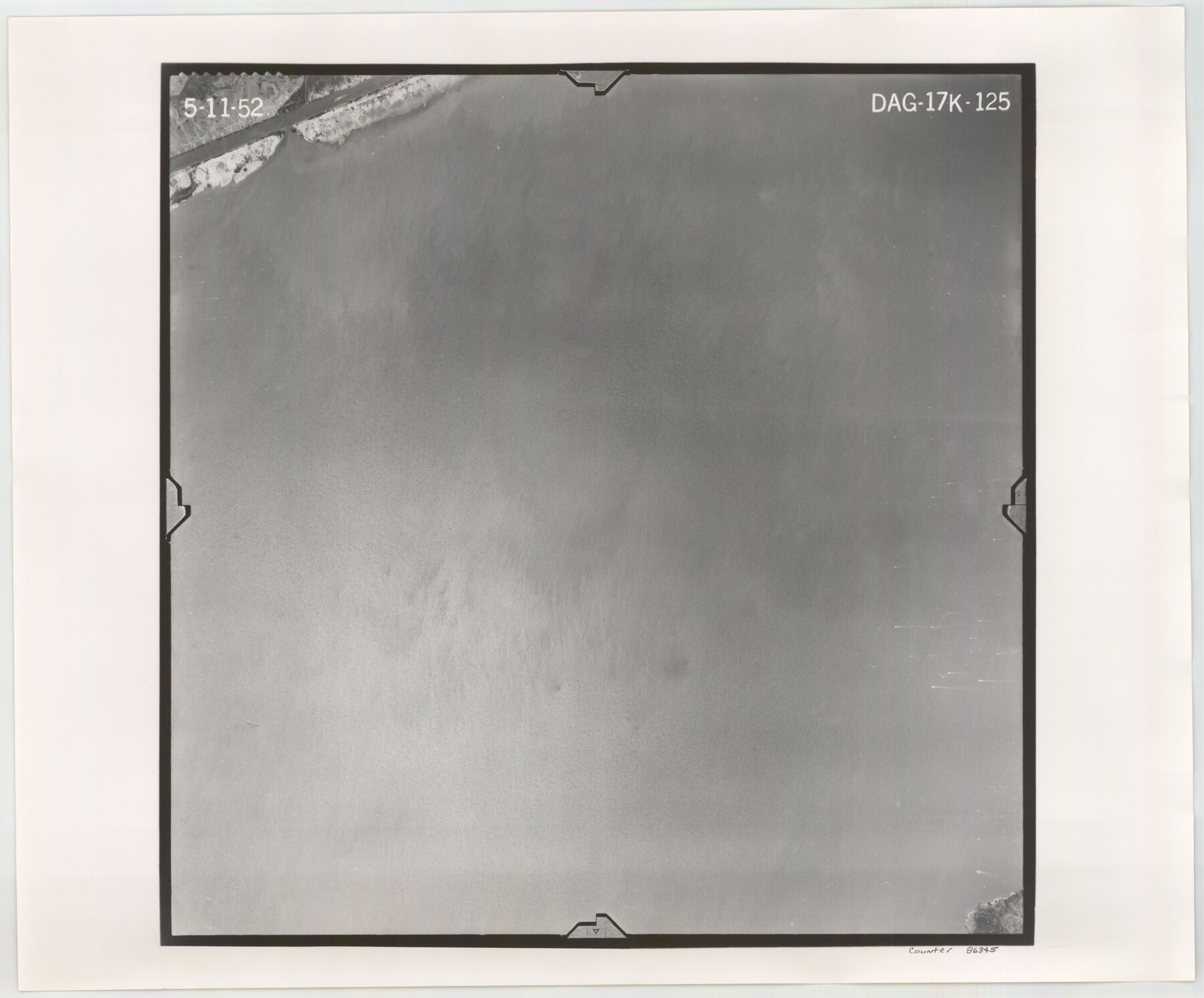
Flight Mission No. DAG-17K, Frame 125, Matagorda County
DAG-17K-125
-
Map/Doc
86345
-
Collection
General Map Collection
-
Object Dates
1952/5/11 (Creation Date)
-
People and Organizations
U. S. Department of Agriculture (Publisher)
-
Counties
Matagorda
-
Subjects
Aerial Photograph
-
Height x Width
18.6 x 22.4 inches
47.2 x 56.9 cm
-
Comments
Flown by Aero Exploration Company of Tulsa, Oklahoma.
Part of: General Map Collection
Grimes County Working Sketch 17

Print $20.00
- Digital $50.00
Grimes County Working Sketch 17
1996
Size 31.1 x 26.6 inches
Map/Doc 63308
Presidio County Rolled Sketch 74

Print $20.00
- Digital $50.00
Presidio County Rolled Sketch 74
Size 20.5 x 14.0 inches
Map/Doc 7362
Crockett County Working Sketch 49

Print $20.00
- Digital $50.00
Crockett County Working Sketch 49
1938
Size 46.7 x 43.9 inches
Map/Doc 68382
Reagan County Sketch File 1

Print $20.00
- Digital $50.00
Reagan County Sketch File 1
1914
Size 24.3 x 30.3 inches
Map/Doc 12210
Sketch of Resurvey of J. R. Castlebury Est., SF 12725 in Gregg County

Print $20.00
- Digital $50.00
Sketch of Resurvey of J. R. Castlebury Est., SF 12725 in Gregg County
1931
Size 38.6 x 33.3 inches
Map/Doc 2039
Topographical Map of the Rio Grande, Sheet No. 24

Print $20.00
- Digital $50.00
Topographical Map of the Rio Grande, Sheet No. 24
1912
Map/Doc 89548
[Surveys in Power and Hewetson's Colony]
![2, [Surveys in Power and Hewetson's Colony], General Map Collection](https://historictexasmaps.com/wmedia_w700/maps/2.tif.jpg)
Print $20.00
- Digital $50.00
[Surveys in Power and Hewetson's Colony]
1830
Size 21.3 x 22.5 inches
Map/Doc 2
Gulf Oil Corp. Fishgide - Freeport

Gulf Oil Corp. Fishgide - Freeport
1960
Size 12.3 x 22.4 inches
Map/Doc 75978
Packery Channel

Print $20.00
- Digital $50.00
Packery Channel
1950
Size 17.2 x 17.1 inches
Map/Doc 2996
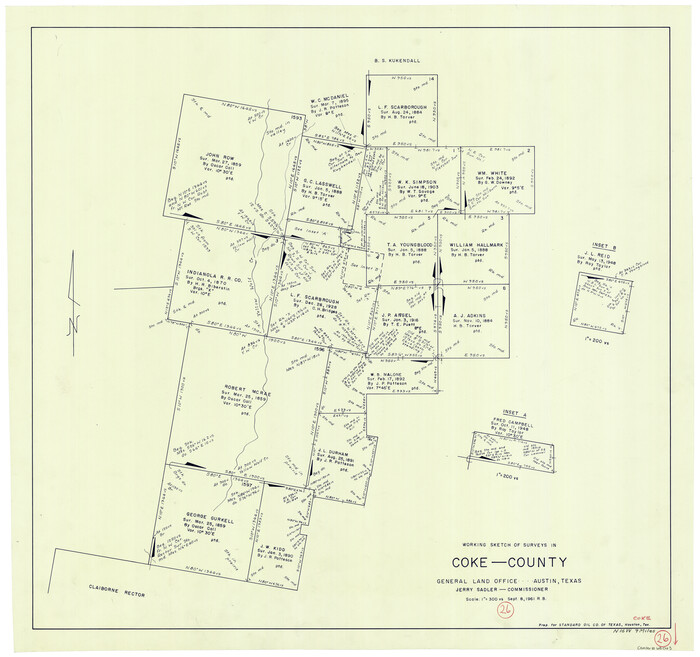
Coke County Working Sketch 26
Print $20.00
- Digital $50.00
Coke County Working Sketch 26
1961
Size 29.1 x 31.2 inches
Map/Doc 68063
Lubbock County Sketch File 6

Print $20.00
- Digital $50.00
Lubbock County Sketch File 6
1902
Size 33.0 x 20.8 inches
Map/Doc 12017
Reeves County Sketch File 25

Print $4.00
- Digital $50.00
Reeves County Sketch File 25
1873
Size 8.4 x 5.6 inches
Map/Doc 35224
You may also like
Sketch in Northwest part Crockett County

Print $20.00
- Digital $50.00
Sketch in Northwest part Crockett County
Size 14.5 x 26.3 inches
Map/Doc 90475
Cottle County Sketch File 1

Print $20.00
- Digital $50.00
Cottle County Sketch File 1
1882
Size 20.7 x 18.9 inches
Map/Doc 11189
[Capitol Leagues Eastward from Bl, LC2 to H. & T.C. Blk. 44]
![89921, [Capitol Leagues Eastward from Bl, LC2 to H. & T.C. Blk. 44], Twichell Survey Records](https://historictexasmaps.com/wmedia_w700/maps/89921-1.tif.jpg)
Print $40.00
- Digital $50.00
[Capitol Leagues Eastward from Bl, LC2 to H. & T.C. Blk. 44]
Size 64.0 x 41.9 inches
Map/Doc 89921
McMullen County Sketch File 23

Print $4.00
- Digital $50.00
McMullen County Sketch File 23
1876
Size 10.0 x 8.0 inches
Map/Doc 31379
Presidio County Sketch File 19a

Print $4.00
- Digital $50.00
Presidio County Sketch File 19a
1886
Size 13.8 x 8.8 inches
Map/Doc 34452
Canyon City,Texas, County Seat of Randall County

Print $20.00
- Digital $50.00
Canyon City,Texas, County Seat of Randall County
Size 20.3 x 25.1 inches
Map/Doc 92152
[Sketch showing Block H, Section 11 of Roberts County, including the south bank of the Canadian River]
![91761, [Sketch showing Block H, Section 11 of Roberts County, including the south bank of the Canadian River], Twichell Survey Records](https://historictexasmaps.com/wmedia_w700/maps/91761-1.tif.jpg)
Print $2.00
- Digital $50.00
[Sketch showing Block H, Section 11 of Roberts County, including the south bank of the Canadian River]
1919
Size 14.4 x 8.8 inches
Map/Doc 91761
Travis County Appraisal District Plat Map 1_0202

Print $20.00
- Digital $50.00
Travis County Appraisal District Plat Map 1_0202
Size 21.6 x 26.5 inches
Map/Doc 94206
Shackelford County Sketch File 13

Print $22.00
- Digital $50.00
Shackelford County Sketch File 13
1875
Size 12.8 x 15.8 inches
Map/Doc 36583
Coke County Sketch File 25

Print $34.00
- Digital $50.00
Coke County Sketch File 25
1930
Size 14.2 x 8.9 inches
Map/Doc 18618
Henderson County

Print $40.00
- Digital $50.00
Henderson County
1988
Size 30.8 x 63.0 inches
Map/Doc 77310
Map of Anderson County

Print $20.00
- Digital $50.00
Map of Anderson County
1855
Size 23.7 x 28.9 inches
Map/Doc 3225