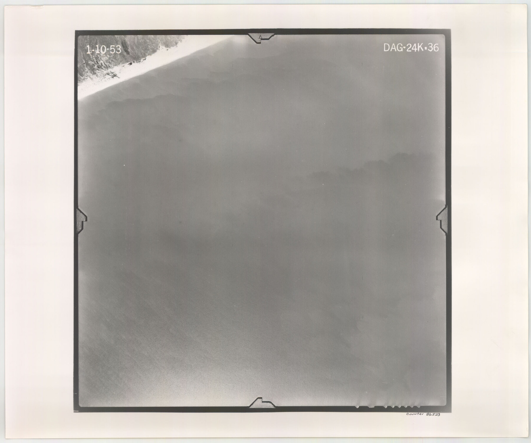
Flight Mission No. DAG-24K, Frame 36, Matagorda County
DAG-24K-36
-
Map/Doc
86523
-
Collection
General Map Collection
-
Object Dates
1953/1/10 (Creation Date)
-
People and Organizations
U. S. Department of Agriculture (Publisher)
-
Counties
Matagorda
-
Subjects
Aerial Photograph
-
Height x Width
18.5 x 22.2 inches
47.0 x 56.4 cm
-
Comments
Flown by Aero Exploration Company of Tulsa, Oklahoma.
Part of: General Map Collection
Hamilton County Sketch File 6

Print $6.00
- Digital $50.00
Hamilton County Sketch File 6
Size 15.7 x 10.6 inches
Map/Doc 24910
Flight Mission No. DAG-21K, Frame 38, Matagorda County

Print $20.00
- Digital $50.00
Flight Mission No. DAG-21K, Frame 38, Matagorda County
1952
Size 18.6 x 22.3 inches
Map/Doc 86405
Val Verde County Sketch File XX

Print $20.00
- Digital $50.00
Val Verde County Sketch File XX
Size 14.5 x 16.7 inches
Map/Doc 12546
Hutchinson County Sketch File 52

Print $14.00
- Digital $50.00
Hutchinson County Sketch File 52
1992
Size 14.2 x 8.8 inches
Map/Doc 27449
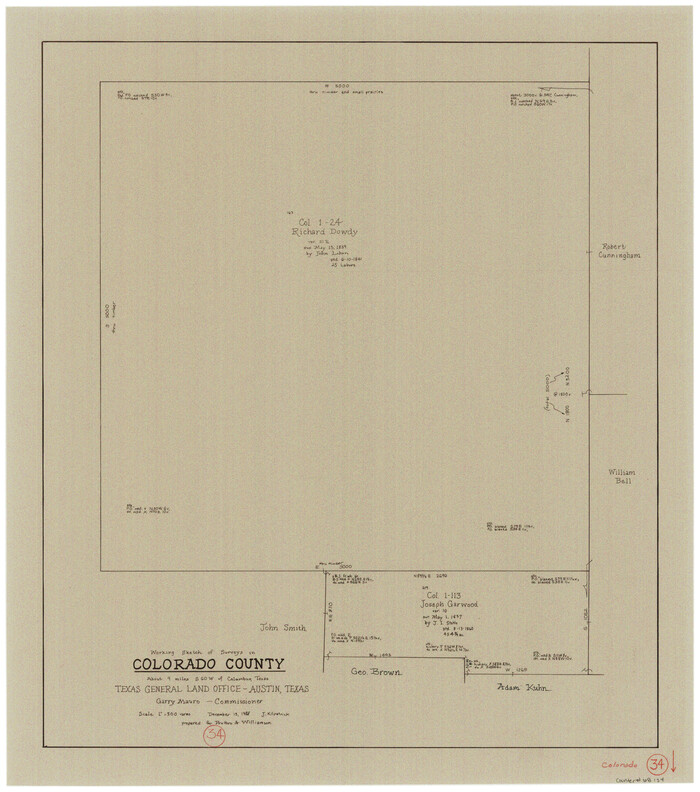
Colorado County Working Sketch 34
Print $20.00
- Digital $50.00
Colorado County Working Sketch 34
1988
Size 26.9 x 23.9 inches
Map/Doc 68134
Little River, Faubion Bridge Sheet

Print $20.00
- Digital $50.00
Little River, Faubion Bridge Sheet
1914
Size 18.5 x 27.6 inches
Map/Doc 69682
Mitchell County Sketch File 16b

Print $20.00
- Digital $50.00
Mitchell County Sketch File 16b
Size 28.7 x 36.8 inches
Map/Doc 10545
Knox County Working Sketch 14

Print $20.00
- Digital $50.00
Knox County Working Sketch 14
1953
Size 21.7 x 31.1 inches
Map/Doc 70256
Duval County Sketch File 4d

Print $4.00
- Digital $50.00
Duval County Sketch File 4d
1874
Size 10.8 x 8.7 inches
Map/Doc 21288
Kimble County Rolled Sketch 24

Print $20.00
- Digital $50.00
Kimble County Rolled Sketch 24
1934
Size 31.6 x 17.7 inches
Map/Doc 6514
Concho, San Saba & Llano Valley Railway, Sterling City Branch, Texas. Right of Way and Track Map

Print $40.00
- Digital $50.00
Concho, San Saba & Llano Valley Railway, Sterling City Branch, Texas. Right of Way and Track Map
1910
Size 17.7 x 57.8 inches
Map/Doc 64437
Controlled Mosaic by Jack Amman Photogrammetric Engineers, Inc - Sheet 40

Print $20.00
- Digital $50.00
Controlled Mosaic by Jack Amman Photogrammetric Engineers, Inc - Sheet 40
1954
Size 20.0 x 24.0 inches
Map/Doc 83495
You may also like
Winkler County Working Sketch 17

Print $20.00
- Digital $50.00
Winkler County Working Sketch 17
1973
Size 36.5 x 36.7 inches
Map/Doc 72611
Red River County Working Sketch 43

Print $40.00
- Digital $50.00
Red River County Working Sketch 43
1968
Size 72.5 x 36.8 inches
Map/Doc 72026
Dimmit County Working Sketch 41

Print $20.00
- Digital $50.00
Dimmit County Working Sketch 41
1971
Size 26.1 x 27.0 inches
Map/Doc 68702
Ochiltree County Working Sketch 8

Print $20.00
- Digital $50.00
Ochiltree County Working Sketch 8
1982
Size 23.4 x 20.8 inches
Map/Doc 71321
Sketch showing Damon's Mound and adjacent surveys

Print $20.00
- Digital $50.00
Sketch showing Damon's Mound and adjacent surveys
Size 19.4 x 17.7 inches
Map/Doc 90218
Amistad International Reservoir on Rio Grande 78

Print $20.00
- Digital $50.00
Amistad International Reservoir on Rio Grande 78
1949
Size 28.5 x 40.2 inches
Map/Doc 75506
Montgomery County Working Sketch 50

Print $20.00
- Digital $50.00
Montgomery County Working Sketch 50
1959
Size 25.3 x 21.9 inches
Map/Doc 71157
Duval County Boundary File 3i

Print $4.00
- Digital $50.00
Duval County Boundary File 3i
Size 8.3 x 10.3 inches
Map/Doc 52751
Jasper County Boundary File 2

Print $58.00
- Digital $50.00
Jasper County Boundary File 2
Size 9.0 x 8.0 inches
Map/Doc 55469
Map of the Rio Grande and Pecos Railway showing its connections with…

Print $20.00
Map of the Rio Grande and Pecos Railway showing its connections with…
1882
Size 42.1 x 40.2 inches
Map/Doc 93620
[Plat and field notes of 3.107 acre tract for Clement Cove Harbor Company]
![60397, [Plat and field notes of 3.107 acre tract for Clement Cove Harbor Company], General Map Collection](https://historictexasmaps.com/wmedia_w700/maps/60397-1.tif.jpg)
Print $20.00
- Digital $50.00
[Plat and field notes of 3.107 acre tract for Clement Cove Harbor Company]
1987
Size 24.2 x 36.5 inches
Map/Doc 60397
Presidio County Sketch File 71

Print $10.00
- Digital $50.00
Presidio County Sketch File 71
1942
Size 11.3 x 8.8 inches
Map/Doc 34674