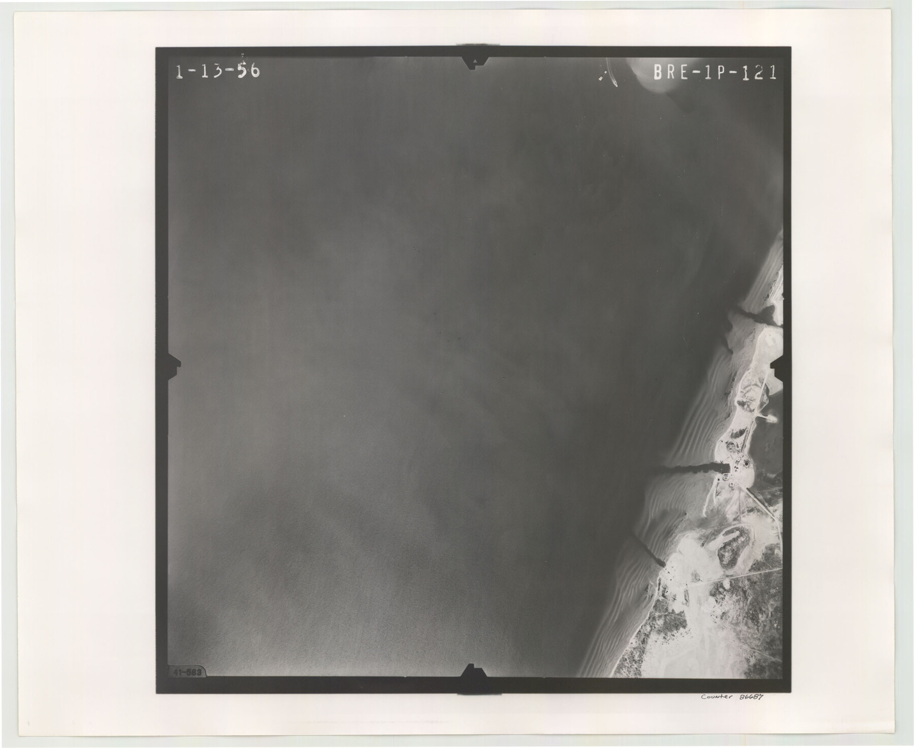
Flight Mission No. BRE-1P, Frame 121, Nueces County
BRE-1P-121
-
Map/Doc
86687
-
Collection
General Map Collection
-
Object Dates
1956/1/13 (Creation Date)
-
People and Organizations
U. S. Department of Agriculture (Publisher)
-
Counties
Nueces
-
Subjects
Aerial Photograph
-
Height x Width
18.6 x 22.7 inches
47.2 x 57.7 cm
-
Comments
Flown by V. L. Beavers and Associates of San Antonio, Texas.
Part of: General Map Collection
Randall County Rolled Sketch 8

Print $20.00
- Digital $50.00
Randall County Rolled Sketch 8
Size 16.1 x 29.8 inches
Map/Doc 7430
El Paso County Working Sketch 36

Print $20.00
- Digital $50.00
El Paso County Working Sketch 36
1983
Size 34.0 x 40.3 inches
Map/Doc 69058
Map of Refugio

Print $20.00
- Digital $50.00
Map of Refugio
1851
Size 27.2 x 25.6 inches
Map/Doc 3989
Reagan County Working Sketch 14b

Print $20.00
- Digital $50.00
Reagan County Working Sketch 14b
Size 20.3 x 9.0 inches
Map/Doc 71855
Matagorda County Working Sketch 20

Print $20.00
- Digital $50.00
Matagorda County Working Sketch 20
1961
Size 26.1 x 37.7 inches
Map/Doc 70878

Medina County Working Sketch 25

Print $20.00
- Digital $50.00
Medina County Working Sketch 25
1985
Size 37.6 x 42.9 inches
Map/Doc 70940
Hutchinson County Rolled Sketch 44-19

Print $20.00
- Digital $50.00
Hutchinson County Rolled Sketch 44-19
2002
Size 24.0 x 36.0 inches
Map/Doc 77555
Montgomery County Working Sketch 76

Print $20.00
- Digital $50.00
Montgomery County Working Sketch 76
Size 16.5 x 18.3 inches
Map/Doc 78191
Mosaic composed of aerial photographs - Houston Ship Channel, Tex.

Print $20.00
- Digital $50.00
Mosaic composed of aerial photographs - Houston Ship Channel, Tex.
1923
Size 13.7 x 38.0 inches
Map/Doc 97172
Robertson County Working Sketch 14

Print $40.00
- Digital $50.00
Robertson County Working Sketch 14
1988
Size 48.6 x 39.6 inches
Map/Doc 63587
Henderson County Working Sketch 11

Print $20.00
- Digital $50.00
Henderson County Working Sketch 11
1914
Size 20.7 x 22.5 inches
Map/Doc 66144
You may also like
Motley County Rolled Sketch 1

Print $20.00
- Digital $50.00
Motley County Rolled Sketch 1
1989
Size 39.0 x 47.6 inches
Map/Doc 9552
Webb County Rolled Sketch 76

Print $20.00
- Digital $50.00
Webb County Rolled Sketch 76
1959
Size 32.8 x 44.0 inches
Map/Doc 10133
Culberson County Working Sketch 80

Print $40.00
- Digital $50.00
Culberson County Working Sketch 80
1978
Size 56.4 x 43.4 inches
Map/Doc 68534
DeWitt County Working Sketch 8

Print $20.00
- Digital $50.00
DeWitt County Working Sketch 8
1979
Size 35.7 x 41.9 inches
Map/Doc 68598
Galveston County NRC Article 33.136 Sketch 43

Print $59.00
- Digital $50.00
Galveston County NRC Article 33.136 Sketch 43
2002
Size 24.7 x 36.9 inches
Map/Doc 87156
[Plat map showing mostly Overton Addition]
![92825, [Plat map showing mostly Overton Addition], Twichell Survey Records](https://historictexasmaps.com/wmedia_w700/maps/92825-1.tif.jpg)
Print $20.00
- Digital $50.00
[Plat map showing mostly Overton Addition]
Size 31.7 x 31.4 inches
Map/Doc 92825
Panola County Working Sketch 29

Print $20.00
- Digital $50.00
Panola County Working Sketch 29
1980
Map/Doc 71438
Liberty County Working Sketch 91a

Print $40.00
- Digital $50.00
Liberty County Working Sketch 91a
1919
Size 48.6 x 42.1 inches
Map/Doc 65457
![91461, [Block B7], Twichell Survey Records](https://historictexasmaps.com/wmedia_w700/maps/91461-1.tif.jpg)
[Connecting lines from west corner of S. K. & K. Block M6 to northwest corner section 1, J. G. & S. M. Blk. 2Z]
![90399, [Connecting lines from west corner of S. K. & K. Block M6 to northwest corner section 1, J. G. & S. M. Blk. 2Z], Twichell Survey Records](https://historictexasmaps.com/wmedia_w700/maps/90399-1.tif.jpg)
Print $20.00
- Digital $50.00
[Connecting lines from west corner of S. K. & K. Block M6 to northwest corner section 1, J. G. & S. M. Blk. 2Z]
Size 25.1 x 17.0 inches
Map/Doc 90399
San Saba County Sketch File 18

Print $12.00
- Digital $50.00
San Saba County Sketch File 18
1919
Size 11.4 x 8.8 inches
Map/Doc 36460
Brazoria County Rolled Sketch 33

Print $133.00
- Digital $50.00
Brazoria County Rolled Sketch 33
Size 10.3 x 15.4 inches
Map/Doc 42960