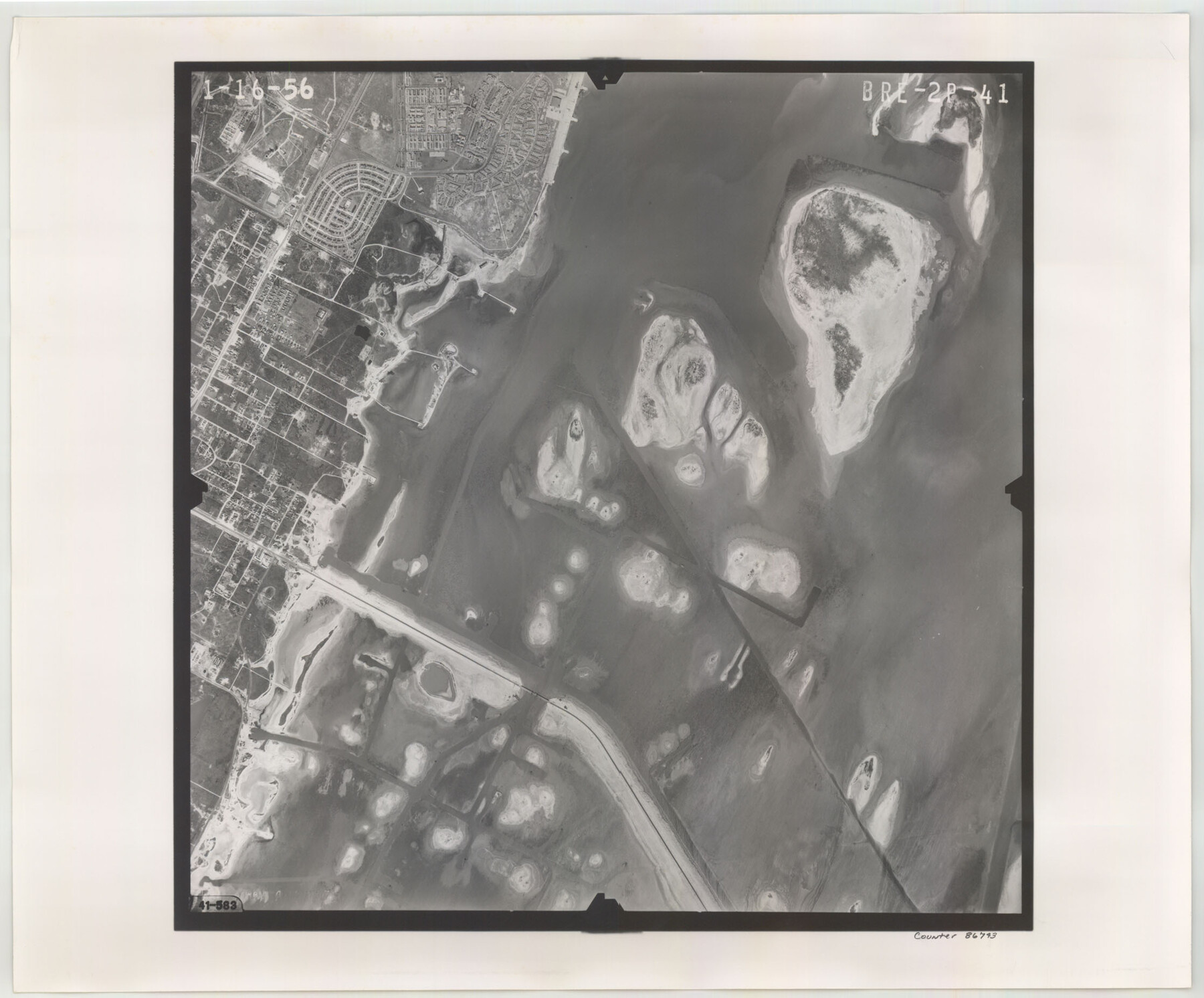
Flight Mission No. BRE-2P, Frame 41, Nueces County
BRE-2P-41
-
Map/Doc
86743
-
Collection
General Map Collection
-
Object Dates
1956/1/16 (Creation Date)
-
People and Organizations
U. S. Department of Agriculture (Publisher)
-
Counties
Nueces
-
Subjects
Aerial Photograph
-
Height x Width
18.5 x 22.4 inches
47.0 x 56.9 cm
-
Comments
Flown by V. L. Beavers and Associates of San Antonio, Texas.
Part of: General Map Collection
Calhoun County Rolled Sketch 14

Print $20.00
- Digital $50.00
Calhoun County Rolled Sketch 14
Size 22.1 x 40.6 inches
Map/Doc 5460
Flight Mission No. DQN-2K, Frame 139, Calhoun County

Print $20.00
- Digital $50.00
Flight Mission No. DQN-2K, Frame 139, Calhoun County
1953
Size 16.3 x 16.2 inches
Map/Doc 84308
Reeves County Rolled Sketch 1

Print $40.00
- Digital $50.00
Reeves County Rolled Sketch 1
Size 52.9 x 38.5 inches
Map/Doc 9844
[Surveys on Galveston and East Bay]
![248, [Surveys on Galveston and East Bay], General Map Collection](https://historictexasmaps.com/wmedia_w700/maps/248.tif.jpg)
Print $2.00
- Digital $50.00
[Surveys on Galveston and East Bay]
1846
Size 8.8 x 7.9 inches
Map/Doc 248
Moore County Boundary File 1

Print $42.00
- Digital $50.00
Moore County Boundary File 1
Size 8.9 x 3.8 inches
Map/Doc 57452

Duval County Working Sketch 58

Print $20.00
- Digital $50.00
Duval County Working Sketch 58
Size 21.0 x 33.0 inches
Map/Doc 67498
Flight Mission No. CRC-6R, Frame 12, Chambers County

Print $20.00
- Digital $50.00
Flight Mission No. CRC-6R, Frame 12, Chambers County
1956
Size 18.7 x 22.3 inches
Map/Doc 84966
Lynn County Sketch File 1

Print $8.00
- Digital $50.00
Lynn County Sketch File 1
1892
Size 14.0 x 8.8 inches
Map/Doc 30443
Trinity River, Red Bank Sheet

Print $20.00
- Digital $50.00
Trinity River, Red Bank Sheet
1925
Size 16.4 x 24.4 inches
Map/Doc 69687
Texas-United States Boundary Line 3

Print $40.00
- Digital $50.00
Texas-United States Boundary Line 3
Size 54.6 x 10.5 inches
Map/Doc 74979
Mason County Working Sketch 19

Print $20.00
- Digital $50.00
Mason County Working Sketch 19
1981
Size 27.0 x 37.1 inches
Map/Doc 70855
You may also like
T and P as Surveyed January 1876, Blocks 35-36

Print $40.00
- Digital $50.00
T and P as Surveyed January 1876, Blocks 35-36
1876
Size 29.0 x 95.2 inches
Map/Doc 93184
Kleberg County Rolled Sketch 10-3

Print $20.00
- Digital $50.00
Kleberg County Rolled Sketch 10-3
1951
Size 37.5 x 32.0 inches
Map/Doc 9388
Map of Lampasas County, Texas

Print $20.00
- Digital $50.00
Map of Lampasas County, Texas
1879
Size 23.4 x 28.4 inches
Map/Doc 560
Liberty County Working Sketch 27

Print $20.00
- Digital $50.00
Liberty County Working Sketch 27
1942
Size 22.1 x 25.2 inches
Map/Doc 70486
[San Antonio & Aransas Pass Through Gonzales County]
![64288, [San Antonio & Aransas Pass Through Gonzales County], General Map Collection](https://historictexasmaps.com/wmedia_w700/maps/64288.tif.jpg)
Print $20.00
- Digital $50.00
[San Antonio & Aransas Pass Through Gonzales County]
1880
Size 11.4 x 30.7 inches
Map/Doc 64288

Harris County Working Sketch 9

Print $20.00
- Digital $50.00
Harris County Working Sketch 9
1908
Size 27.7 x 39.4 inches
Map/Doc 65901
San Patricio County, Texas

Print $20.00
- Digital $50.00
San Patricio County, Texas
1879
Size 18.1 x 22.8 inches
Map/Doc 611
General Highway Map. Detail of Cities and Towns in Bexar County, Texas. City Map of San Antonio, Alamo Heights, Olmos Park, Terrell Hills, Castle Hills, Balcones Heights, and vicinity, Bexar County, Texas

Print $20.00
General Highway Map. Detail of Cities and Towns in Bexar County, Texas. City Map of San Antonio, Alamo Heights, Olmos Park, Terrell Hills, Castle Hills, Balcones Heights, and vicinity, Bexar County, Texas
1961
Size 25.1 x 18.2 inches
Map/Doc 79372
Crockett County Working Sketch 88

Print $20.00
- Digital $50.00
Crockett County Working Sketch 88
1976
Size 34.0 x 32.9 inches
Map/Doc 68421
Palo Pinto County Boundary File 2

Print $18.00
- Digital $50.00
Palo Pinto County Boundary File 2
Size 9.1 x 3.9 inches
Map/Doc 57791
Hudspeth County Rolled Sketch 19

Print $20.00
- Digital $50.00
Hudspeth County Rolled Sketch 19
Size 47.8 x 44.6 inches
Map/Doc 9205