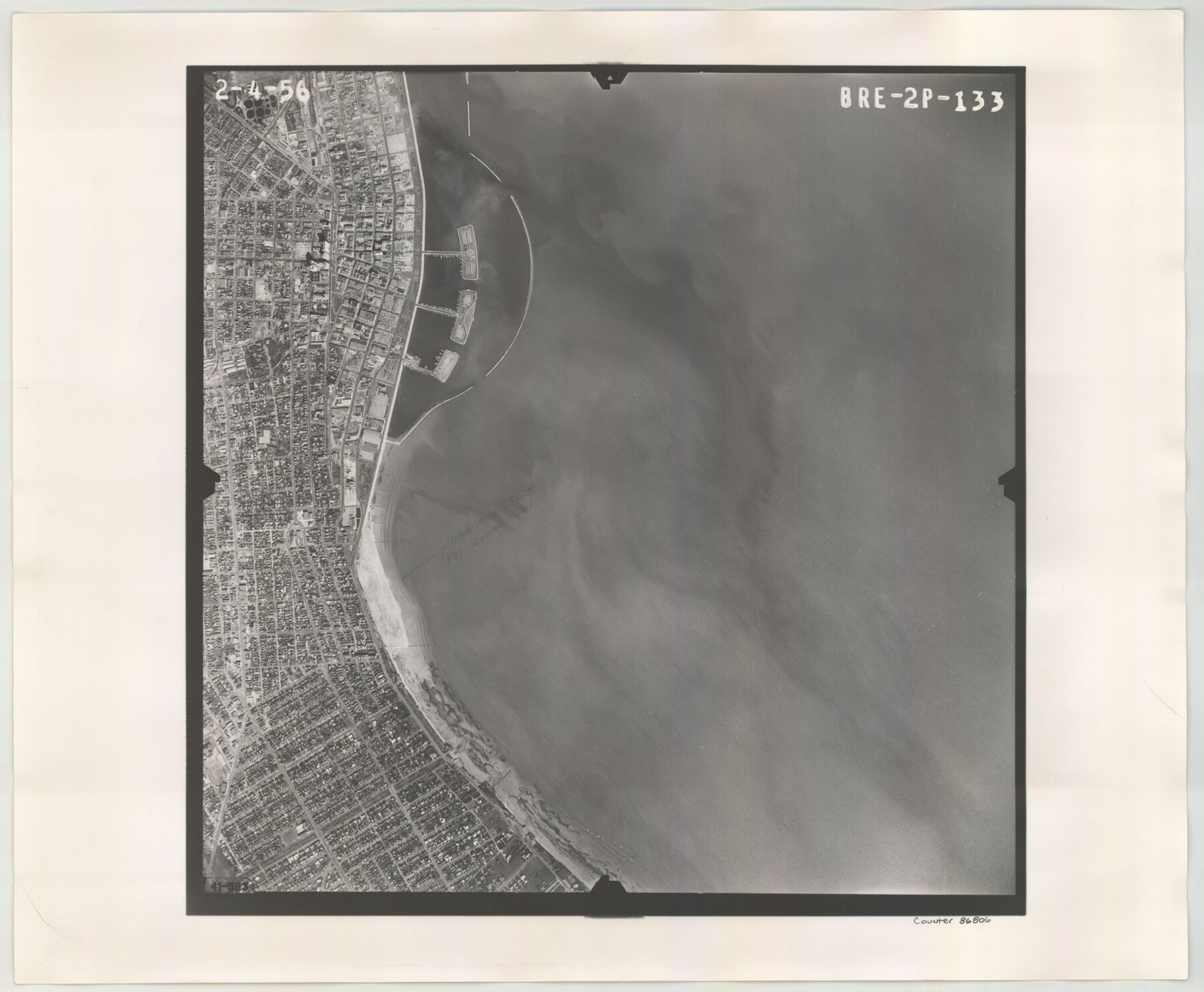
Flight Mission No. BRE-2P, Frame 133, Nueces County
BRE-2P-133
-
Map/Doc
86806
-
Collection
General Map Collection
-
Object Dates
1956/2/4 (Creation Date)
-
People and Organizations
U. S. Department of Agriculture (Publisher)
-
Counties
Nueces
-
Subjects
Aerial Photograph
-
Height x Width
18.5 x 22.5 inches
47.0 x 57.2 cm
-
Comments
Flown by V. L. Beavers and Associates of San Antonio, Texas.
Part of: General Map Collection
Duval County Working Sketch 56

Print $20.00
- Digital $50.00
Duval County Working Sketch 56
1989
Size 26.7 x 27.2 inches
Map/Doc 68780
Hale County Working Sketch 1

Print $20.00
- Digital $50.00
Hale County Working Sketch 1
1910
Size 34.5 x 22.1 inches
Map/Doc 63321
Map and Profile No. 1 from the Red River to the Rio Grande; from Explorations and surveys made under the direction of the Hon. Jeffeson Davis, Secretary of War

Print $40.00
- Digital $50.00
Map and Profile No. 1 from the Red River to the Rio Grande; from Explorations and surveys made under the direction of the Hon. Jeffeson Davis, Secretary of War
1856
Size 30.5 x 57.0 inches
Map/Doc 4330
Bowie County Sketch File A

Print $40.00
- Digital $50.00
Bowie County Sketch File A
1902
Size 15.6 x 27.3 inches
Map/Doc 10946
Amistad International Reservoir on Rio Grande 110

Print $20.00
- Digital $50.00
Amistad International Reservoir on Rio Grande 110
1950
Size 41.4 x 29.5 inches
Map/Doc 75541
Duval County Sketch File 84

Print $6.00
- Digital $50.00
Duval County Sketch File 84
1945
Size 14.4 x 8.9 inches
Map/Doc 21531
Dallam County Sketch File 2

Print $260.00
- Digital $50.00
Dallam County Sketch File 2
1886
Size 29.9 x 17.4 inches
Map/Doc 11278
Parker County Boundary File 1

Print $6.00
- Digital $50.00
Parker County Boundary File 1
Size 11.2 x 8.7 inches
Map/Doc 57833
Matagorda County NRC Article 33.136 Sketch 17

Print $24.00
Matagorda County NRC Article 33.136 Sketch 17
2023
Map/Doc 97274

Houston County Working Sketch 25

Print $40.00
- Digital $50.00
Houston County Working Sketch 25
1983
Size 43.6 x 89.0 inches
Map/Doc 66255

You may also like
Travis County Working Sketch 22

Print $20.00
- Digital $50.00
Travis County Working Sketch 22
1947
Size 19.6 x 20.8 inches
Map/Doc 69406
Flight Mission No. DQO-11K, Frame 20, Galveston County

Print $20.00
- Digital $50.00
Flight Mission No. DQO-11K, Frame 20, Galveston County
1952
Size 18.8 x 22.4 inches
Map/Doc 85215
Reeves County Rolled Sketch 37

Print $20.00
- Digital $50.00
Reeves County Rolled Sketch 37
2017
Size 22.9 x 17.1 inches
Map/Doc 95203
Terrell County

Print $40.00
- Digital $50.00
Terrell County
1931
Size 48.5 x 40.5 inches
Map/Doc 73300
Panola County Working Sketch 23

Print $20.00
- Digital $50.00
Panola County Working Sketch 23
1951
Map/Doc 71432
Titus County Sketch File 3

Print $40.00
- Digital $50.00
Titus County Sketch File 3
1852
Size 19.9 x 8.4 inches
Map/Doc 38134
Van Zandt County Sketch File 32a

Print $4.00
- Digital $50.00
Van Zandt County Sketch File 32a
1860
Size 12.3 x 8.1 inches
Map/Doc 39467
[South Part of Terrell County, West Part of Val Verde County]
![91960, [South Part of Terrell County, West Part of Val Verde County], Twichell Survey Records](https://historictexasmaps.com/wmedia_w700/maps/91960-1.tif.jpg)
Print $20.00
- Digital $50.00
[South Part of Terrell County, West Part of Val Verde County]
Size 38.6 x 18.5 inches
Map/Doc 91960
Van Zandt County Sketch File 29a

Print $4.00
- Digital $50.00
Van Zandt County Sketch File 29a
1859
Size 14.2 x 6.6 inches
Map/Doc 39455
Galveston County Sketch File 41

Print $7.00
- Digital $50.00
Galveston County Sketch File 41
Size 11.3 x 8.9 inches
Map/Doc 23451
Sterling County Working Sketch 11

Print $20.00
- Digital $50.00
Sterling County Working Sketch 11
1987
Size 20.1 x 40.8 inches
Map/Doc 63993
Goliad County Working Sketch 3

Print $40.00
- Digital $50.00
Goliad County Working Sketch 3
1916
Size 42.8 x 76.4 inches
Map/Doc 63193