![91738, [Sketch showing Block 154], Twichell Survey Records](https://historictexasmaps.com/wmedia_w1800h1800/maps/91738-1.tif.jpg)
[Sketch showing Block 154]
188-94
-
Map/Doc
91738
-
Collection
Twichell Survey Records
-
Counties
Potter
-
Height x Width
22.4 x 21.5 inches
56.9 x 54.6 cm
-
Comments
Amarillo cemetery plots
Part of: Twichell Survey Records
[Capitol Leagues in Lamb County]
![91013, [Capitol Leagues in Lamb County], Twichell Survey Records](https://historictexasmaps.com/wmedia_w700/maps/91013-1.tif.jpg)
Print $2.00
- Digital $50.00
[Capitol Leagues in Lamb County]
1912
Size 13.1 x 8.8 inches
Map/Doc 91013
W. S. Mabry Land Corners and Connections, Potter County

Print $20.00
- Digital $50.00
W. S. Mabry Land Corners and Connections, Potter County
Size 22.6 x 17.5 inches
Map/Doc 91806
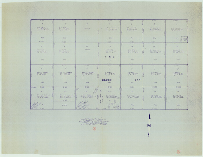
[PSL Block B-19]
![93127, [PSL Block B-19], Twichell Survey Records](https://historictexasmaps.com/wmedia_w700/maps/93127-1.tif.jpg)
Print $40.00
- Digital $50.00
[PSL Block B-19]
Size 49.1 x 45.5 inches
Map/Doc 93127
Map of Adrian, the New Town in the Panhandle, Oldham County, Texas (verso - Adrian promotional text)

Print $20.00
- Digital $50.00
Map of Adrian, the New Town in the Panhandle, Oldham County, Texas (verso - Adrian promotional text)
Size 26.0 x 21.5 inches
Map/Doc 92136
Sketch in Parmer County

Print $20.00
- Digital $50.00
Sketch in Parmer County
1901
Size 15.1 x 23.8 inches
Map/Doc 91644
[Lgs. 209-212, 182, 183, 195-200 with notes]
![90159, [Lgs. 209-212, 182, 183, 195-200 with notes], Twichell Survey Records](https://historictexasmaps.com/wmedia_w700/maps/90159-1.tif.jpg)
Print $20.00
- Digital $50.00
[Lgs. 209-212, 182, 183, 195-200 with notes]
Size 18.7 x 15.6 inches
Map/Doc 90159
[H. & T. C. 47, Sections 57- 61] / [Blocks 4 and 6]
![91416, [H. & T. C. 47, Sections 57- 61] / [Blocks 4 and 6], Twichell Survey Records](https://historictexasmaps.com/wmedia_w700/maps/91416-1.tif.jpg)
Print $20.00
- Digital $50.00
[H. & T. C. 47, Sections 57- 61] / [Blocks 4 and 6]
Size 26.0 x 19.5 inches
Map/Doc 91416
'O Bar O' Ranch

Print $20.00
- Digital $50.00
'O Bar O' Ranch
1946
Size 21.1 x 36.2 inches
Map/Doc 92162
[Blocks K3, K4, K7, K8, K14, M7, east part of Leagues]
![90593, [Blocks K3, K4, K7, K8, K14, M7, east part of Leagues], Twichell Survey Records](https://historictexasmaps.com/wmedia_w700/maps/90593-1.tif.jpg)
Print $20.00
- Digital $50.00
[Blocks K3, K4, K7, K8, K14, M7, east part of Leagues]
Size 32.6 x 32.4 inches
Map/Doc 90593
[H. & G. N. Block 1]
![90941, [H. & G. N. Block 1], Twichell Survey Records](https://historictexasmaps.com/wmedia_w700/maps/90941-1.tif.jpg)
Print $20.00
- Digital $50.00
[H. & G. N. Block 1]
1873
Size 17.5 x 14.3 inches
Map/Doc 90941
MacKenzie SP - 52 - T Base Map

Print $20.00
- Digital $50.00
MacKenzie SP - 52 - T Base Map
1935
Size 36.9 x 24.9 inches
Map/Doc 92802
Map of Abernathy Located on Section 12, Block CK, Hale and Lubbock Counties, Texas

Print $20.00
- Digital $50.00
Map of Abernathy Located on Section 12, Block CK, Hale and Lubbock Counties, Texas
Size 30.4 x 33.2 inches
Map/Doc 92700
You may also like
Duval County Boundary File 4

Print $40.00
- Digital $50.00
Duval County Boundary File 4
Size 39.5 x 13.7 inches
Map/Doc 52767
Reeves County Rolled Sketch 37

Print $20.00
- Digital $50.00
Reeves County Rolled Sketch 37
2017
Size 22.9 x 17.1 inches
Map/Doc 95203
Harris County Rolled Sketch 73

Print $20.00
- Digital $50.00
Harris County Rolled Sketch 73
1947
Size 41.0 x 33.9 inches
Map/Doc 9133
Pecos County Rolled Sketch 100

Print $20.00
- Digital $50.00
Pecos County Rolled Sketch 100
1936
Size 45.2 x 25.2 inches
Map/Doc 9712
[Sketch of Runnels County School Land and vicinity]
![91666, [Sketch of Runnels County School Land and vicinity], Twichell Survey Records](https://historictexasmaps.com/wmedia_w700/maps/91666-1.tif.jpg)
Print $20.00
- Digital $50.00
[Sketch of Runnels County School Land and vicinity]
Size 17.3 x 15.3 inches
Map/Doc 91666
Comanche County Working Sketch 25

Print $20.00
- Digital $50.00
Comanche County Working Sketch 25
1976
Size 34.8 x 31.9 inches
Map/Doc 68159
Potter County Working Sketch 1

Print $20.00
- Digital $50.00
Potter County Working Sketch 1
Size 16.3 x 17.2 inches
Map/Doc 71661
Brazoria County Rolled Sketch 40

Print $20.00
- Digital $50.00
Brazoria County Rolled Sketch 40
1954
Size 32.1 x 21.5 inches
Map/Doc 5175
Red River County Sketch File 17

Print $26.00
- Digital $50.00
Red River County Sketch File 17
1868
Size 12.8 x 8.2 inches
Map/Doc 35141
Culberson County Working Sketch 76
Print $20.00
- Digital $50.00
Culberson County Working Sketch 76
1975
Size 33.4 x 43.1 inches
Map/Doc 68530
Revised Sectional Map No. 4 showing land surveys in the western portion of the county of El Paso, Texas

Print $20.00
- Digital $50.00
Revised Sectional Map No. 4 showing land surveys in the western portion of the county of El Paso, Texas
Size 19.0 x 24.2 inches
Map/Doc 4477
Flight Mission No. BRE-2P, Frame 105, Nueces County

Print $20.00
- Digital $50.00
Flight Mission No. BRE-2P, Frame 105, Nueces County
1956
Size 18.4 x 22.2 inches
Map/Doc 86790