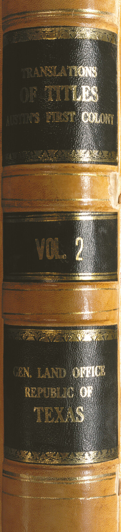
Translation of Titles - Austin's First Colony, Vol. 2
-
Map/Doc
94545
-
Collection
Historical Volumes
-
Object Dates
1841 (Creation Date)
-
People and Organizations
Wm. Sevey (Spanish Translator)
-
Subjects
Bound Volume Colony Mexican Texas
-
Medium
paper, bound volume
Part of: Historical Volumes

Record of Translations of Empresario Contracts (RTEC)

Record of Translations of Empresario Contracts (RTEC)
Size 17.0 x 13.6 inches
Map/Doc 94266

Acts of the Visit of the Royal Commissioners (sometimes referred to as the “Visita General”) - Camargo

Acts of the Visit of the Royal Commissioners (sometimes referred to as the “Visita General”) - Camargo
1767
Size 14.3 x 9.5 inches
Map/Doc 94254
Record of Spanish Titles, Vol. IV

Record of Spanish Titles, Vol. IV
Size 19.2 x 12.8 inches
Map/Doc 94529
Minutes of the Ayuntamiento of San Felipe de Austin Vol. 2

Minutes of the Ayuntamiento of San Felipe de Austin Vol. 2
Size 13.3 x 10.5 inches
Map/Doc 94261
English Field Notes of the Spanish Archives - Book C

English Field Notes of the Spanish Archives - Book C
1835
Map/Doc 96541

English Field Notes of the Spanish Archives - Book SAW

English Field Notes of the Spanish Archives - Book SAW
1834
Map/Doc 96544
Translations of Titles - Austin's Second Contract, Vol. 3

Translations of Titles - Austin's Second Contract, Vol. 3
1841
Map/Doc 94548
Index to Titles, Field, Notes, and Plats, A-Z

Index to Titles, Field, Notes, and Plats, A-Z
Size 17.0 x 12.1 inches
Map/Doc 94525
English Field Notes of the Spanish Archives - Book 11

English Field Notes of the Spanish Archives - Book 11
1832
Map/Doc 96537
You may also like
English Field Notes of the Spanish Archives - Book J. Strode

English Field Notes of the Spanish Archives - Book J. Strode
1835
Map/Doc 96549
Dawson County Rolled Sketch 8

Print $40.00
- Digital $50.00
Dawson County Rolled Sketch 8
1940
Size 33.5 x 54.3 inches
Map/Doc 8772
[H. & T. C. Block 47, Block 1PD, and Vicinity]
![91435, [H. & T. C. Block 47, Block 1PD, and Vicinity], Twichell Survey Records](https://historictexasmaps.com/wmedia_w700/maps/91435-1.tif.jpg)
Print $20.00
- Digital $50.00
[H. & T. C. Block 47, Block 1PD, and Vicinity]
1912
Size 31.8 x 33.5 inches
Map/Doc 91435
Winkler County

Print $20.00
- Digital $50.00
Winkler County
1901
Size 44.1 x 37.9 inches
Map/Doc 63131
Bexar County Working Sketch 20

Print $20.00
- Digital $50.00
Bexar County Working Sketch 20
1982
Size 42.4 x 43.6 inches
Map/Doc 67336
Hays County Working Sketch 20

Print $40.00
- Digital $50.00
Hays County Working Sketch 20
1980
Size 42.9 x 65.6 inches
Map/Doc 66094
Brooks County Sketch File 11

Print $14.00
- Digital $50.00
Brooks County Sketch File 11
Size 11.3 x 8.9 inches
Map/Doc 16573
[Blocks O5, O2, O, JD, A1, A2, A3, A4, B, T, D10, and vicinity]
![90717, [Blocks O5, O2, O, JD, A1, A2, A3, A4, B, T, D10, and vicinity], Twichell Survey Records](https://historictexasmaps.com/wmedia_w700/maps/90717-1.tif.jpg)
Print $20.00
- Digital $50.00
[Blocks O5, O2, O, JD, A1, A2, A3, A4, B, T, D10, and vicinity]
Size 34.7 x 29.3 inches
Map/Doc 90717
Pecos County Rolled Sketch 111

Print $20.00
- Digital $50.00
Pecos County Rolled Sketch 111
1941
Size 30.0 x 20.9 inches
Map/Doc 7256
Hutchinson County Boundary File 2

Print $2.00
- Digital $50.00
Hutchinson County Boundary File 2
Size 11.2 x 8.8 inches
Map/Doc 55302
Nueces County Rolled Sketch 30

Print $40.00
- Digital $50.00
Nueces County Rolled Sketch 30
1952
Size 60.3 x 38.9 inches
Map/Doc 9598
Wise County Sketch File 48

Print $10.00
- Digital $50.00
Wise County Sketch File 48
1922
Size 14.2 x 8.7 inches
Map/Doc 40613