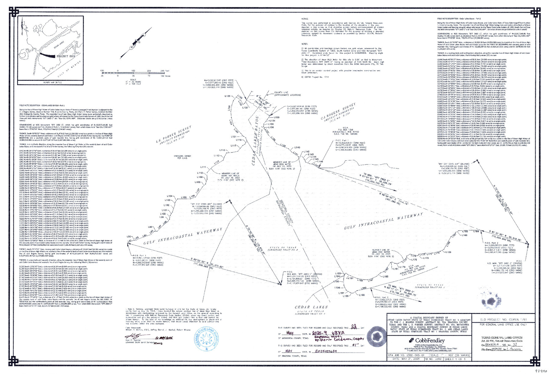
Brazoria County NRC Article 33.136 Sketch 32
-
Map/Doc
97490
-
Collection
General Map Collection
-
Object Dates
5/21/2025 (Creation Date)
7/24/2025 (File Date)
-
People and Organizations
Kyle C. Sunday (Surveyor/Engineer)
-
Counties
Brazoria
-
Subjects
Surveying CBS
-
Comments
Project: Cedar Lakes Bayou - L.E. Parker, A-464 - Sunday
Project No.: CEPRA #1711
Part of: General Map Collection
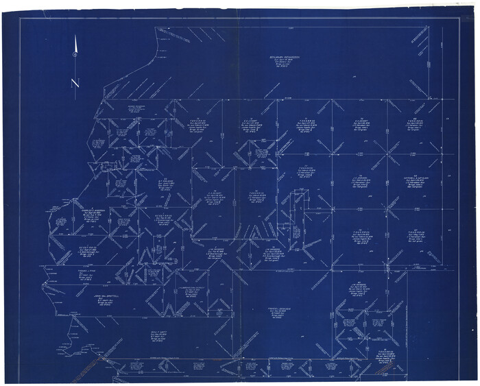
Wood County Working Sketch 12

Print $20.00
- Digital $50.00
Wood County Working Sketch 12
1964
Size 37.4 x 34.5 inches
Map/Doc 62012
No. 2 Chart of Corpus Christi Pass, Texas

Print $20.00
- Digital $50.00
No. 2 Chart of Corpus Christi Pass, Texas
1878
Size 18.3 x 27.2 inches
Map/Doc 73028
Map of the Navosoto [sp.] River, Washington County
![64, Map of the Navosoto [sp.] River, Washington County, General Map Collection](https://historictexasmaps.com/wmedia_w700/maps/64.tif.jpg)
Print $20.00
- Digital $50.00
Map of the Navosoto [sp.] River, Washington County
1842
Size 15.7 x 14.2 inches
Map/Doc 64
McLennan County

Print $20.00
- Digital $50.00
McLennan County
1946
Size 42.5 x 45.8 inches
Map/Doc 73235
Jasper County Working Sketch 24
Print $40.00
- Digital $50.00
Jasper County Working Sketch 24
1948
Size 44.2 x 54.9 inches
Map/Doc 69651
Pecos County Rolled Sketch 25B

Print $20.00
- Digital $50.00
Pecos County Rolled Sketch 25B
1892
Size 22.2 x 16.0 inches
Map/Doc 7210
Flight Mission No. CUG-1P, Frame 43, Kleberg County

Print $20.00
- Digital $50.00
Flight Mission No. CUG-1P, Frame 43, Kleberg County
1956
Size 18.6 x 22.4 inches
Map/Doc 86121
Montgomery County Sketch File 33A

Print $20.00
- Digital $50.00
Montgomery County Sketch File 33A
1948
Size 21.3 x 28.3 inches
Map/Doc 42124
Sutton County Working Sketch 37

Print $20.00
- Digital $50.00
Sutton County Working Sketch 37
1947
Size 31.0 x 41.4 inches
Map/Doc 62380
Live Oak County Working Sketch 5

Print $20.00
- Digital $50.00
Live Oak County Working Sketch 5
1911
Size 25.1 x 35.6 inches
Map/Doc 70590
Flight Mission No. CRC-3R, Frame 44, Chambers County

Print $20.00
- Digital $50.00
Flight Mission No. CRC-3R, Frame 44, Chambers County
1956
Size 18.6 x 22.3 inches
Map/Doc 84817
Armstrong County Sketch File 2

Print $40.00
- Digital $50.00
Armstrong County Sketch File 2
Size 21.5 x 40.0 inches
Map/Doc 10371
You may also like
Mason County Sketch File 18

Print $4.00
- Digital $50.00
Mason County Sketch File 18
1901
Size 14.0 x 8.6 inches
Map/Doc 30709
Index for Texas Railroad ROW & track maps available on microfilm at THD & Archives and Records

Print $2.00
- Digital $50.00
Index for Texas Railroad ROW & track maps available on microfilm at THD & Archives and Records
1977
Size 11.2 x 8.8 inches
Map/Doc 60757
Map of the River Sabine from its mouth on the Gulf of Mexico in the sea to Logan's Ferry in latitude 31° 58' 24" north

Print $20.00
- Digital $50.00
Map of the River Sabine from its mouth on the Gulf of Mexico in the sea to Logan's Ferry in latitude 31° 58' 24" north
1842
Size 18.5 x 9.0 inches
Map/Doc 65384
Culberson County Working Sketch 79
Print $20.00
- Digital $50.00
Culberson County Working Sketch 79
1976
Size 30.9 x 30.6 inches
Map/Doc 68533
Corpus Christi Pass, Texas

Print $20.00
- Digital $50.00
Corpus Christi Pass, Texas
1871
Size 26.1 x 18.2 inches
Map/Doc 72980
Reeves County Working Sketch 55

Print $20.00
- Digital $50.00
Reeves County Working Sketch 55
1978
Size 36.1 x 34.7 inches
Map/Doc 63498
Concho County Working Sketch 14
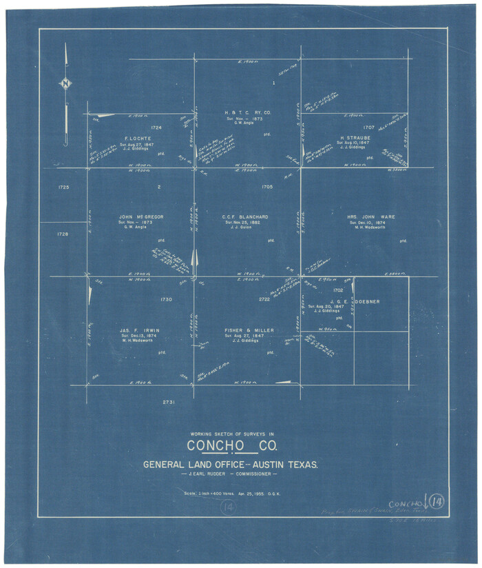
Print $20.00
- Digital $50.00
Concho County Working Sketch 14
1955
Size 24.7 x 21.0 inches
Map/Doc 68196
The Republic County of Fort Bend. January 28, 1841

Print $20.00
The Republic County of Fort Bend. January 28, 1841
2020
Size 14.7 x 21.6 inches
Map/Doc 96140
Flight Mission No. DAG-23K, Frame 164, Matagorda County

Print $20.00
- Digital $50.00
Flight Mission No. DAG-23K, Frame 164, Matagorda County
1953
Size 18.6 x 22.3 inches
Map/Doc 86502
[Surveys in Austin's Colony along the east bank of Mill Creek]
![216, [Surveys in Austin's Colony along the east bank of Mill Creek], General Map Collection](https://historictexasmaps.com/wmedia_w700/maps/216.tif.jpg)
Print $3.00
- Digital $50.00
[Surveys in Austin's Colony along the east bank of Mill Creek]
1827
Size 14.4 x 11.1 inches
Map/Doc 216
Kinney County Working Sketch 48

Print $40.00
- Digital $50.00
Kinney County Working Sketch 48
1979
Size 37.0 x 53.9 inches
Map/Doc 70230
Kimble County Working Sketch 72

Print $20.00
- Digital $50.00
Kimble County Working Sketch 72
1966
Size 28.7 x 17.6 inches
Map/Doc 70140