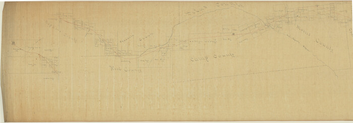
Camp County Sketch File 1

Print $4.00
- Digital $50.00
Camp County Sketch File 1
Size: 10.4 x 8.1 inches
17333
Titus County Sketch File 4

Print $4.00
- Digital $50.00
Titus County Sketch File 4
Size: 8.2 x 10.2 inches
38136
Upshur County Sketch File 5

Print $4.00
- Digital $50.00
Upshur County Sketch File 5
1855
Size: 8.3 x 12.9 inches
38740
Right of Way and Track Map of The Missouri, Kansas & Texas Railway of Texas

Print $40.00
- Digital $50.00
Right of Way and Track Map of The Missouri, Kansas & Texas Railway of Texas
1918
Size: 24.8 x 53.4 inches
64534
Right of Way and Track Map of The Missouri, Kansas & Texas Railway of Texas

Print $40.00
- Digital $50.00
Right of Way and Track Map of The Missouri, Kansas & Texas Railway of Texas
1918
Size: 24.9 x 51.6 inches
64535
Right of Way and Track Map of The Missouri, Kansas & Texas Railway of Texas

Print $40.00
- Digital $50.00
Right of Way and Track Map of The Missouri, Kansas & Texas Railway of Texas
1918
Size: 25.0 x 50.7 inches
64536
Right of Way and Track Map of The Missouri, Kansas & Texas Railway of Texas

Print $40.00
- Digital $50.00
Right of Way and Track Map of The Missouri, Kansas & Texas Railway of Texas
1918
Size: 24.9 x 53.1 inches
64537
Right of Way and Track Map of The Missouri, Kansas & Texas Railway of Texas

Print $40.00
- Digital $50.00
Right of Way and Track Map of The Missouri, Kansas & Texas Railway of Texas
1918
Size: 24.4 x 50.7 inches
64538
[East Line & Red River Railroad from Sulphur Springs to Jefferson]
Print $40.00
- Digital $50.00
[East Line & Red River Railroad from Sulphur Springs to Jefferson]
1879
Size: 38.0 x 108.5 inches
64768
Red River, Water-Shed of Cypress Creek in Texas Drainage Area

Print $4.00
- Digital $50.00
Red River, Water-Shed of Cypress Creek in Texas Drainage Area
1925
Size: 16.3 x 19.2 inches
65057
Map of Wood County, Texas

Print $20.00
- Digital $50.00
Map of Wood County, Texas
1879
Size: 17.5 x 17.1 inches
659
Camp County Working Sketch 1

Print $20.00
- Digital $50.00
Camp County Working Sketch 1
1970
Size: 32.9 x 29.7 inches
67877
Camp County Working Sketch 2

Print $20.00
- Digital $50.00
Camp County Working Sketch 2
1975
Size: 24.8 x 24.5 inches
67878
Camp County Working Sketch 3

Print $20.00
- Digital $50.00
Camp County Working Sketch 3
1982
Size: 32.1 x 24.4 inches
67879
Titus County Working Sketch 7

Print $20.00
- Digital $50.00
Titus County Working Sketch 7
1970
Size: 31.5 x 28.7 inches
69368
Camp County Working Sketch Graphic Index

Print $20.00
- Digital $50.00
Camp County Working Sketch Graphic Index
1942
Size: 25.1 x 29.7 inches
76487
General Highway Map, Franklin County, Morris County, Titus County, Camp County

Print $20.00
General Highway Map, Franklin County, Morris County, Titus County, Camp County
1940
Size: 18.4 x 25.1 inches
79040
General Highway Map, Camp County, Morris County, Titus County, Texas

Print $20.00
General Highway Map, Camp County, Morris County, Titus County, Texas
1961
Size: 24.7 x 18.1 inches
79400
Camp County Working Sketch 4

Print $20.00
- Digital $50.00
Camp County Working Sketch 4
2003
Size: 31.6 x 25.3 inches
82432
Morris County Rolled Sketch 2

Print $40.00
- Digital $50.00
Morris County Rolled Sketch 2
1944
Size: 59.4 x 43.5 inches
9550
Camp County Sketch File 1
Print $4.00
- Digital $50.00
Camp County Sketch File 1
-
Size
10.4 x 8.1 inches
-
Map/Doc
17333
Camp County

Print $20.00
- Digital $50.00
Camp County
1942
-
Size
25.6 x 31.6 inches
-
Map/Doc
1794
-
Creation Date
1942
Camp County

Print $20.00
- Digital $50.00
Camp County
1897
-
Size
18.0 x 26.3 inches
-
Map/Doc
3366
-
Creation Date
1897
Titus County Sketch File 4
Print $4.00
- Digital $50.00
Titus County Sketch File 4
-
Size
8.2 x 10.2 inches
-
Map/Doc
38136
Upshur County Sketch File 5
Print $4.00
- Digital $50.00
Upshur County Sketch File 5
1855
-
Size
8.3 x 12.9 inches
-
Map/Doc
38740
-
Creation Date
1855
Camp Co.

Print $20.00
- Digital $50.00
Camp Co.
1897
-
Size
19.5 x 28.5 inches
-
Map/Doc
4903
-
Creation Date
1897
Camp County, Texas

Print $3.00
- Digital $50.00
Camp County, Texas
1879
-
Size
9.6 x 16.8 inches
-
Map/Doc
512
-
Creation Date
1879
Right of Way and Track Map of The Missouri, Kansas & Texas Railway of Texas
Print $40.00
- Digital $50.00
Right of Way and Track Map of The Missouri, Kansas & Texas Railway of Texas
1918
-
Size
24.8 x 53.4 inches
-
Map/Doc
64534
-
Creation Date
1918
Right of Way and Track Map of The Missouri, Kansas & Texas Railway of Texas
Print $40.00
- Digital $50.00
Right of Way and Track Map of The Missouri, Kansas & Texas Railway of Texas
1918
-
Size
24.9 x 51.6 inches
-
Map/Doc
64535
-
Creation Date
1918
Right of Way and Track Map of The Missouri, Kansas & Texas Railway of Texas
Print $40.00
- Digital $50.00
Right of Way and Track Map of The Missouri, Kansas & Texas Railway of Texas
1918
-
Size
25.0 x 50.7 inches
-
Map/Doc
64536
-
Creation Date
1918
Right of Way and Track Map of The Missouri, Kansas & Texas Railway of Texas
Print $40.00
- Digital $50.00
Right of Way and Track Map of The Missouri, Kansas & Texas Railway of Texas
1918
-
Size
24.9 x 53.1 inches
-
Map/Doc
64537
-
Creation Date
1918
Right of Way and Track Map of The Missouri, Kansas & Texas Railway of Texas
Print $40.00
- Digital $50.00
Right of Way and Track Map of The Missouri, Kansas & Texas Railway of Texas
1918
-
Size
24.4 x 50.7 inches
-
Map/Doc
64538
-
Creation Date
1918
[East Line & Red River Railroad from Sulphur Springs to Jefferson]
Print $40.00
- Digital $50.00
[East Line & Red River Railroad from Sulphur Springs to Jefferson]
1879
-
Size
38.0 x 108.5 inches
-
Map/Doc
64768
-
Creation Date
1879
Red River, Water-Shed of Cypress Creek in Texas Drainage Area
Print $4.00
- Digital $50.00
Red River, Water-Shed of Cypress Creek in Texas Drainage Area
1925
-
Size
16.3 x 19.2 inches
-
Map/Doc
65057
-
Creation Date
1925
Map of Wood County, Texas
Print $20.00
- Digital $50.00
Map of Wood County, Texas
1879
-
Size
17.5 x 17.1 inches
-
Map/Doc
659
-
Creation Date
1879
Camp County Working Sketch 1
Print $20.00
- Digital $50.00
Camp County Working Sketch 1
1970
-
Size
32.9 x 29.7 inches
-
Map/Doc
67877
-
Creation Date
1970
Camp County Working Sketch 2
Print $20.00
- Digital $50.00
Camp County Working Sketch 2
1975
-
Size
24.8 x 24.5 inches
-
Map/Doc
67878
-
Creation Date
1975
Camp County Working Sketch 3
Print $20.00
- Digital $50.00
Camp County Working Sketch 3
1982
-
Size
32.1 x 24.4 inches
-
Map/Doc
67879
-
Creation Date
1982
Titus County Working Sketch 7
Print $20.00
- Digital $50.00
Titus County Working Sketch 7
1970
-
Size
31.5 x 28.7 inches
-
Map/Doc
69368
-
Creation Date
1970
Camp County

Print $20.00
- Digital $50.00
Camp County
1942
-
Size
25.6 x 31.4 inches
-
Map/Doc
73099
-
Creation Date
1942
Camp County Working Sketch Graphic Index
Print $20.00
- Digital $50.00
Camp County Working Sketch Graphic Index
1942
-
Size
25.1 x 29.7 inches
-
Map/Doc
76487
-
Creation Date
1942
Camp County

Print $20.00
- Digital $50.00
Camp County
1942
-
Size
22.2 x 28.7 inches
-
Map/Doc
77231
-
Creation Date
1942
General Highway Map, Franklin County, Morris County, Titus County, Camp County
Print $20.00
General Highway Map, Franklin County, Morris County, Titus County, Camp County
1940
-
Size
18.4 x 25.1 inches
-
Map/Doc
79040
-
Creation Date
1940
General Highway Map, Camp County, Morris County, Titus County, Texas
Print $20.00
General Highway Map, Camp County, Morris County, Titus County, Texas
1961
-
Size
24.7 x 18.1 inches
-
Map/Doc
79400
-
Creation Date
1961
Camp County Working Sketch 4
Print $20.00
- Digital $50.00
Camp County Working Sketch 4
2003
-
Size
31.6 x 25.3 inches
-
Map/Doc
82432
-
Creation Date
2003
Camp County

Print $20.00
- Digital $50.00
Camp County
1942
-
Size
25.7 x 32.0 inches
-
Map/Doc
95448
-
Creation Date
1942
Morris County Rolled Sketch 2
Print $40.00
- Digital $50.00
Morris County Rolled Sketch 2
1944
-
Size
59.4 x 43.5 inches
-
Map/Doc
9550
-
Creation Date
1944