Correct Map of Texas and Louisiana

Print $40.00
- Digital $50.00
Correct Map of Texas and Louisiana
1917
Size: 41.6 x 53.6 inches
2142
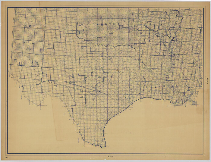
Grid Map Showing Texas, Louisiana, Arkansas, Mississippi and portions of New Mexico, Oklahoma and Tennessee

Print $40.00
- Digital $50.00
Grid Map Showing Texas, Louisiana, Arkansas, Mississippi and portions of New Mexico, Oklahoma and Tennessee
1940
Size: 34.2 x 48.1 inches
3121
[Grid Map Showing Texas, Louisiana, Arkansas, Mississippi and portions of New Mexico, Oklahoma and Tennessee]
Print $20.00
- Digital $50.00
[Grid Map Showing Texas, Louisiana, Arkansas, Mississippi and portions of New Mexico, Oklahoma and Tennessee]
1940
Size: 36.4 x 47.3 inches
4668
Current Miscellaneous File 37

Print $4.00
- Digital $50.00
Current Miscellaneous File 37
Size: 13.2 x 8.7 inches
73956
Stieler Map of 1879

Print $4.00
- Digital $50.00
Stieler Map of 1879
1879
Size: 28.9 x 23.1 inches
76054
Stieler Map of 1879

Print $4.00
- Digital $50.00
Stieler Map of 1879
1879
Size: 28.9 x 23.0 inches
76055
Stieler Map of 1879

Print $4.00
- Digital $50.00
Stieler Map of 1879
1879
Size: 28.8 x 23.0 inches
76056
Stieler Map of 1879

Print $4.00
- Digital $50.00
Stieler Map of 1879
1879
Size: 28.9 x 23.0 inches
76057
Missouri, Kansas, and Texas Railway

Print $20.00
Missouri, Kansas, and Texas Railway
1878
Size: 16.5 x 12.2 inches
76188
Missouri Pacific Railway System

Print $20.00
- Digital $50.00
Missouri Pacific Railway System
1888
Size: 20.0 x 20.0 inches
89223
International and Great Northern Railroad Lone Star Route and Connections

Print $20.00
- Digital $50.00
International and Great Northern Railroad Lone Star Route and Connections
1877
Size: 17.3 x 23.2 inches
93462
Map of Louisiana, Texas, Arkansas and Indian Territory

Print $20.00
- Digital $50.00
Map of Louisiana, Texas, Arkansas and Indian Territory
1885
Size: 9.0 x 12.2 inches
93519
Map of the State of Louisiana engraved for Mitchell's new intermediate geography, Louisiana Edition (Inset: Vicinity of New Orleans)

Print $20.00
- Digital $50.00
Map of the State of Louisiana engraved for Mitchell's new intermediate geography, Louisiana Edition (Inset: Vicinity of New Orleans)
1885
Size: 9.0 x 12.2 inches
93533
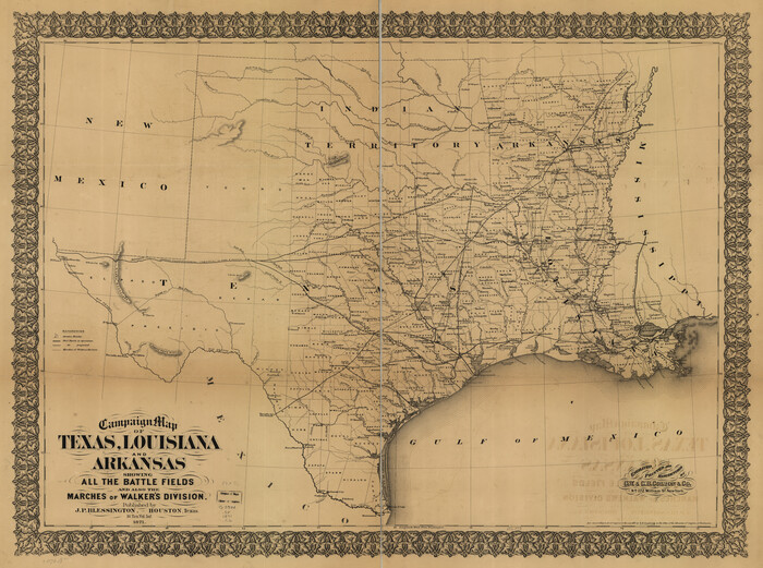
Campaign map of Texas, Louisiana and Arkansas, showing all the battle fields and also the marches of Walker's Division. [1861-65]
Print $20.00
Campaign map of Texas, Louisiana and Arkansas, showing all the battle fields and also the marches of Walker's Division. [1861-65]
1871
Size: 27.6 x 37.0 inches
93567
Map of the Military Department of the Gulf

Print $20.00
Map of the Military Department of the Gulf
1864
Size: 24.4 x 45.7 inches
93568
Map exhibiting the fixed location of the main trunk of the New-Orleans, Opelousas & Great Western Railroad of Louisiana…

Print $20.00
Map exhibiting the fixed location of the main trunk of the New-Orleans, Opelousas & Great Western Railroad of Louisiana…
1859
Size: 25.2 x 37.0 inches
93582
Map of the military dep't of Texas : being a section of the map of the territory of the U.S. from the Mississippi River to the Pacific Ocean

Print $20.00
Map of the military dep't of Texas : being a section of the map of the territory of the U.S. from the Mississippi River to the Pacific Ocean
1859
Size: 20.9 x 24.0 inches
93596
J. H. Colton's map of the state of Louisiana and eastern part of Texas compiled from United States Surveys, and other authentic sources, showing the counties, townships, sections. Fractional sections, settlement rights, railroads, &c.

Print $20.00
J. H. Colton's map of the state of Louisiana and eastern part of Texas compiled from United States Surveys, and other authentic sources, showing the counties, townships, sections. Fractional sections, settlement rights, railroads, &c.
1863
Size: 35.8 x 43.3 inches
93603
Map showing the Houston & Texas Central Railroad and its connections

Print $20.00
Map showing the Houston & Texas Central Railroad and its connections
1867
Size: 22.0 x 25.2 inches
93604
Map showing the Kansas & Gulf Short Line R.R. and the Texas & St. Louis R'y with its branches, extensions and connections.

Print $20.00
Map showing the Kansas & Gulf Short Line R.R. and the Texas & St. Louis R'y with its branches, extensions and connections.
1881
Size: 30.3 x 30.9 inches
93608
Maps showing Arkansas Central, the Helena & Corinth, and the Pine Bluff & Southwestern Railroads together forming the Texas & Northeastern Railway.

Print $20.00
Maps showing Arkansas Central, the Helena & Corinth, and the Pine Bluff & Southwestern Railroads together forming the Texas & Northeastern Railway.
1872
Size: 26.8 x 29.1 inches
93609
Map showing the line of the Cairo & Fulton Railroad and its connections.

Print $20.00
Map showing the line of the Cairo & Fulton Railroad and its connections.
1871
Size: 24.0 x 22.0 inches
93611
Map of the Rio Grande and Pecos Railway showing its connections with…

Print $20.00
Map of the Rio Grande and Pecos Railway showing its connections with…
1882
Size: 42.1 x 40.2 inches
93620
Maps of the new and popular St. Louis and Texas Short Line composed of the St. Louis, Iron Mountain & Southern, Texas & Pacific and International & Great Northern Railways

Print $20.00
- Digital $50.00
Maps of the new and popular St. Louis and Texas Short Line composed of the St. Louis, Iron Mountain & Southern, Texas & Pacific and International & Great Northern Railways
1874
Size: 19.0 x 32.0 inches
93638
Colton's new map of the State of Texas, the Indian Territory and adjoining portions of New Mexico, Louisiana and Arkansas

Print $20.00
- Digital $50.00
Colton's new map of the State of Texas, the Indian Territory and adjoining portions of New Mexico, Louisiana and Arkansas
1874
Size: 34.7 x 38.7 inches
93762
Colton's New Map of the State of Texas, the Indian Territory and adjoining portions of New Mexico, Louisiana and Arkansas

Print $20.00
- Digital $50.00
Colton's New Map of the State of Texas, the Indian Territory and adjoining portions of New Mexico, Louisiana and Arkansas
1882
Size: 32.8 x 37.3 inches
93909
Langtree's New Sectional Map of the State of Arkansas

Print $20.00
- Digital $50.00
Langtree's New Sectional Map of the State of Arkansas
Size: 34.6 x 38.4 inches
93987
Map of the Interior of Louisiana with a part of New Mexico

Print $20.00
Map of the Interior of Louisiana with a part of New Mexico
1811
Size: 11.1 x 14.2 inches
94269
Correct Map of Texas and Louisiana
Print $40.00
- Digital $50.00
Correct Map of Texas and Louisiana
1917
-
Size
41.6 x 53.6 inches
-
Map/Doc
2142
-
Creation Date
1917
Grid Map Showing Texas, Louisiana, Arkansas, Mississippi and portions of New Mexico, Oklahoma and Tennessee
Print $40.00
- Digital $50.00
Grid Map Showing Texas, Louisiana, Arkansas, Mississippi and portions of New Mexico, Oklahoma and Tennessee
1940
-
Size
34.2 x 48.1 inches
-
Map/Doc
3121
-
Creation Date
1940
[Grid Map Showing Texas, Louisiana, Arkansas, Mississippi and portions of New Mexico, Oklahoma and Tennessee]
Print $20.00
- Digital $50.00
[Grid Map Showing Texas, Louisiana, Arkansas, Mississippi and portions of New Mexico, Oklahoma and Tennessee]
1940
-
Size
36.4 x 47.3 inches
-
Map/Doc
4668
-
Creation Date
1940
Current Miscellaneous File 37
Print $4.00
- Digital $50.00
Current Miscellaneous File 37
-
Size
13.2 x 8.7 inches
-
Map/Doc
73956
Stieler Map of 1879
Print $4.00
- Digital $50.00
Stieler Map of 1879
1879
-
Size
28.9 x 23.1 inches
-
Map/Doc
76054
-
Creation Date
1879
Stieler Map of 1879
Print $4.00
- Digital $50.00
Stieler Map of 1879
1879
-
Size
28.9 x 23.0 inches
-
Map/Doc
76055
-
Creation Date
1879
Stieler Map of 1879
Print $4.00
- Digital $50.00
Stieler Map of 1879
1879
-
Size
28.8 x 23.0 inches
-
Map/Doc
76056
-
Creation Date
1879
Stieler Map of 1879
Print $4.00
- Digital $50.00
Stieler Map of 1879
1879
-
Size
28.9 x 23.0 inches
-
Map/Doc
76057
-
Creation Date
1879
Missouri, Kansas, and Texas Railway
Print $20.00
Missouri, Kansas, and Texas Railway
1878
-
Size
16.5 x 12.2 inches
-
Map/Doc
76188
-
Creation Date
1878
Map of the Southwest

Print $20.00
Map of the Southwest
1881
-
Size
27.4 x 25.5 inches
-
Map/Doc
76243
-
Creation Date
1881
Missouri Pacific Railway System
Print $20.00
- Digital $50.00
Missouri Pacific Railway System
1888
-
Size
20.0 x 20.0 inches
-
Map/Doc
89223
-
Creation Date
1888
International and Great Northern Railroad Lone Star Route and Connections
Print $20.00
- Digital $50.00
International and Great Northern Railroad Lone Star Route and Connections
1877
-
Size
17.3 x 23.2 inches
-
Map/Doc
93462
-
Creation Date
1877
Map of Louisiana, Texas, Arkansas and Indian Territory
Print $20.00
- Digital $50.00
Map of Louisiana, Texas, Arkansas and Indian Territory
1885
-
Size
9.0 x 12.2 inches
-
Map/Doc
93519
-
Creation Date
1885
Map of the State of Louisiana engraved for Mitchell's new intermediate geography, Louisiana Edition (Inset: Vicinity of New Orleans)
Print $20.00
- Digital $50.00
Map of the State of Louisiana engraved for Mitchell's new intermediate geography, Louisiana Edition (Inset: Vicinity of New Orleans)
1885
-
Size
9.0 x 12.2 inches
-
Map/Doc
93533
-
Creation Date
1885
Campaign map of Texas, Louisiana and Arkansas, showing all the battle fields and also the marches of Walker's Division. [1861-65]
Print $20.00
Campaign map of Texas, Louisiana and Arkansas, showing all the battle fields and also the marches of Walker's Division. [1861-65]
1871
-
Size
27.6 x 37.0 inches
-
Map/Doc
93567
-
Creation Date
1871
Map of the Military Department of the Gulf
Print $20.00
Map of the Military Department of the Gulf
1864
-
Size
24.4 x 45.7 inches
-
Map/Doc
93568
-
Creation Date
1864
Map exhibiting the fixed location of the main trunk of the New-Orleans, Opelousas & Great Western Railroad of Louisiana…
Print $20.00
Map exhibiting the fixed location of the main trunk of the New-Orleans, Opelousas & Great Western Railroad of Louisiana…
1859
-
Size
25.2 x 37.0 inches
-
Map/Doc
93582
-
Creation Date
1859
Map of the military dep't of Texas : being a section of the map of the territory of the U.S. from the Mississippi River to the Pacific Ocean
Print $20.00
Map of the military dep't of Texas : being a section of the map of the territory of the U.S. from the Mississippi River to the Pacific Ocean
1859
-
Size
20.9 x 24.0 inches
-
Map/Doc
93596
-
Creation Date
1859
J. H. Colton's map of the state of Louisiana and eastern part of Texas compiled from United States Surveys, and other authentic sources, showing the counties, townships, sections. Fractional sections, settlement rights, railroads, &c.
Print $20.00
J. H. Colton's map of the state of Louisiana and eastern part of Texas compiled from United States Surveys, and other authentic sources, showing the counties, townships, sections. Fractional sections, settlement rights, railroads, &c.
1863
-
Size
35.8 x 43.3 inches
-
Map/Doc
93603
-
Creation Date
1863
Map showing the Houston & Texas Central Railroad and its connections
Print $20.00
Map showing the Houston & Texas Central Railroad and its connections
1867
-
Size
22.0 x 25.2 inches
-
Map/Doc
93604
-
Creation Date
1867
Map showing the Kansas & Gulf Short Line R.R. and the Texas & St. Louis R'y with its branches, extensions and connections.
Print $20.00
Map showing the Kansas & Gulf Short Line R.R. and the Texas & St. Louis R'y with its branches, extensions and connections.
1881
-
Size
30.3 x 30.9 inches
-
Map/Doc
93608
-
Creation Date
1881
Maps showing Arkansas Central, the Helena & Corinth, and the Pine Bluff & Southwestern Railroads together forming the Texas & Northeastern Railway.
Print $20.00
Maps showing Arkansas Central, the Helena & Corinth, and the Pine Bluff & Southwestern Railroads together forming the Texas & Northeastern Railway.
1872
-
Size
26.8 x 29.1 inches
-
Map/Doc
93609
-
Creation Date
1872
Map showing the line of the Cairo & Fulton Railroad and its connections.
Print $20.00
Map showing the line of the Cairo & Fulton Railroad and its connections.
1871
-
Size
24.0 x 22.0 inches
-
Map/Doc
93611
-
Creation Date
1871
Map of the Rio Grande and Pecos Railway showing its connections with…
Print $20.00
Map of the Rio Grande and Pecos Railway showing its connections with…
1882
-
Size
42.1 x 40.2 inches
-
Map/Doc
93620
-
Creation Date
1882
Maps of the new and popular St. Louis and Texas Short Line composed of the St. Louis, Iron Mountain & Southern, Texas & Pacific and International & Great Northern Railways
Print $20.00
- Digital $50.00
Maps of the new and popular St. Louis and Texas Short Line composed of the St. Louis, Iron Mountain & Southern, Texas & Pacific and International & Great Northern Railways
1874
-
Size
19.0 x 32.0 inches
-
Map/Doc
93638
-
Creation Date
1874
Colton's new map of the State of Texas, the Indian Territory and adjoining portions of New Mexico, Louisiana and Arkansas
Print $20.00
- Digital $50.00
Colton's new map of the State of Texas, the Indian Territory and adjoining portions of New Mexico, Louisiana and Arkansas
1874
-
Size
34.7 x 38.7 inches
-
Map/Doc
93762
-
Creation Date
1874
Colton's New Map of the State of Texas, the Indian Territory and adjoining portions of New Mexico, Louisiana and Arkansas
Print $20.00
- Digital $50.00
Colton's New Map of the State of Texas, the Indian Territory and adjoining portions of New Mexico, Louisiana and Arkansas
1882
-
Size
32.8 x 37.3 inches
-
Map/Doc
93909
-
Creation Date
1882
Langtree's New Sectional Map of the State of Arkansas
Print $20.00
- Digital $50.00
Langtree's New Sectional Map of the State of Arkansas
-
Size
34.6 x 38.4 inches
-
Map/Doc
93987
Map of the Interior of Louisiana with a part of New Mexico
Print $20.00
Map of the Interior of Louisiana with a part of New Mexico
1811
-
Size
11.1 x 14.2 inches
-
Map/Doc
94269
-
Creation Date
1811
Gulf States and Arkansas

Print $20.00
Gulf States and Arkansas
1874
-
Size
9.4 x 12.0 inches
-
Map/Doc
95285
-
Creation Date
1874