Cochran County Rolled Sketch 6

Print $20.00
- Digital $50.00
Cochran County Rolled Sketch 6
2025
Size: 20.5 x 28.2 inches
97417
Cochran County Working Sketch 4

Print $20.00
- Digital $50.00
Cochran County Working Sketch 4
1984
Size: 37.7 x 24.8 inches
68015
Cochran County Working Sketch 3

Print $20.00
- Digital $50.00
Cochran County Working Sketch 3
1979
Size: 33.4 x 30.9 inches
68014
Cochran County Working Sketch 2

Print $40.00
- Digital $50.00
Cochran County Working Sketch 2
1971
Size: 52.9 x 45.3 inches
68013
General Highway Map, Cochran County, Texas

Print $20.00
General Highway Map, Cochran County, Texas
1961
Size: 24.8 x 18.2 inches
79410
Roberts Addition to the City of Morton

Print $3.00
- Digital $50.00
Roberts Addition to the City of Morton
1958
Size: 11.8 x 11.4 inches
92540
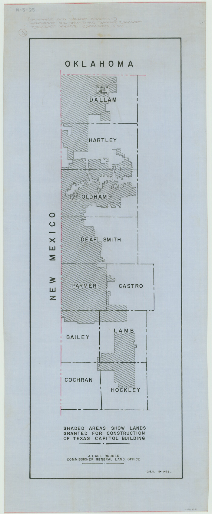
[Capitol lands granted for purpose of building State Capitol]
Print $20.00
- Digital $50.00
[Capitol lands granted for purpose of building State Capitol]
1956
Size: 31.5 x 13.0 inches
2073
Terry County Sketch File 17

Print $5.00
- Digital $50.00
Terry County Sketch File 17
1956
Size: 27.7 x 24.7 inches
12429
Section 10, Block Z, Cochran County, Texas

Print $20.00
- Digital $50.00
Section 10, Block Z, Cochran County, Texas
1952
Size: 12.2 x 17.0 inches
92521
Slaughter Addition, Morton, Texas

Print $3.00
- Digital $50.00
Slaughter Addition, Morton, Texas
1951
Size: 16.6 x 11.8 inches
92541
Cochran County Rolled Sketch 5

Print $20.00
- Digital $50.00
Cochran County Rolled Sketch 5
1949
Size: 21.5 x 22.0 inches
5502
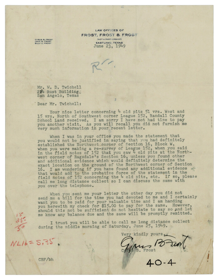
[Randall County School Land League 152 and vicinity]
Print $2.00
- Digital $50.00
[Randall County School Land League 152 and vicinity]
1949
Size: 5.8 x 7.5 inches
92999
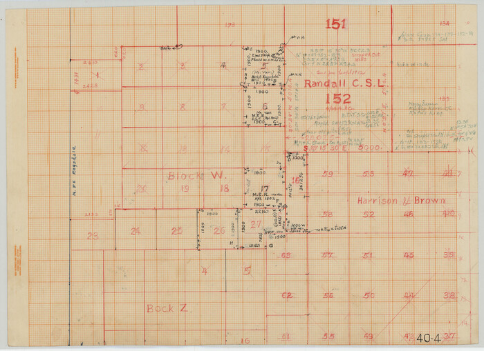
[Blocks W and Z with tie lines]
Print $20.00
- Digital $50.00
[Blocks W and Z with tie lines]
1949
Size: 14.4 x 14.2 inches
90451
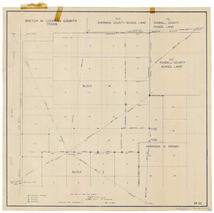
Sketch in Cochran County, Texas

Print $20.00
- Digital $50.00
Sketch in Cochran County, Texas
1949
Size: 21.8 x 21.0 inches
92495
Sketch in Cochran County, Texas

Print $20.00
- Digital $50.00
Sketch in Cochran County, Texas
1949
Size: 22.4 x 21.6 inches
92523
[Randall County School Land League 152 and vicinity]
Print $3.00
- Digital $50.00
[Randall County School Land League 152 and vicinity]
1949
Size: 15.0 x 10.9 inches
92998
General Highway Map Cochran County, Texas

Print $20.00
- Digital $50.00
General Highway Map Cochran County, Texas
1948
Size: 18.7 x 25.6 inches
92498
Cochran County Working Sketch Graphic Index

Print $20.00
- Digital $50.00
Cochran County Working Sketch Graphic Index
1946
Size: 31.9 x 23.9 inches
76495
Cochran County Rolled Sketch 4

Print $20.00
- Digital $50.00
Cochran County Rolled Sketch 4
1945
Size: 16.8 x 23.7 inches
5501
Cochran and Yoakum Counties, Texas

Print $20.00
- Digital $50.00
Cochran and Yoakum Counties, Texas
1945
Size: 24.4 x 17.4 inches
92513
Cochran County Rolled Sketch 3

Print $20.00
- Digital $50.00
Cochran County Rolled Sketch 3
1944
Size: 29.3 x 43.4 inches
8607
Terry County Rolled Sketch 6

Print $20.00
- Digital $50.00
Terry County Rolled Sketch 6
1944
Size: 36.5 x 43.7 inches
9996
Hockley County Sketch File 19a

Print $20.00
- Digital $50.00
Hockley County Sketch File 19a
1944
Size: 15.7 x 25.1 inches
11776
Hockley County Sketch File 19

Print $20.00
- Digital $50.00
Hockley County Sketch File 19
1944
Size: 14.9 x 25.8 inches
11775
General Highway Map Cochran County, Texas

Print $40.00
- Digital $50.00
General Highway Map Cochran County, Texas
1942
Size: 37.4 x 50.1 inches
89851
Cochran County Sketch File 8

Print $32.00
- Digital $50.00
Cochran County Sketch File 8
1940
Size: 11.0 x 8.8 inches
18555
Cochran County Rolled Sketch 6
Print $20.00
- Digital $50.00
Cochran County Rolled Sketch 6
2025
-
Size
20.5 x 28.2 inches
-
Map/Doc
97417
-
Creation Date
2025
Cochran County Working Sketch 4
Print $20.00
- Digital $50.00
Cochran County Working Sketch 4
1984
-
Size
37.7 x 24.8 inches
-
Map/Doc
68015
-
Creation Date
1984
Cochran County Working Sketch 3
Print $20.00
- Digital $50.00
Cochran County Working Sketch 3
1979
-
Size
33.4 x 30.9 inches
-
Map/Doc
68014
-
Creation Date
1979
Cochran County Working Sketch 2
Print $40.00
- Digital $50.00
Cochran County Working Sketch 2
1971
-
Size
52.9 x 45.3 inches
-
Map/Doc
68013
-
Creation Date
1971
General Highway Map, Cochran County, Texas
Print $20.00
General Highway Map, Cochran County, Texas
1961
-
Size
24.8 x 18.2 inches
-
Map/Doc
79410
-
Creation Date
1961
Roberts Addition to the City of Morton
Print $3.00
- Digital $50.00
Roberts Addition to the City of Morton
1958
-
Size
11.8 x 11.4 inches
-
Map/Doc
92540
-
Creation Date
1958
[Capitol lands granted for purpose of building State Capitol]
Print $20.00
- Digital $50.00
[Capitol lands granted for purpose of building State Capitol]
1956
-
Size
31.5 x 13.0 inches
-
Map/Doc
2073
-
Creation Date
1956
Terry County Sketch File 17
Print $5.00
- Digital $50.00
Terry County Sketch File 17
1956
-
Size
27.7 x 24.7 inches
-
Map/Doc
12429
-
Creation Date
1956
Section 10, Block Z, Cochran County, Texas
Print $20.00
- Digital $50.00
Section 10, Block Z, Cochran County, Texas
1952
-
Size
12.2 x 17.0 inches
-
Map/Doc
92521
-
Creation Date
1952
Slaughter Addition, Morton, Texas
Print $3.00
- Digital $50.00
Slaughter Addition, Morton, Texas
1951
-
Size
16.6 x 11.8 inches
-
Map/Doc
92541
-
Creation Date
1951
Cochran County Rolled Sketch 5
Print $20.00
- Digital $50.00
Cochran County Rolled Sketch 5
1949
-
Size
21.5 x 22.0 inches
-
Map/Doc
5502
-
Creation Date
1949
[Randall County School Land League 152 and vicinity]
Print $2.00
- Digital $50.00
[Randall County School Land League 152 and vicinity]
1949
-
Size
5.8 x 7.5 inches
-
Map/Doc
92999
-
Creation Date
1949
[Blocks W and Z with tie lines]
Print $20.00
- Digital $50.00
[Blocks W and Z with tie lines]
1949
-
Size
14.4 x 14.2 inches
-
Map/Doc
90451
-
Creation Date
1949
Sketch in Cochran County, Texas
Print $20.00
- Digital $50.00
Sketch in Cochran County, Texas
1949
-
Size
21.8 x 21.0 inches
-
Map/Doc
92495
-
Creation Date
1949
Sketch in Cochran County, Texas
Print $20.00
- Digital $50.00
Sketch in Cochran County, Texas
1949
-
Size
22.4 x 21.6 inches
-
Map/Doc
92523
-
Creation Date
1949
[Randall County School Land League 152 and vicinity]
Print $3.00
- Digital $50.00
[Randall County School Land League 152 and vicinity]
1949
-
Size
15.0 x 10.9 inches
-
Map/Doc
92998
-
Creation Date
1949
General Highway Map Cochran County, Texas
Print $20.00
- Digital $50.00
General Highway Map Cochran County, Texas
1948
-
Size
18.7 x 25.6 inches
-
Map/Doc
92498
-
Creation Date
1948
Cochran County

Print $20.00
- Digital $50.00
Cochran County
1946
-
Size
33.2 x 25.0 inches
-
Map/Doc
1801
-
Creation Date
1946
Cochran County

Print $20.00
- Digital $50.00
Cochran County
1946
-
Size
33.0 x 25.3 inches
-
Map/Doc
73107
-
Creation Date
1946
Cochran County

Print $20.00
- Digital $50.00
Cochran County
1946
-
Size
30.8 x 23.1 inches
-
Map/Doc
77239
-
Creation Date
1946
Cochran County Working Sketch Graphic Index
Print $20.00
- Digital $50.00
Cochran County Working Sketch Graphic Index
1946
-
Size
31.9 x 23.9 inches
-
Map/Doc
76495
-
Creation Date
1946
Cochran County

Print $20.00
- Digital $50.00
Cochran County
1946
-
Size
33.3 x 25.5 inches
-
Map/Doc
95456
-
Creation Date
1946
Cochran County Rolled Sketch 4
Print $20.00
- Digital $50.00
Cochran County Rolled Sketch 4
1945
-
Size
16.8 x 23.7 inches
-
Map/Doc
5501
-
Creation Date
1945
Cochran and Yoakum Counties, Texas
Print $20.00
- Digital $50.00
Cochran and Yoakum Counties, Texas
1945
-
Size
24.4 x 17.4 inches
-
Map/Doc
92513
-
Creation Date
1945
Cochran County Rolled Sketch 3
Print $20.00
- Digital $50.00
Cochran County Rolled Sketch 3
1944
-
Size
29.3 x 43.4 inches
-
Map/Doc
8607
-
Creation Date
1944
Terry County Rolled Sketch 6
Print $20.00
- Digital $50.00
Terry County Rolled Sketch 6
1944
-
Size
36.5 x 43.7 inches
-
Map/Doc
9996
-
Creation Date
1944
Hockley County Sketch File 19a
Print $20.00
- Digital $50.00
Hockley County Sketch File 19a
1944
-
Size
15.7 x 25.1 inches
-
Map/Doc
11776
-
Creation Date
1944
Hockley County Sketch File 19
Print $20.00
- Digital $50.00
Hockley County Sketch File 19
1944
-
Size
14.9 x 25.8 inches
-
Map/Doc
11775
-
Creation Date
1944
General Highway Map Cochran County, Texas
Print $40.00
- Digital $50.00
General Highway Map Cochran County, Texas
1942
-
Size
37.4 x 50.1 inches
-
Map/Doc
89851
-
Creation Date
1942
Cochran County Sketch File 8
Print $32.00
- Digital $50.00
Cochran County Sketch File 8
1940
-
Size
11.0 x 8.8 inches
-
Map/Doc
18555
-
Creation Date
1940