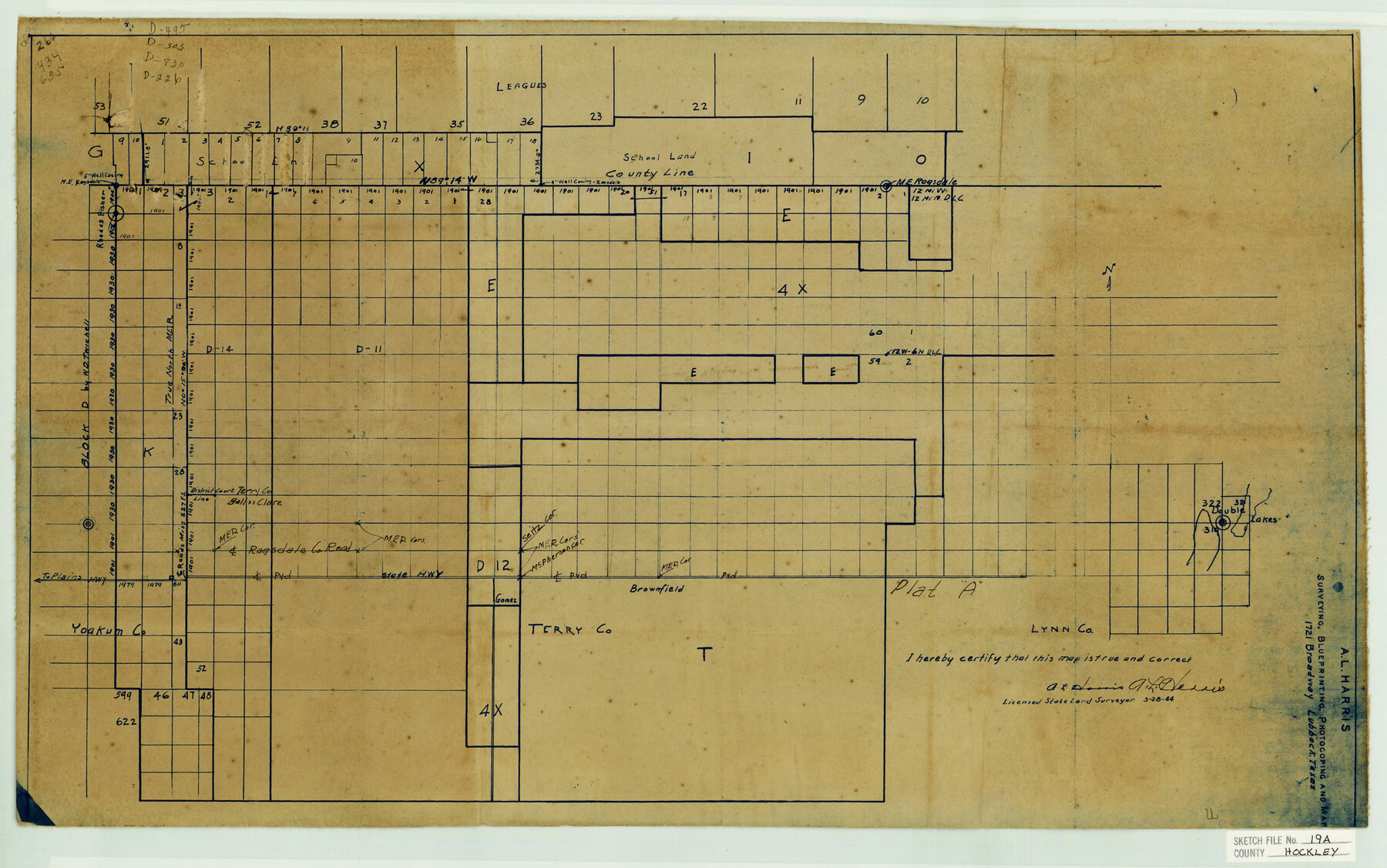
Hockley County Sketch File 19a
Hockley-Cochran-Terry-Yoakum Counties General Sketch
-
Map/Doc
11776
-
Collection
General Map Collection
-
Object Dates
3/28/1944 (Creation Date)
6/22/1944 (File Date)
-
People and Organizations
A.L. Harris (Surveyor/Engineer)
-
Counties
Hockley Cochran Terry Yoakum
-
Subjects
Cadastral Surveying Sketch File
-
Height x Width
15.7 x 25.1 inches
39.9 x 63.8 cm
-
Medium
blueprint/diazo
Part of: General Map Collection
Sterling County Rolled Sketch 12
![9946, Sterling County Rolled Sketch 12, General Map Collection](https://historictexasmaps.com/wmedia_w700/maps/9946.tif.jpg)
Print $20.00
- Digital $50.00
Sterling County Rolled Sketch 12
1941
Size 35.6 x 35.0 inches
Map/Doc 9946
Right of Way and Track Map, Dayton-Goose Creek Ry. Co., Station 612+40 to Station 792+00
![64368, Right of Way and Track Map, Dayton-Goose Creek Ry. Co., Station 612+40 to Station 792+00, General Map Collection](https://historictexasmaps.com/wmedia_w700/maps/64368.tif.jpg)
Print $40.00
- Digital $50.00
Right of Way and Track Map, Dayton-Goose Creek Ry. Co., Station 612+40 to Station 792+00
1917
Size 25.3 x 56.5 inches
Map/Doc 64368
Hudspeth County Working Sketch 14
![66296, Hudspeth County Working Sketch 14, General Map Collection](https://historictexasmaps.com/wmedia_w700/maps/66296-1.tif.jpg)
Print $20.00
- Digital $50.00
Hudspeth County Working Sketch 14
Size 24.2 x 41.2 inches
Map/Doc 66296
Right of Way and Track Map Houston & Texas Central R.R. operated by the T. and N. O. R.R. Co., Fort Worth Branch
![64540, Right of Way and Track Map Houston & Texas Central R.R. operated by the T. and N. O. R.R. Co., Fort Worth Branch, General Map Collection](https://historictexasmaps.com/wmedia_w700/maps/64540.tif.jpg)
Print $40.00
- Digital $50.00
Right of Way and Track Map Houston & Texas Central R.R. operated by the T. and N. O. R.R. Co., Fort Worth Branch
1918
Size 31.1 x 57.4 inches
Map/Doc 64540
Flight Mission No. BRA-16M, Frame 65, Jefferson County
![85682, Flight Mission No. BRA-16M, Frame 65, Jefferson County, General Map Collection](https://historictexasmaps.com/wmedia_w700/pdf_converted_jpg/qi_pdf_thumbnail_32879.jpg)
Print $20.00
- Digital $50.00
Flight Mission No. BRA-16M, Frame 65, Jefferson County
1953
Size 18.7 x 22.4 inches
Map/Doc 85682
Crockett County Sketch File 99
![19980, Crockett County Sketch File 99, General Map Collection](https://historictexasmaps.com/wmedia_w700/pdf_converted_jpg/qi_pdf_thumbnail_10529.jpg)
Print $14.00
- Digital $50.00
Crockett County Sketch File 99
1925
Size 14.4 x 9.4 inches
Map/Doc 19980
Menard County Working Sketch 16
![70963, Menard County Working Sketch 16, General Map Collection](https://historictexasmaps.com/wmedia_w700/maps/70963.tif.jpg)
Print $40.00
- Digital $50.00
Menard County Working Sketch 16
Size 49.1 x 39.1 inches
Map/Doc 70963
Flight Mission No. CRC-4R, Frame 184, Chambers County
![84935, Flight Mission No. CRC-4R, Frame 184, Chambers County, General Map Collection](https://historictexasmaps.com/wmedia_w700/pdf_converted_jpg/qi_pdf_thumbnail_32148.jpg)
Print $20.00
- Digital $50.00
Flight Mission No. CRC-4R, Frame 184, Chambers County
1956
Size 18.6 x 22.3 inches
Map/Doc 84935
Sketch showing progress of topographical work Laguna Madre and vicinity from Rainey Is. to Baffins Bay, Coast of Texas Sect. IX [and accompanying letter]
![72959, Sketch showing progress of topographical work Laguna Madre and vicinity from Rainey Is. to Baffins Bay, Coast of Texas Sect. IX [and accompanying letter], General Map Collection](https://historictexasmaps.com/wmedia_w700/maps/72959.tif.jpg)
Print $2.00
- Digital $50.00
Sketch showing progress of topographical work Laguna Madre and vicinity from Rainey Is. to Baffins Bay, Coast of Texas Sect. IX [and accompanying letter]
1881
Size 11.0 x 8.7 inches
Map/Doc 72959
Flight Mission No. CGI-3N, Frame 52, Cameron County
![84558, Flight Mission No. CGI-3N, Frame 52, Cameron County, General Map Collection](https://historictexasmaps.com/wmedia_w700/pdf_converted_jpg/qi_pdf_thumbnail_31773.jpg)
Print $20.00
- Digital $50.00
Flight Mission No. CGI-3N, Frame 52, Cameron County
1954
Size 18.7 x 22.2 inches
Map/Doc 84558
[Sketch of Oyster Bay, Bastrop Bay, Chocolate Bay, and West Bay]
![3103, [Sketch of Oyster Bay, Bastrop Bay, Chocolate Bay, and West Bay], General Map Collection](https://historictexasmaps.com/wmedia_w700/maps/3103.tif.jpg)
Print $20.00
- Digital $50.00
[Sketch of Oyster Bay, Bastrop Bay, Chocolate Bay, and West Bay]
1871
Size 6.0 x 23.9 inches
Map/Doc 3103
Clay County Boundary File 17a
![51435, Clay County Boundary File 17a, General Map Collection](https://historictexasmaps.com/wmedia_w700/pdf_converted_jpg/qi_pdf_thumbnail_15769.jpg)
Print $40.00
- Digital $50.00
Clay County Boundary File 17a
Size 47.0 x 22.0 inches
Map/Doc 51435
You may also like
Map of Cherokee County
![3388, Map of Cherokee County, General Map Collection](https://historictexasmaps.com/wmedia_w700/maps/3388.tif.jpg)
Print $20.00
- Digital $50.00
Map of Cherokee County
1871
Size 25.0 x 17.6 inches
Map/Doc 3388
Baylor County Working Sketch 12
![67297, Baylor County Working Sketch 12, General Map Collection](https://historictexasmaps.com/wmedia_w700/maps/67297.tif.jpg)
Print $20.00
- Digital $50.00
Baylor County Working Sketch 12
1960
Size 27.3 x 21.6 inches
Map/Doc 67297
Map of the County and City of Galveston, Texas
![79290, Map of the County and City of Galveston, Texas, Texas State Library and Archives](https://historictexasmaps.com/wmedia_w700/maps/79290.tif.jpg)
Print $20.00
Map of the County and City of Galveston, Texas
1891
Size 24.5 x 34.4 inches
Map/Doc 79290
[Block 4 and Vicinity]
![91424, [Block 4 and Vicinity], Twichell Survey Records](https://historictexasmaps.com/wmedia_w700/maps/91424-1.tif.jpg)
Print $20.00
- Digital $50.00
[Block 4 and Vicinity]
1883
Size 43.2 x 15.2 inches
Map/Doc 91424
Water-Shed of the Brazos River
![65263, Water-Shed of the Brazos River, General Map Collection](https://historictexasmaps.com/wmedia_w700/maps/65263-GC.tif.jpg)
Print $40.00
- Digital $50.00
Water-Shed of the Brazos River
1925
Size 35.0 x 88.0 inches
Map/Doc 65263
Flight Mission No. DQN-2K, Frame 30, Calhoun County
![84237, Flight Mission No. DQN-2K, Frame 30, Calhoun County, General Map Collection](https://historictexasmaps.com/wmedia_w700/pdf_converted_jpg/qi_pdf_thumbnail_31454.jpg)
Print $20.00
- Digital $50.00
Flight Mission No. DQN-2K, Frame 30, Calhoun County
1953
Size 18.5 x 22.2 inches
Map/Doc 84237
Baylor County Boundary File 16
![50433, Baylor County Boundary File 16, General Map Collection](https://historictexasmaps.com/wmedia_w700/pdf_converted_jpg/qi_pdf_thumbnail_15643.jpg)
Print $2.00
- Digital $50.00
Baylor County Boundary File 16
Size 11.2 x 8.7 inches
Map/Doc 50433
Glasscock County Rolled Sketch 5
![6016, Glasscock County Rolled Sketch 5, General Map Collection](https://historictexasmaps.com/wmedia_w700/maps/6016-GC.tif.jpg)
Print $20.00
- Digital $50.00
Glasscock County Rolled Sketch 5
1944
Size 41.4 x 33.7 inches
Map/Doc 6016
Falls County Sketch File 11
![22352, Falls County Sketch File 11, General Map Collection](https://historictexasmaps.com/wmedia_w700/pdf_converted_jpg/qi_pdf_thumbnail_11059.jpg)
Print $13.00
- Digital $50.00
Falls County Sketch File 11
1859
Size 12.6 x 9.8 inches
Map/Doc 22352
McCulloch County
![73234, McCulloch County, General Map Collection](https://historictexasmaps.com/wmedia_w700/maps/73234.tif.jpg)
Print $20.00
- Digital $50.00
McCulloch County
1949
Size 47.0 x 35.8 inches
Map/Doc 73234
Live Oak County Sketch File 13
![30270, Live Oak County Sketch File 13, General Map Collection](https://historictexasmaps.com/wmedia_w700/pdf_converted_jpg/qi_pdf_thumbnail_12773.jpg)
Print $17.00
- Digital $50.00
Live Oak County Sketch File 13
1880
Size 10.2 x 13.7 inches
Map/Doc 30270
Hockley County
![3675, Hockley County, General Map Collection](https://historictexasmaps.com/wmedia_w700/maps/3675-1.tif.jpg)
Print $20.00
- Digital $50.00
Hockley County
1897
Size 19.1 x 20.5 inches
Map/Doc 3675