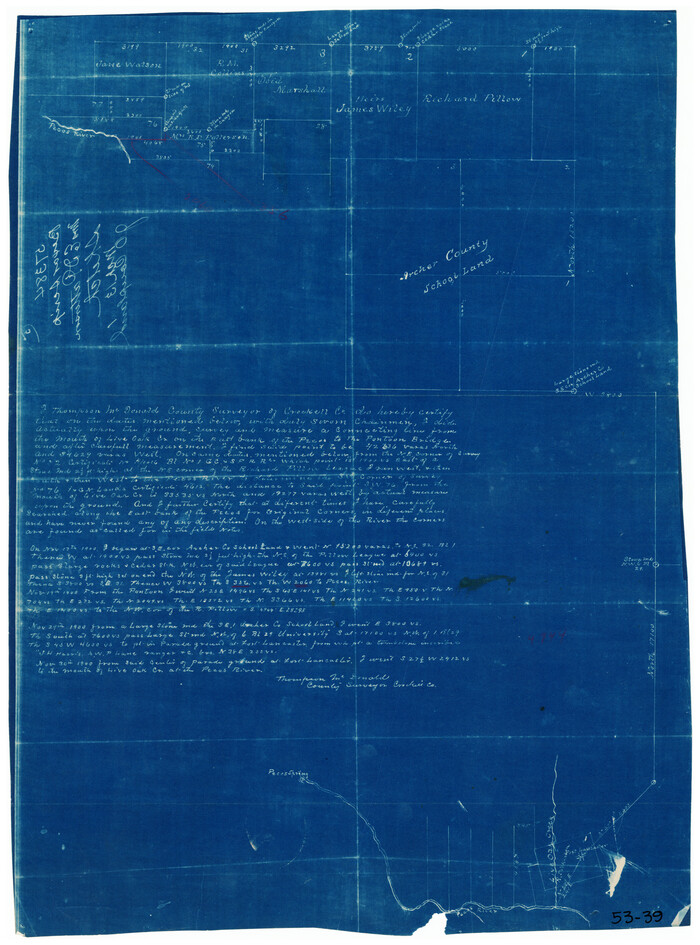
[Western part of Crockett County]
Print $20.00
- Digital $50.00
[Western part of Crockett County]
Size: 17.3 x 14.3 inches
90323
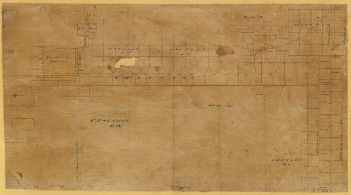
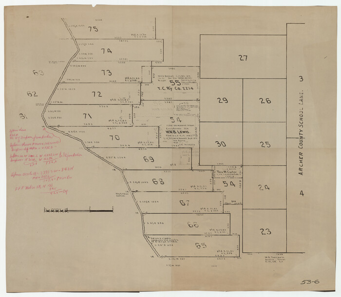
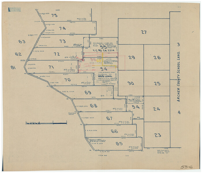
[Surveys in the vicinity of Archer County School Land]
Print $20.00
- Digital $50.00
[Surveys in the vicinity of Archer County School Land]
Size: 15.1 x 20.6 inches
90325
[Sketch showing surveys in Sutton and Val Verde Counties, Texas]
Print $20.00
- Digital $50.00
[Sketch showing surveys in Sutton and Val Verde Counties, Texas]
1880
Size: 28.0 x 14.5 inches
10779
[Sketch of Surveys in Crockett County, Texas]
Print $20.00
- Digital $50.00
[Sketch of Surveys in Crockett County, Texas]
1880
Size: 12.7 x 21.3 inches
10778
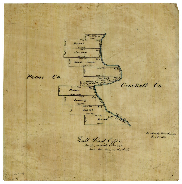
[Sketch of Pecos County School Land surveys along Pecos River in Val Verde County]
Print $2.00
- Digital $50.00
[Sketch of Pecos County School Land surveys along Pecos River in Val Verde County]
1882
Size: 10.2 x 8.9 inches
369
[Sketch for Mineral Applications 26885-6 - Reagan and Crockett Cos., W. H. Bland]
Print $20.00
- Digital $50.00
[Sketch for Mineral Applications 26885-6 - Reagan and Crockett Cos., W. H. Bland]
1932
Size: 41.5 x 36.6 inches
2854
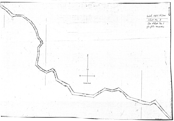
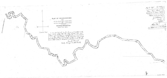
[Sketch for Mineral Application 16700 - Pecos River Bed]
Print $20.00
- Digital $50.00
[Sketch for Mineral Application 16700 - Pecos River Bed]
1927
Size: 20.3 x 29.1 inches
2806
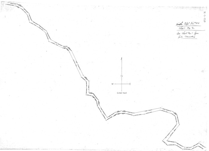
[Sketch for Mineral Application 16700 - Pecos River Bed]
Print $20.00
- Digital $50.00
[Sketch for Mineral Application 16700 - Pecos River Bed]
1927
Size: 32.9 x 15.3 inches
2807
[Sketch for Mineral Application 16700 - Pecos River Bed]
Print $20.00
- Digital $50.00
[Sketch for Mineral Application 16700 - Pecos River Bed]
1927
Size: 19.9 x 30.9 inches
2808
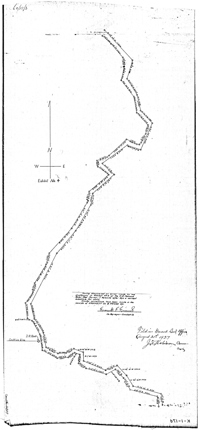
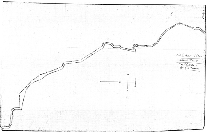
[Sketch for Mineral Application 16700 - Pecos River Bed]
Print $20.00
- Digital $50.00
[Sketch for Mineral Application 16700 - Pecos River Bed]
1927
Size: 14.8 x 30.8 inches
2809
[Sketch for Mineral Application 16700 - Pecos River Bed]
Print $20.00
- Digital $50.00
[Sketch for Mineral Application 16700 - Pecos River Bed]
1927
Size: 17.0 x 36.1 inches
2810
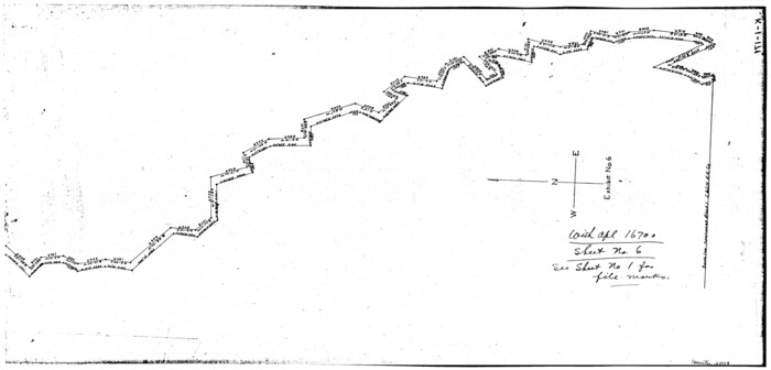
[Sketch for Mineral Application 16700 - Pecos River Bed]
Print $20.00
- Digital $50.00
[Sketch for Mineral Application 16700 - Pecos River Bed]
1927
Size: 20.6 x 28.6 inches
2811
[Sketch Showing Surveys in Schleicher, Menard & Concho Counties, Texas]
Print $20.00
- Digital $50.00
[Sketch Showing Surveys in Schleicher, Menard & Concho Counties, Texas]
Size: 16.1 x 28.9 inches
75782
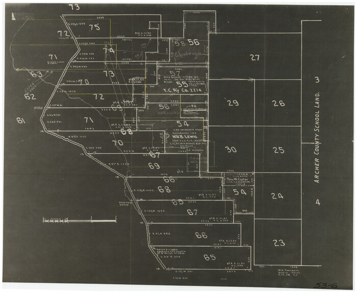
[Sections 55-58, Blk. GG and surrounding surveys]
Print $20.00
- Digital $50.00
[Sections 55-58, Blk. GG and surrounding surveys]
Size: 41.1 x 29.7 inches
90319
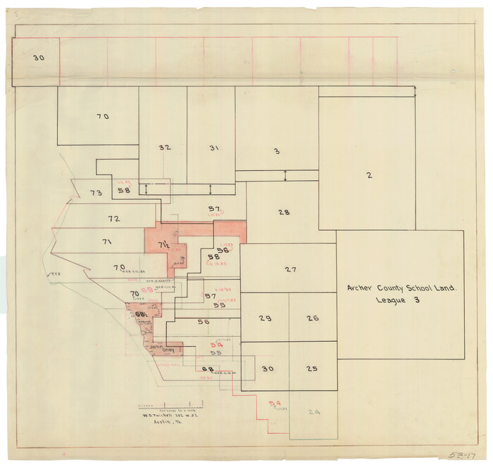
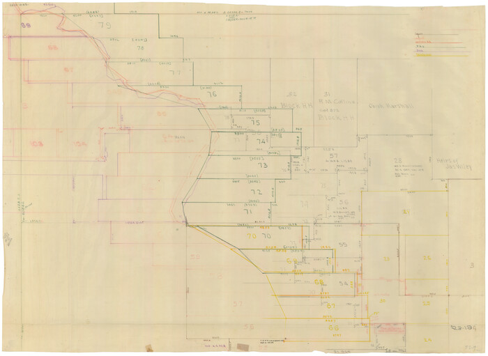
[River Sections 54-73, part of Blk. GG]
Print $20.00
- Digital $50.00
[River Sections 54-73, part of Blk. GG]
Size: 37.0 x 35.9 inches
90317
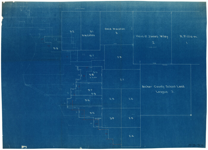
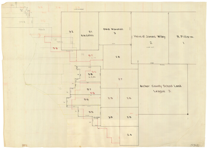
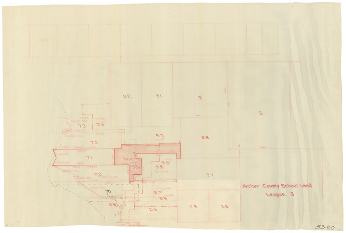
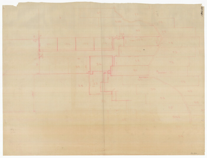
[River Secs. 68-73, Archer County School Land League 3 and surrounding surveys]
Print $20.00
- Digital $50.00
[River Secs. 68-73, Archer County School Land League 3 and surrounding surveys]
Size: 38.4 x 36.4 inches
90468
[River Secs. 68 1/2-73, Pt. Blk. GG]
Print $20.00
- Digital $50.00
[River Secs. 68 1/2-73, Pt. Blk. GG]
Size: 27.6 x 20.7 inches
90478
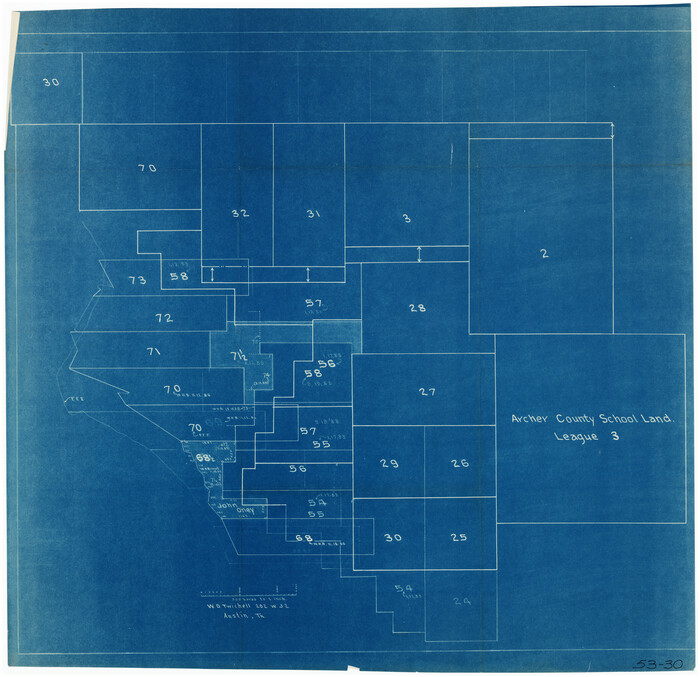
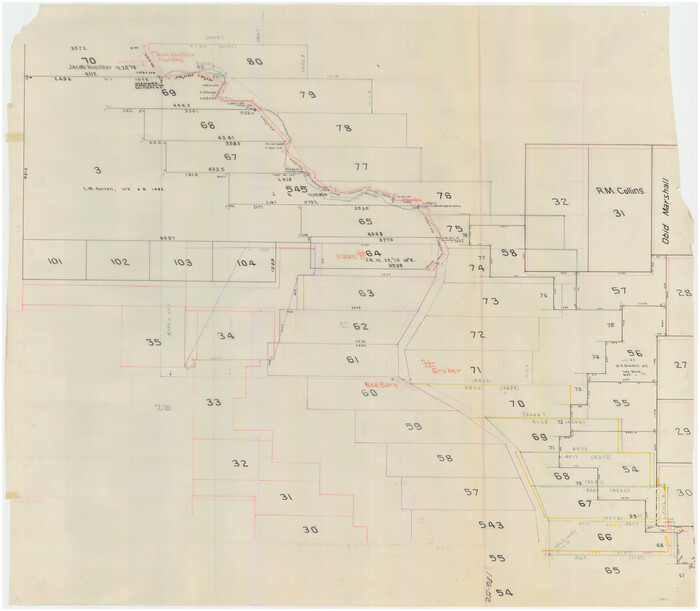
[River Secs. 55-79, Archer County School Land League 3 and surrounding surveys]
Print $20.00
- Digital $50.00
[River Secs. 55-79, Archer County School Land League 3 and surrounding surveys]
Size: 28.3 x 20.4 inches
90472
[Part of Block GG and river sections 69-79]
Print $20.00
- Digital $50.00
[Part of Block GG and river sections 69-79]
Size: 43.2 x 31.2 inches
90470
[Part of Block GG and river sections 68 1/2 -73]
Print $20.00
- Digital $50.00
[Part of Block GG and river sections 68 1/2 -73]
Size: 28.0 x 19.2 inches
90471
[Part of Block GG and river sections 65-75]
Print $20.00
- Digital $50.00
[Part of Block GG and river sections 65-75]
Size: 21.9 x 20.2 inches
90469
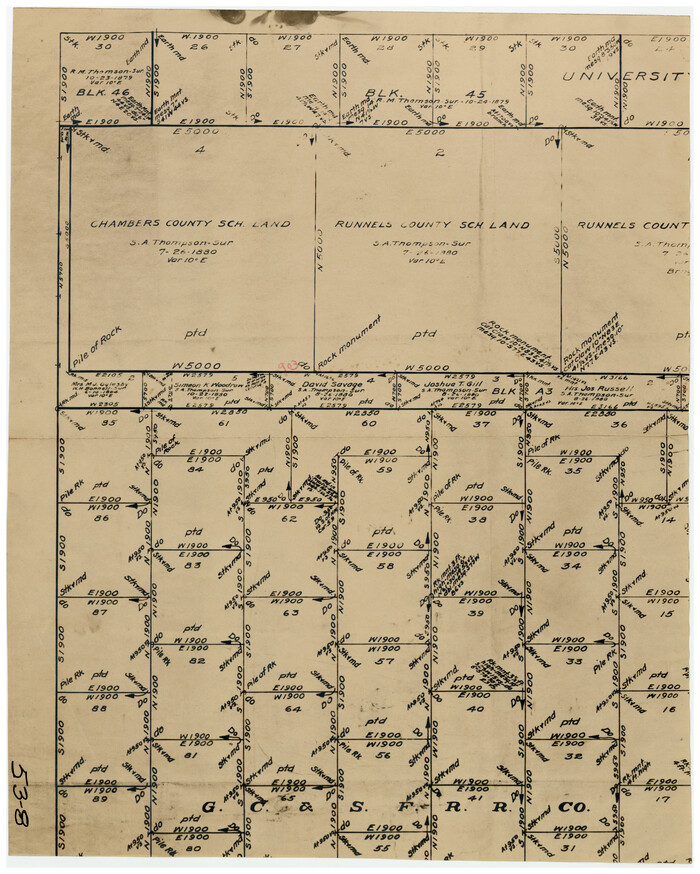
[North part of G. C. & S. F. Block OP, Runnels County School Land]
Print $20.00
- Digital $50.00
[North part of G. C. & S. F. Block OP, Runnels County School Land]
Size: 14.3 x 17.6 inches
90309
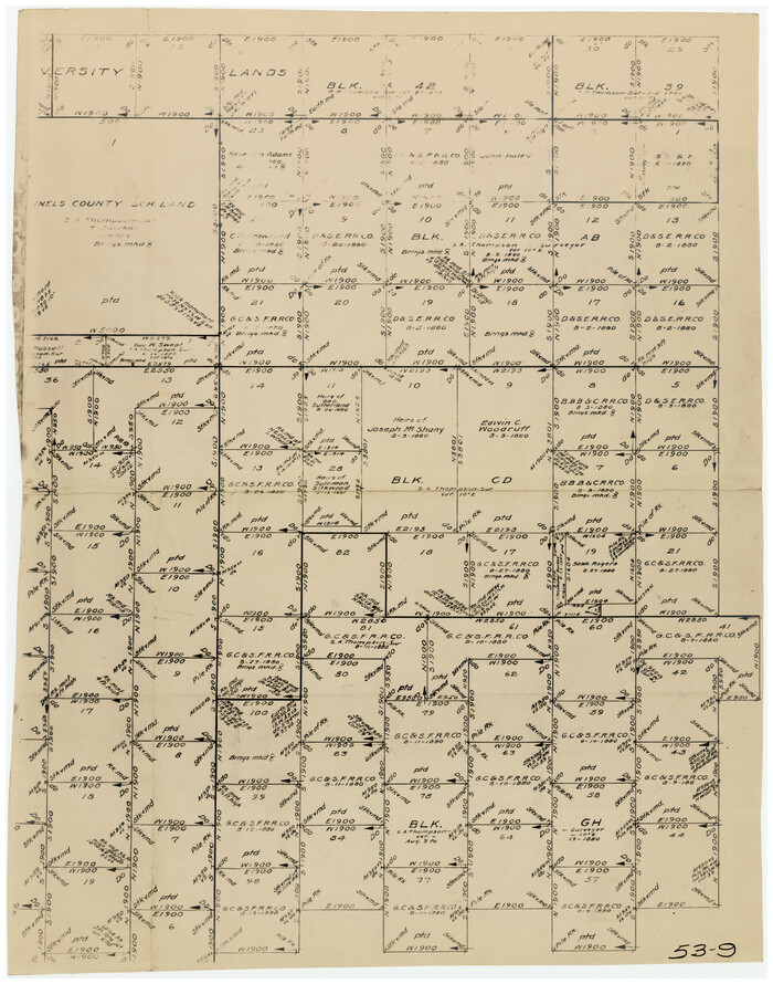
[North part of G. C. & S. F. Block OP, Runnels County School Land and Blks. AB, CD and GH]
Print $20.00
- Digital $50.00
[North part of G. C. & S. F. Block OP, Runnels County School Land and Blks. AB, CD and GH]
Size: 17.5 x 22.4 inches
90310
[I. & G. N. Block 1, sections 57-70]
Print $20.00
- Digital $50.00
[I. & G. N. Block 1, sections 57-70]
Size: 42.0 x 36.5 inches
89833
[I. & G. N. Block 1, sections 57-70]
Print $20.00
- Digital $50.00
[I. & G. N. Block 1, sections 57-70]
Size: 28.8 x 22.1 inches
91668
[I. & G. N. Block 1, Secs. 65-75]
Print $20.00
- Digital $50.00
[I. & G. N. Block 1, Secs. 65-75]
1928
Size: 24.6 x 21.5 inches
90305
[I. & G. N. Block 1, Secs. 65-75]
Print $20.00
- Digital $50.00
[I. & G. N. Block 1, Secs. 65-75]
1928
Size: 24.9 x 21.3 inches
90306
[I. & G. N. Block 1, Secs. 65-75]
Print $20.00
- Digital $50.00
[I. & G. N. Block 1, Secs. 65-75]
1928
Size: 22.0 x 18.0 inches
90307
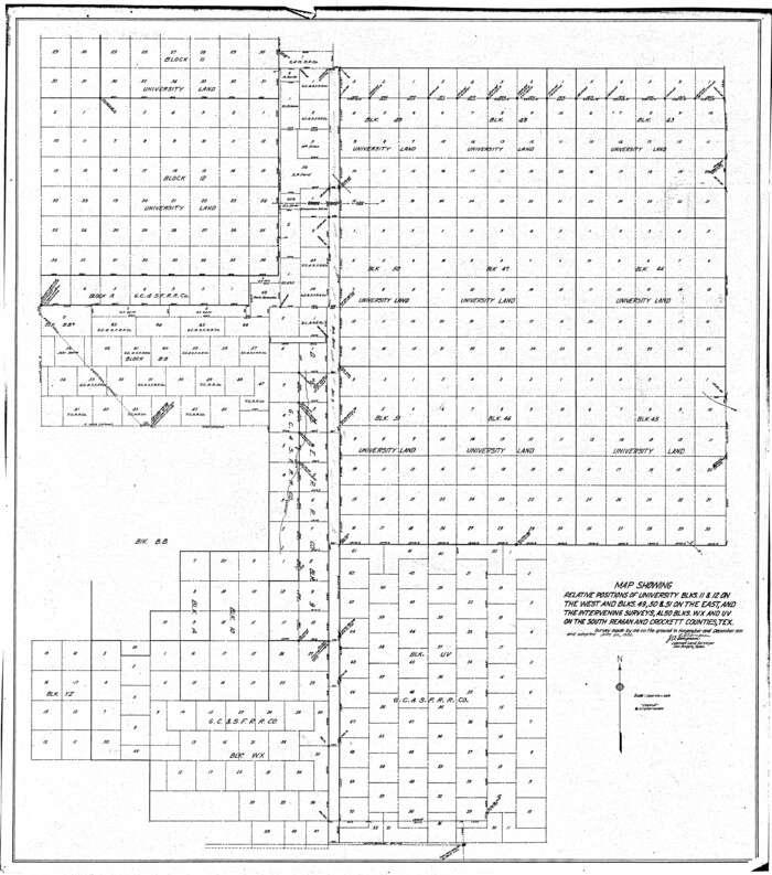
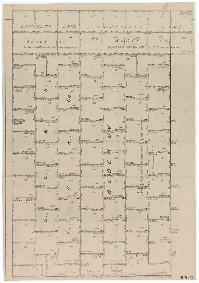
[G. C. & S. F. RR. Co. Block UV, and parts of University Land Blocks 51 and 46]
Print $20.00
- Digital $50.00
[G. C. & S. F. RR. Co. Block UV, and parts of University Land Blocks 51 and 46]
Size: 15.4 x 21.8 inches
90311
[Western part of Crockett County]
Print $20.00
- Digital $50.00
[Western part of Crockett County]
-
Size
17.3 x 14.3 inches
-
Map/Doc
90323
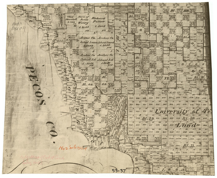
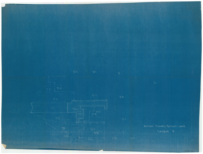
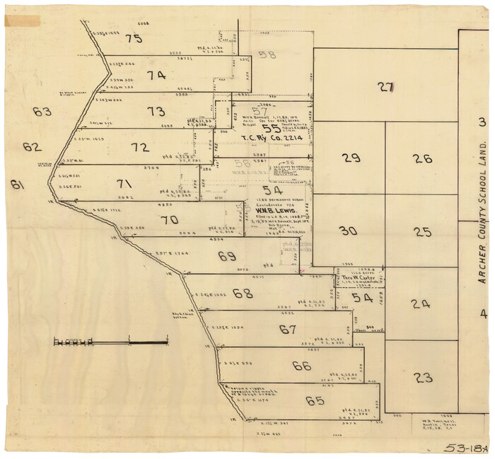
[Surveys in the vicinity of Archer County School Land]
Print $20.00
- Digital $50.00
[Surveys in the vicinity of Archer County School Land]
-
Size
15.1 x 20.6 inches
-
Map/Doc
90325
[Sketch showing surveys in Sutton and Val Verde Counties, Texas]
Print $20.00
- Digital $50.00
[Sketch showing surveys in Sutton and Val Verde Counties, Texas]
1880
-
Size
28.0 x 14.5 inches
-
Map/Doc
10779
-
Creation Date
1880
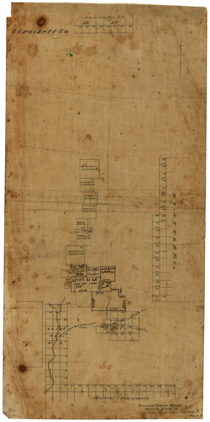
[Sketch of Surveys in Crockett County, Texas]
Print $20.00
- Digital $50.00
[Sketch of Surveys in Crockett County, Texas]
1880
-
Size
12.7 x 21.3 inches
-
Map/Doc
10778
-
Creation Date
1880
[Sketch of Pecos County School Land surveys along Pecos River in Val Verde County]
Print $2.00
- Digital $50.00
[Sketch of Pecos County School Land surveys along Pecos River in Val Verde County]
1882
-
Size
10.2 x 8.9 inches
-
Map/Doc
369
-
Creation Date
1882
[Sketch for Mineral Applications 26885-6 - Reagan and Crockett Cos., W. H. Bland]
Print $20.00
- Digital $50.00
[Sketch for Mineral Applications 26885-6 - Reagan and Crockett Cos., W. H. Bland]
1932
-
Size
41.5 x 36.6 inches
-
Map/Doc
2854
-
Creation Date
1932
[Sketch for Mineral Application 16700 - Pecos River Bed]
Print $20.00
- Digital $50.00
[Sketch for Mineral Application 16700 - Pecos River Bed]
1927
-
Size
20.3 x 29.1 inches
-
Map/Doc
2806
-
Creation Date
1927
[Sketch for Mineral Application 16700 - Pecos River Bed]
Print $20.00
- Digital $50.00
[Sketch for Mineral Application 16700 - Pecos River Bed]
1927
-
Size
32.9 x 15.3 inches
-
Map/Doc
2807
-
Creation Date
1927
[Sketch for Mineral Application 16700 - Pecos River Bed]
Print $20.00
- Digital $50.00
[Sketch for Mineral Application 16700 - Pecos River Bed]
1927
-
Size
19.9 x 30.9 inches
-
Map/Doc
2808
-
Creation Date
1927
[Sketch for Mineral Application 16700 - Pecos River Bed]
Print $20.00
- Digital $50.00
[Sketch for Mineral Application 16700 - Pecos River Bed]
1927
-
Size
14.8 x 30.8 inches
-
Map/Doc
2809
-
Creation Date
1927
[Sketch for Mineral Application 16700 - Pecos River Bed]
Print $20.00
- Digital $50.00
[Sketch for Mineral Application 16700 - Pecos River Bed]
1927
-
Size
17.0 x 36.1 inches
-
Map/Doc
2810
-
Creation Date
1927
[Sketch for Mineral Application 16700 - Pecos River Bed]
Print $20.00
- Digital $50.00
[Sketch for Mineral Application 16700 - Pecos River Bed]
1927
-
Size
20.6 x 28.6 inches
-
Map/Doc
2811
-
Creation Date
1927
[Sketch Showing Surveys in Schleicher, Menard & Concho Counties, Texas]
Print $20.00
- Digital $50.00
[Sketch Showing Surveys in Schleicher, Menard & Concho Counties, Texas]
-
Size
16.1 x 28.9 inches
-
Map/Doc
75782
[Sections 55-58, Blk. GG and surrounding surveys]
Print $20.00
- Digital $50.00
[Sections 55-58, Blk. GG and surrounding surveys]
-
Size
41.1 x 29.7 inches
-
Map/Doc
90319
[River Sections 54-73, part of Blk. GG]
Print $20.00
- Digital $50.00
[River Sections 54-73, part of Blk. GG]
-
Size
37.0 x 35.9 inches
-
Map/Doc
90317
[River Secs. 68-73, Archer County School Land League 3 and surrounding surveys]
Print $20.00
- Digital $50.00
[River Secs. 68-73, Archer County School Land League 3 and surrounding surveys]
-
Size
38.4 x 36.4 inches
-
Map/Doc
90468
[River Secs. 68 1/2-73, Pt. Blk. GG]
Print $20.00
- Digital $50.00
[River Secs. 68 1/2-73, Pt. Blk. GG]
-
Size
27.6 x 20.7 inches
-
Map/Doc
90478
[River Secs. 55-79, Archer County School Land League 3 and surrounding surveys]
Print $20.00
- Digital $50.00
[River Secs. 55-79, Archer County School Land League 3 and surrounding surveys]
-
Size
28.3 x 20.4 inches
-
Map/Doc
90472
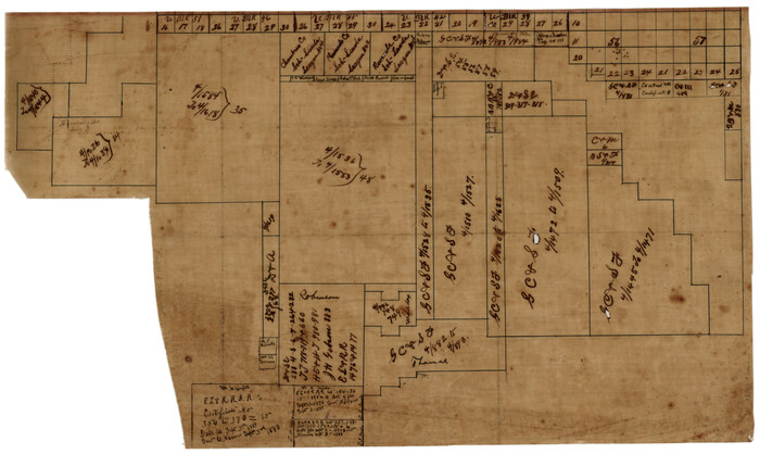
[Part of Block GG]
![90314, [Part of Block GG], Twichell Survey Records](https://historictexasmaps.com/wmedia_w700/maps/90314-1.tif.jpg)
Print $20.00
- Digital $50.00
[Part of Block GG]
-
Size
15.2 x 21.5 inches
-
Map/Doc
90314
[Part of Block GG and river sections 69-79]
Print $20.00
- Digital $50.00
[Part of Block GG and river sections 69-79]
-
Size
43.2 x 31.2 inches
-
Map/Doc
90470
[Part of Block GG and river sections 68 1/2 -73]
Print $20.00
- Digital $50.00
[Part of Block GG and river sections 68 1/2 -73]
-
Size
28.0 x 19.2 inches
-
Map/Doc
90471
[Part of Block GG and river sections 65-75]
Print $20.00
- Digital $50.00
[Part of Block GG and river sections 65-75]
-
Size
21.9 x 20.2 inches
-
Map/Doc
90469
[North part of G. C. & S. F. Block OP, Runnels County School Land]
Print $20.00
- Digital $50.00
[North part of G. C. & S. F. Block OP, Runnels County School Land]
-
Size
14.3 x 17.6 inches
-
Map/Doc
90309
[North part of G. C. & S. F. Block OP, Runnels County School Land and Blks. AB, CD and GH]
Print $20.00
- Digital $50.00
[North part of G. C. & S. F. Block OP, Runnels County School Land and Blks. AB, CD and GH]
-
Size
17.5 x 22.4 inches
-
Map/Doc
90310
[I. & G. N. Block 1, sections 57-70]
Print $20.00
- Digital $50.00
[I. & G. N. Block 1, sections 57-70]
-
Size
42.0 x 36.5 inches
-
Map/Doc
89833
[I. & G. N. Block 1, sections 57-70]
Print $20.00
- Digital $50.00
[I. & G. N. Block 1, sections 57-70]
-
Size
28.8 x 22.1 inches
-
Map/Doc
91668
[I. & G. N. Block 1, Secs. 65-75]
Print $20.00
- Digital $50.00
[I. & G. N. Block 1, Secs. 65-75]
1928
-
Size
24.6 x 21.5 inches
-
Map/Doc
90305
-
Creation Date
1928
[I. & G. N. Block 1, Secs. 65-75]
Print $20.00
- Digital $50.00
[I. & G. N. Block 1, Secs. 65-75]
1928
-
Size
24.9 x 21.3 inches
-
Map/Doc
90306
-
Creation Date
1928
[I. & G. N. Block 1, Secs. 65-75]
Print $20.00
- Digital $50.00
[I. & G. N. Block 1, Secs. 65-75]
1928
-
Size
22.0 x 18.0 inches
-
Map/Doc
90307
-
Creation Date
1928
[G. C. & S. F. RR. Co. Block UV, and parts of University Land Blocks 51 and 46]
Print $20.00
- Digital $50.00
[G. C. & S. F. RR. Co. Block UV, and parts of University Land Blocks 51 and 46]
-
Size
15.4 x 21.8 inches
-
Map/Doc
90311