[Texas & Pacific Railway through Callahan County]
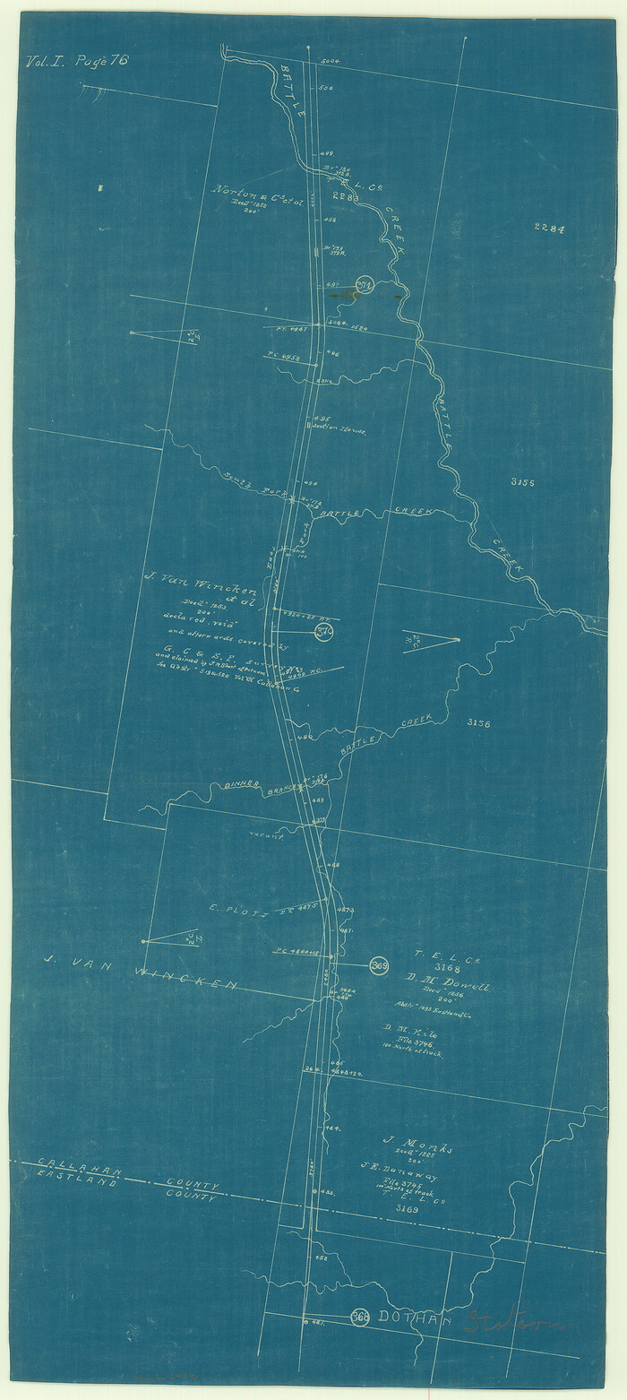
Print $20.00
- Digital $50.00
[Texas & Pacific Railway through Callahan County]
1918
Size: 21.2 x 9.5 inches
64231
[Surveys to the North and West of the Francis Blundell survey containing townsite]
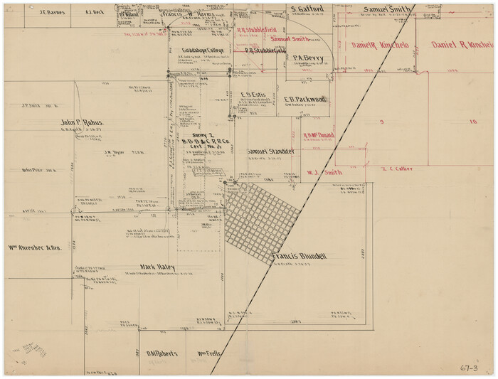
Print $20.00
- Digital $50.00
[Surveys to the North and West of the Francis Blundell survey containing townsite]
Size: 26.2 x 19.9 inches
90883
[Surveys to the North and West of the Francis Blundell survey containing townsite]
Print $20.00
- Digital $50.00
[Surveys to the North and West of the Francis Blundell survey containing townsite]
Size: 26.3 x 19.8 inches
90884
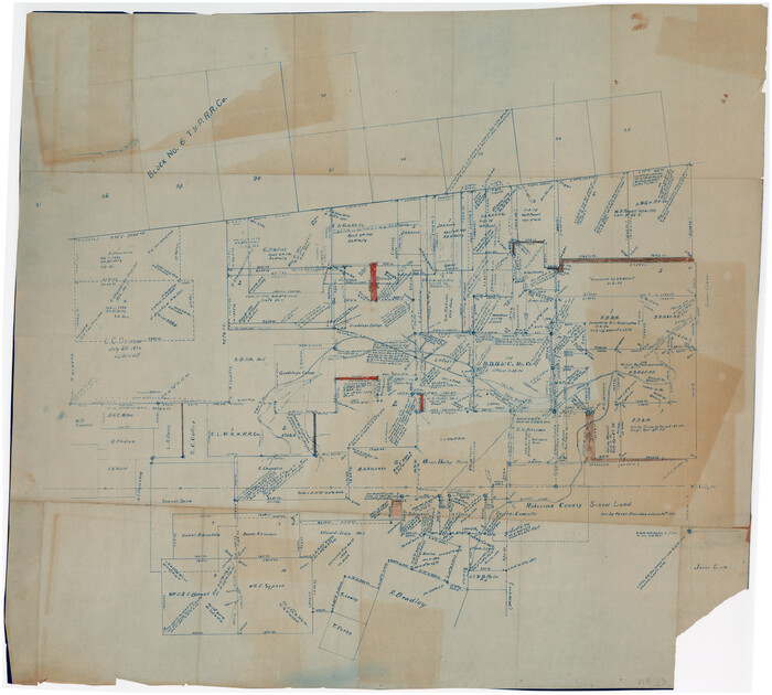
[Southeast part of Stephens County]
Print $20.00
- Digital $50.00
[Southeast part of Stephens County]
Size: 37.2 x 32.7 inches
91844
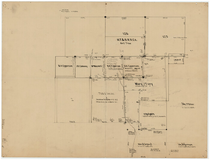
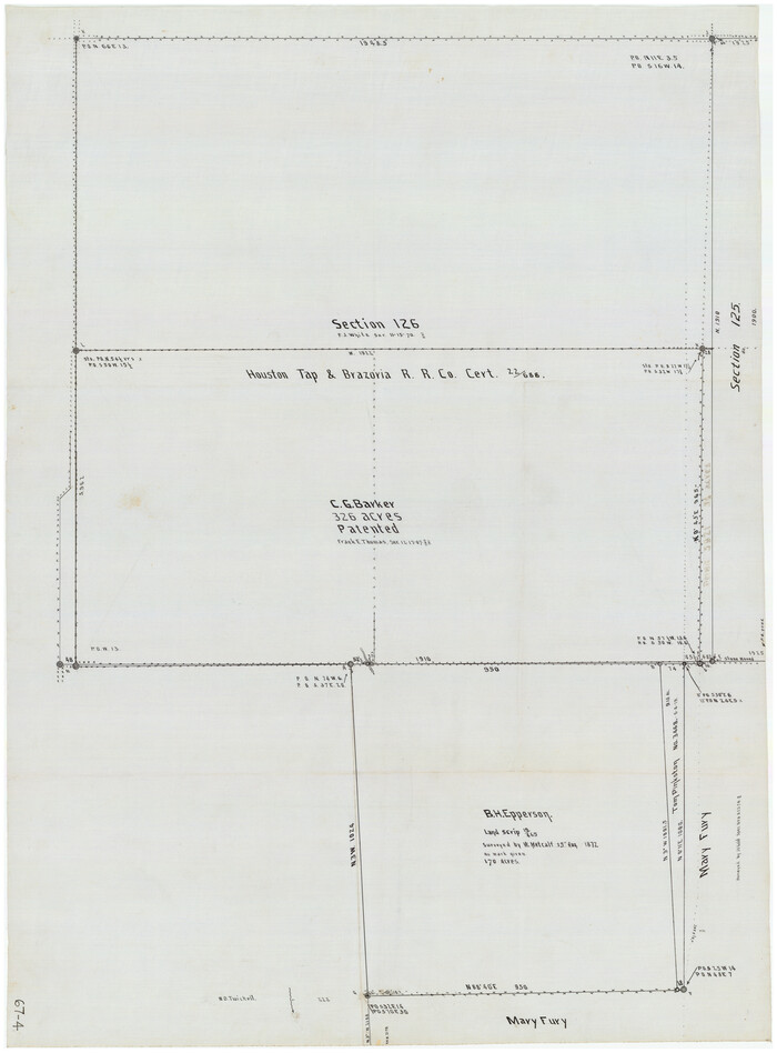
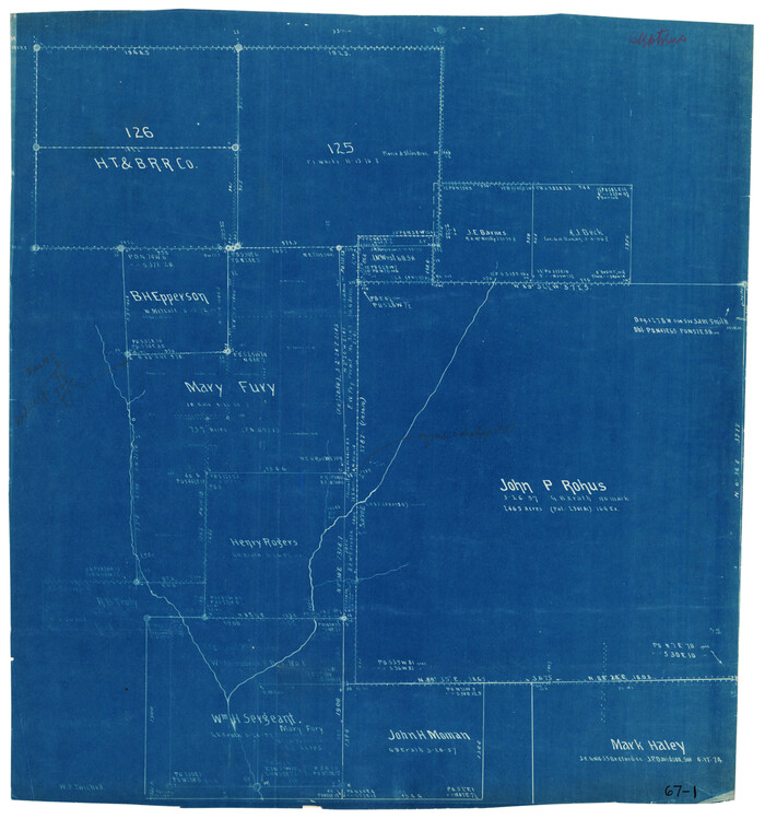
[Sketch showing H. T. & B. section 126 and B. H. Epperson]
Print $20.00
- Digital $50.00
[Sketch showing H. T. & B. section 126 and B. H. Epperson]
Size: 23.9 x 32.5 inches
90932
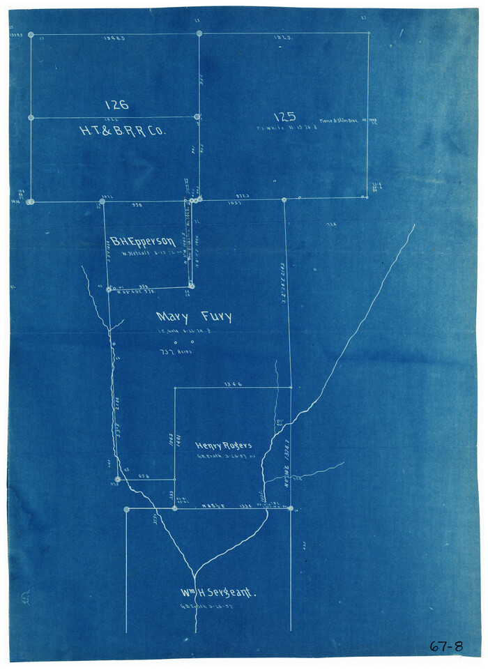
[Sketch showing H. T. & B. RR. Co. Sections 125 and 126, B. H. Epperson, Mary Fury, Henry Rogers and Wm. H. Sergeant]
Print $20.00
- Digital $50.00
[Sketch showing H. T. & B. RR. Co. Sections 125 and 126, B. H. Epperson, Mary Fury, Henry Rogers and Wm. H. Sergeant]
Size: 14.5 x 19.4 inches
90882
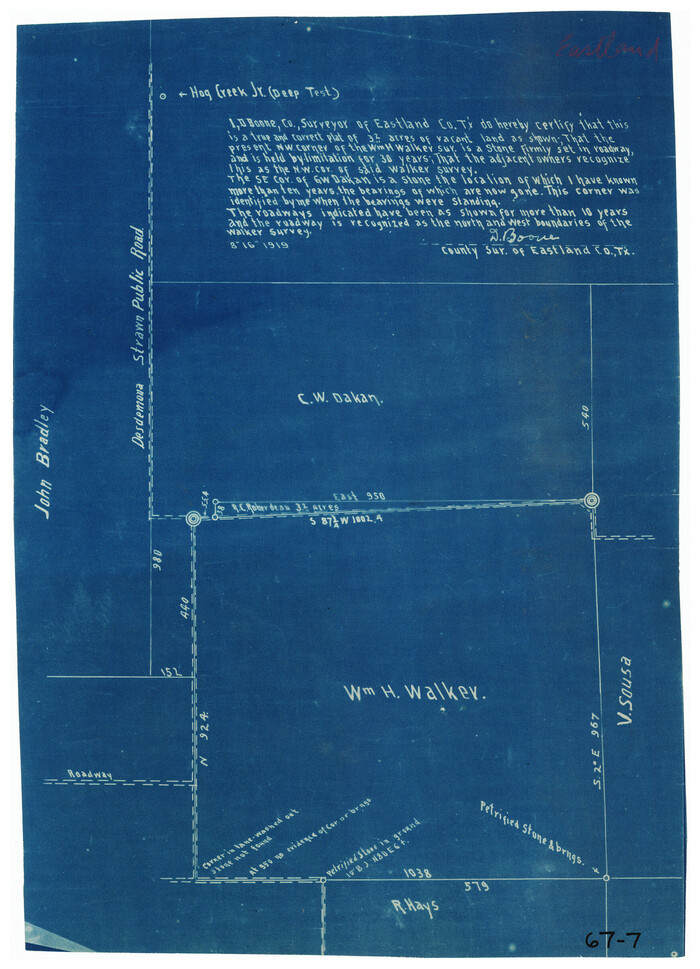
[Sketch showing C. W. Dakan, Wm. H. Walker and surrounding surveys]
Print $2.00
- Digital $50.00
[Sketch showing C. W. Dakan, Wm. H. Walker and surrounding surveys]
1919
Size: 8.9 x 12.3 inches
90880
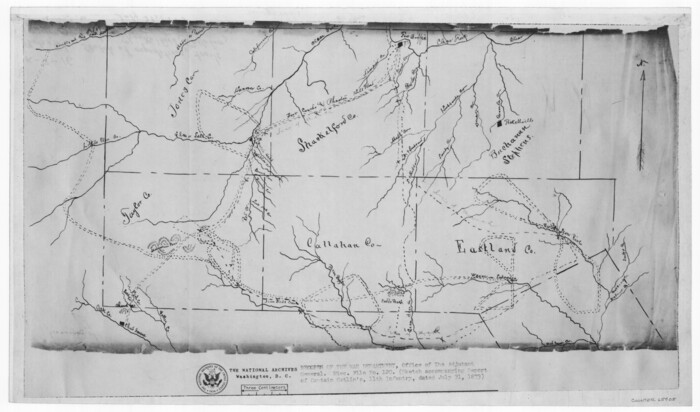
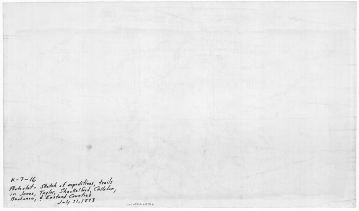
[Sketch of expeditions, trails in Jones, Taylor, Shackelford, Callahan, Buchanan/Stephens and Eastland Counties]
Print $4.00
- Digital $50.00
[Sketch of expeditions, trails in Jones, Taylor, Shackelford, Callahan, Buchanan/Stephens and Eastland Counties]
1873
Size: 10.8 x 18.3 inches
65405
[Sketch of expeditions, trails in Jones, Taylor, Shackelford, Callahan, Buchanan/Stephens and Eastland Counties]
Print $4.00
- Digital $50.00
[Sketch of expeditions, trails in Jones, Taylor, Shackelford, Callahan, Buchanan/Stephens and Eastland Counties]
1873
Size: 10.7 x 18.1 inches
65406
[Sections in the vicinity of John P. Rohus and Mary Fury surveys]
Print $20.00
- Digital $50.00
[Sections in the vicinity of John P. Rohus and Mary Fury surveys]
Size: 12.2 x 13.1 inches
92987
[SE Pt. of Stephens County]
Print $20.00
- Digital $50.00
[SE Pt. of Stephens County]
Size: 38.1 x 35.9 inches
89639
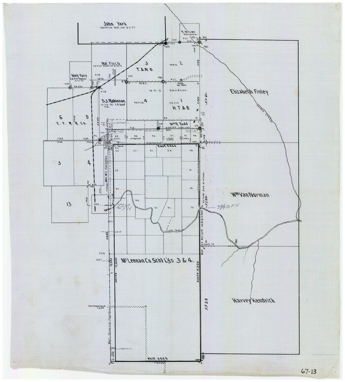
[McLennan County School Leagues 3 and 4, Elizabeth Finley, Wm. Van Norman, Harvey Kendrick surveys and surveys to the west]
Print $20.00
- Digital $50.00
[McLennan County School Leagues 3 and 4, Elizabeth Finley, Wm. Van Norman, Harvey Kendrick surveys and surveys to the west]
Size: 18.2 x 20.1 inches
90900
[McLennan County School Leagues 3 and 4, Elizabeth Finley, Wm. Van Norman, Harvey Kendrick surveys and surveys to the west]
Print $20.00
- Digital $50.00
[McLennan County School Leagues 3 and 4, Elizabeth Finley, Wm. Van Norman, Harvey Kendrick surveys and surveys to the west]
Size: 19.5 x 26.7 inches
90929
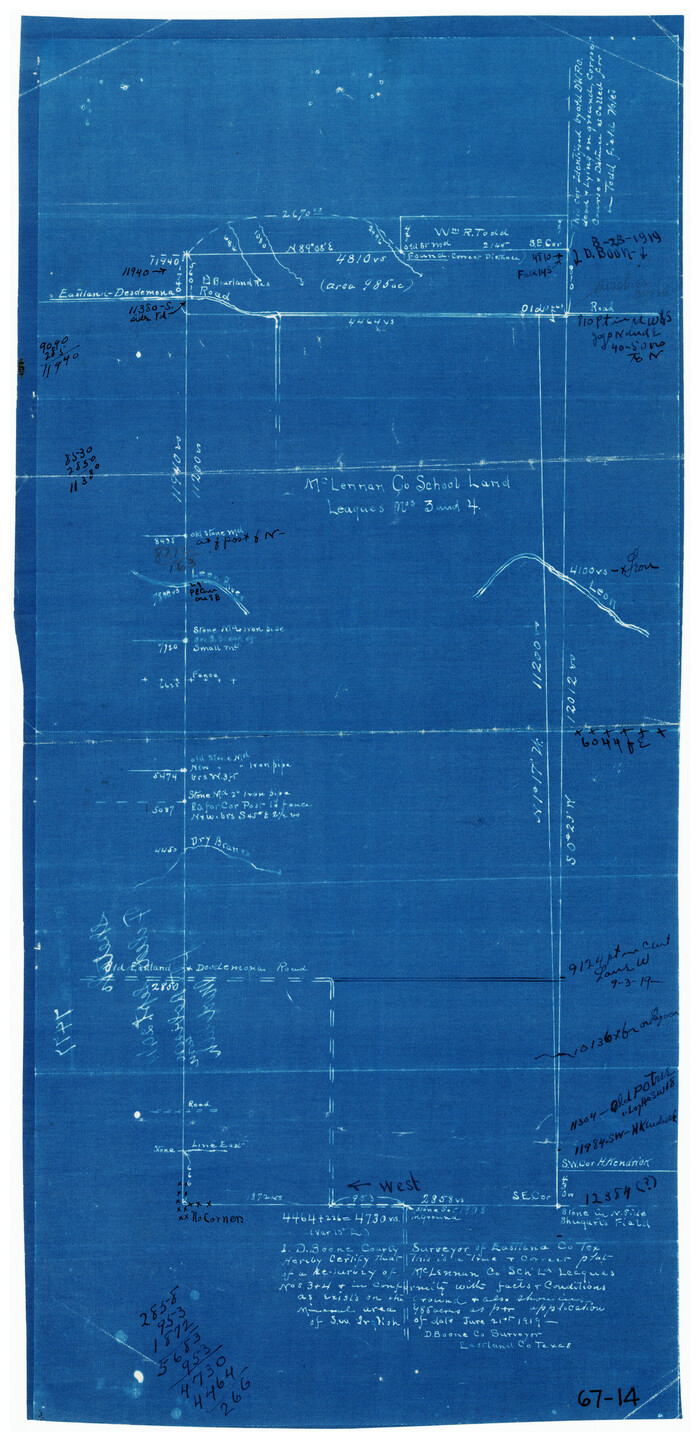
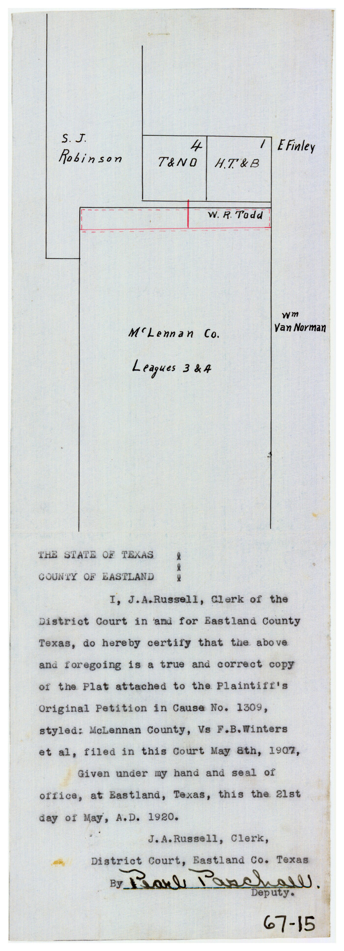
[McLennan County School Land Leagues Nos. 3 and 4]
Print $20.00
- Digital $50.00
[McLennan County School Land Leagues Nos. 3 and 4]
1919
Size: 9.1 x 18.6 inches
90879
[Map of a portion of Bexar and Travis Districts]
Print $20.00
- Digital $50.00
[Map of a portion of Bexar and Travis Districts]
Size: 47.5 x 47.2 inches
16943
[Map of Counties south of Panhandle]
Print $20.00
- Digital $50.00
[Map of Counties south of Panhandle]
Size: 22.1 x 15.8 inches
92960
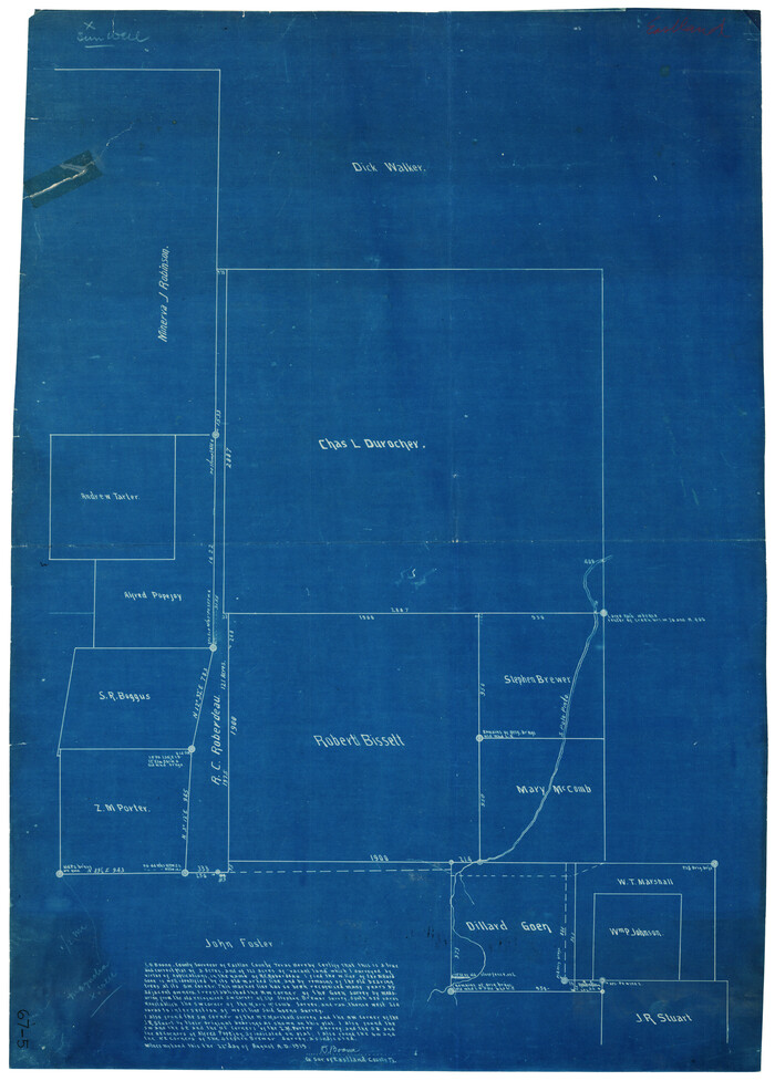
[Chas. L. Durocher and Surrounding Surveys]
Print $20.00
- Digital $50.00
[Chas. L. Durocher and Surrounding Surveys]
1919
Size: 19.7 x 27.4 inches
90815
[Area along North line of McLennan County School Land]
Print $2.00
- Digital $50.00
[Area along North line of McLennan County School Land]
1920
Size: 5.5 x 14.9 inches
90928
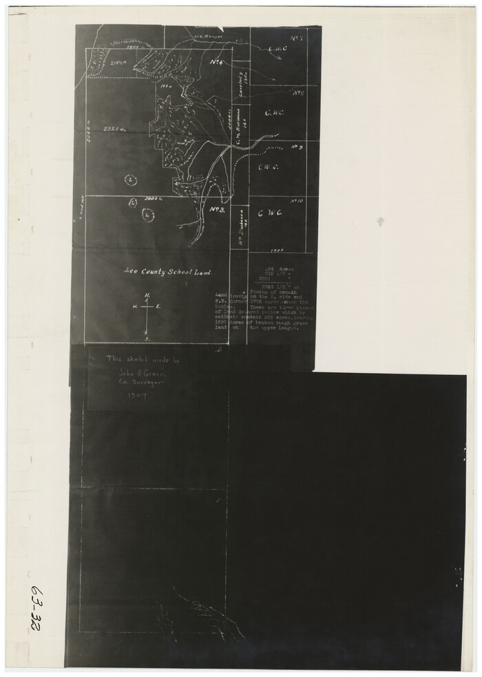
[Area Surrounding Lee County School Land]
Print $20.00
- Digital $50.00
[Area Surrounding Lee County School Land]
1907
Size: 13.9 x 19.2 inches
90887
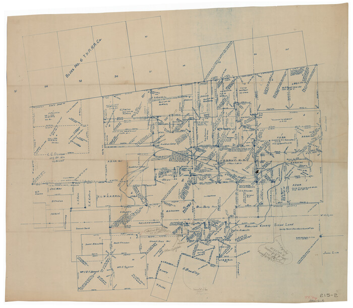
Working Sketch in Eastland, Stephens, and Palo Pinto Co's.

Print $20.00
- Digital $50.00
Working Sketch in Eastland, Stephens, and Palo Pinto Co's.
1919
Size: 40.3 x 35.7 inches
91995
Working Sketch in Eastland County

Print $20.00
- Digital $50.00
Working Sketch in Eastland County
1919
Size: 20.1 x 14.6 inches
90931
Working Sketch in Eastland Co.

Print $20.00
- Digital $50.00
Working Sketch in Eastland Co.
1918
Size: 12.2 x 17.1 inches
90881
Stephens County Working Sketch 37

Print $40.00
- Digital $50.00
Stephens County Working Sketch 37
1983
Size: 42.9 x 67.7 inches
63980
Stephens County Sketch File 13

Print $4.00
- Digital $50.00
Stephens County Sketch File 13
Size: 11.2 x 8.8 inches
37063
Stephens County Sketch File 12a

Print $23.00
- Digital $50.00
Stephens County Sketch File 12a
Size: 18.2 x 11.2 inches
37061
Sketch showing the Connnecting Lines run by Olliver Hedgcoxe for the Texan Emigration and Land Company connecting their Surveys made by them in Peters' Colony, Texas

Print $40.00
- Digital $50.00
Sketch showing the Connnecting Lines run by Olliver Hedgcoxe for the Texan Emigration and Land Company connecting their Surveys made by them in Peters' Colony, Texas
1854
Size: 45.8 x 61.9 inches
1969

Plat of tract surveyed for S. W. Inglish

Print $20.00
- Digital $50.00
Plat of tract surveyed for S. W. Inglish
1920
Size: 18.2 x 6.7 inches
90822
Plat of NE portion of Leagues 3 & 4, McLennan Co. School Land taken from official map filed in District Court

Print $3.00
- Digital $50.00
Plat of NE portion of Leagues 3 & 4, McLennan Co. School Land taken from official map filed in District Court
Size: 11.6 x 9.9 inches
90927
Plat of 83.94 acre vacant tract of land showing connections to adjoining surveys

Print $20.00
- Digital $50.00
Plat of 83.94 acre vacant tract of land showing connections to adjoining surveys
1918
Size: 17.7 x 21.1 inches
90823
[Texas & Pacific Railway through Callahan County]
Print $20.00
- Digital $50.00
[Texas & Pacific Railway through Callahan County]
1918
-
Size
21.2 x 9.5 inches
-
Map/Doc
64231
-
Creation Date
1918
[Surveys to the North and West of the Francis Blundell survey containing townsite]
Print $20.00
- Digital $50.00
[Surveys to the North and West of the Francis Blundell survey containing townsite]
-
Size
26.2 x 19.9 inches
-
Map/Doc
90883
[Surveys to the North and West of the Francis Blundell survey containing townsite]
Print $20.00
- Digital $50.00
[Surveys to the North and West of the Francis Blundell survey containing townsite]
-
Size
26.3 x 19.8 inches
-
Map/Doc
90884
[Southeast part of Stephens County]
Print $20.00
- Digital $50.00
[Southeast part of Stephens County]
-
Size
37.2 x 32.7 inches
-
Map/Doc
91844
[Sketch showing H. T. & B. section 126 and B. H. Epperson]
Print $20.00
- Digital $50.00
[Sketch showing H. T. & B. section 126 and B. H. Epperson]
-
Size
23.9 x 32.5 inches
-
Map/Doc
90932
[Sketch showing H. T. & B. RR. Co. Sections 125 and 126, B. H. Epperson, Mary Fury, Henry Rogers and Wm. H. Sergeant]
Print $20.00
- Digital $50.00
[Sketch showing H. T. & B. RR. Co. Sections 125 and 126, B. H. Epperson, Mary Fury, Henry Rogers and Wm. H. Sergeant]
-
Size
14.5 x 19.4 inches
-
Map/Doc
90882
[Sketch showing C. W. Dakan, Wm. H. Walker and surrounding surveys]
Print $2.00
- Digital $50.00
[Sketch showing C. W. Dakan, Wm. H. Walker and surrounding surveys]
1919
-
Size
8.9 x 12.3 inches
-
Map/Doc
90880
-
Creation Date
1919
[Sketch of expeditions, trails in Jones, Taylor, Shackelford, Callahan, Buchanan/Stephens and Eastland Counties]
Print $4.00
- Digital $50.00
[Sketch of expeditions, trails in Jones, Taylor, Shackelford, Callahan, Buchanan/Stephens and Eastland Counties]
1873
-
Size
10.8 x 18.3 inches
-
Map/Doc
65405
-
Creation Date
1873
[Sketch of expeditions, trails in Jones, Taylor, Shackelford, Callahan, Buchanan/Stephens and Eastland Counties]
Print $4.00
- Digital $50.00
[Sketch of expeditions, trails in Jones, Taylor, Shackelford, Callahan, Buchanan/Stephens and Eastland Counties]
1873
-
Size
10.7 x 18.1 inches
-
Map/Doc
65406
-
Creation Date
1873
[Sections in the vicinity of John P. Rohus and Mary Fury surveys]
Print $20.00
- Digital $50.00
[Sections in the vicinity of John P. Rohus and Mary Fury surveys]
-
Size
12.2 x 13.1 inches
-
Map/Doc
92987
[SE Pt. of Stephens County]
Print $20.00
- Digital $50.00
[SE Pt. of Stephens County]
-
Size
38.1 x 35.9 inches
-
Map/Doc
89639
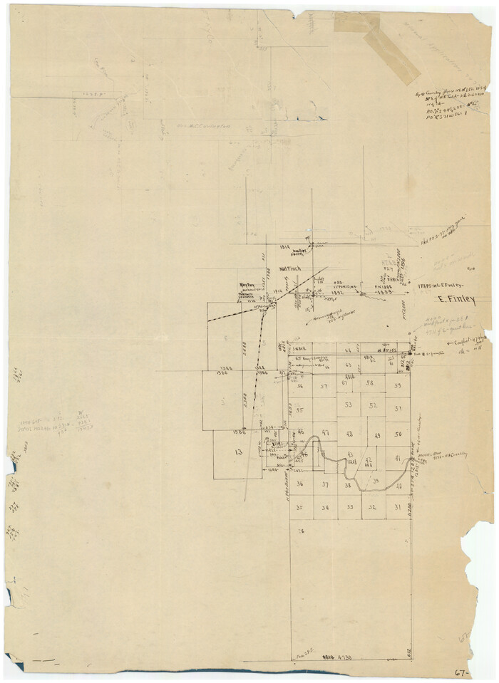
[McLennan County School Leagues 3 and 4, Elizabeth Finley, Wm. Van Norman, Harvey Kendrick surveys and surveys to the west]
Print $20.00
- Digital $50.00
[McLennan County School Leagues 3 and 4, Elizabeth Finley, Wm. Van Norman, Harvey Kendrick surveys and surveys to the west]
-
Size
18.2 x 20.1 inches
-
Map/Doc
90900
[McLennan County School Leagues 3 and 4, Elizabeth Finley, Wm. Van Norman, Harvey Kendrick surveys and surveys to the west]
Print $20.00
- Digital $50.00
[McLennan County School Leagues 3 and 4, Elizabeth Finley, Wm. Van Norman, Harvey Kendrick surveys and surveys to the west]
-
Size
19.5 x 26.7 inches
-
Map/Doc
90929
[McLennan County School Land Leagues Nos. 3 and 4]
Print $20.00
- Digital $50.00
[McLennan County School Land Leagues Nos. 3 and 4]
1919
-
Size
9.1 x 18.6 inches
-
Map/Doc
90879
-
Creation Date
1919
[Map of a portion of Bexar and Travis Districts]
Print $20.00
- Digital $50.00
[Map of a portion of Bexar and Travis Districts]
-
Size
47.5 x 47.2 inches
-
Map/Doc
16943
[Map of Counties south of Panhandle]
Print $20.00
- Digital $50.00
[Map of Counties south of Panhandle]
-
Size
22.1 x 15.8 inches
-
Map/Doc
92960
[Chas. L. Durocher and Surrounding Surveys]
Print $20.00
- Digital $50.00
[Chas. L. Durocher and Surrounding Surveys]
1919
-
Size
19.7 x 27.4 inches
-
Map/Doc
90815
-
Creation Date
1919
[Area along North line of McLennan County School Land]
Print $2.00
- Digital $50.00
[Area along North line of McLennan County School Land]
1920
-
Size
5.5 x 14.9 inches
-
Map/Doc
90928
-
Creation Date
1920
[Area Surrounding Lee County School Land]
Print $20.00
- Digital $50.00
[Area Surrounding Lee County School Land]
1907
-
Size
13.9 x 19.2 inches
-
Map/Doc
90887
-
Creation Date
1907
Working Sketch in Eastland, Stephens, and Palo Pinto Co's.
Print $20.00
- Digital $50.00
Working Sketch in Eastland, Stephens, and Palo Pinto Co's.
1919
-
Size
40.3 x 35.7 inches
-
Map/Doc
91995
-
Creation Date
1919
Working Sketch in Eastland County
Print $20.00
- Digital $50.00
Working Sketch in Eastland County
1919
-
Size
20.1 x 14.6 inches
-
Map/Doc
90931
-
Creation Date
1919
Working Sketch in Eastland Co.
Print $20.00
- Digital $50.00
Working Sketch in Eastland Co.
1918
-
Size
12.2 x 17.1 inches
-
Map/Doc
90881
-
Creation Date
1918
Stephens County Working Sketch 37
Print $40.00
- Digital $50.00
Stephens County Working Sketch 37
1983
-
Size
42.9 x 67.7 inches
-
Map/Doc
63980
-
Creation Date
1983
Stephens County Sketch File 13
Print $4.00
- Digital $50.00
Stephens County Sketch File 13
-
Size
11.2 x 8.8 inches
-
Map/Doc
37063
Stephens County Sketch File 12a
Print $23.00
- Digital $50.00
Stephens County Sketch File 12a
-
Size
18.2 x 11.2 inches
-
Map/Doc
37061
Sketch showing the Connnecting Lines run by Olliver Hedgcoxe for the Texan Emigration and Land Company connecting their Surveys made by them in Peters' Colony, Texas
Print $40.00
- Digital $50.00
Sketch showing the Connnecting Lines run by Olliver Hedgcoxe for the Texan Emigration and Land Company connecting their Surveys made by them in Peters' Colony, Texas
1854
-
Size
45.8 x 61.9 inches
-
Map/Doc
1969
-
Creation Date
1854
Plat of tract surveyed for S. W. Inglish
Print $20.00
- Digital $50.00
Plat of tract surveyed for S. W. Inglish
1920
-
Size
18.2 x 6.7 inches
-
Map/Doc
90822
-
Creation Date
1920
Plat of NE portion of Leagues 3 & 4, McLennan Co. School Land taken from official map filed in District Court
Print $3.00
- Digital $50.00
Plat of NE portion of Leagues 3 & 4, McLennan Co. School Land taken from official map filed in District Court
-
Size
11.6 x 9.9 inches
-
Map/Doc
90927
Plat of 83.94 acre vacant tract of land showing connections to adjoining surveys
Print $20.00
- Digital $50.00
Plat of 83.94 acre vacant tract of land showing connections to adjoining surveys
1918
-
Size
17.7 x 21.1 inches
-
Map/Doc
90823
-
Creation Date
1918