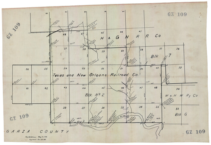
[Texas and New Orleans Railroad Company, Block 2]
Print $20.00
- Digital $50.00
[Texas and New Orleans Railroad Company, Block 2]
1906
Size: 21.1 x 14.4 inches
92702
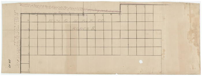
[T. T. RR. Co. Block 8 and vicinity]
Print $20.00
- Digital $50.00
[T. T. RR. Co. Block 8 and vicinity]
Size: 20.3 x 15.2 inches
90795
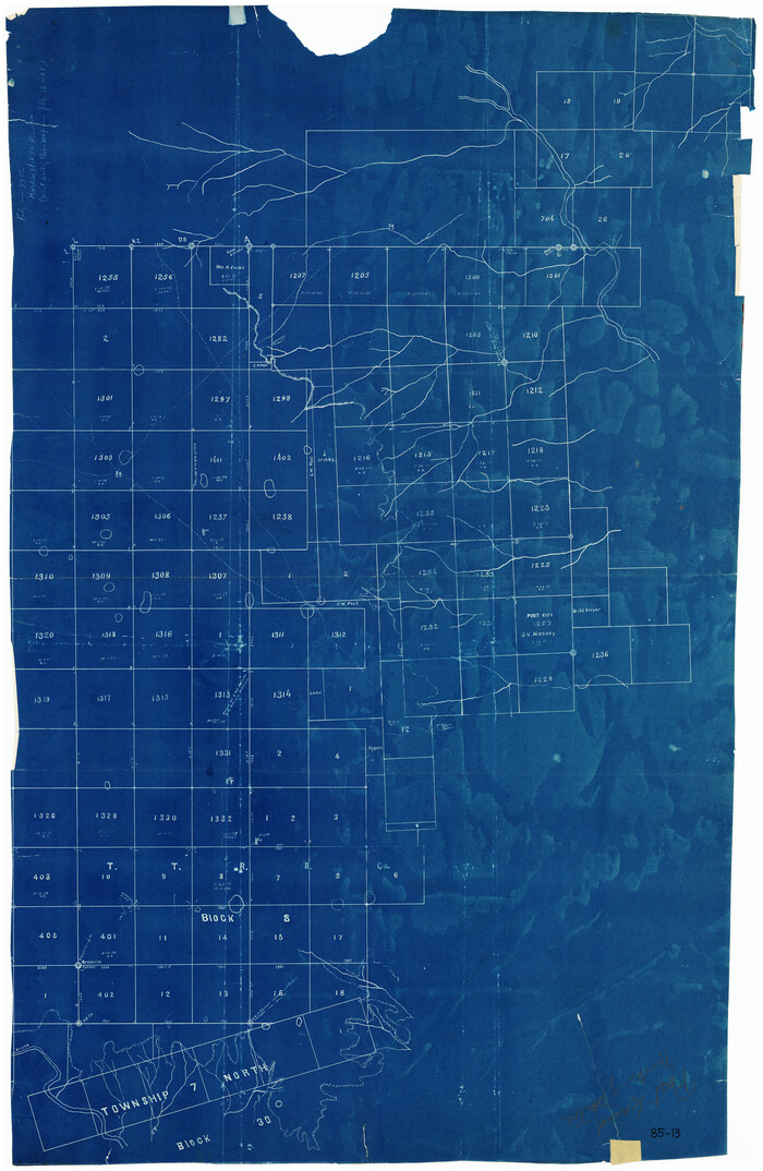
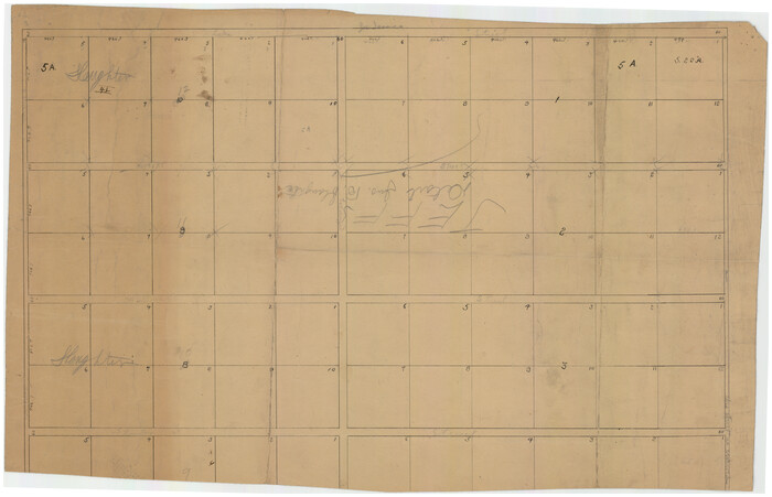
[T. T. RR. Co. Block 8 and vicinity]
Print $20.00
- Digital $50.00
[T. T. RR. Co. Block 8 and vicinity]
Size: 25.3 x 39.0 inches
90875
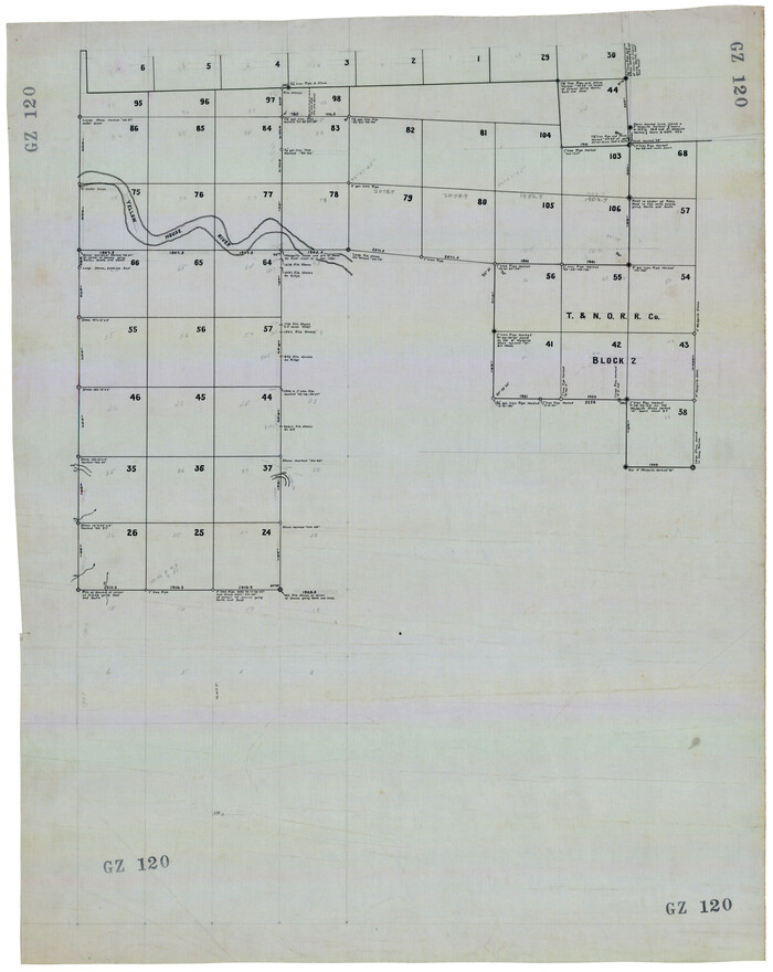
[T. & N. O. RR. Co. Block 2]
Print $20.00
- Digital $50.00
[T. & N. O. RR. Co. Block 2]
Size: 22.5 x 28.0 inches
92696
[Southwest part of H. & G. N. Block 8]
Print $20.00
- Digital $50.00
[Southwest part of H. & G. N. Block 8]
Size: 24.6 x 9.3 inches
90372
[Southwest part of County]
Print $20.00
- Digital $50.00
[Southwest part of County]
Size: 29.0 x 18.3 inches
90921
[Southwest part of County]
Print $20.00
- Digital $50.00
[Southwest part of County]
Size: 28.8 x 18.4 inches
90922
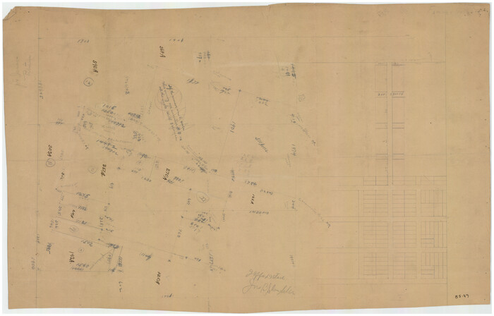
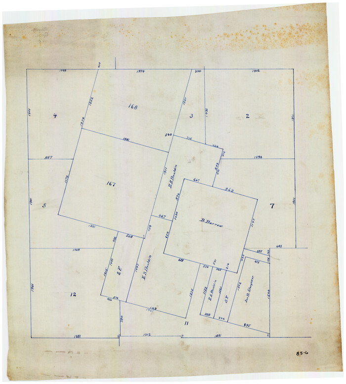
[Southwest part of County around B. Barrow survey]
Print $20.00
- Digital $50.00
[Southwest part of County around B. Barrow survey]
Size: 19.6 x 21.1 inches
90919
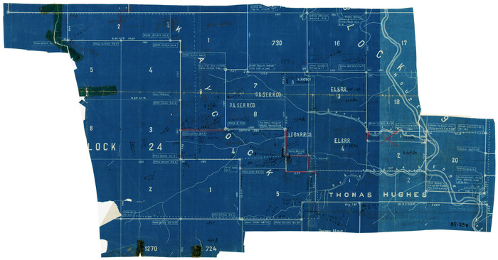
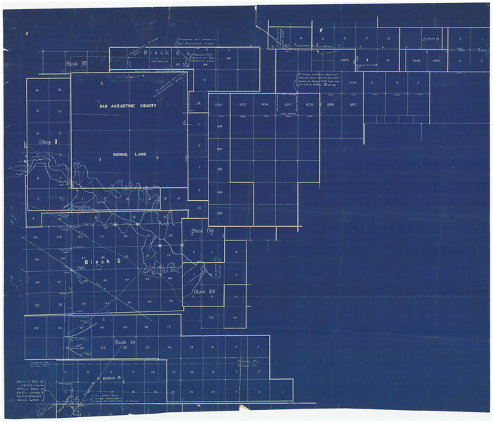
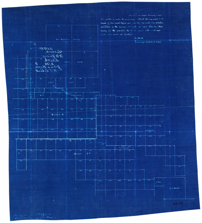
[Southwest corner of county covering Blks. 24 and B9]
Print $20.00
- Digital $50.00
[Southwest corner of county covering Blks. 24 and B9]
1905
Size: 16.7 x 13.9 inches
90489
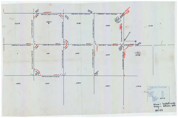
[Southwest 1/4 of Northwest 1/4 of County in vicinity of surveys 1281, 1282, 1297 and 1302]
Print $20.00
- Digital $50.00
[Southwest 1/4 of Northwest 1/4 of County in vicinity of surveys 1281, 1282, 1297 and 1302]
Size: 21.5 x 14.2 inches
90897
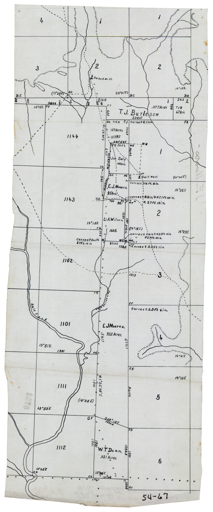
[South Center of County near surveys 1144 and 1143]
Print $2.00
- Digital $50.00
[South Center of County near surveys 1144 and 1143]
Size: 6.6 x 16.1 inches
90502
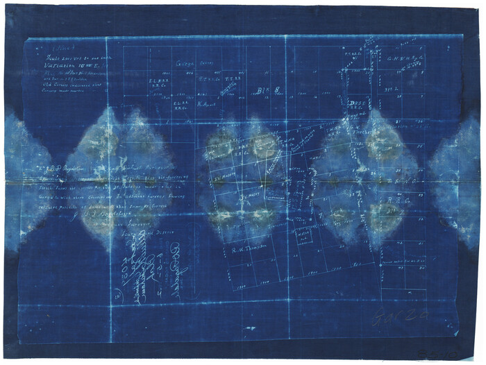
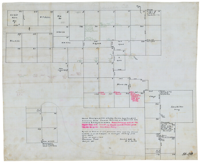
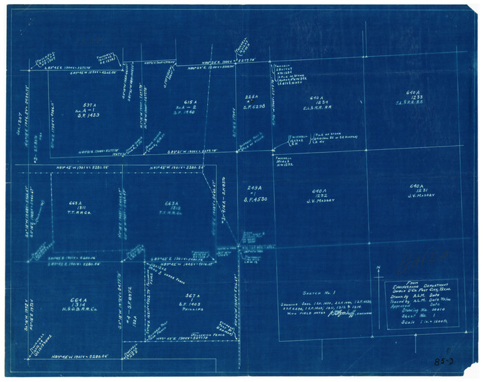
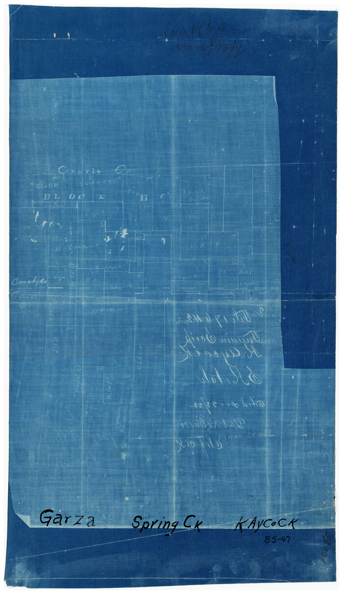
[Sketch showing parts of H. & G. N. RR. Co. Blocks 7 and 8, K. Aycock Block 4, G. H. & H. RR. Co. Block 5 and various surveys west]
Print $20.00
- Digital $50.00
[Sketch showing parts of H. & G. N. RR. Co. Blocks 7 and 8, K. Aycock Block 4, G. H. & H. RR. Co. Block 5 and various surveys west]
1902
Size: 25.5 x 17.3 inches
90871
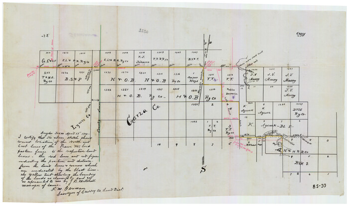
[Sketch showing correct location of the North and East lines of the Nave McCord pasture fence]
Print $20.00
- Digital $50.00
[Sketch showing correct location of the North and East lines of the Nave McCord pasture fence]
1900
Size: 20.3 x 11.8 inches
90896
[Sketch showing Blocks 1, B18 and E.L. & RR. Co. Blocks 2, 8 and 97]
Print $40.00
- Digital $50.00
[Sketch showing Blocks 1, B18 and E.L. & RR. Co. Blocks 2, 8 and 97]
Size: 55.1 x 44.9 inches
89950
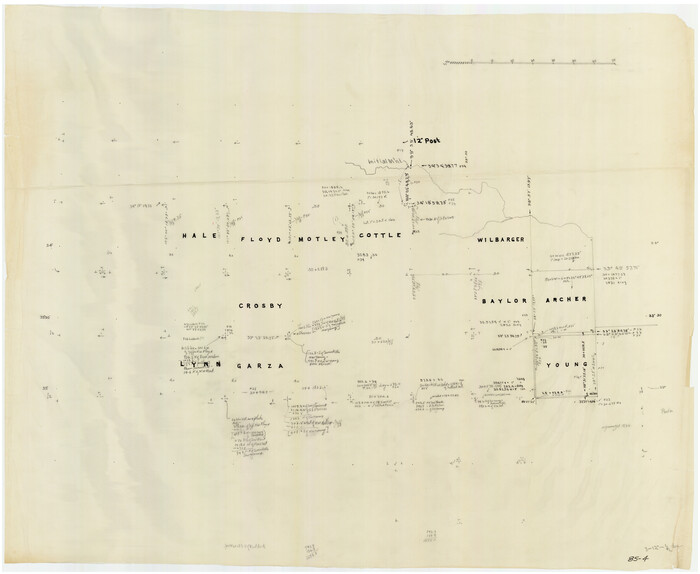
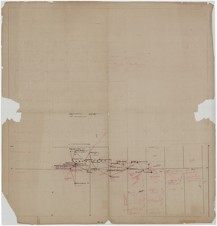
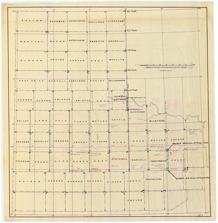
[Sketch of counties just south of the Panhandle]
Print $20.00
- Digital $50.00
[Sketch of counties just south of the Panhandle]
Size: 42.7 x 34.8 inches
90913
[Sketch fragment in Garza and Crosby Counties]
Print $20.00
- Digital $50.00
[Sketch fragment in Garza and Crosby Counties]
Size: 32.6 x 17.0 inches
90855
[Sketch focused on Southeast corner of Lubbock County]
Print $20.00
- Digital $50.00
[Sketch focused on Southeast corner of Lubbock County]
Size: 42.8 x 36.9 inches
89899
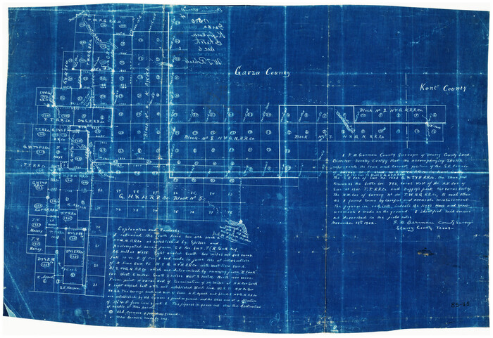
[Sketch along Garza-Kent County Line]
Print $20.00
- Digital $50.00
[Sketch along Garza-Kent County Line]
Size: 41.5 x 43.7 inches
89920
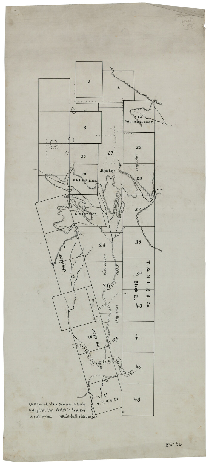
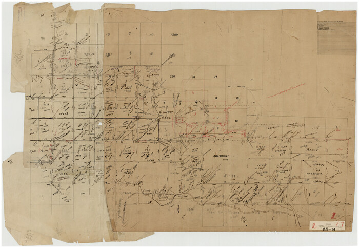
[Part of T. & N. O. RR. Co Block 2 and area around Jasper Hays survey]
Print $20.00
- Digital $50.00
[Part of T. & N. O. RR. Co Block 2 and area around Jasper Hays survey]
1907
Size: 13.3 x 28.4 inches
90850
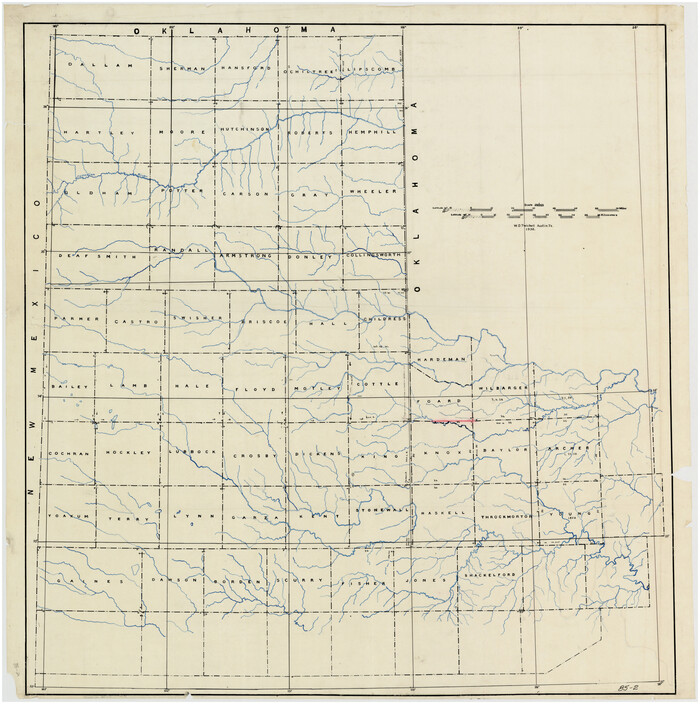
[Panhandle Counties]
Print $20.00
- Digital $50.00
[Panhandle Counties]
1930
Size: 42.3 x 42.8 inches
89923
[Panhandle Counties]
Print $20.00
- Digital $50.00
[Panhandle Counties]
Size: 41.8 x 43.2 inches
89951
[Panhandle Counties]
Print $20.00
- Digital $50.00
[Panhandle Counties]
1908
Size: 18.4 x 14.8 inches
90796
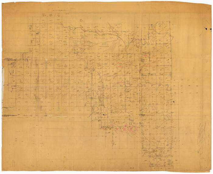
[Northwest part of County]
Print $20.00
- Digital $50.00
[Northwest part of County]
Size: 32.3 x 22.3 inches
90865
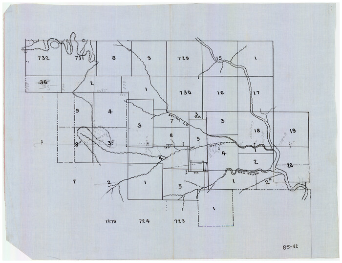
[Northwest part of County showing surveys along Spring Creek, Harvey Creek, and Red Hollow Creek]
Print $20.00
- Digital $50.00
[Northwest part of County showing surveys along Spring Creek, Harvey Creek, and Red Hollow Creek]
Size: 18.5 x 14.4 inches
90909
[Northwest corner of the County]
Print $20.00
- Digital $50.00
[Northwest corner of the County]
1903
Size: 19.1 x 21.5 inches
90873
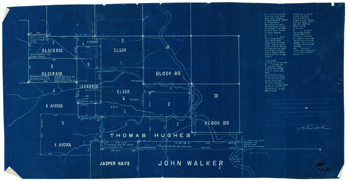
[Northwest Garza County around John Walker and Thomas Hughes surveys]
Print $20.00
- Digital $50.00
[Northwest Garza County around John Walker and Thomas Hughes surveys]
1913
Size: 27.5 x 14.3 inches
90848
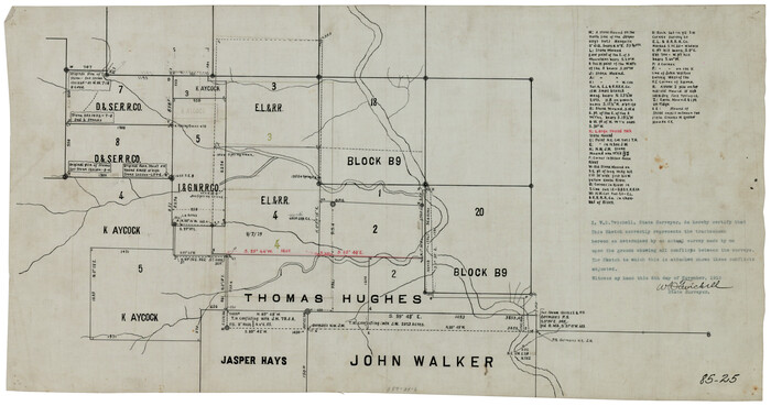
[Northwest Garza County around John Walker and Thomas Hughes surveys]
Print $20.00
- Digital $50.00
[Northwest Garza County around John Walker and Thomas Hughes surveys]
1913
Size: 27.5 x 14.5 inches
90849
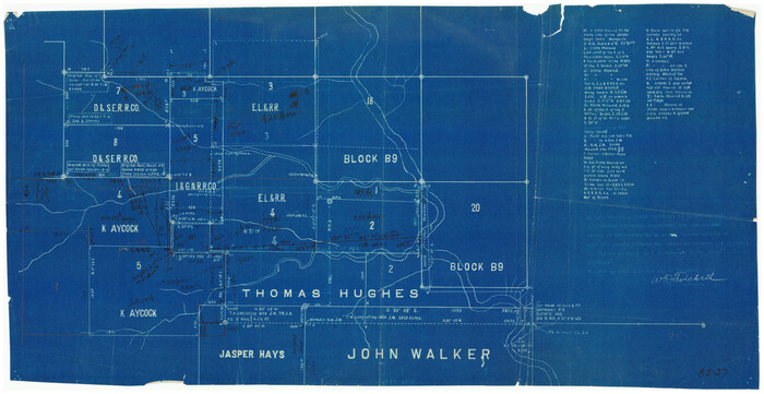
[Northwest Garza County around John Walker and Thomas Hughes surveys]
Print $20.00
- Digital $50.00
[Northwest Garza County around John Walker and Thomas Hughes surveys]
1913
Size: 28.3 x 14.5 inches
90906
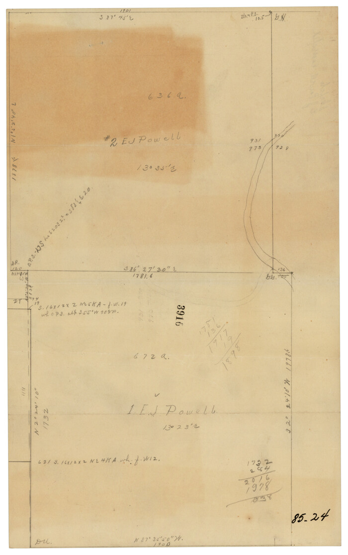
[Northwest Garza Co., E. J. Powell surveys and vicinity]
Print $2.00
- Digital $50.00
[Northwest Garza Co., E. J. Powell surveys and vicinity]
Size: 8.9 x 14.2 inches
90852
[Northeast 1/4 County]
Print $20.00
- Digital $50.00
[Northeast 1/4 County]
Size: 11.9 x 20.3 inches
90876
[Texas and New Orleans Railroad Company, Block 2]
Print $20.00
- Digital $50.00
[Texas and New Orleans Railroad Company, Block 2]
1906
-
Size
21.1 x 14.4 inches
-
Map/Doc
92702
-
Creation Date
1906
[T. T. RR. Co. Block 8 and vicinity]
Print $20.00
- Digital $50.00
[T. T. RR. Co. Block 8 and vicinity]
-
Size
20.3 x 15.2 inches
-
Map/Doc
90795
[T. T. RR. Co. Block 8 and vicinity]
Print $20.00
- Digital $50.00
[T. T. RR. Co. Block 8 and vicinity]
-
Size
25.3 x 39.0 inches
-
Map/Doc
90875
[T. & N. O. RR. Co. Block 2]
Print $20.00
- Digital $50.00
[T. & N. O. RR. Co. Block 2]
-
Size
22.5 x 28.0 inches
-
Map/Doc
92696
[Southwest part of H. & G. N. Block 8]
Print $20.00
- Digital $50.00
[Southwest part of H. & G. N. Block 8]
-
Size
24.6 x 9.3 inches
-
Map/Doc
90372
[Southwest part of County]
Print $20.00
- Digital $50.00
[Southwest part of County]
-
Size
29.0 x 18.3 inches
-
Map/Doc
90921
[Southwest part of County]
Print $20.00
- Digital $50.00
[Southwest part of County]
-
Size
28.8 x 18.4 inches
-
Map/Doc
90922
[Southwest part of County around B. Barrow survey]
Print $20.00
- Digital $50.00
[Southwest part of County around B. Barrow survey]
-
Size
19.6 x 21.1 inches
-
Map/Doc
90919
[Southwest corner of county covering Blks. 24 and B9]
Print $20.00
- Digital $50.00
[Southwest corner of county covering Blks. 24 and B9]
1905
-
Size
16.7 x 13.9 inches
-
Map/Doc
90489
-
Creation Date
1905
[Southwest 1/4 of Northwest 1/4 of County in vicinity of surveys 1281, 1282, 1297 and 1302]
Print $20.00
- Digital $50.00
[Southwest 1/4 of Northwest 1/4 of County in vicinity of surveys 1281, 1282, 1297 and 1302]
-
Size
21.5 x 14.2 inches
-
Map/Doc
90897
[South Center of County near surveys 1144 and 1143]
Print $2.00
- Digital $50.00
[South Center of County near surveys 1144 and 1143]
-
Size
6.6 x 16.1 inches
-
Map/Doc
90502
[Sketch showing parts of H. & G. N. RR. Co. Blocks 7 and 8, K. Aycock Block 4, G. H. & H. RR. Co. Block 5 and various surveys west]
Print $20.00
- Digital $50.00
[Sketch showing parts of H. & G. N. RR. Co. Blocks 7 and 8, K. Aycock Block 4, G. H. & H. RR. Co. Block 5 and various surveys west]
1902
-
Size
25.5 x 17.3 inches
-
Map/Doc
90871
-
Creation Date
1902
[Sketch showing correct location of the North and East lines of the Nave McCord pasture fence]
Print $20.00
- Digital $50.00
[Sketch showing correct location of the North and East lines of the Nave McCord pasture fence]
1900
-
Size
20.3 x 11.8 inches
-
Map/Doc
90896
-
Creation Date
1900
[Sketch showing Blocks 1, B18 and E.L. & RR. Co. Blocks 2, 8 and 97]
Print $40.00
- Digital $50.00
[Sketch showing Blocks 1, B18 and E.L. & RR. Co. Blocks 2, 8 and 97]
-
Size
55.1 x 44.9 inches
-
Map/Doc
89950
[Sketch of counties just south of the Panhandle]
Print $20.00
- Digital $50.00
[Sketch of counties just south of the Panhandle]
-
Size
42.7 x 34.8 inches
-
Map/Doc
90913
[Sketch fragment in Garza and Crosby Counties]
Print $20.00
- Digital $50.00
[Sketch fragment in Garza and Crosby Counties]
-
Size
32.6 x 17.0 inches
-
Map/Doc
90855
[Sketch focused on Southeast corner of Lubbock County]
Print $20.00
- Digital $50.00
[Sketch focused on Southeast corner of Lubbock County]
-
Size
42.8 x 36.9 inches
-
Map/Doc
89899
[Sketch along Garza-Kent County Line]
Print $20.00
- Digital $50.00
[Sketch along Garza-Kent County Line]
-
Size
41.5 x 43.7 inches
-
Map/Doc
89920
[Part of T. & N. O. RR. Co Block 2 and area around Jasper Hays survey]
Print $20.00
- Digital $50.00
[Part of T. & N. O. RR. Co Block 2 and area around Jasper Hays survey]
1907
-
Size
13.3 x 28.4 inches
-
Map/Doc
90850
-
Creation Date
1907
[Panhandle Counties]
Print $20.00
- Digital $50.00
[Panhandle Counties]
1930
-
Size
42.3 x 42.8 inches
-
Map/Doc
89923
-
Creation Date
1930
[Panhandle Counties]
Print $20.00
- Digital $50.00
[Panhandle Counties]
-
Size
41.8 x 43.2 inches
-
Map/Doc
89951
[Panhandle Counties]
Print $20.00
- Digital $50.00
[Panhandle Counties]
1908
-
Size
18.4 x 14.8 inches
-
Map/Doc
90796
-
Creation Date
1908
[Northwest part of County]
Print $20.00
- Digital $50.00
[Northwest part of County]
-
Size
32.3 x 22.3 inches
-
Map/Doc
90865
[Northwest part of County showing surveys along Spring Creek, Harvey Creek, and Red Hollow Creek]
Print $20.00
- Digital $50.00
[Northwest part of County showing surveys along Spring Creek, Harvey Creek, and Red Hollow Creek]
-
Size
18.5 x 14.4 inches
-
Map/Doc
90909
[Northwest corner of the County]
Print $20.00
- Digital $50.00
[Northwest corner of the County]
1903
-
Size
19.1 x 21.5 inches
-
Map/Doc
90873
-
Creation Date
1903
[Northwest Garza County around John Walker and Thomas Hughes surveys]
Print $20.00
- Digital $50.00
[Northwest Garza County around John Walker and Thomas Hughes surveys]
1913
-
Size
27.5 x 14.3 inches
-
Map/Doc
90848
-
Creation Date
1913
[Northwest Garza County around John Walker and Thomas Hughes surveys]
Print $20.00
- Digital $50.00
[Northwest Garza County around John Walker and Thomas Hughes surveys]
1913
-
Size
27.5 x 14.5 inches
-
Map/Doc
90849
-
Creation Date
1913
[Northwest Garza County around John Walker and Thomas Hughes surveys]
Print $20.00
- Digital $50.00
[Northwest Garza County around John Walker and Thomas Hughes surveys]
1913
-
Size
28.3 x 14.5 inches
-
Map/Doc
90906
-
Creation Date
1913
[Northwest Garza Co., E. J. Powell surveys and vicinity]
Print $2.00
- Digital $50.00
[Northwest Garza Co., E. J. Powell surveys and vicinity]
-
Size
8.9 x 14.2 inches
-
Map/Doc
90852
[Northeast 1/4 County]
Print $20.00
- Digital $50.00
[Northeast 1/4 County]
-
Size
11.9 x 20.3 inches
-
Map/Doc
90876