[Surrounding McCrummens Second Addition]
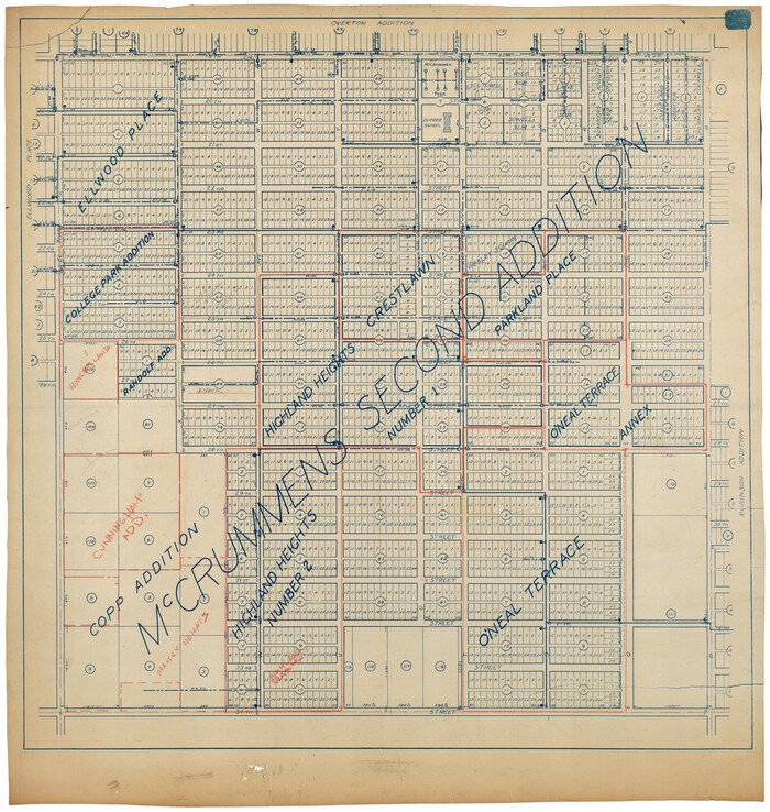
Print $20.00
- Digital $50.00
[Surrounding McCrummens Second Addition]
Size: 31.2 x 33.1 inches
92839
[Southwest corner of county covering Blks. 24 and B9]
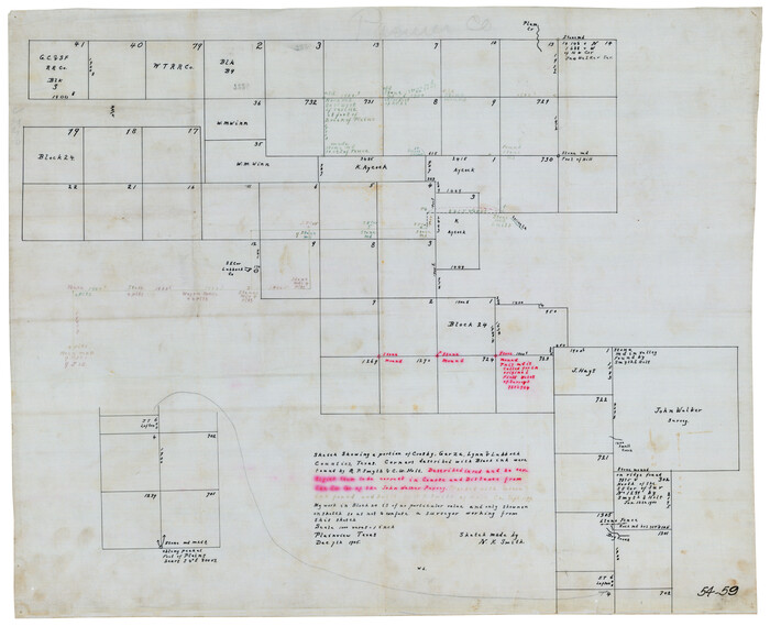
Print $20.00
- Digital $50.00
[Southwest corner of county covering Blks. 24 and B9]
1905
Size: 16.7 x 13.9 inches
90489
[Southeast Portion of Lubbock County]
Print $20.00
- Digital $50.00
[Southeast Portion of Lubbock County]
Size: 24.7 x 18.5 inches
91313
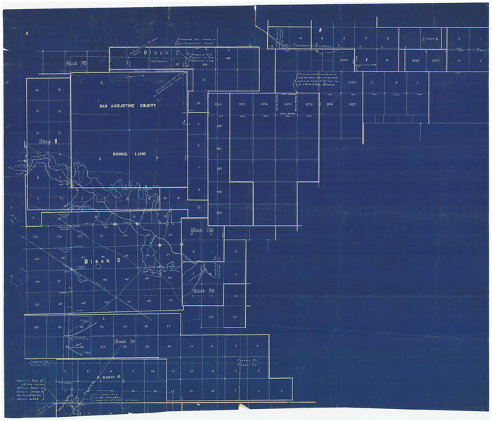
[South Line of Block RG]
Print $20.00
- Digital $50.00
[South Line of Block RG]
Size: 34.9 x 14.1 inches
91322
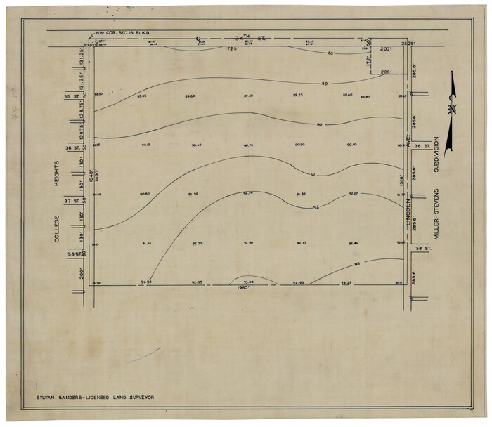
[Sketch showing elevation between College Heights and Miller-Stevens Subdivision along Lincoln Ave.]
Print $20.00
- Digital $50.00
[Sketch showing elevation between College Heights and Miller-Stevens Subdivision along Lincoln Ave.]
Size: 15.7 x 13.8 inches
92881
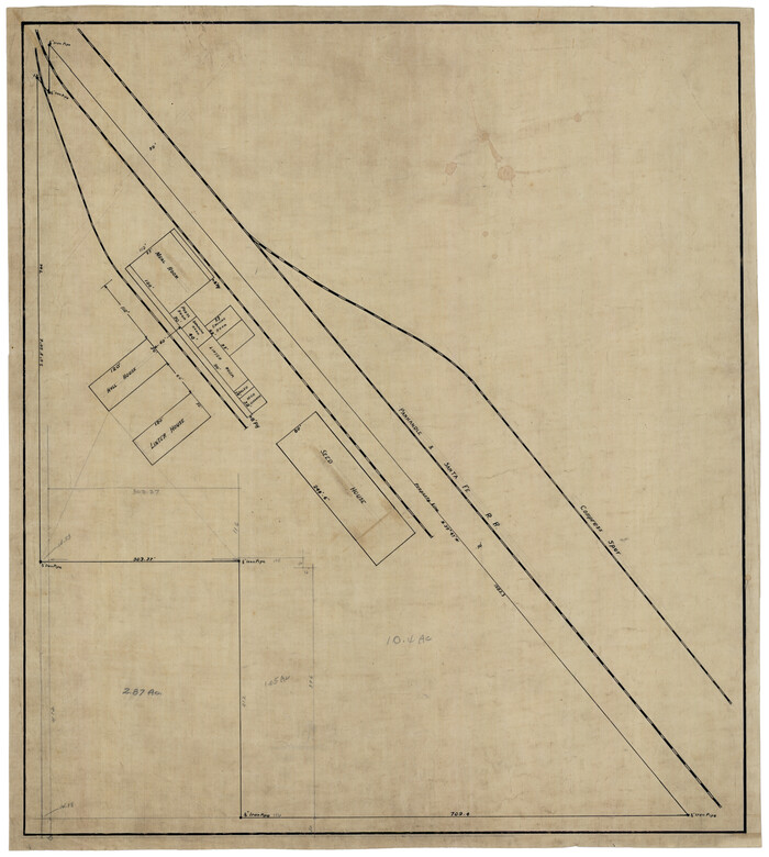
[Sketch showing Panhandle and Santa Fe Railroad, Compress Spur and Seed House structures]
Print $20.00
- Digital $50.00
[Sketch showing Panhandle and Santa Fe Railroad, Compress Spur and Seed House structures]
Size: 20.8 x 22.8 inches
92880
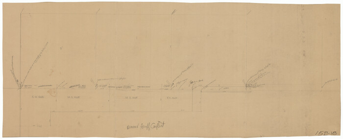
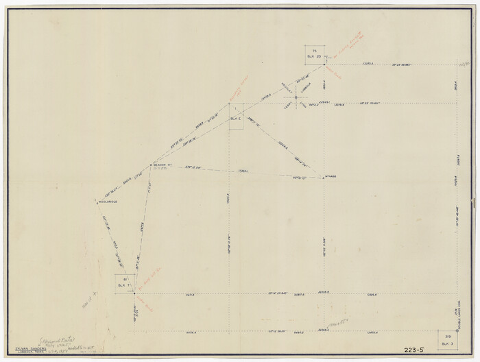
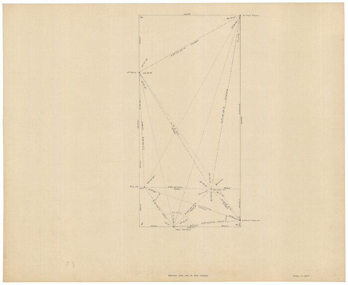
[Sketch showing Connecting Lines]
Print $20.00
- Digital $50.00
[Sketch showing Connecting Lines]
Size: 24.3 x 18.3 inches
91938
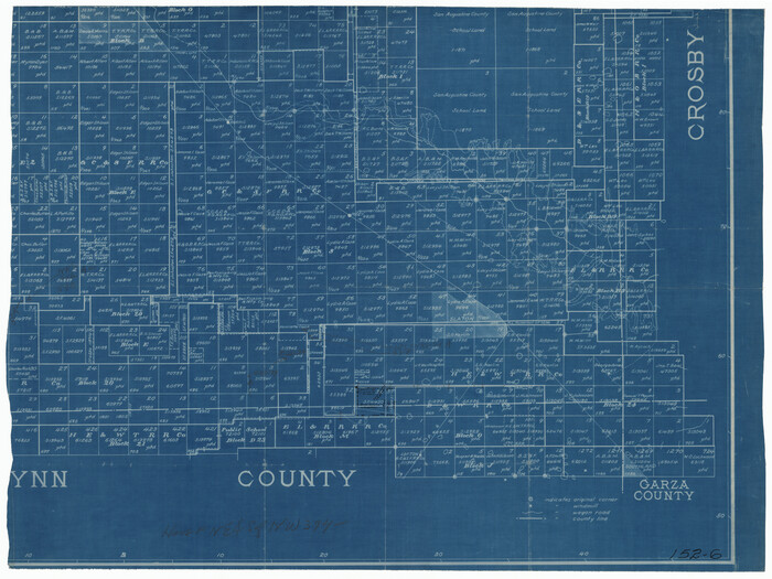
[Sketch of most of Crosby County]
Print $40.00
- Digital $50.00
[Sketch of most of Crosby County]
Size: 54.9 x 45.3 inches
89762
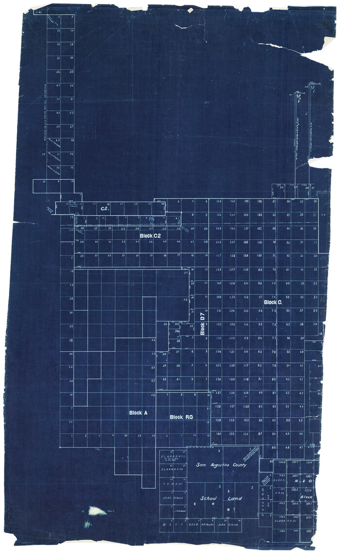
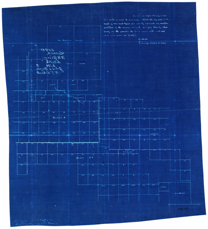
[Sketch of Blocks C2, C, D7, A, RG and San Augustine County School Land]
Print $20.00
- Digital $50.00
[Sketch of Blocks C2, C, D7, A, RG and San Augustine County School Land]
Size: 15.5 x 25.8 inches
93021
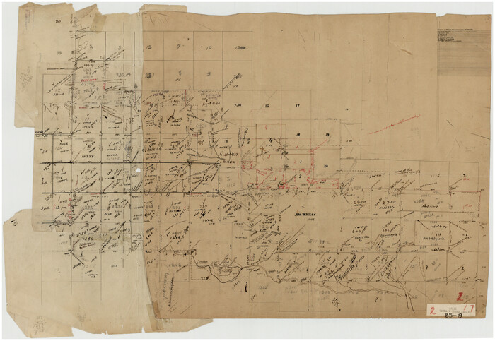
[Sketch focused on Southeast corner of Lubbock County]
Print $20.00
- Digital $50.00
[Sketch focused on Southeast corner of Lubbock County]
Size: 42.8 x 36.9 inches
89899
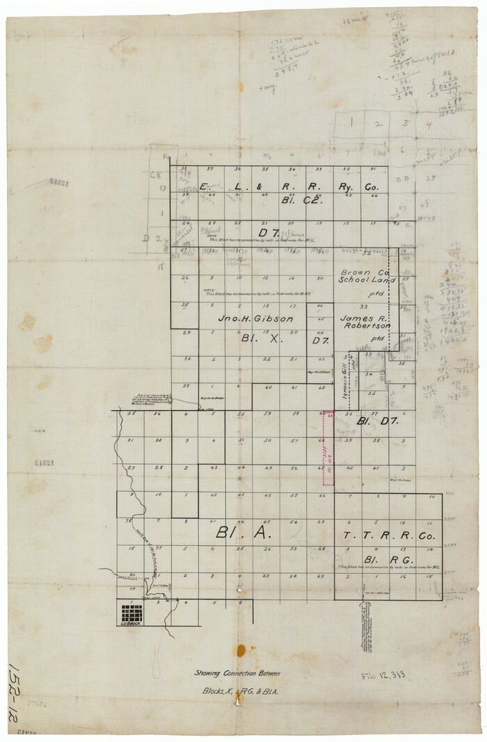
[Sketch Showing Connections Between Blocks X, RG, and A]
Print $20.00
- Digital $50.00
[Sketch Showing Connections Between Blocks X, RG, and A]
Size: 17.5 x 26.0 inches
91375
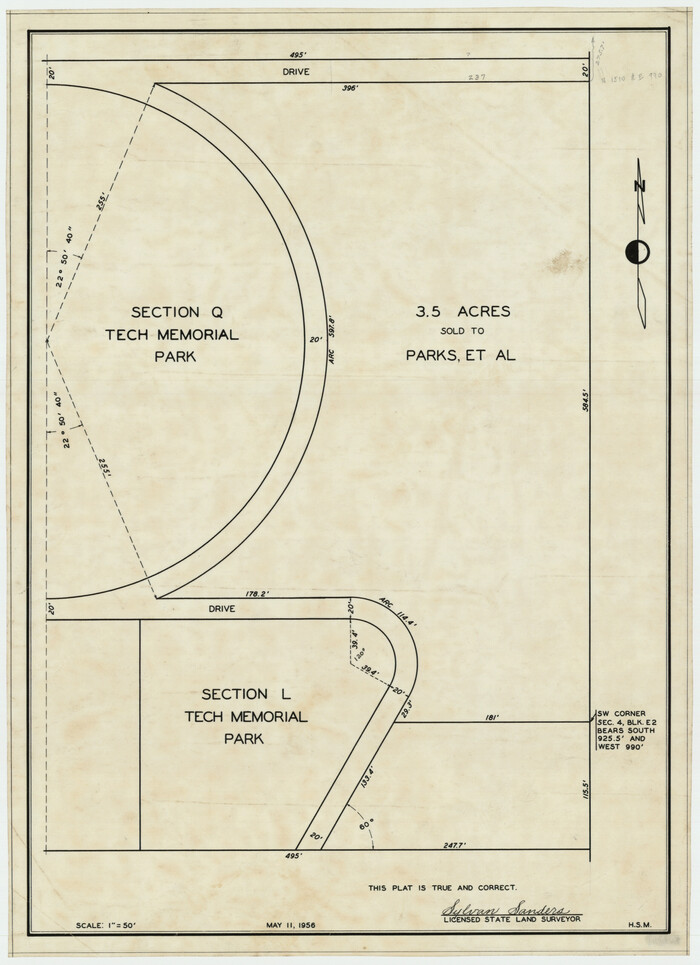
[Sections Q, L Tech Memorial Park]
Print $20.00
- Digital $50.00
[Sections Q, L Tech Memorial Park]
1956
Size: 13.0 x 17.8 inches
92303
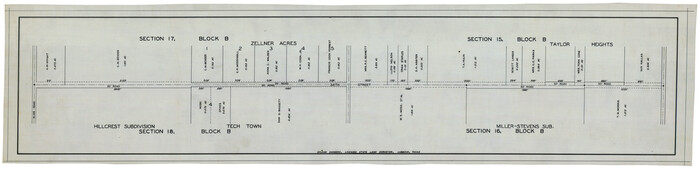
[Sections 15, 16, 17, 18, Block B]
Print $20.00
- Digital $50.00
[Sections 15, 16, 17, 18, Block B]
Size: 40.0 x 10.5 inches
92798
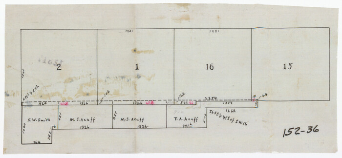
[Sections 1, 2, 15, and 16 and vicinity]
Print $2.00
- Digital $50.00
[Sections 1, 2, 15, and 16 and vicinity]
Size: 8.7 x 4.3 inches
91396
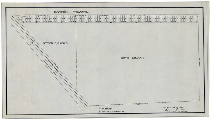
[Sections 1 & 2, Block S]
Print $20.00
- Digital $50.00
[Sections 1 & 2, Block S]
Size: 27.8 x 15.7 inches
92859
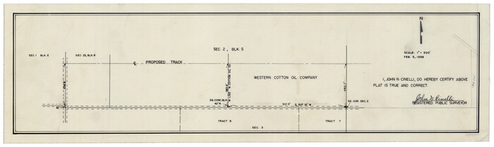
[Section 2, Block S]
Print $20.00
- Digital $50.00
[Section 2, Block S]
1958
Size: 22.2 x 6.8 inches
92860
[Section 11, Block JS, Section 14, Block A, Lubbock County]
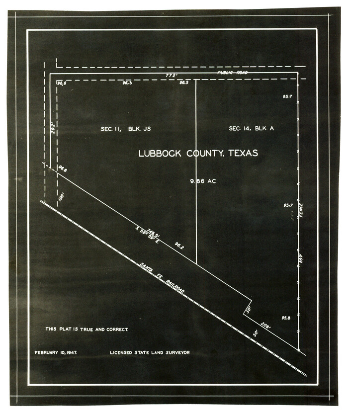
Print $2.00
- Digital $50.00
[Section 11, Block JS, Section 14, Block A, Lubbock County]
1947
Size: 7.1 x 8.5 inches
92711
[San Augustine County School Land]
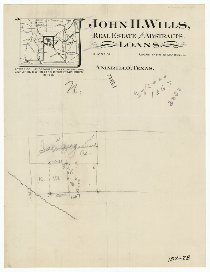
Print $3.00
- Digital $50.00
[San Augustine County School Land]
Size: 9.3 x 11.6 inches
91331
[Portions of Blocks 20, 24, S, and the West Lone of Wilson County School Land]
Print $20.00
- Digital $50.00
[Portions of Blocks 20, 24, S, and the West Lone of Wilson County School Land]
1910
Size: 27.9 x 15.7 inches
91326
[Plat showing 1.0 acre of land out of the NE/4 of Section 2, Block E]
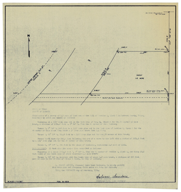
Print $3.00
- Digital $50.00
[Plat showing 1.0 acre of land out of the NE/4 of Section 2, Block E]
1954
Size: 9.6 x 10.2 inches
92706
[Plat map showing mostly Overton Addition]
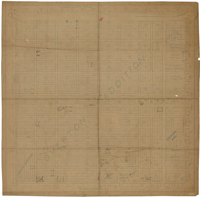
Print $20.00
- Digital $50.00
[Plat map showing mostly Overton Addition]
Size: 31.9 x 31.3 inches
92812
[Plat map showing mostly Overton Addition]
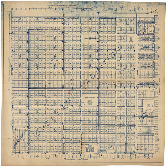
Print $20.00
- Digital $50.00
[Plat map showing mostly Overton Addition]
Size: 31.7 x 31.4 inches
92825
[Northwest part of County]
Print $20.00
- Digital $50.00
[Northwest part of County]
Size: 32.3 x 22.3 inches
90865
[Northwest corner of the County]
Print $20.00
- Digital $50.00
[Northwest corner of the County]
1903
Size: 19.1 x 21.5 inches
90873
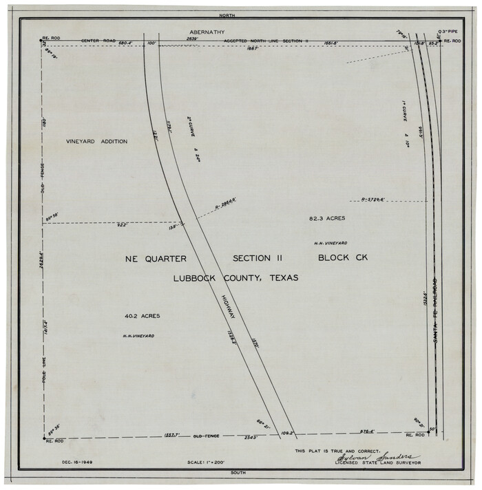
[NE Quarter Section 11 Block CK Lubbock County, Texas]
Print $20.00
- Digital $50.00
[NE Quarter Section 11 Block CK Lubbock County, Texas]
1949
Size: 16.1 x 16.5 inches
92871
[Meridian thru 19th St. Muni. Standpipe]
Print $20.00
- Digital $50.00
[Meridian thru 19th St. Muni. Standpipe]
Size: 23.8 x 19.5 inches
92864
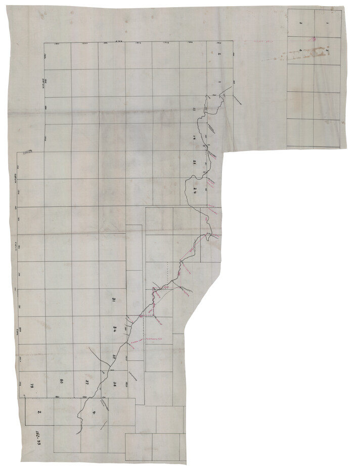
[Meander of Yellow House Creek from Northeast Corner of Section 37, Block S to Northeast corner of Section 3, Block O]
Print $20.00
- Digital $50.00
[Meander of Yellow House Creek from Northeast Corner of Section 37, Block S to Northeast corner of Section 3, Block O]
Size: 24.8 x 32.7 inches
91387
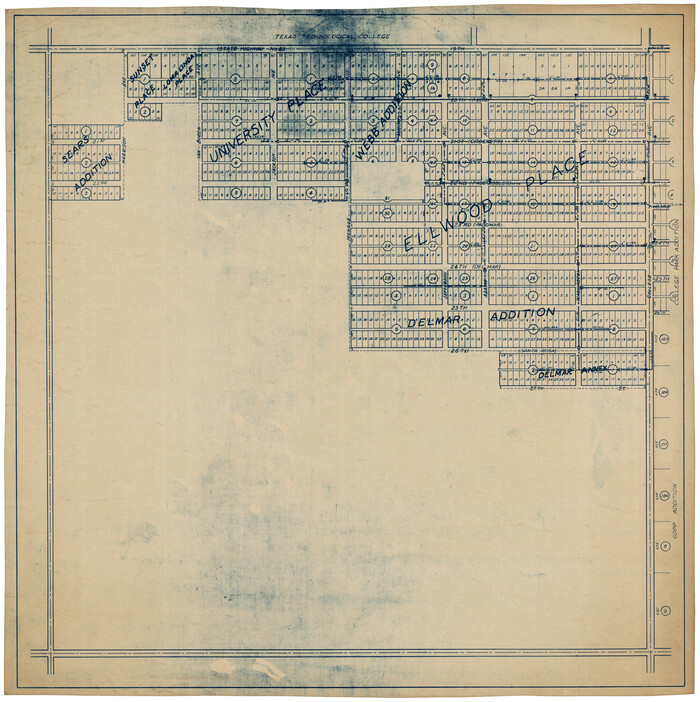
[Map of Lubbock showing Sears Addition, Sunset Place, Loma Linda Place, University Place, Webb Addition, Ellwood Place, Del Mar Addition and Del Mar Annex]
Print $20.00
- Digital $50.00
[Map of Lubbock showing Sears Addition, Sunset Place, Loma Linda Place, University Place, Webb Addition, Ellwood Place, Del Mar Addition and Del Mar Annex]
Size: 30.8 x 30.8 inches
92729
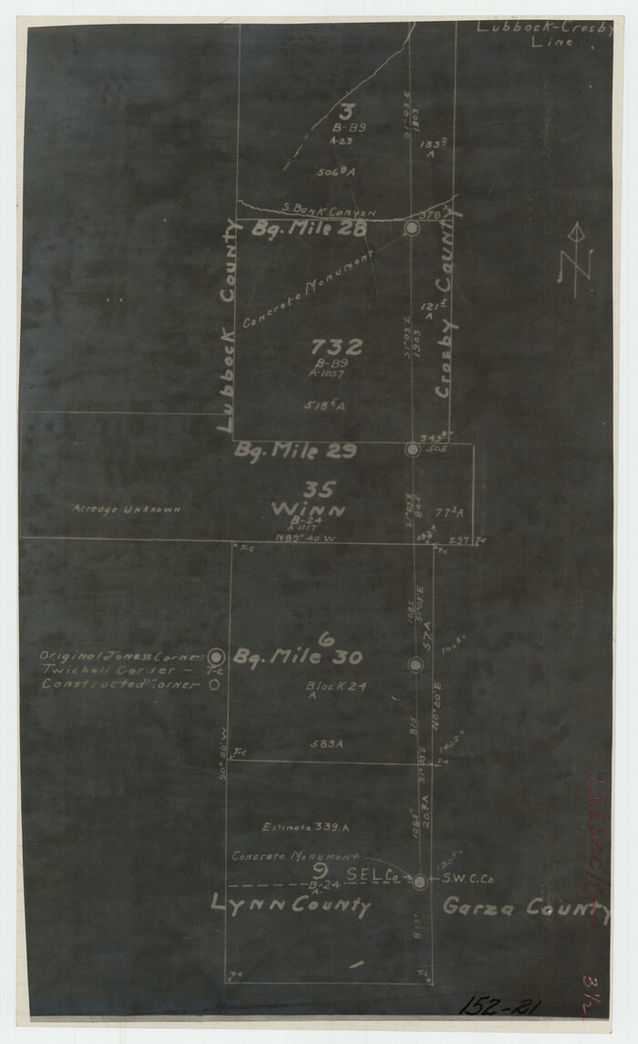
[Lubbock, Crosby County Line]
Print $2.00
- Digital $50.00
[Lubbock, Crosby County Line]
Size: 9.2 x 14.7 inches
91323
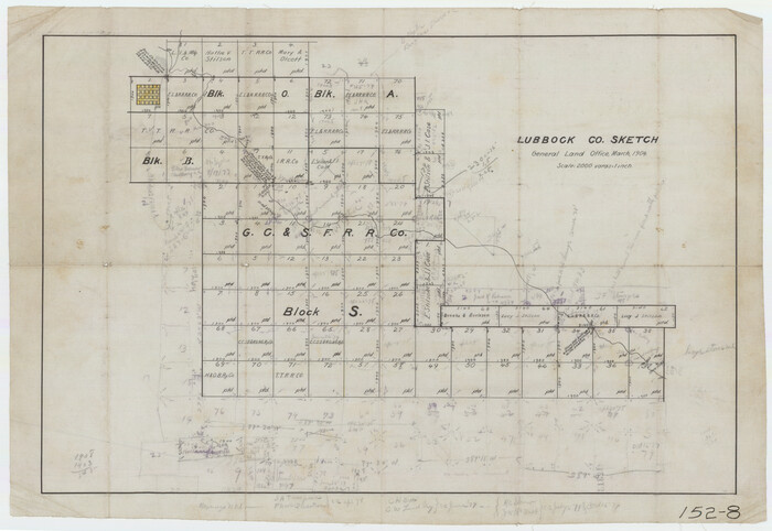
[Lubbock County Sketch, Blocks O, A, B, and S]
Print $20.00
- Digital $50.00
[Lubbock County Sketch, Blocks O, A, B, and S]
Size: 20.7 x 14.2 inches
91376
[Surrounding McCrummens Second Addition]
Print $20.00
- Digital $50.00
[Surrounding McCrummens Second Addition]
-
Size
31.2 x 33.1 inches
-
Map/Doc
92839
[Southwest corner of county covering Blks. 24 and B9]
Print $20.00
- Digital $50.00
[Southwest corner of county covering Blks. 24 and B9]
1905
-
Size
16.7 x 13.9 inches
-
Map/Doc
90489
-
Creation Date
1905
[Southeast Portion of Lubbock County]
Print $20.00
- Digital $50.00
[Southeast Portion of Lubbock County]
-
Size
24.7 x 18.5 inches
-
Map/Doc
91313
[South Line of Block RG]
Print $20.00
- Digital $50.00
[South Line of Block RG]
-
Size
34.9 x 14.1 inches
-
Map/Doc
91322
[Sketch showing elevation between College Heights and Miller-Stevens Subdivision along Lincoln Ave.]
Print $20.00
- Digital $50.00
[Sketch showing elevation between College Heights and Miller-Stevens Subdivision along Lincoln Ave.]
-
Size
15.7 x 13.8 inches
-
Map/Doc
92881
[Sketch showing Panhandle and Santa Fe Railroad, Compress Spur and Seed House structures]
Print $20.00
- Digital $50.00
[Sketch showing Panhandle and Santa Fe Railroad, Compress Spur and Seed House structures]
-
Size
20.8 x 22.8 inches
-
Map/Doc
92880
[Sketch showing Connecting Lines]
Print $20.00
- Digital $50.00
[Sketch showing Connecting Lines]
-
Size
24.3 x 18.3 inches
-
Map/Doc
91938
[Sketch of most of Crosby County]
Print $40.00
- Digital $50.00
[Sketch of most of Crosby County]
-
Size
54.9 x 45.3 inches
-
Map/Doc
89762
[Sketch of Blocks C2, C, D7, A, RG and San Augustine County School Land]
Print $20.00
- Digital $50.00
[Sketch of Blocks C2, C, D7, A, RG and San Augustine County School Land]
-
Size
15.5 x 25.8 inches
-
Map/Doc
93021
[Sketch focused on Southeast corner of Lubbock County]
Print $20.00
- Digital $50.00
[Sketch focused on Southeast corner of Lubbock County]
-
Size
42.8 x 36.9 inches
-
Map/Doc
89899
[Sketch Showing Connections Between Blocks X, RG, and A]
Print $20.00
- Digital $50.00
[Sketch Showing Connections Between Blocks X, RG, and A]
-
Size
17.5 x 26.0 inches
-
Map/Doc
91375
[Sections Q, L Tech Memorial Park]
Print $20.00
- Digital $50.00
[Sections Q, L Tech Memorial Park]
1956
-
Size
13.0 x 17.8 inches
-
Map/Doc
92303
-
Creation Date
1956
[Sections 15, 16, 17, 18, Block B]
Print $20.00
- Digital $50.00
[Sections 15, 16, 17, 18, Block B]
-
Size
40.0 x 10.5 inches
-
Map/Doc
92798
[Sections 1, 2, 15, and 16 and vicinity]
Print $2.00
- Digital $50.00
[Sections 1, 2, 15, and 16 and vicinity]
-
Size
8.7 x 4.3 inches
-
Map/Doc
91396
[Sections 1 & 2, Block S]
Print $20.00
- Digital $50.00
[Sections 1 & 2, Block S]
-
Size
27.8 x 15.7 inches
-
Map/Doc
92859
[Section 2, Block S]
Print $20.00
- Digital $50.00
[Section 2, Block S]
1958
-
Size
22.2 x 6.8 inches
-
Map/Doc
92860
-
Creation Date
1958
[Section 11, Block JS, Section 14, Block A, Lubbock County]
Print $2.00
- Digital $50.00
[Section 11, Block JS, Section 14, Block A, Lubbock County]
1947
-
Size
7.1 x 8.5 inches
-
Map/Doc
92711
-
Creation Date
1947
[San Augustine County School Land]
Print $3.00
- Digital $50.00
[San Augustine County School Land]
-
Size
9.3 x 11.6 inches
-
Map/Doc
91331
[Portions of Blocks 20, 24, S, and the West Lone of Wilson County School Land]
Print $20.00
- Digital $50.00
[Portions of Blocks 20, 24, S, and the West Lone of Wilson County School Land]
1910
-
Size
27.9 x 15.7 inches
-
Map/Doc
91326
-
Creation Date
1910
[Plat showing 1.0 acre of land out of the NE/4 of Section 2, Block E]
Print $3.00
- Digital $50.00
[Plat showing 1.0 acre of land out of the NE/4 of Section 2, Block E]
1954
-
Size
9.6 x 10.2 inches
-
Map/Doc
92706
-
Creation Date
1954
[Plat map showing mostly Overton Addition]
Print $20.00
- Digital $50.00
[Plat map showing mostly Overton Addition]
-
Size
31.9 x 31.3 inches
-
Map/Doc
92812
[Plat map showing mostly Overton Addition]
Print $20.00
- Digital $50.00
[Plat map showing mostly Overton Addition]
-
Size
31.7 x 31.4 inches
-
Map/Doc
92825
[Northwest part of County]
Print $20.00
- Digital $50.00
[Northwest part of County]
-
Size
32.3 x 22.3 inches
-
Map/Doc
90865
[Northwest corner of the County]
Print $20.00
- Digital $50.00
[Northwest corner of the County]
1903
-
Size
19.1 x 21.5 inches
-
Map/Doc
90873
-
Creation Date
1903
[NE Quarter Section 11 Block CK Lubbock County, Texas]
Print $20.00
- Digital $50.00
[NE Quarter Section 11 Block CK Lubbock County, Texas]
1949
-
Size
16.1 x 16.5 inches
-
Map/Doc
92871
-
Creation Date
1949
[Meridian thru 19th St. Muni. Standpipe]
Print $20.00
- Digital $50.00
[Meridian thru 19th St. Muni. Standpipe]
-
Size
23.8 x 19.5 inches
-
Map/Doc
92864
[Meander of Yellow House Creek from Northeast Corner of Section 37, Block S to Northeast corner of Section 3, Block O]
Print $20.00
- Digital $50.00
[Meander of Yellow House Creek from Northeast Corner of Section 37, Block S to Northeast corner of Section 3, Block O]
-
Size
24.8 x 32.7 inches
-
Map/Doc
91387
[Map of Lubbock showing Sears Addition, Sunset Place, Loma Linda Place, University Place, Webb Addition, Ellwood Place, Del Mar Addition and Del Mar Annex]
Print $20.00
- Digital $50.00
[Map of Lubbock showing Sears Addition, Sunset Place, Loma Linda Place, University Place, Webb Addition, Ellwood Place, Del Mar Addition and Del Mar Annex]
-
Size
30.8 x 30.8 inches
-
Map/Doc
92729
[Lubbock, Crosby County Line]
Print $2.00
- Digital $50.00
[Lubbock, Crosby County Line]
-
Size
9.2 x 14.7 inches
-
Map/Doc
91323
[Lubbock County Sketch, Blocks O, A, B, and S]
Print $20.00
- Digital $50.00
[Lubbock County Sketch, Blocks O, A, B, and S]
-
Size
20.7 x 14.2 inches
-
Map/Doc
91376