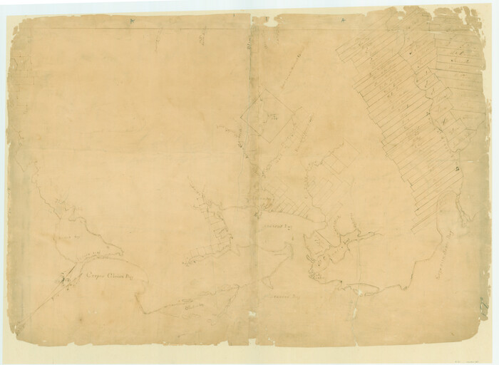
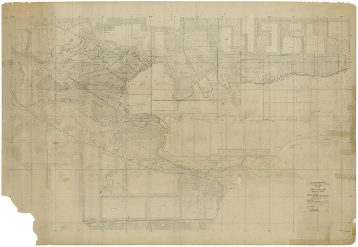
[Surveys on San Antonio River and Aransas Bay area]
Print $20.00
- Digital $50.00
[Surveys on San Antonio River and Aransas Bay area]
1840
Size: 24.1 x 33.0 inches
141
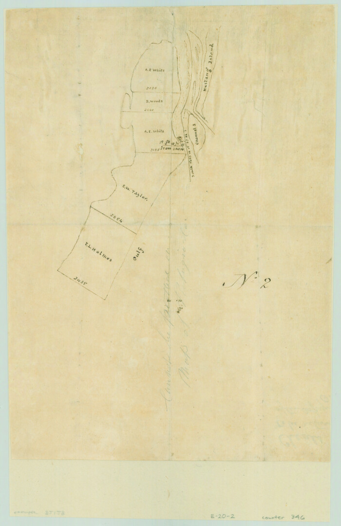
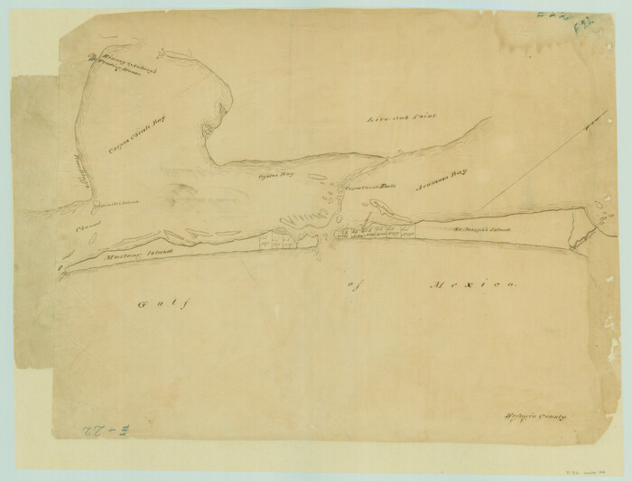
[Surveys along the Texas coast across from Mustang Island]
Print $2.00
- Digital $50.00
[Surveys along the Texas coast across from Mustang Island]
1841
Size: 11.3 x 7.3 inches
346
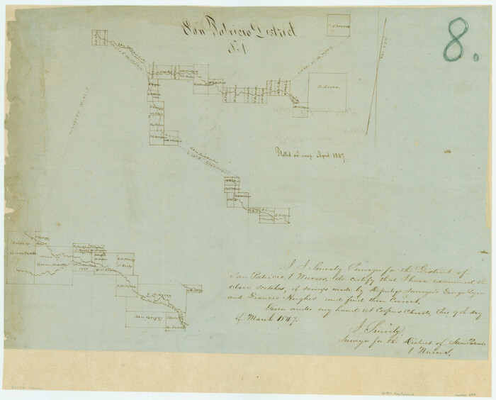
[Surveys along the San Fernando and Santa Gertrudis, San Patricio District]
Print $20.00
- Digital $50.00
[Surveys along the San Fernando and Santa Gertrudis, San Patricio District]
1847
Size: 13.2 x 16.4 inches
290
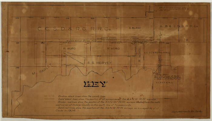
[Surveying Sketch of M. Farley, R. Word, S. S. Hervey, et al in Kleberg County, Texas]
Print $20.00
- Digital $50.00
[Surveying Sketch of M. Farley, R. Word, S. S. Hervey, et al in Kleberg County, Texas]
Size: 23.2 x 40.6 inches
10783
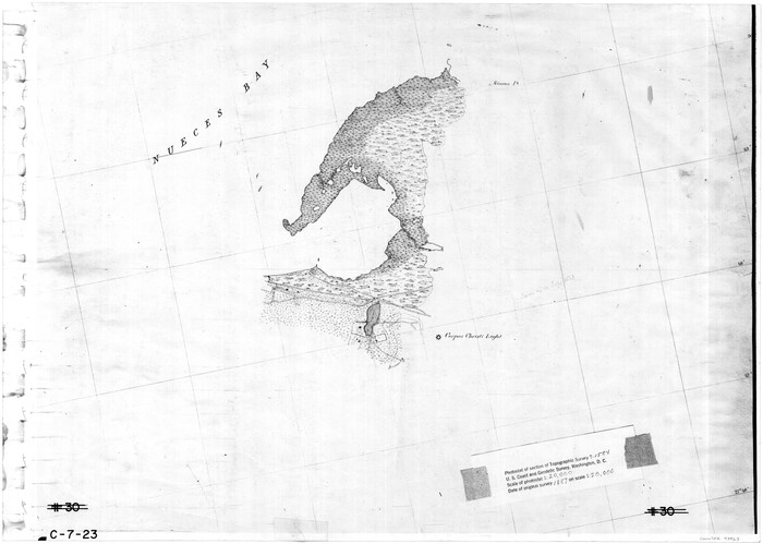
[Subdivision of Nueces Bay and list of Court Decrees]
Print $40.00
- Digital $50.00
[Subdivision of Nueces Bay and list of Court Decrees]
1940
Size: 34.2 x 48.8 inches
2086
[Sketch with field note calls of the boundaries of Webb, Duval, Jim Wells,Nueces, Kleberg, Zapata, Jim Hogg, Brooks, Willacy, Starr, Hidalgo and Cameron Counties]
![1689, [Sketch with field note calls of the boundaries of Webb, Duval, Jim Wells,Nueces, Kleberg, Zapata, Jim Hogg, Brooks, Willacy, Starr, Hidalgo and Cameron Counties], General Map Collection](https://historictexasmaps.com/wmedia_w700/pdf_converted_jpg/qi_pdf_thumbnail_720.jpg)
Print $20.00
- Digital $50.00
[Sketch with field note calls of the boundaries of Webb, Duval, Jim Wells,Nueces, Kleberg, Zapata, Jim Hogg, Brooks, Willacy, Starr, Hidalgo and Cameron Counties]
1915
Size: 21.9 x 26.2 inches
1689
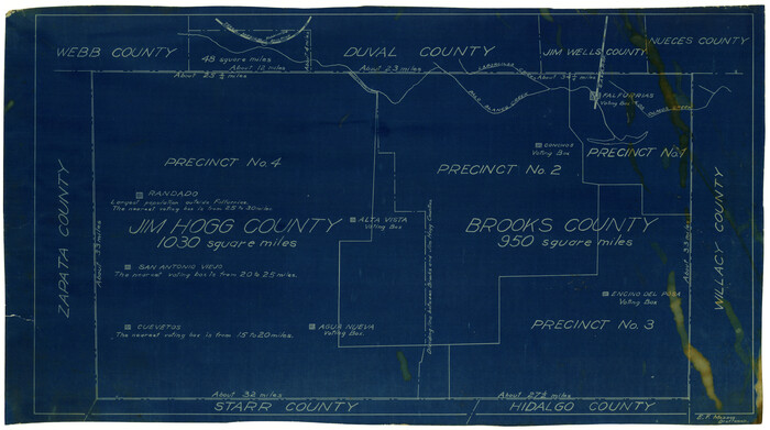
[Sketch showing voting precincts in Jim Hogg and Brooks Counties]
Print $20.00
- Digital $50.00
[Sketch showing voting precincts in Jim Hogg and Brooks Counties]
Size: 10.1 x 18.2 inches
4497
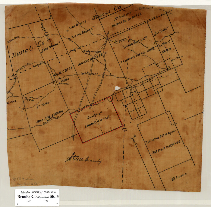
[Sketch of Surveys in Brooks County, Texas]
Print $20.00
- Digital $50.00
[Sketch of Surveys in Brooks County, Texas]
Size: 12.1 x 12.4 inches
10775
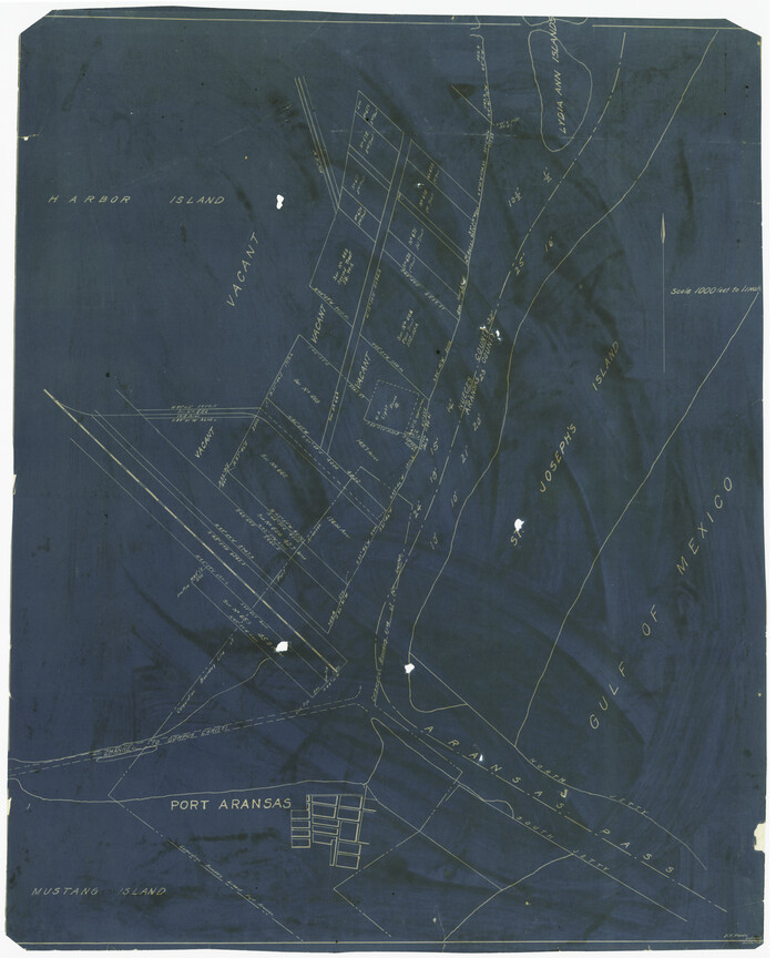
[Sketch of Surveys Near Port Aransas and Aransas Pass, Aransas County, Texas]
Print $20.00
- Digital $50.00
[Sketch of Surveys Near Port Aransas and Aransas Pass, Aransas County, Texas]
Size: 22.8 x 18.5 inches
676
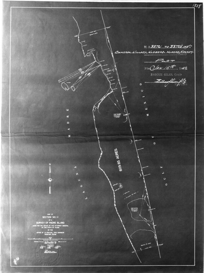
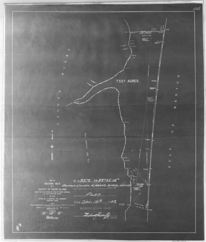
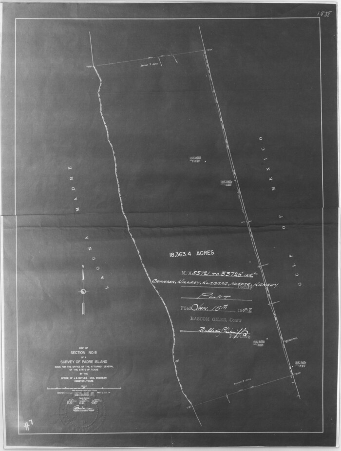
[Sketch for Mineral Application 33721 - 33725 Incl. - Padre and Mustang Island]
Print $20.00
- Digital $50.00
[Sketch for Mineral Application 33721 - 33725 Incl. - Padre and Mustang Island]
1942
Size: 29.7 x 22.3 inches
2868
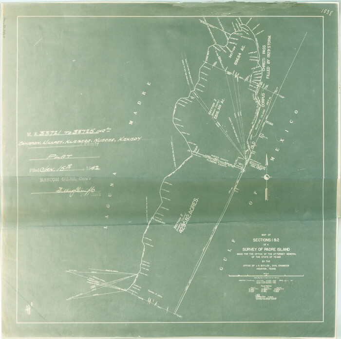
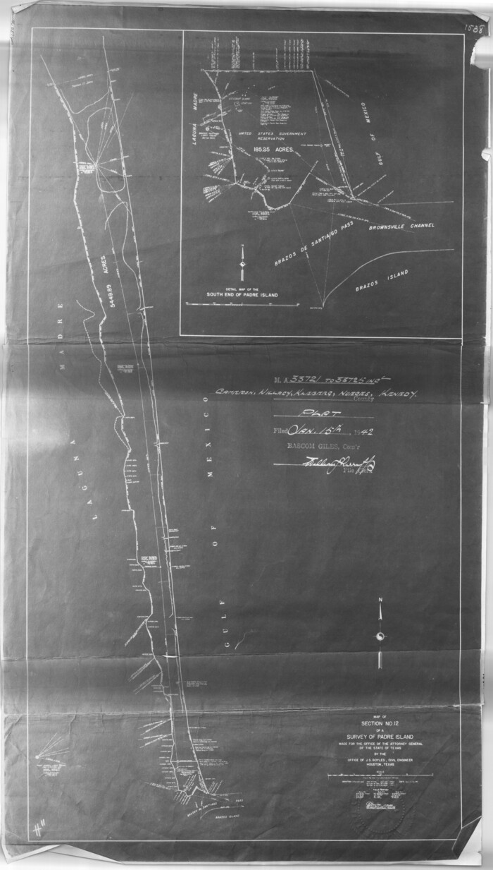
[Sketch for Mineral Application 33721 - 33725 Incl. - Padre and Mustang Island]
Print $20.00
- Digital $50.00
[Sketch for Mineral Application 33721 - 33725 Incl. - Padre and Mustang Island]
1942
Size: 22.2 x 22.3 inches
2869
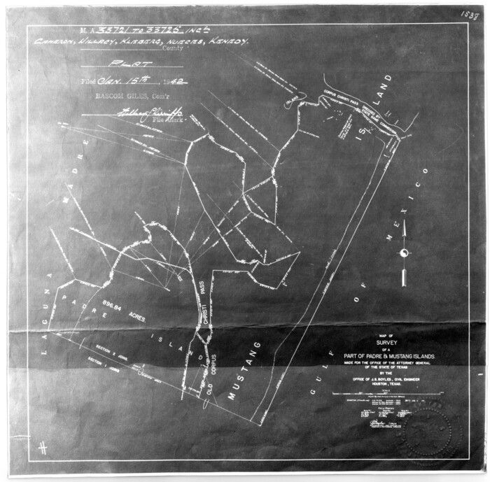
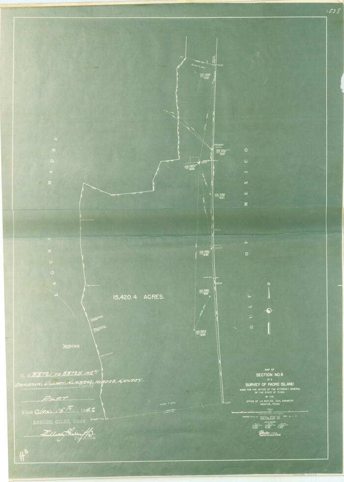
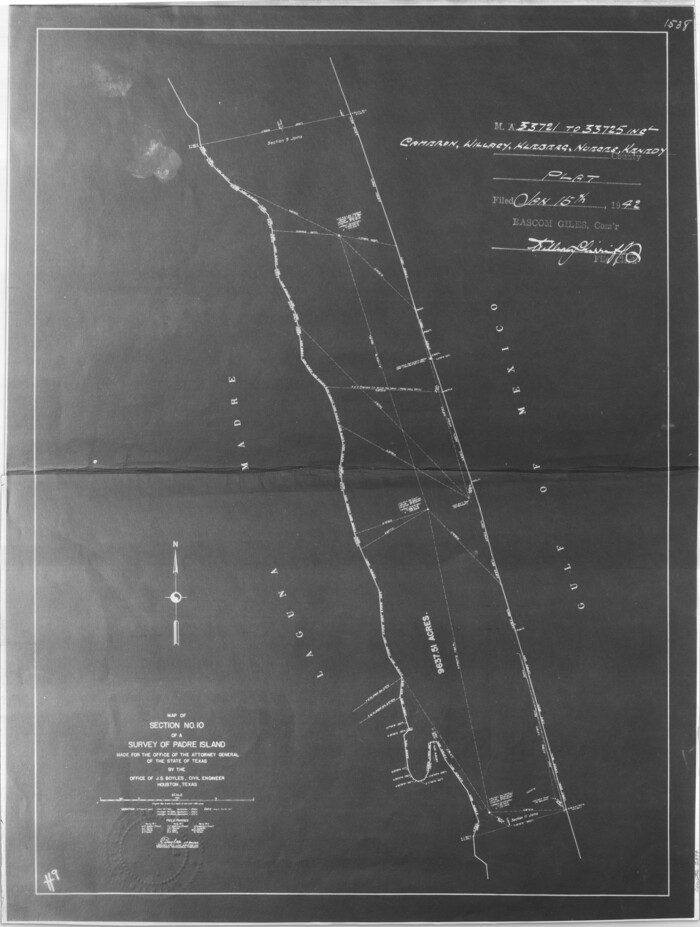
[Sketch for Mineral Application 33721 - 33725 Incl. - Padre and Mustang Island]
Print $20.00
- Digital $50.00
[Sketch for Mineral Application 33721 - 33725 Incl. - Padre and Mustang Island]
1942
Size: 22.1 x 22.4 inches
2870
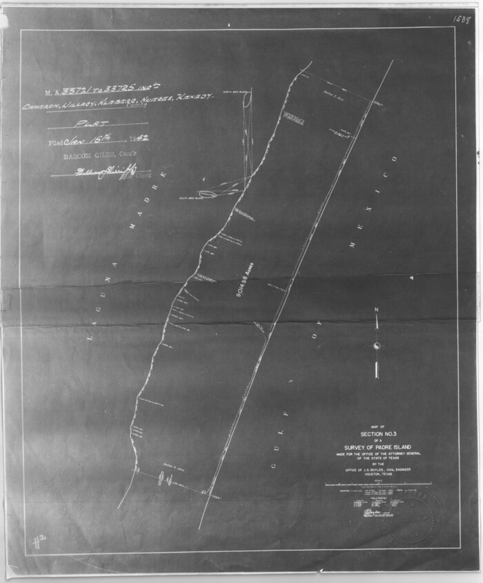
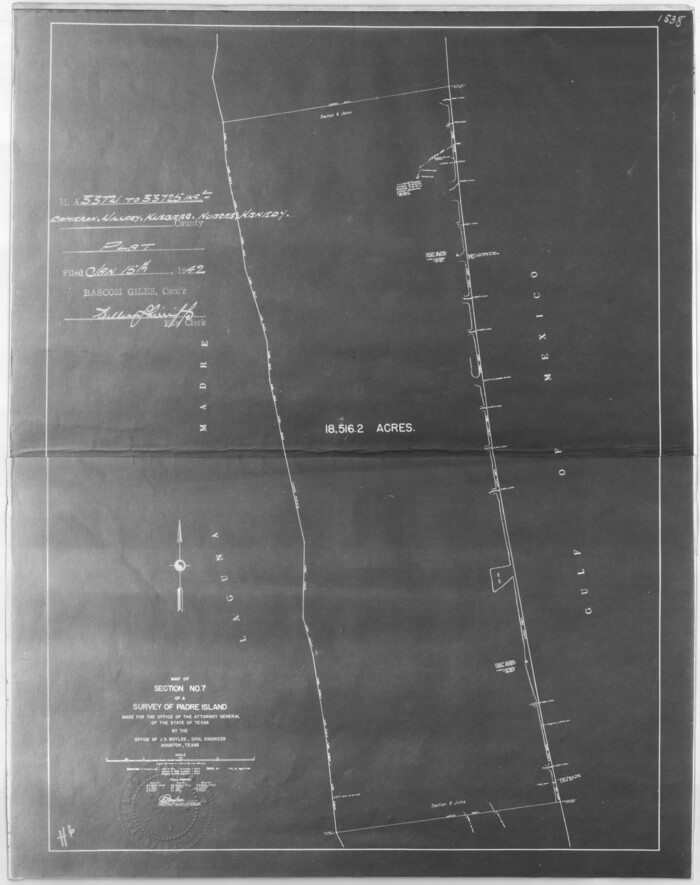
[Sketch for Mineral Application 33721 - 33725 Incl. - Padre and Mustang Island]
Print $20.00
- Digital $50.00
[Sketch for Mineral Application 33721 - 33725 Incl. - Padre and Mustang Island]
1942
Size: 27.0 x 22.4 inches
2871
[Sketch for Mineral Application 33721 - 33725 Incl. - Padre and Mustang Island]
Print $20.00
- Digital $50.00
[Sketch for Mineral Application 33721 - 33725 Incl. - Padre and Mustang Island]
1942
Size: 26.6 x 22.7 inches
2873
[Sketch for Mineral Application 33721 - 33725 Incl. - Padre and Mustang Island]
Print $20.00
- Digital $50.00
[Sketch for Mineral Application 33721 - 33725 Incl. - Padre and Mustang Island]
1941
Size: 40.2 x 22.8 inches
2874
[Sketch for Mineral Application 33721 - 33725 Incl. - Padre and Mustang Island]
Print $20.00
- Digital $50.00
[Sketch for Mineral Application 33721 - 33725 Incl. - Padre and Mustang Island]
1942
Size: 30.9 x 22.0 inches
2875
[Sketch for Mineral Application 33721 - 33725 Incl. - Padre and Mustang Island]
Print $20.00
- Digital $50.00
[Sketch for Mineral Application 33721 - 33725 Incl. - Padre and Mustang Island]
1942
Size: 29.1 x 23.0 inches
2876
[Sketch for Mineral Application 33721 - 33725 Incl. - Padre and Mustang Island]
Print $20.00
- Digital $50.00
[Sketch for Mineral Application 33721 - 33725 Incl. - Padre and Mustang Island]
1942
Size: 29.8 x 22.6 inches
2877
[Sketch for Mineral Application 33721 - 33725 Incl. - Padre and Mustang Island]

Print $20.00
- Digital $50.00
[Sketch for Mineral Application 33721 - 33725 Incl. - Padre and Mustang Island]
1942
Size: 29.8 x 22.7 inches
2878
[Sketch for Mineral Application 33721 - 33725 Incl. - Padre and Mustang Island]
Print $20.00
- Digital $50.00
[Sketch for Mineral Application 33721 - 33725 Incl. - Padre and Mustang Island]
1942
Size: 29.4 x 22.2 inches
2879
[Sketch for Mineral Application 33721 - 33725 Incl. - Padre and Mustang Island]
Print $20.00
- Digital $50.00
[Sketch for Mineral Application 33721 - 33725 Incl. - Padre and Mustang Island]
Size: 42.3 x 22.6 inches
65664
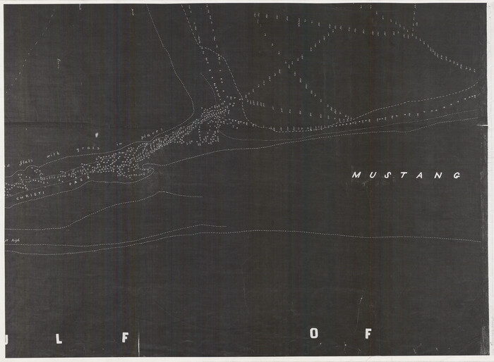
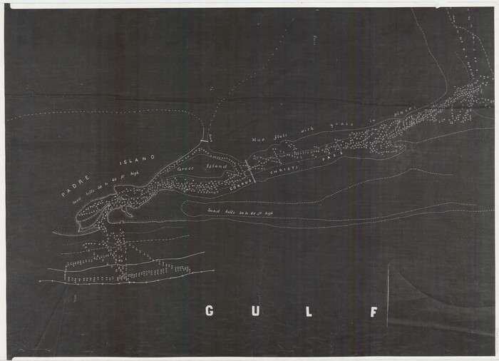
[Redfish Bay, Aransas Pass, and part of Mustang Island]
Print $40.00
- Digital $50.00
[Redfish Bay, Aransas Pass, and part of Mustang Island]
1930
Size: 51.0 x 46.5 inches
83009
[Nueces Bay, Mustang Island and Padre Island]
Print $4.00
- Digital $50.00
[Nueces Bay, Mustang Island and Padre Island]
1887
Size: 18.5 x 26.2 inches
73463
[Nueces Bay, Mustang Island and Padre Island]
Print $4.00
- Digital $50.00
[Nueces Bay, Mustang Island and Padre Island]
Size: 18.1 x 24.7 inches
73465
[Nueces Bay, Mustang Island and Padre Island]
Print $4.00
- Digital $50.00
[Nueces Bay, Mustang Island and Padre Island]
Size: 18.3 x 25.3 inches
73466
[Nueces Bay Islands and Nesting Birds]
Print $20.00
- Digital $50.00
[Nueces Bay Islands and Nesting Birds]
1940
Size: 18.1 x 24.2 inches
2084
[Nueces Bay Islands and Nesting Birds]
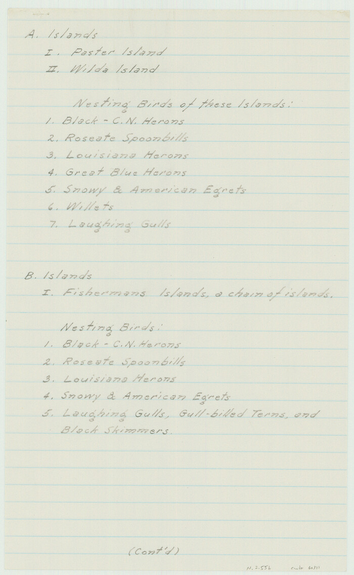
Print $2.00
- Digital $50.00
[Nueces Bay Islands and Nesting Birds]
1940
Size: 11.5 x 7.1 inches
60311
[Nueces Bay Islands and Nesting Birds]
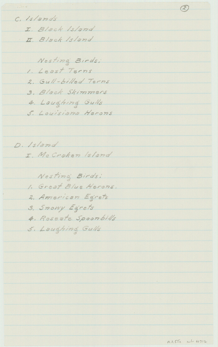
Print $2.00
- Digital $50.00
[Nueces Bay Islands and Nesting Birds]
1940
Size: 11.4 x 7.2 inches
60312
[Corpus Christi Bay and Aransas Bay]
Print $20.00
- Digital $50.00
[Corpus Christi Bay and Aransas Bay]
1840
Size: 17.1 x 22.4 inches
144
[Corpus Christi & Rio Grande Certificates]
![64492, [Corpus Christi & Rio Grande Certificates], General Map Collection](https://historictexasmaps.com/wmedia_w700/pdf_converted_jpg/qi_pdf_thumbnail_19225.jpg)
Print $16.00
- Digital $50.00
[Corpus Christi & Rio Grande Certificates]
1874
Size: 14.3 x 8.7 inches
64492
[Surveys on San Antonio River and Aransas Bay area]
Print $20.00
- Digital $50.00
[Surveys on San Antonio River and Aransas Bay area]
1840
-
Size
24.1 x 33.0 inches
-
Map/Doc
141
-
Creation Date
1840
[Surveys along the Texas coast across from Mustang Island]
Print $2.00
- Digital $50.00
[Surveys along the Texas coast across from Mustang Island]
1841
-
Size
11.3 x 7.3 inches
-
Map/Doc
346
-
Creation Date
1841
[Surveys along the San Fernando and Santa Gertrudis, San Patricio District]
Print $20.00
- Digital $50.00
[Surveys along the San Fernando and Santa Gertrudis, San Patricio District]
1847
-
Size
13.2 x 16.4 inches
-
Map/Doc
290
-
Creation Date
1847
[Surveying Sketch of M. Farley, R. Word, S. S. Hervey, et al in Kleberg County, Texas]
Print $20.00
- Digital $50.00
[Surveying Sketch of M. Farley, R. Word, S. S. Hervey, et al in Kleberg County, Texas]
-
Size
23.2 x 40.6 inches
-
Map/Doc
10783
[Subdivision of Nueces Bay and list of Court Decrees]
Print $40.00
- Digital $50.00
[Subdivision of Nueces Bay and list of Court Decrees]
1940
-
Size
34.2 x 48.8 inches
-
Map/Doc
2086
-
Creation Date
1940
[Sketch with field note calls of the boundaries of Webb, Duval, Jim Wells,Nueces, Kleberg, Zapata, Jim Hogg, Brooks, Willacy, Starr, Hidalgo and Cameron Counties]
Print $20.00
- Digital $50.00
[Sketch with field note calls of the boundaries of Webb, Duval, Jim Wells,Nueces, Kleberg, Zapata, Jim Hogg, Brooks, Willacy, Starr, Hidalgo and Cameron Counties]
1915
-
Size
21.9 x 26.2 inches
-
Map/Doc
1689
-
Creation Date
1915
[Sketch showing voting precincts in Jim Hogg and Brooks Counties]
Print $20.00
- Digital $50.00
[Sketch showing voting precincts in Jim Hogg and Brooks Counties]
-
Size
10.1 x 18.2 inches
-
Map/Doc
4497
[Sketch of Surveys in Brooks County, Texas]
Print $20.00
- Digital $50.00
[Sketch of Surveys in Brooks County, Texas]
-
Size
12.1 x 12.4 inches
-
Map/Doc
10775
[Sketch of Surveys Near Port Aransas and Aransas Pass, Aransas County, Texas]
Print $20.00
- Digital $50.00
[Sketch of Surveys Near Port Aransas and Aransas Pass, Aransas County, Texas]
-
Size
22.8 x 18.5 inches
-
Map/Doc
676
[Sketch for Mineral Application 33721 - 33725 Incl. - Padre and Mustang Island]
Print $20.00
- Digital $50.00
[Sketch for Mineral Application 33721 - 33725 Incl. - Padre and Mustang Island]
1942
-
Size
29.7 x 22.3 inches
-
Map/Doc
2868
-
Creation Date
1942
[Sketch for Mineral Application 33721 - 33725 Incl. - Padre and Mustang Island]
Print $20.00
- Digital $50.00
[Sketch for Mineral Application 33721 - 33725 Incl. - Padre and Mustang Island]
1942
-
Size
22.2 x 22.3 inches
-
Map/Doc
2869
-
Creation Date
1942
[Sketch for Mineral Application 33721 - 33725 Incl. - Padre and Mustang Island]
Print $20.00
- Digital $50.00
[Sketch for Mineral Application 33721 - 33725 Incl. - Padre and Mustang Island]
1942
-
Size
22.1 x 22.4 inches
-
Map/Doc
2870
-
Creation Date
1942
[Sketch for Mineral Application 33721 - 33725 Incl. - Padre and Mustang Island]
Print $20.00
- Digital $50.00
[Sketch for Mineral Application 33721 - 33725 Incl. - Padre and Mustang Island]
1942
-
Size
27.0 x 22.4 inches
-
Map/Doc
2871
-
Creation Date
1942
[Sketch for Mineral Application 33721 - 33725 Incl. - Padre and Mustang Island]
Print $20.00
- Digital $50.00
[Sketch for Mineral Application 33721 - 33725 Incl. - Padre and Mustang Island]
1942
-
Size
26.6 x 22.7 inches
-
Map/Doc
2873
-
Creation Date
1942
[Sketch for Mineral Application 33721 - 33725 Incl. - Padre and Mustang Island]
Print $20.00
- Digital $50.00
[Sketch for Mineral Application 33721 - 33725 Incl. - Padre and Mustang Island]
1941
-
Size
40.2 x 22.8 inches
-
Map/Doc
2874
-
Creation Date
1941
[Sketch for Mineral Application 33721 - 33725 Incl. - Padre and Mustang Island]
Print $20.00
- Digital $50.00
[Sketch for Mineral Application 33721 - 33725 Incl. - Padre and Mustang Island]
1942
-
Size
30.9 x 22.0 inches
-
Map/Doc
2875
-
Creation Date
1942
[Sketch for Mineral Application 33721 - 33725 Incl. - Padre and Mustang Island]
Print $20.00
- Digital $50.00
[Sketch for Mineral Application 33721 - 33725 Incl. - Padre and Mustang Island]
1942
-
Size
29.1 x 23.0 inches
-
Map/Doc
2876
-
Creation Date
1942
[Sketch for Mineral Application 33721 - 33725 Incl. - Padre and Mustang Island]
Print $20.00
- Digital $50.00
[Sketch for Mineral Application 33721 - 33725 Incl. - Padre and Mustang Island]
1942
-
Size
29.8 x 22.6 inches
-
Map/Doc
2877
-
Creation Date
1942
[Sketch for Mineral Application 33721 - 33725 Incl. - Padre and Mustang Island]
Print $20.00
- Digital $50.00
[Sketch for Mineral Application 33721 - 33725 Incl. - Padre and Mustang Island]
1942
-
Size
29.8 x 22.7 inches
-
Map/Doc
2878
-
Creation Date
1942
[Sketch for Mineral Application 33721 - 33725 Incl. - Padre and Mustang Island]
Print $20.00
- Digital $50.00
[Sketch for Mineral Application 33721 - 33725 Incl. - Padre and Mustang Island]
1942
-
Size
29.4 x 22.2 inches
-
Map/Doc
2879
-
Creation Date
1942
[Sketch for Mineral Application 33721 - 33725 Incl. - Padre and Mustang Island]
Print $20.00
- Digital $50.00
[Sketch for Mineral Application 33721 - 33725 Incl. - Padre and Mustang Island]
-
Size
42.3 x 22.6 inches
-
Map/Doc
65664
[Redfish Bay, Aransas Pass, and part of Mustang Island]
Print $40.00
- Digital $50.00
[Redfish Bay, Aransas Pass, and part of Mustang Island]
1930
-
Size
51.0 x 46.5 inches
-
Map/Doc
83009
-
Creation Date
1930
[Nueces Bay, Mustang Island and Padre Island]
Print $4.00
- Digital $50.00
[Nueces Bay, Mustang Island and Padre Island]
1887
-
Size
18.5 x 26.2 inches
-
Map/Doc
73463
-
Creation Date
1887
[Nueces Bay, Mustang Island and Padre Island]
Print $4.00
- Digital $50.00
[Nueces Bay, Mustang Island and Padre Island]
-
Size
18.1 x 24.7 inches
-
Map/Doc
73465
[Nueces Bay, Mustang Island and Padre Island]
Print $4.00
- Digital $50.00
[Nueces Bay, Mustang Island and Padre Island]
-
Size
18.3 x 25.3 inches
-
Map/Doc
73466
[Nueces Bay Islands and Nesting Birds]
Print $20.00
- Digital $50.00
[Nueces Bay Islands and Nesting Birds]
1940
-
Size
18.1 x 24.2 inches
-
Map/Doc
2084
-
Creation Date
1940
[Nueces Bay Islands and Nesting Birds]
Print $2.00
- Digital $50.00
[Nueces Bay Islands and Nesting Birds]
1940
-
Size
11.5 x 7.1 inches
-
Map/Doc
60311
-
Creation Date
1940
[Nueces Bay Islands and Nesting Birds]
Print $2.00
- Digital $50.00
[Nueces Bay Islands and Nesting Birds]
1940
-
Size
11.4 x 7.2 inches
-
Map/Doc
60312
-
Creation Date
1940
[Corpus Christi Bay and Aransas Bay]
Print $20.00
- Digital $50.00
[Corpus Christi Bay and Aransas Bay]
1840
-
Size
17.1 x 22.4 inches
-
Map/Doc
144
-
Creation Date
1840
[Corpus Christi & Rio Grande Certificates]
Print $16.00
- Digital $50.00
[Corpus Christi & Rio Grande Certificates]
1874
-
Size
14.3 x 8.7 inches
-
Map/Doc
64492
-
Creation Date
1874