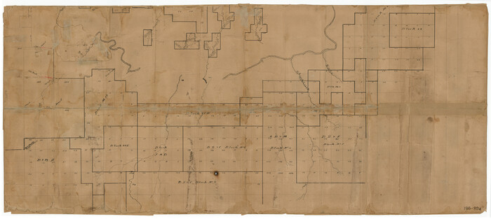
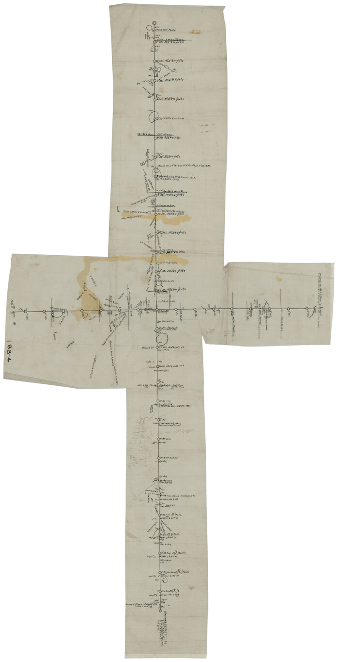
[Young Territory]

Print $40.00
- Digital $50.00
[Young Territory]
1875
Size: 49.0 x 87.4 inches
16784
[West Half of Potter County, South of River and West Half of Randall County]
Print $20.00
- Digital $50.00
[West Half of Potter County, South of River and West Half of Randall County]
Size: 25.9 x 43.0 inches
91828
[W. S. Mabry's maps in south part of Oldham County]
Print $20.00
- Digital $50.00
[W. S. Mabry's maps in south part of Oldham County]
Size: 40.4 x 15.8 inches
93065
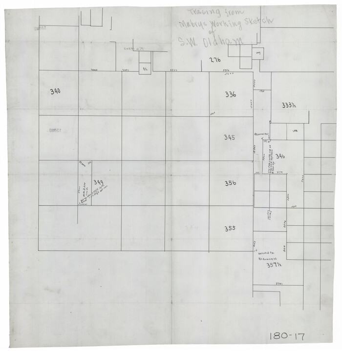
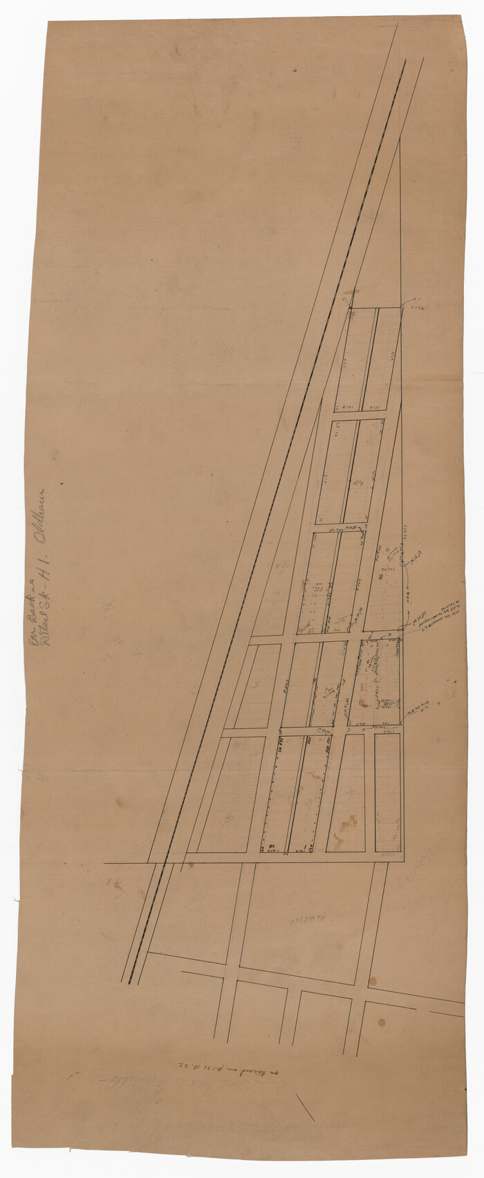
[Tracing from Mabry's Working Sketch in Southwest Oldham County]
Print $20.00
- Digital $50.00
[Tracing from Mabry's Working Sketch in Southwest Oldham County]
Size: 19.3 x 19.8 inches
91474
[T. C. & S. F. Block K11, Capitol Leagues 367, 373, 374, and Blocks D and B]
Print $3.00
- Digital $50.00
[T. C. & S. F. Block K11, Capitol Leagues 367, 373, 374, and Blocks D and B]
Size: 9.8 x 13.5 inches
90542
[Surveys along State Line]
Print $3.00
- Digital $50.00
[Surveys along State Line]
Size: 7.4 x 17.2 inches
91403
[Sketch showing town lots near railroad track]
Print $20.00
- Digital $50.00
[Sketch showing town lots near railroad track]
Size: 22.9 x 9.4 inches
92087
[Sketch showing the south half of the northeast quarter of the county showing surveys south of the Canadian River]
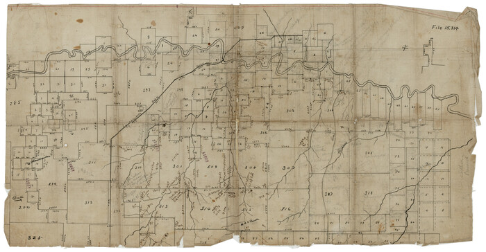
Print $20.00
- Digital $50.00
[Sketch showing the south half of the northeast quarter of the county showing surveys south of the Canadian River]
Size: 19.7 x 10.2 inches
93013
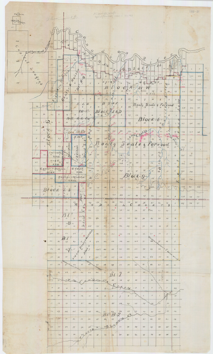
[Sketch showing surveys on the south side of the Canadian River, Blocks 4, M-3, M-19, M-20, 21-W, and Y-2]
Print $20.00
- Digital $50.00
[Sketch showing surveys on the south side of the Canadian River, Blocks 4, M-3, M-19, M-20, 21-W, and Y-2]
Size: 43.4 x 25.1 inches
91740
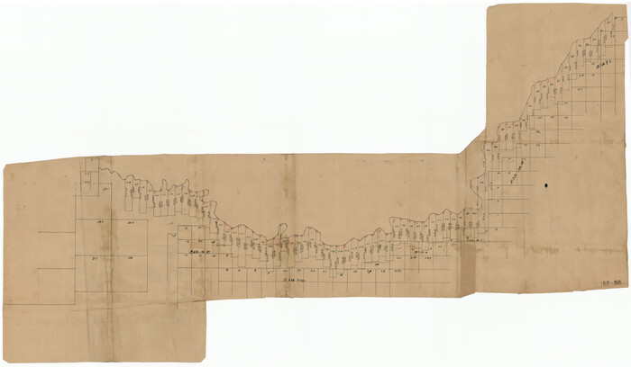
[Sketch showing surveys in the south half of Potter County, Blocks 6, 20-E, JAD, M-3, S, B. S. & F. Blocks 1 and 9, and A. B. and M. Block 2]
Print $20.00
- Digital $50.00
[Sketch showing surveys in the south half of Potter County, Blocks 6, 20-E, JAD, M-3, S, B. S. & F. Blocks 1 and 9, and A. B. and M. Block 2]
Size: 40.5 x 18.1 inches
91741
[Sketch showing surveys in the north half of Potter County, Blocks 1, 6-T, 25, B-10, B-12, O-18, P and Mc, and H. & T. C., Block 44]
Print $20.00
- Digital $50.00
[Sketch showing surveys in the north half of Potter County, Blocks 1, 6-T, 25, B-10, B-12, O-18, P and Mc, and H. & T. C., Block 44]
Size: 40.4 x 17.7 inches
91742
[Sketch showing counties along Texas-New Mexico border]
Print $3.00
- Digital $50.00
[Sketch showing counties along Texas-New Mexico border]
Size: 11.0 x 16.7 inches
91986
[Sketch showing counties along Texas-New Mexico border]
Print $20.00
- Digital $50.00
[Sketch showing counties along Texas-New Mexico border]
Size: 12.4 x 17.5 inches
91987
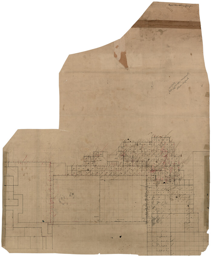
[Sketch showing G. C. & S.F. Block S, T. T. RR. Co. Block H1, G. & M. Block M19, Block Z3 and Block 8]
Print $40.00
- Digital $50.00
[Sketch showing G. C. & S.F. Block S, T. T. RR. Co. Block H1, G. & M. Block M19, Block Z3 and Block 8]
Size: 43.7 x 52.8 inches
93122
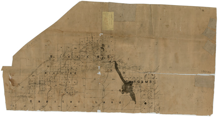
[Sketch showing Blocks B5, B6 and G.&M. Block 5 north of Capitol Land]
Print $20.00
- Digital $50.00
[Sketch showing Blocks B5, B6 and G.&M. Block 5 north of Capitol Land]
Size: 38.4 x 20.9 inches
92989
[Sketch showing Blocks B5, B6 and G.&M. Block 5 north of Capitol Land]

Print $20.00
- Digital $50.00
[Sketch showing Blocks B5, B6 and G.&M. Block 5 north of Capitol Land]
Size: 20.7 x 38.2 inches
92990
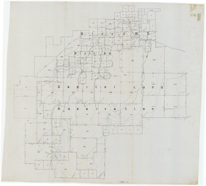
[Sketch showing Blocks B5 and B6 and Capitol Land Reservation]
Print $20.00
- Digital $50.00
[Sketch showing Blocks B5 and B6 and Capitol Land Reservation]
Size: 46.3 x 41.9 inches
89973
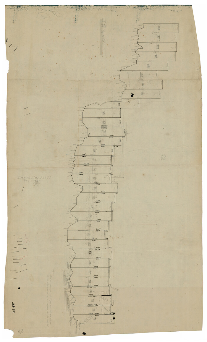
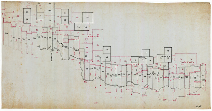
[Sketch showing Block 47, sections 77-108]
Print $20.00
- Digital $50.00
[Sketch showing Block 47, sections 77-108]
1919
Size: 20.5 x 34.1 inches
91732
[Sketch of common corner of Oldham, Potter, Deaf Smith and Randall Counties]
Print $20.00
- Digital $50.00
[Sketch of common corner of Oldham, Potter, Deaf Smith and Randall Counties]
Size: 17.2 x 33.1 inches
93060
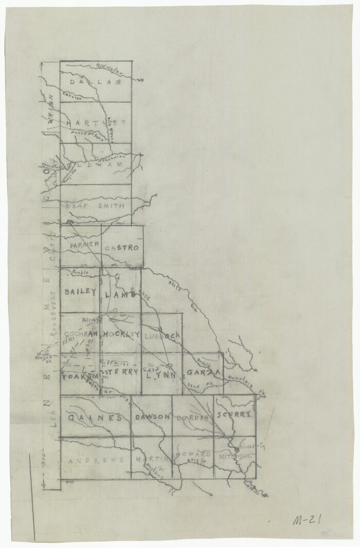
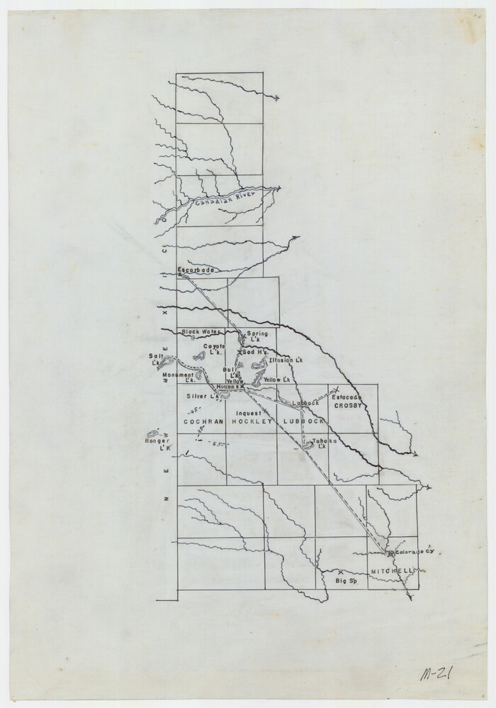
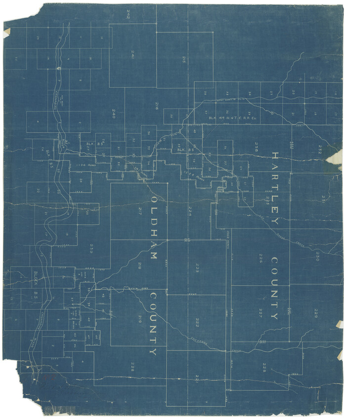
[Sketch of all of County]
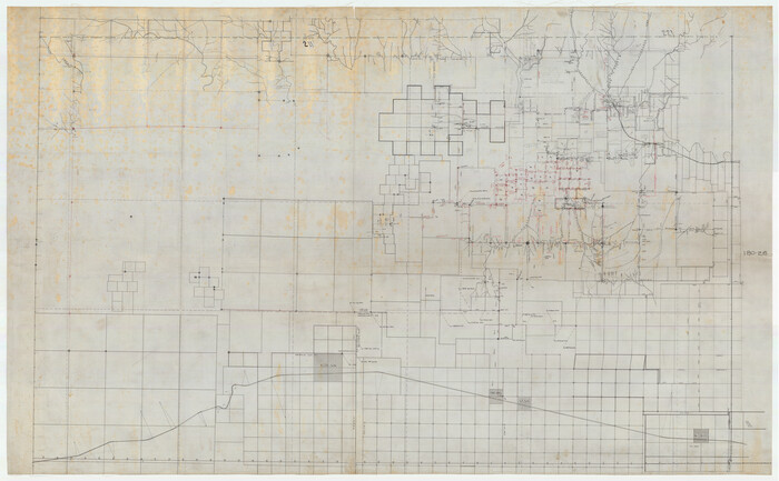
Print $40.00
- Digital $50.00
[Sketch of all of County]
Size: 71.0 x 44.3 inches
89972
[Sketch Number 1, Block LC2 and Adjacent Leagues]
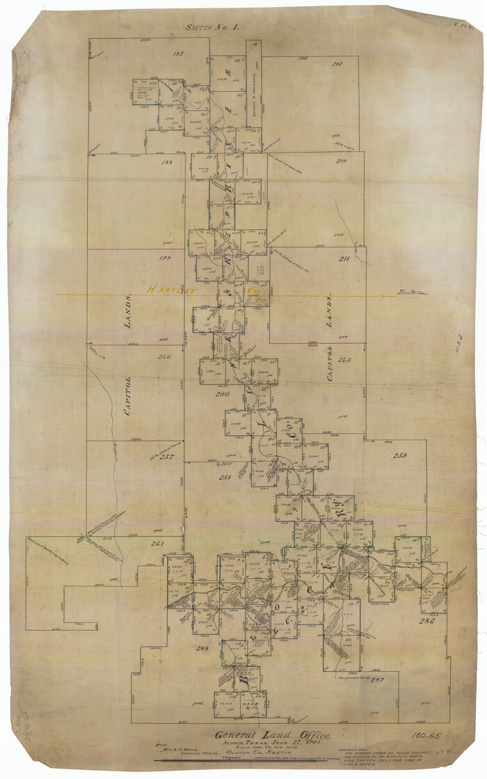
Print $20.00
- Digital $50.00
[Sketch Number 1, Block LC2 and Adjacent Leagues]
Size: 25.6 x 40.8 inches
91476
[Sections 77-114, Block 47 and part of G. & M. Blocks 2 and 3]
Print $20.00
- Digital $50.00
[Sections 77-114, Block 47 and part of G. & M. Blocks 2 and 3]
Size: 38.1 x 19.8 inches
91827
[Reynolds Cattle Company Lands]
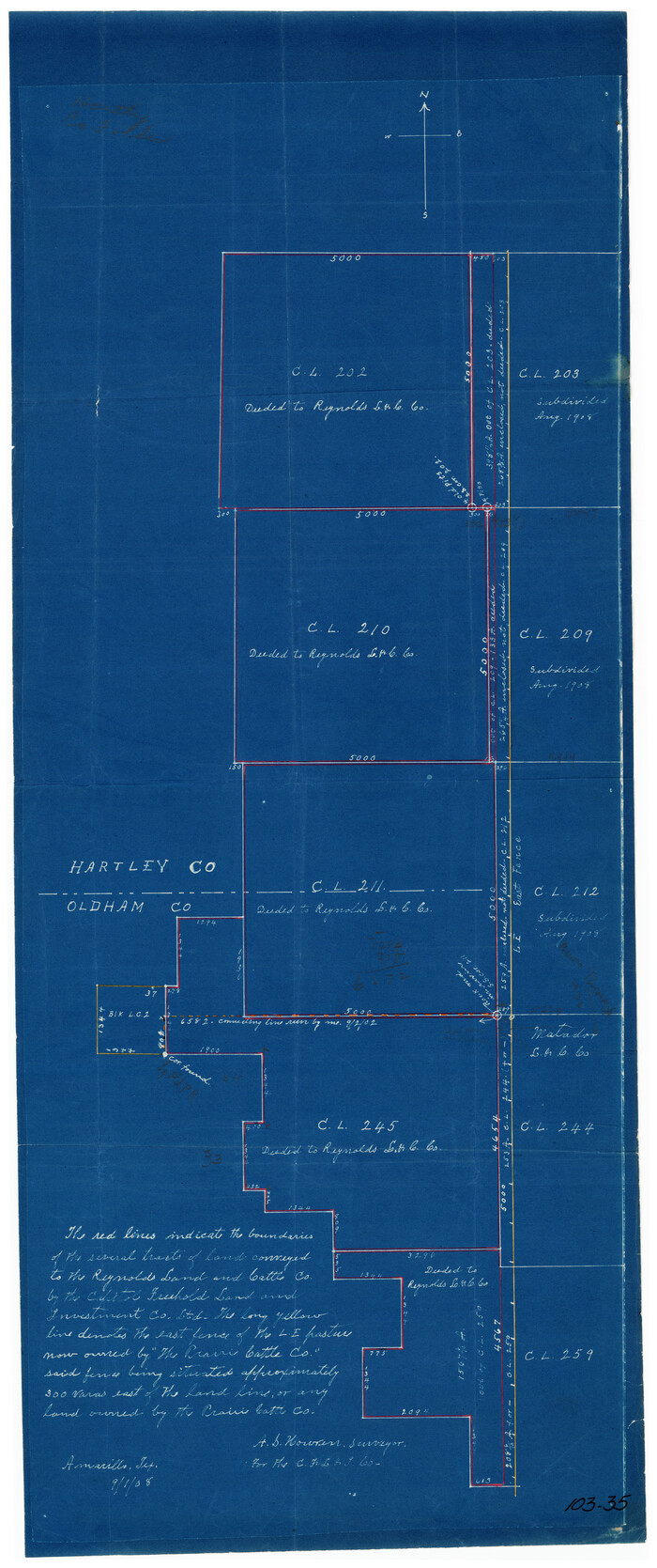
Print $20.00
- Digital $50.00
[Reynolds Cattle Company Lands]
1908
Size: 12.6 x 30.7 inches
90680
[Plat of Survey 1, Block B]
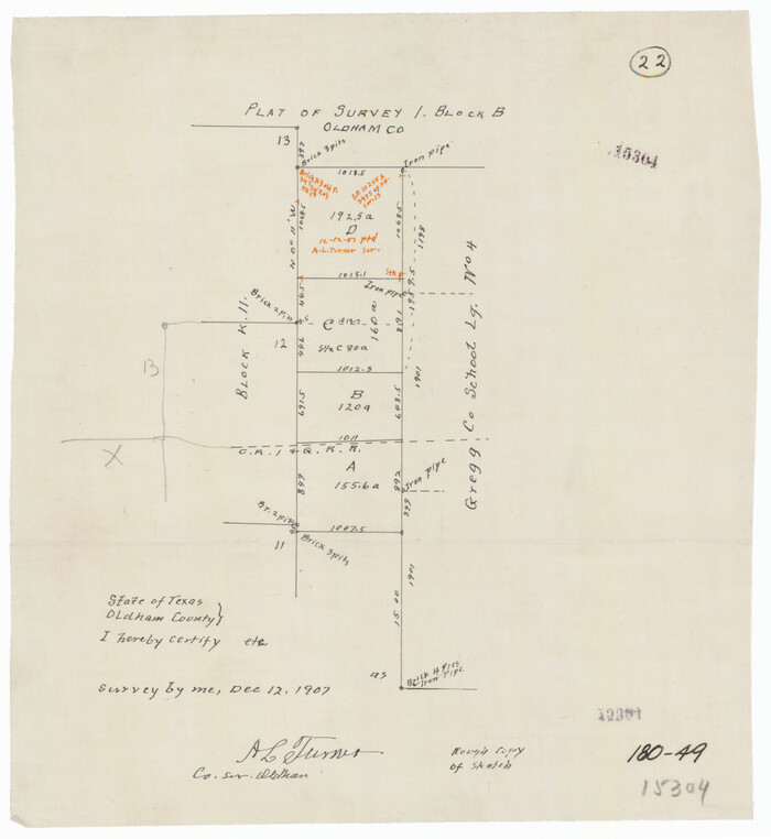
Print $3.00
- Digital $50.00
[Plat of Survey 1, Block B]
1907
Size: 11.7 x 12.6 inches
91448
[Part of Block K11, Leagues 346, 357 1/2, 367]
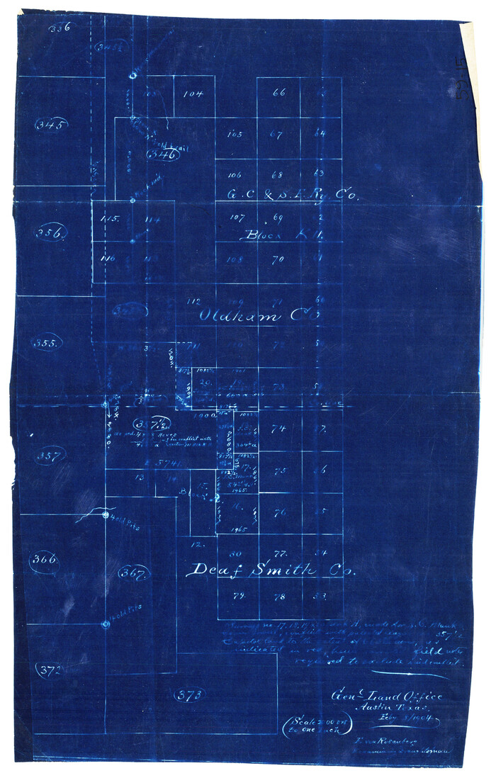
Print $2.00
- Digital $50.00
[Part of Block K11, Leagues 346, 357 1/2, 367]
Size: 7.3 x 11.6 inches
90530
[North/South line through middle of Block K5]
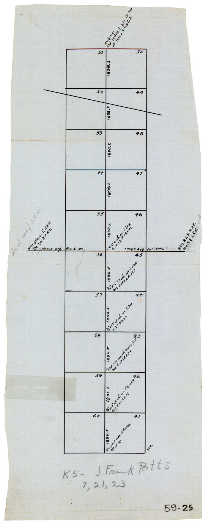
Print $3.00
- Digital $50.00
[North/South line through middle of Block K5]
Size: 6.8 x 16.9 inches
90600
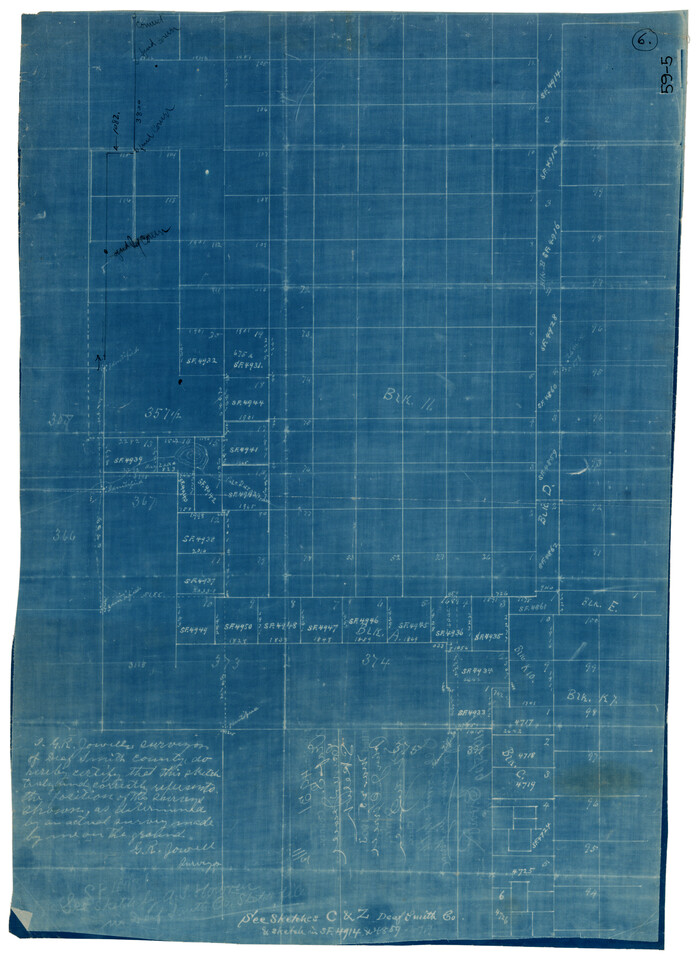
[Map showing resurvey of Capitol Leagues in Hartley & Oldham Counties, Texas]
Print $20.00
- Digital $50.00
[Map showing resurvey of Capitol Leagues in Hartley & Oldham Counties, Texas]
1918
Size: 30.8 x 37.4 inches
1754
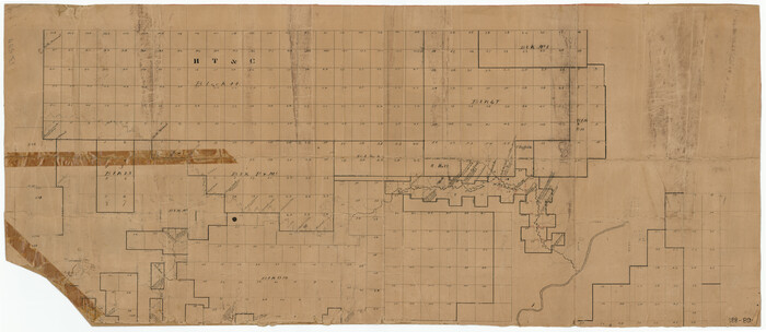
[Map of the Fort Worth & Denver City Railway]
Print $40.00
- Digital $50.00
[Map of the Fort Worth & Denver City Railway]
1887
Size: 21.3 x 122.7 inches
64432
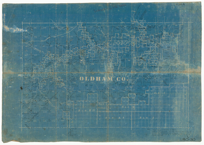
[Map of Oldham County]
Print $20.00
- Digital $50.00
[Map of Oldham County]
Size: 28.4 x 20.5 inches
91456
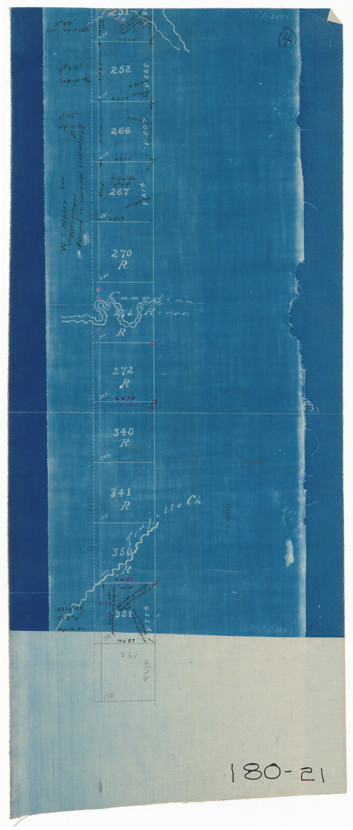
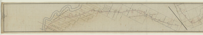
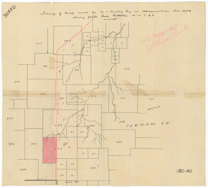
[Map Showing Fence Line between Blocks XIT and LS]
Print $20.00
- Digital $50.00
[Map Showing Fence Line between Blocks XIT and LS]
1886
Size: 18.4 x 16.7 inches
91408
[Young Territory]
Print $40.00
- Digital $50.00
[Young Territory]
1875
-
Size
49.0 x 87.4 inches
-
Map/Doc
16784
-
Creation Date
1875
[West Half of Potter County, South of River and West Half of Randall County]
Print $20.00
- Digital $50.00
[West Half of Potter County, South of River and West Half of Randall County]
-
Size
25.9 x 43.0 inches
-
Map/Doc
91828
[W. S. Mabry's maps in south part of Oldham County]
Print $20.00
- Digital $50.00
[W. S. Mabry's maps in south part of Oldham County]
-
Size
40.4 x 15.8 inches
-
Map/Doc
93065
[Tracing from Mabry's Working Sketch in Southwest Oldham County]
Print $20.00
- Digital $50.00
[Tracing from Mabry's Working Sketch in Southwest Oldham County]
-
Size
19.3 x 19.8 inches
-
Map/Doc
91474
[T. C. & S. F. Block K11, Capitol Leagues 367, 373, 374, and Blocks D and B]
Print $3.00
- Digital $50.00
[T. C. & S. F. Block K11, Capitol Leagues 367, 373, 374, and Blocks D and B]
-
Size
9.8 x 13.5 inches
-
Map/Doc
90542
[Surveys along State Line]
Print $3.00
- Digital $50.00
[Surveys along State Line]
-
Size
7.4 x 17.2 inches
-
Map/Doc
91403
[Sketch showing town lots near railroad track]
Print $20.00
- Digital $50.00
[Sketch showing town lots near railroad track]
-
Size
22.9 x 9.4 inches
-
Map/Doc
92087
[Sketch showing the south half of the northeast quarter of the county showing surveys south of the Canadian River]
Print $20.00
- Digital $50.00
[Sketch showing the south half of the northeast quarter of the county showing surveys south of the Canadian River]
-
Size
19.7 x 10.2 inches
-
Map/Doc
93013
[Sketch showing surveys on the south side of the Canadian River, Blocks 4, M-3, M-19, M-20, 21-W, and Y-2]
Print $20.00
- Digital $50.00
[Sketch showing surveys on the south side of the Canadian River, Blocks 4, M-3, M-19, M-20, 21-W, and Y-2]
-
Size
43.4 x 25.1 inches
-
Map/Doc
91740
[Sketch showing surveys in the south half of Potter County, Blocks 6, 20-E, JAD, M-3, S, B. S. & F. Blocks 1 and 9, and A. B. and M. Block 2]
Print $20.00
- Digital $50.00
[Sketch showing surveys in the south half of Potter County, Blocks 6, 20-E, JAD, M-3, S, B. S. & F. Blocks 1 and 9, and A. B. and M. Block 2]
-
Size
40.5 x 18.1 inches
-
Map/Doc
91741
[Sketch showing surveys in the north half of Potter County, Blocks 1, 6-T, 25, B-10, B-12, O-18, P and Mc, and H. & T. C., Block 44]
Print $20.00
- Digital $50.00
[Sketch showing surveys in the north half of Potter County, Blocks 1, 6-T, 25, B-10, B-12, O-18, P and Mc, and H. & T. C., Block 44]
-
Size
40.4 x 17.7 inches
-
Map/Doc
91742
[Sketch showing counties along Texas-New Mexico border]
Print $3.00
- Digital $50.00
[Sketch showing counties along Texas-New Mexico border]
-
Size
11.0 x 16.7 inches
-
Map/Doc
91986
[Sketch showing counties along Texas-New Mexico border]
Print $20.00
- Digital $50.00
[Sketch showing counties along Texas-New Mexico border]
-
Size
12.4 x 17.5 inches
-
Map/Doc
91987
[Sketch showing G. C. & S.F. Block S, T. T. RR. Co. Block H1, G. & M. Block M19, Block Z3 and Block 8]
Print $40.00
- Digital $50.00
[Sketch showing G. C. & S.F. Block S, T. T. RR. Co. Block H1, G. & M. Block M19, Block Z3 and Block 8]
-
Size
43.7 x 52.8 inches
-
Map/Doc
93122
[Sketch showing Blocks B5, B6 and G.&M. Block 5 north of Capitol Land]
Print $20.00
- Digital $50.00
[Sketch showing Blocks B5, B6 and G.&M. Block 5 north of Capitol Land]
-
Size
38.4 x 20.9 inches
-
Map/Doc
92989
[Sketch showing Blocks B5, B6 and G.&M. Block 5 north of Capitol Land]
Print $20.00
- Digital $50.00
[Sketch showing Blocks B5, B6 and G.&M. Block 5 north of Capitol Land]
-
Size
20.7 x 38.2 inches
-
Map/Doc
92990
[Sketch showing Blocks B5 and B6 and Capitol Land Reservation]
Print $20.00
- Digital $50.00
[Sketch showing Blocks B5 and B6 and Capitol Land Reservation]
-
Size
46.3 x 41.9 inches
-
Map/Doc
89973
[Sketch showing Block 47, sections 77-108]
Print $20.00
- Digital $50.00
[Sketch showing Block 47, sections 77-108]
1919
-
Size
20.5 x 34.1 inches
-
Map/Doc
91732
-
Creation Date
1919
[Sketch of common corner of Oldham, Potter, Deaf Smith and Randall Counties]
Print $20.00
- Digital $50.00
[Sketch of common corner of Oldham, Potter, Deaf Smith and Randall Counties]
-
Size
17.2 x 33.1 inches
-
Map/Doc
93060
[Sketch of all of County]
Print $40.00
- Digital $50.00
[Sketch of all of County]
-
Size
71.0 x 44.3 inches
-
Map/Doc
89972
[Sketch Number 1, Block LC2 and Adjacent Leagues]
Print $20.00
- Digital $50.00
[Sketch Number 1, Block LC2 and Adjacent Leagues]
-
Size
25.6 x 40.8 inches
-
Map/Doc
91476
[Sections 77-114, Block 47 and part of G. & M. Blocks 2 and 3]
Print $20.00
- Digital $50.00
[Sections 77-114, Block 47 and part of G. & M. Blocks 2 and 3]
-
Size
38.1 x 19.8 inches
-
Map/Doc
91827
[Reynolds Cattle Company Lands]
Print $20.00
- Digital $50.00
[Reynolds Cattle Company Lands]
1908
-
Size
12.6 x 30.7 inches
-
Map/Doc
90680
-
Creation Date
1908
[Plat of Survey 1, Block B]
Print $3.00
- Digital $50.00
[Plat of Survey 1, Block B]
1907
-
Size
11.7 x 12.6 inches
-
Map/Doc
91448
-
Creation Date
1907
[Part of Block K11, Leagues 346, 357 1/2, 367]
Print $2.00
- Digital $50.00
[Part of Block K11, Leagues 346, 357 1/2, 367]
-
Size
7.3 x 11.6 inches
-
Map/Doc
90530
[North/South line through middle of Block K5]
Print $3.00
- Digital $50.00
[North/South line through middle of Block K5]
-
Size
6.8 x 16.9 inches
-
Map/Doc
90600
[Map showing resurvey of Capitol Leagues in Hartley & Oldham Counties, Texas]
Print $20.00
- Digital $50.00
[Map showing resurvey of Capitol Leagues in Hartley & Oldham Counties, Texas]
1918
-
Size
30.8 x 37.4 inches
-
Map/Doc
1754
-
Creation Date
1918
[Map of the Fort Worth & Denver City Railway]
Print $40.00
- Digital $50.00
[Map of the Fort Worth & Denver City Railway]
1887
-
Size
21.3 x 122.7 inches
-
Map/Doc
64432
-
Creation Date
1887
[Map of Oldham County]
Print $20.00
- Digital $50.00
[Map of Oldham County]
-
Size
28.4 x 20.5 inches
-
Map/Doc
91456
[Map Showing Fence Line between Blocks XIT and LS]
Print $20.00
- Digital $50.00
[Map Showing Fence Line between Blocks XIT and LS]
1886
-
Size
18.4 x 16.7 inches
-
Map/Doc
91408
-
Creation Date
1886