Moore County Sketch File 1

Print $20.00
- Digital $50.00
Moore County Sketch File 1
Size: 28.9 x 38.6 inches
10552
Potter County Sketch File 2

Print $20.00
- Digital $50.00
Potter County Sketch File 2
1887
Size: 29.3 x 39.4 inches
10573
Potter County Sketch File 3

Print $20.00
- Digital $50.00
Potter County Sketch File 3
1883
Size: 37.5 x 47.6 inches
10574
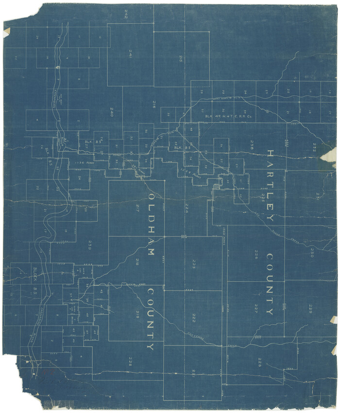
Oldham County Rolled Sketch 11

Print $40.00
- Digital $50.00
Oldham County Rolled Sketch 11
Size: 48.6 x 39.9 inches
10641
Capitol Land Reservation

Print $20.00
- Digital $50.00
Capitol Land Reservation
1880
Size: 43.7 x 34.2 inches
10745
Dallam County Sketch File 2

Print $260.00
- Digital $50.00
Dallam County Sketch File 2
1886
Size: 29.9 x 17.4 inches
11278
Deaf Smith County Sketch File 1 1/2

Print $20.00
- Digital $50.00
Deaf Smith County Sketch File 1 1/2
Size: 20.7 x 17.1 inches
11302
Deaf Smith County Sketch File D

Print $20.00
- Digital $50.00
Deaf Smith County Sketch File D
Size: 12.6 x 27.7 inches
11306
Deaf Smith County Sketch File E

Print $20.00
- Digital $50.00
Deaf Smith County Sketch File E
Size: 22.3 x 12.9 inches
11308
Hartley County Sketch File 8

Print $20.00
- Digital $50.00
Hartley County Sketch File 8
Size: 23.9 x 19.1 inches
11699
Hartley County Sketch File 15

Print $20.00
- Digital $50.00
Hartley County Sketch File 15
Size: 31.2 x 16.6 inches
11737
Oldham County Sketch File 4

Print $20.00
- Digital $50.00
Oldham County Sketch File 4
1883
Size: 13.7 x 22.5 inches
12111
Oldham County Sketch File 9

Print $20.00
- Digital $50.00
Oldham County Sketch File 9
1886
Size: 18.4 x 26.1 inches
12112
Oldham County Sketch File 12

Print $20.00
- Digital $50.00
Oldham County Sketch File 12
Size: 20.0 x 20.1 inches
12113
Oldham County Sketch File 14

Print $20.00
- Digital $50.00
Oldham County Sketch File 14
1904
Size: 20.0 x 24.6 inches
12115
Oldham County Sketch File 19

Print $20.00
- Digital $50.00
Oldham County Sketch File 19
1904
Size: 18.2 x 24.0 inches
12116
Potter County Sketch File 7

Print $20.00
- Digital $50.00
Potter County Sketch File 7
Size: 23.2 x 18.0 inches
12197
Potter County Sketch File 9

Print $20.00
- Digital $50.00
Potter County Sketch File 9
1887
Size: 12.5 x 17.7 inches
12198
[Young Territory]

Print $40.00
- Digital $50.00
[Young Territory]
1875
Size: 49.0 x 87.4 inches
16784
[Map showing resurvey of Capitol Leagues in Hartley & Oldham Counties, Texas]
Print $20.00
- Digital $50.00
[Map showing resurvey of Capitol Leagues in Hartley & Oldham Counties, Texas]
1918
Size: 30.8 x 37.4 inches
1754
Map showing resurvey of Capitol Leagues, Oldham Co., Texas

Print $40.00
- Digital $50.00
Map showing resurvey of Capitol Leagues, Oldham Co., Texas
1918
Size: 38.6 x 51.0 inches
1755
Dallam County Sketch File 5

Print $22.00
- Digital $50.00
Dallam County Sketch File 5
1880
Size: 14.2 x 8.8 inches
20339
Deaf Smith County Sketch File 1b

Print $24.00
- Digital $50.00
Deaf Smith County Sketch File 1b
1902
Size: 11.3 x 8.9 inches
20627
Deaf Smith County Sketch File 5

Print $9.00
- Digital $50.00
Deaf Smith County Sketch File 5
1905
Size: 11.3 x 8.9 inches
20648
Deaf Smith County Sketch File Z

Print $34.00
- Digital $50.00
Deaf Smith County Sketch File Z
1903
Size: 9.6 x 4.7 inches
20651
Deaf Smith County Sketch File 6

Print $12.00
- Digital $50.00
Deaf Smith County Sketch File 6
1912
Size: 7.0 x 7.4 inches
20658
Hutchinson County Sketch File 4

Print $32.00
- Digital $50.00
Hutchinson County Sketch File 4
1890
Size: 14.2 x 8.7 inches
27179
Oldham County Sketch File 1

Print $24.00
- Digital $50.00
Oldham County Sketch File 1
1880
Size: 12.6 x 7.9 inches
33213
Oldham County Sketch File 2

Print $6.00
- Digital $50.00
Oldham County Sketch File 2
1882
Size: 12.7 x 8.2 inches
33225
Oldham County Sketch File 3

Print $12.00
- Digital $50.00
Oldham County Sketch File 3
1883
Size: 8.2 x 7.8 inches
33228
Moore County Sketch File 1
Print $20.00
- Digital $50.00
Moore County Sketch File 1
-
Size
28.9 x 38.6 inches
-
Map/Doc
10552
Potter County Sketch File 2
Print $20.00
- Digital $50.00
Potter County Sketch File 2
1887
-
Size
29.3 x 39.4 inches
-
Map/Doc
10573
-
Creation Date
1887
Potter County Sketch File 3
Print $20.00
- Digital $50.00
Potter County Sketch File 3
1883
-
Size
37.5 x 47.6 inches
-
Map/Doc
10574
-
Creation Date
1883
Oldham County Rolled Sketch 11
Print $40.00
- Digital $50.00
Oldham County Rolled Sketch 11
-
Size
48.6 x 39.9 inches
-
Map/Doc
10641
Capitol Land Reservation
Print $20.00
- Digital $50.00
Capitol Land Reservation
1880
-
Size
43.7 x 34.2 inches
-
Map/Doc
10745
-
Creation Date
1880
Dallam County Sketch File 2
Print $260.00
- Digital $50.00
Dallam County Sketch File 2
1886
-
Size
29.9 x 17.4 inches
-
Map/Doc
11278
-
Creation Date
1886
Deaf Smith County Sketch File 1 1/2
Print $20.00
- Digital $50.00
Deaf Smith County Sketch File 1 1/2
-
Size
20.7 x 17.1 inches
-
Map/Doc
11302
Deaf Smith County Sketch File D
Print $20.00
- Digital $50.00
Deaf Smith County Sketch File D
-
Size
12.6 x 27.7 inches
-
Map/Doc
11306
Deaf Smith County Sketch File E
Print $20.00
- Digital $50.00
Deaf Smith County Sketch File E
-
Size
22.3 x 12.9 inches
-
Map/Doc
11308
Hartley County Sketch File 8
Print $20.00
- Digital $50.00
Hartley County Sketch File 8
-
Size
23.9 x 19.1 inches
-
Map/Doc
11699
Hartley County Sketch File 15
Print $20.00
- Digital $50.00
Hartley County Sketch File 15
-
Size
31.2 x 16.6 inches
-
Map/Doc
11737
Oldham County Sketch File 4
Print $20.00
- Digital $50.00
Oldham County Sketch File 4
1883
-
Size
13.7 x 22.5 inches
-
Map/Doc
12111
-
Creation Date
1883
Oldham County Sketch File 9
Print $20.00
- Digital $50.00
Oldham County Sketch File 9
1886
-
Size
18.4 x 26.1 inches
-
Map/Doc
12112
-
Creation Date
1886
Oldham County Sketch File 12
Print $20.00
- Digital $50.00
Oldham County Sketch File 12
-
Size
20.0 x 20.1 inches
-
Map/Doc
12113
Oldham County Sketch File 14
Print $20.00
- Digital $50.00
Oldham County Sketch File 14
1904
-
Size
20.0 x 24.6 inches
-
Map/Doc
12115
-
Creation Date
1904
Oldham County Sketch File 19
Print $20.00
- Digital $50.00
Oldham County Sketch File 19
1904
-
Size
18.2 x 24.0 inches
-
Map/Doc
12116
-
Creation Date
1904
Potter County Sketch File 7
Print $20.00
- Digital $50.00
Potter County Sketch File 7
-
Size
23.2 x 18.0 inches
-
Map/Doc
12197
Potter County Sketch File 9
Print $20.00
- Digital $50.00
Potter County Sketch File 9
1887
-
Size
12.5 x 17.7 inches
-
Map/Doc
12198
-
Creation Date
1887
[Young Territory]
Print $40.00
- Digital $50.00
[Young Territory]
1875
-
Size
49.0 x 87.4 inches
-
Map/Doc
16784
-
Creation Date
1875
[Map showing resurvey of Capitol Leagues in Hartley & Oldham Counties, Texas]
Print $20.00
- Digital $50.00
[Map showing resurvey of Capitol Leagues in Hartley & Oldham Counties, Texas]
1918
-
Size
30.8 x 37.4 inches
-
Map/Doc
1754
-
Creation Date
1918
Map showing resurvey of Capitol Leagues, Oldham Co., Texas
Print $40.00
- Digital $50.00
Map showing resurvey of Capitol Leagues, Oldham Co., Texas
1918
-
Size
38.6 x 51.0 inches
-
Map/Doc
1755
-
Creation Date
1918
Dallam County Sketch File 5
Print $22.00
- Digital $50.00
Dallam County Sketch File 5
1880
-
Size
14.2 x 8.8 inches
-
Map/Doc
20339
-
Creation Date
1880
Deaf Smith County Sketch File 1b
Print $24.00
- Digital $50.00
Deaf Smith County Sketch File 1b
1902
-
Size
11.3 x 8.9 inches
-
Map/Doc
20627
-
Creation Date
1902
Deaf Smith County Sketch File 5
Print $9.00
- Digital $50.00
Deaf Smith County Sketch File 5
1905
-
Size
11.3 x 8.9 inches
-
Map/Doc
20648
-
Creation Date
1905
Deaf Smith County Sketch File Z
Print $34.00
- Digital $50.00
Deaf Smith County Sketch File Z
1903
-
Size
9.6 x 4.7 inches
-
Map/Doc
20651
-
Creation Date
1903
Deaf Smith County Sketch File 6
Print $12.00
- Digital $50.00
Deaf Smith County Sketch File 6
1912
-
Size
7.0 x 7.4 inches
-
Map/Doc
20658
-
Creation Date
1912
Hutchinson County Sketch File 4
Print $32.00
- Digital $50.00
Hutchinson County Sketch File 4
1890
-
Size
14.2 x 8.7 inches
-
Map/Doc
27179
-
Creation Date
1890
Oldham County Sketch File 1
Print $24.00
- Digital $50.00
Oldham County Sketch File 1
1880
-
Size
12.6 x 7.9 inches
-
Map/Doc
33213
-
Creation Date
1880
Oldham County Sketch File 2
Print $6.00
- Digital $50.00
Oldham County Sketch File 2
1882
-
Size
12.7 x 8.2 inches
-
Map/Doc
33225
-
Creation Date
1882
Oldham County Sketch File 3
Print $12.00
- Digital $50.00
Oldham County Sketch File 3
1883
-
Size
8.2 x 7.8 inches
-
Map/Doc
33228
-
Creation Date
1883