[Young Territory]

Print $40.00
- Digital $50.00
[Young Territory]
1875
Size: 49.0 x 87.4 inches
16784
[West Half of Potter County, South of River and West Half of Randall County]
Print $20.00
- Digital $50.00
[West Half of Potter County, South of River and West Half of Randall County]
Size: 25.9 x 43.0 inches
91828
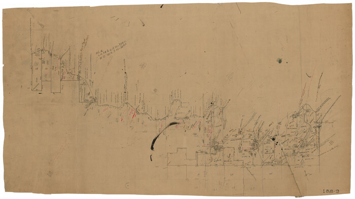
[Surveys on the south side of the Canadian River]
Print $3.00
- Digital $50.00
[Surveys on the south side of the Canadian River]
Size: 11.2 x 15.9 inches
91788
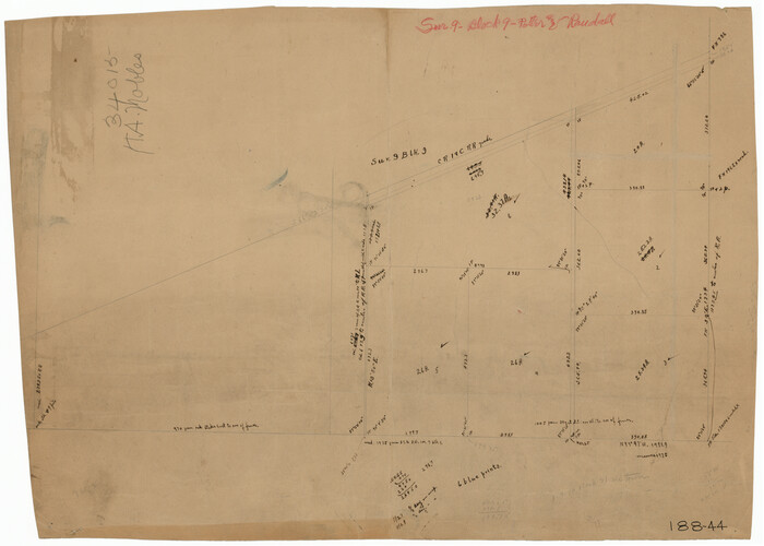
[Survey 9, Block 9 Potter and Randall]
Print $20.00
- Digital $50.00
[Survey 9, Block 9 Potter and Randall]
Size: 22.3 x 15.9 inches
91720
[Survey 9, Block 9 Potter and Randall]
Print $20.00
- Digital $50.00
[Survey 9, Block 9 Potter and Randall]
Size: 22.1 x 15.9 inches
91721
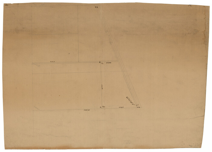
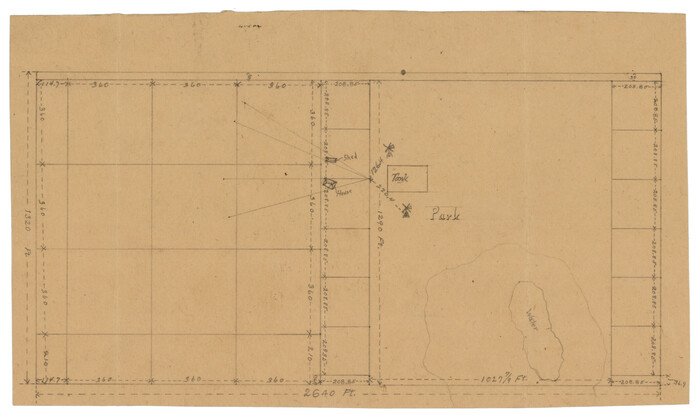
[Subdivision Plat of 80 acres]
Print $2.00
- Digital $50.00
[Subdivision Plat of 80 acres]
Size: 10.6 x 6.3 inches
93074
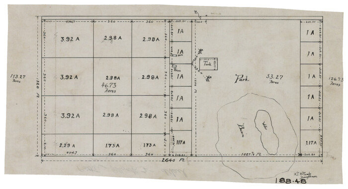
[Subdivision Plat of 80 acres]
Print $2.00
- Digital $50.00
[Subdivision Plat of 80 acres]
Size: 11.7 x 6.2 inches
93075
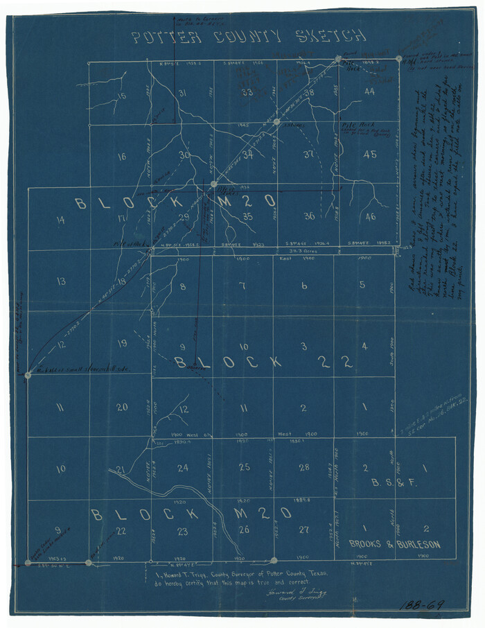
[Sketch showing west part of county]
Print $3.00
- Digital $50.00
[Sketch showing west part of county]
1907
Size: 16.4 x 11.1 inches
91712
[Sketch showing west part of county]
Print $20.00
- Digital $50.00
[Sketch showing west part of county]
Size: 24.2 x 13.8 inches
91713
[Sketch showing the southwest part of the Glidden and Sanborn Addition]
Print $20.00
- Digital $50.00
[Sketch showing the southwest part of the Glidden and Sanborn Addition]
Size: 20.0 x 29.3 inches
91746
[Sketch showing surveys on the south side of the Canadian River, Blocks 4, M-3, M-19, M-20, 21-W, and Y-2]
Print $20.00
- Digital $50.00
[Sketch showing surveys on the south side of the Canadian River, Blocks 4, M-3, M-19, M-20, 21-W, and Y-2]
Size: 43.4 x 25.1 inches
91740
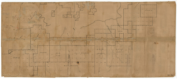
[Sketch showing surveys on the north side of the Canadian River, Blocks B-11, L, O-18, and G and M 2 and 3]
Print $20.00
- Digital $50.00
[Sketch showing surveys on the north side of the Canadian River, Blocks B-11, L, O-18, and G and M 2 and 3]
1883
Size: 35.4 x 25.3 inches
91737
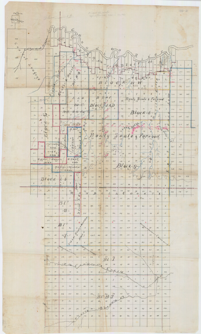
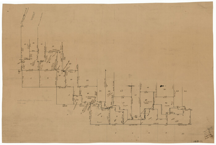
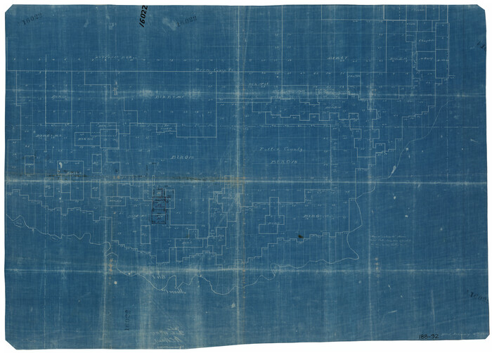
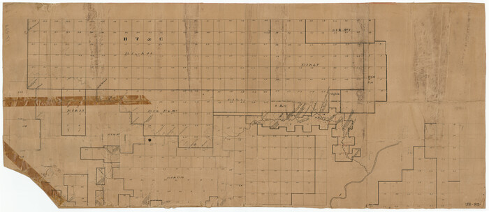
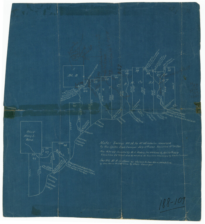
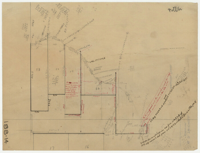
[Sketch showing surveys in the south half of Potter County, Blocks 6, 20-E, JAD, M-3, S, B. S. & F. Blocks 1 and 9, and A. B. and M. Block 2]
Print $20.00
- Digital $50.00
[Sketch showing surveys in the south half of Potter County, Blocks 6, 20-E, JAD, M-3, S, B. S. & F. Blocks 1 and 9, and A. B. and M. Block 2]
Size: 40.5 x 18.1 inches
91741
[Sketch showing surveys in the north half of Potter County, Blocks 1, 6-T, 25, B-10, B-12, O-18, P and Mc, and H. & T. C., Block 44]
Print $20.00
- Digital $50.00
[Sketch showing surveys in the north half of Potter County, Blocks 1, 6-T, 25, B-10, B-12, O-18, P and Mc, and H. & T. C., Block 44]
Size: 40.4 x 17.7 inches
91742
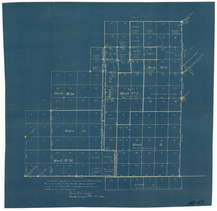
[Sketch showing parts of Blocks 3, 5, 22, M-20, S, T and Block BB, surveys 1, 2 and 3]
Print $20.00
- Digital $50.00
[Sketch showing parts of Blocks 3, 5, 22, M-20, S, T and Block BB, surveys 1, 2 and 3]
Size: 15.9 x 15.3 inches
91729
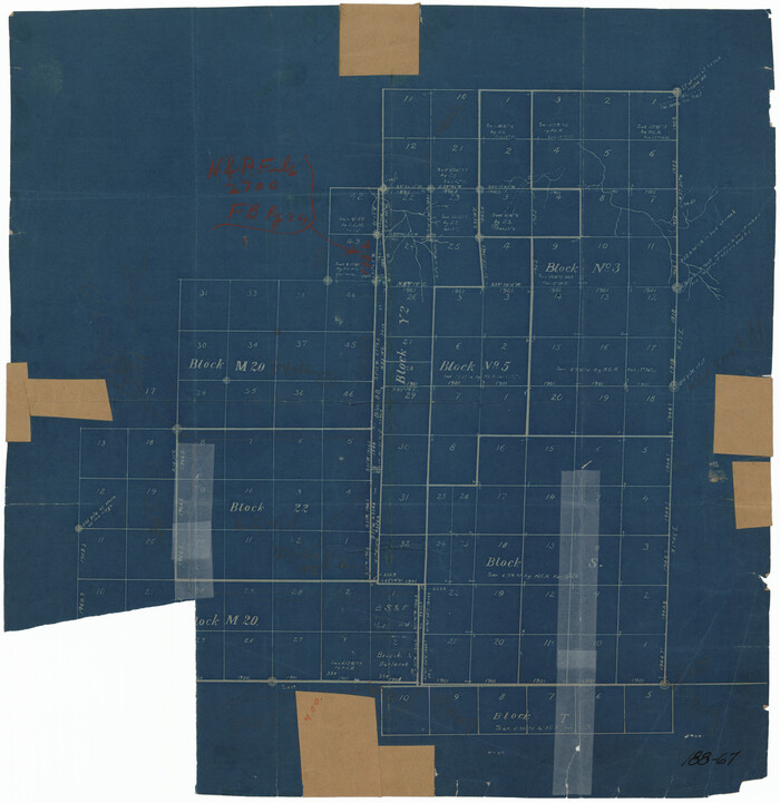
[Sketch showing parts of Blocks 3, 5, 22, M-20, S, T and Block BB, surveys 1, 2 and 3]
Print $20.00
- Digital $50.00
[Sketch showing parts of Blocks 3, 5, 22, M-20, S, T and Block BB, surveys 1, 2 and 3]
Size: 15.5 x 15.9 inches
91730
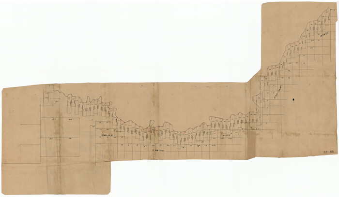
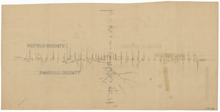
[Sketch showing county line between Randall and Potter Counties]
Print $20.00
- Digital $50.00
[Sketch showing county line between Randall and Potter Counties]
Size: 18.8 x 37.0 inches
91760
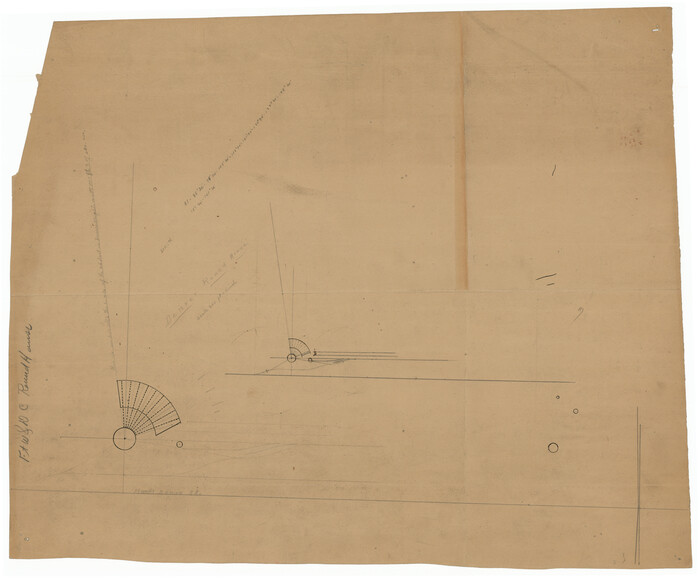
[Sketch showing Potter County Block 2] / [Sketch showing F. W. & D. C. Round House]
Print $20.00
- Digital $50.00
[Sketch showing Potter County Block 2] / [Sketch showing F. W. & D. C. Round House]
Size: 12.2 x 14.6 inches
91709
[Sketch showing Potter County Block 2] / [Sketch showing F. W. & D. C. Round House]
Print $20.00
- Digital $50.00
[Sketch showing Potter County Block 2] / [Sketch showing F. W. & D. C. Round House]
Size: 14.6 x 12.1 inches
91710
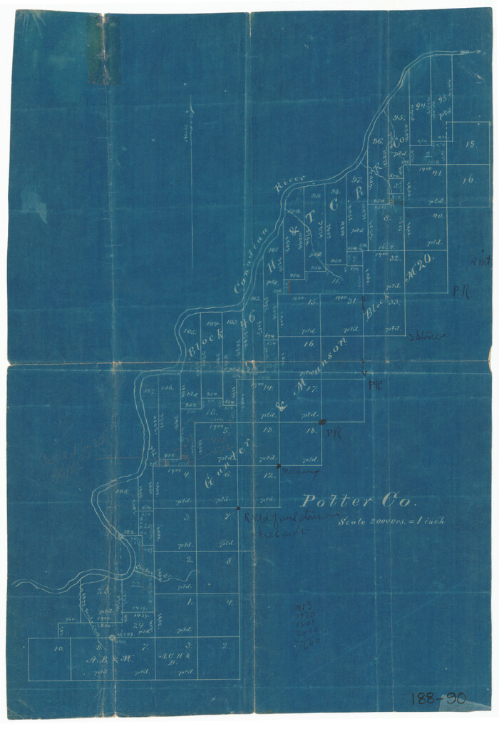
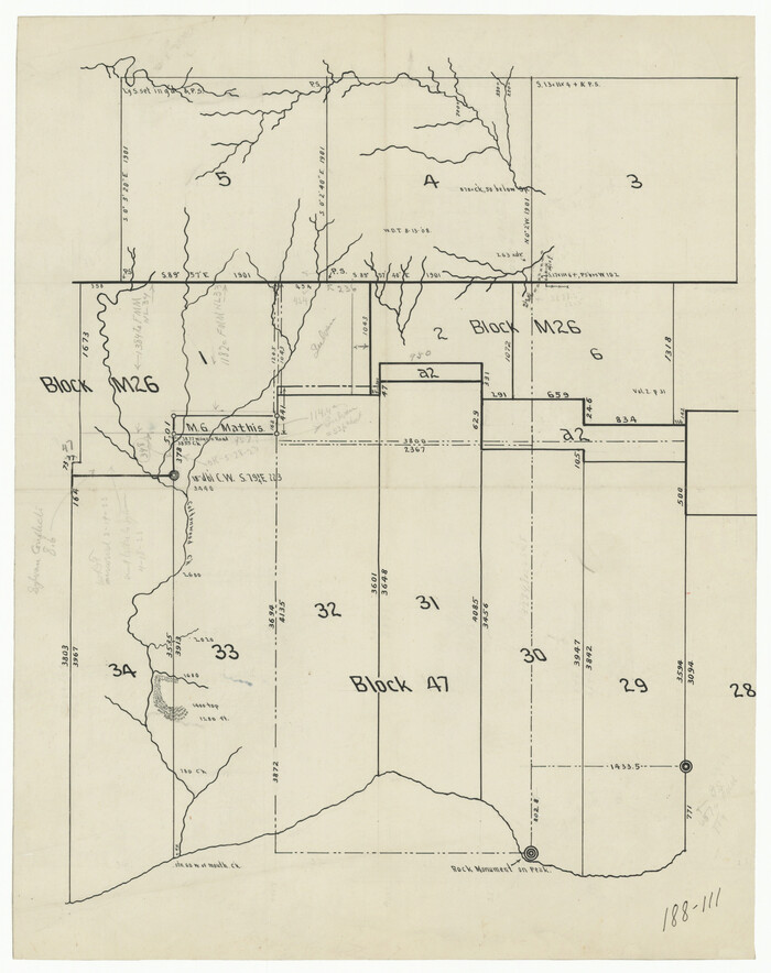
[Sketch showing H. and T. C. Blocks 46 and 47]
Print $20.00
- Digital $50.00
[Sketch showing H. and T. C. Blocks 46 and 47]
1884
Size: 38.5 x 24.7 inches
91735
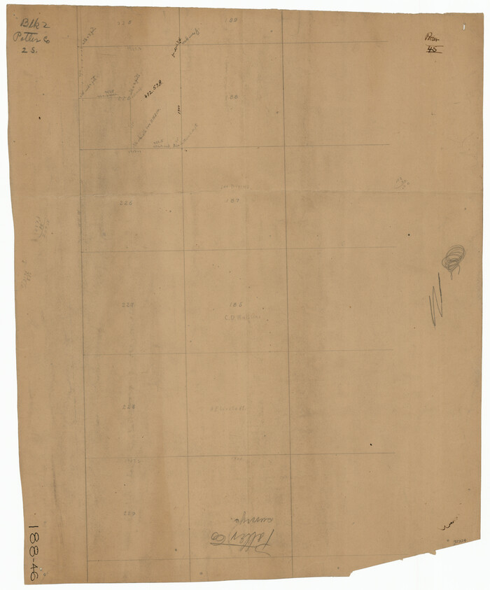
[Sketch showing H. & T. C. Blocks 47 and M-26]
Print $3.00
- Digital $50.00
[Sketch showing H. & T. C. Blocks 47 and M-26]
Size: 9.5 x 12.0 inches
91698
[Sketch showing H. & T. C. Block 47]
Print $2.00
- Digital $50.00
[Sketch showing H. & T. C. Block 47]
Size: 6.1 x 6.7 inches
91699
[Sketch showing G. C. & S.F. Block S, T. T. RR. Co. Block H1, G. & M. Block M19, Block Z3 and Block 8]
Print $40.00
- Digital $50.00
[Sketch showing G. C. & S.F. Block S, T. T. RR. Co. Block H1, G. & M. Block M19, Block Z3 and Block 8]
Size: 43.7 x 52.8 inches
93122
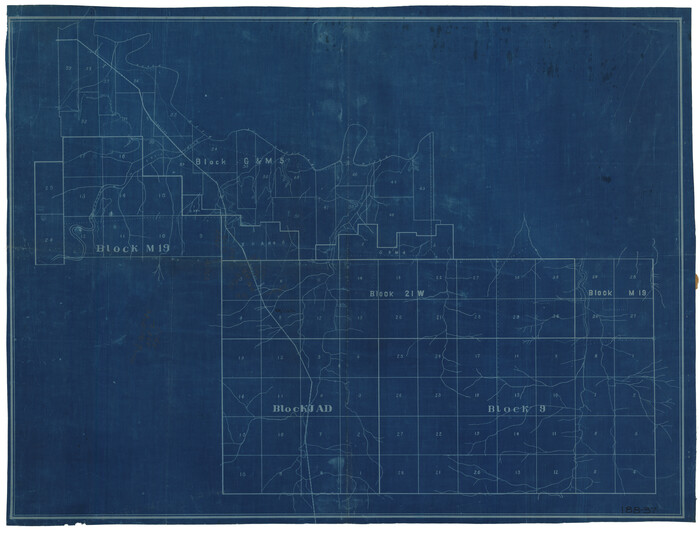
[Sketch showing G. & M. Blocks 5 and M-19 and B. S. & F. Block 9]
Print $20.00
- Digital $50.00
[Sketch showing G. & M. Blocks 5 and M-19 and B. S. & F. Block 9]
Size: 22.9 x 17.4 inches
91718
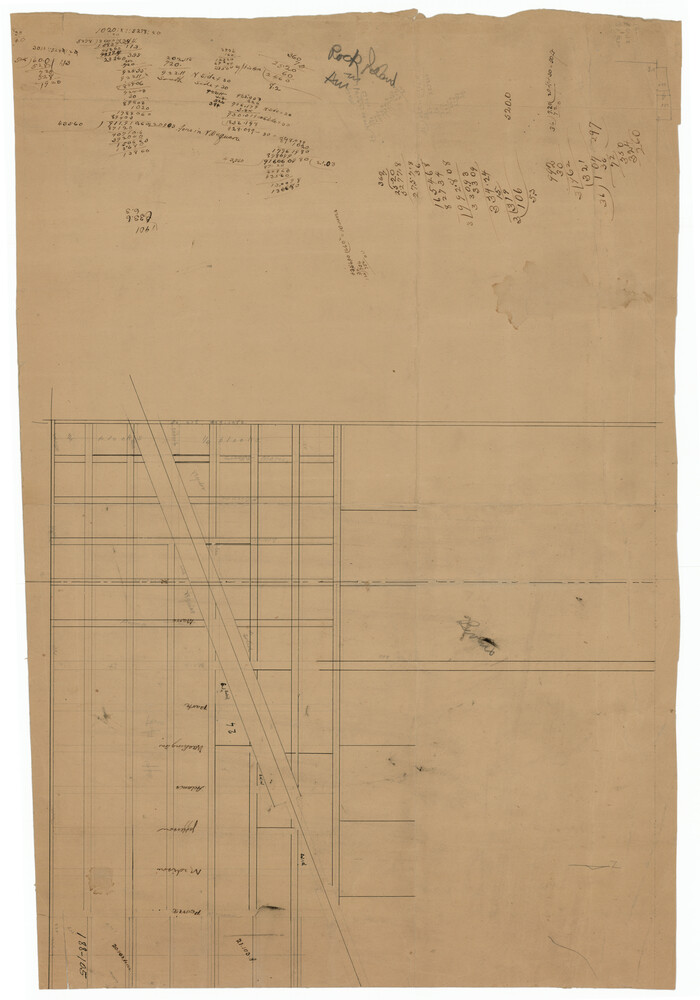
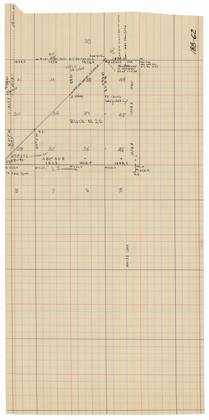
[Sketch showing G. & M. Block M-20, Sections 29-46]
Print $2.00
- Digital $50.00
[Sketch showing G. & M. Block M-20, Sections 29-46]
Size: 6.7 x 13.4 inches
91706
[Sketch showing G. & M. Block 5]
Print $2.00
- Digital $50.00
[Sketch showing G. & M. Block 5]
Size: 7.5 x 5.8 inches
91704
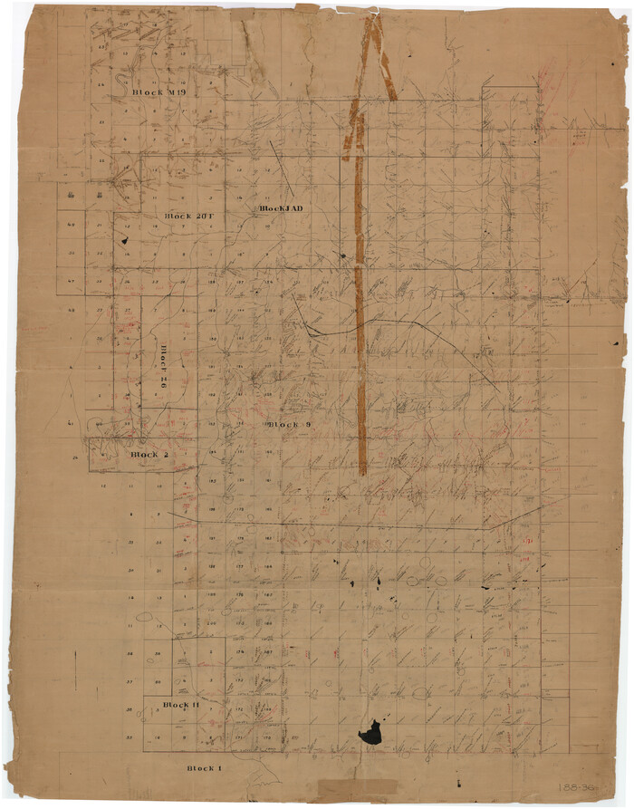
[Sketch showing Blocks M19, 20F, JAD, Z6, 2, 9 and 11]
Print $40.00
- Digital $50.00
[Sketch showing Blocks M19, 20F, JAD, Z6, 2, 9 and 11]
Size: 42.2 x 54.7 inches
89787
[Sketch showing Blocks M-20 and M-22]
Print $20.00
- Digital $50.00
[Sketch showing Blocks M-20 and M-22]
Size: 15.0 x 19.5 inches
91722
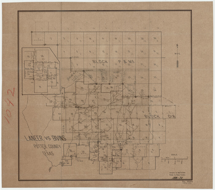
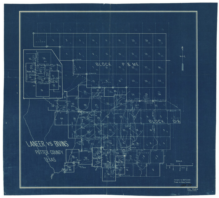
[Sketch showing Blocks B-11, O-18, P and Mc in case of Laneer vs. Bivens]
Print $20.00
- Digital $50.00
[Sketch showing Blocks B-11, O-18, P and Mc in case of Laneer vs. Bivens]
Size: 21.2 x 18.6 inches
91726
[Sketch showing Blocks B-11, O-18, P and Mc in case of Laneer vs. Bivens]
Print $20.00
- Digital $50.00
[Sketch showing Blocks B-11, O-18, P and Mc in case of Laneer vs. Bivens]
Size: 20.9 x 18.9 inches
91727
[Young Territory]
Print $40.00
- Digital $50.00
[Young Territory]
1875
-
Size
49.0 x 87.4 inches
-
Map/Doc
16784
-
Creation Date
1875
[West Half of Potter County, South of River and West Half of Randall County]
Print $20.00
- Digital $50.00
[West Half of Potter County, South of River and West Half of Randall County]
-
Size
25.9 x 43.0 inches
-
Map/Doc
91828
[Surveys on the south side of the Canadian River]
Print $3.00
- Digital $50.00
[Surveys on the south side of the Canadian River]
-
Size
11.2 x 15.9 inches
-
Map/Doc
91788
[Survey 9, Block 9 Potter and Randall]
Print $20.00
- Digital $50.00
[Survey 9, Block 9 Potter and Randall]
-
Size
22.3 x 15.9 inches
-
Map/Doc
91720
[Survey 9, Block 9 Potter and Randall]
Print $20.00
- Digital $50.00
[Survey 9, Block 9 Potter and Randall]
-
Size
22.1 x 15.9 inches
-
Map/Doc
91721
[Subdivision Plat of 80 acres]
Print $2.00
- Digital $50.00
[Subdivision Plat of 80 acres]
-
Size
10.6 x 6.3 inches
-
Map/Doc
93074
[Subdivision Plat of 80 acres]
Print $2.00
- Digital $50.00
[Subdivision Plat of 80 acres]
-
Size
11.7 x 6.2 inches
-
Map/Doc
93075
[Sketch showing west part of county]
Print $3.00
- Digital $50.00
[Sketch showing west part of county]
1907
-
Size
16.4 x 11.1 inches
-
Map/Doc
91712
-
Creation Date
1907
[Sketch showing west part of county]
Print $20.00
- Digital $50.00
[Sketch showing west part of county]
-
Size
24.2 x 13.8 inches
-
Map/Doc
91713
[Sketch showing the southwest part of the Glidden and Sanborn Addition]
Print $20.00
- Digital $50.00
[Sketch showing the southwest part of the Glidden and Sanborn Addition]
-
Size
20.0 x 29.3 inches
-
Map/Doc
91746
[Sketch showing surveys on the south side of the Canadian River, Blocks 4, M-3, M-19, M-20, 21-W, and Y-2]
Print $20.00
- Digital $50.00
[Sketch showing surveys on the south side of the Canadian River, Blocks 4, M-3, M-19, M-20, 21-W, and Y-2]
-
Size
43.4 x 25.1 inches
-
Map/Doc
91740
[Sketch showing surveys on the north side of the Canadian River, Blocks B-11, L, O-18, and G and M 2 and 3]
Print $20.00
- Digital $50.00
[Sketch showing surveys on the north side of the Canadian River, Blocks B-11, L, O-18, and G and M 2 and 3]
1883
-
Size
35.4 x 25.3 inches
-
Map/Doc
91737
-
Creation Date
1883
[Sketch showing surveys in the south half of Potter County, Blocks 6, 20-E, JAD, M-3, S, B. S. & F. Blocks 1 and 9, and A. B. and M. Block 2]
Print $20.00
- Digital $50.00
[Sketch showing surveys in the south half of Potter County, Blocks 6, 20-E, JAD, M-3, S, B. S. & F. Blocks 1 and 9, and A. B. and M. Block 2]
-
Size
40.5 x 18.1 inches
-
Map/Doc
91741
[Sketch showing surveys in the north half of Potter County, Blocks 1, 6-T, 25, B-10, B-12, O-18, P and Mc, and H. & T. C., Block 44]
Print $20.00
- Digital $50.00
[Sketch showing surveys in the north half of Potter County, Blocks 1, 6-T, 25, B-10, B-12, O-18, P and Mc, and H. & T. C., Block 44]
-
Size
40.4 x 17.7 inches
-
Map/Doc
91742
[Sketch showing parts of Blocks 3, 5, 22, M-20, S, T and Block BB, surveys 1, 2 and 3]
Print $20.00
- Digital $50.00
[Sketch showing parts of Blocks 3, 5, 22, M-20, S, T and Block BB, surveys 1, 2 and 3]
-
Size
15.9 x 15.3 inches
-
Map/Doc
91729
[Sketch showing parts of Blocks 3, 5, 22, M-20, S, T and Block BB, surveys 1, 2 and 3]
Print $20.00
- Digital $50.00
[Sketch showing parts of Blocks 3, 5, 22, M-20, S, T and Block BB, surveys 1, 2 and 3]
-
Size
15.5 x 15.9 inches
-
Map/Doc
91730
[Sketch showing county line between Randall and Potter Counties]
Print $20.00
- Digital $50.00
[Sketch showing county line between Randall and Potter Counties]
-
Size
18.8 x 37.0 inches
-
Map/Doc
91760
[Sketch showing Potter County Block 2] / [Sketch showing F. W. & D. C. Round House]
Print $20.00
- Digital $50.00
[Sketch showing Potter County Block 2] / [Sketch showing F. W. & D. C. Round House]
-
Size
12.2 x 14.6 inches
-
Map/Doc
91709
[Sketch showing Potter County Block 2] / [Sketch showing F. W. & D. C. Round House]
Print $20.00
- Digital $50.00
[Sketch showing Potter County Block 2] / [Sketch showing F. W. & D. C. Round House]
-
Size
14.6 x 12.1 inches
-
Map/Doc
91710
[Sketch showing H. and T. C. Blocks 46 and 47]
Print $20.00
- Digital $50.00
[Sketch showing H. and T. C. Blocks 46 and 47]
1884
-
Size
38.5 x 24.7 inches
-
Map/Doc
91735
-
Creation Date
1884
[Sketch showing H. & T. C. Blocks 47 and M-26]
Print $3.00
- Digital $50.00
[Sketch showing H. & T. C. Blocks 47 and M-26]
-
Size
9.5 x 12.0 inches
-
Map/Doc
91698
[Sketch showing H. & T. C. Block 47]
Print $2.00
- Digital $50.00
[Sketch showing H. & T. C. Block 47]
-
Size
6.1 x 6.7 inches
-
Map/Doc
91699
[Sketch showing G. C. & S.F. Block S, T. T. RR. Co. Block H1, G. & M. Block M19, Block Z3 and Block 8]
Print $40.00
- Digital $50.00
[Sketch showing G. C. & S.F. Block S, T. T. RR. Co. Block H1, G. & M. Block M19, Block Z3 and Block 8]
-
Size
43.7 x 52.8 inches
-
Map/Doc
93122
[Sketch showing G. & M. Blocks 5 and M-19 and B. S. & F. Block 9]
Print $20.00
- Digital $50.00
[Sketch showing G. & M. Blocks 5 and M-19 and B. S. & F. Block 9]
-
Size
22.9 x 17.4 inches
-
Map/Doc
91718
[Sketch showing G. & M. Block M-20, Sections 29-46]
Print $2.00
- Digital $50.00
[Sketch showing G. & M. Block M-20, Sections 29-46]
-
Size
6.7 x 13.4 inches
-
Map/Doc
91706
[Sketch showing G. & M. Block 5]
Print $2.00
- Digital $50.00
[Sketch showing G. & M. Block 5]
-
Size
7.5 x 5.8 inches
-
Map/Doc
91704
[Sketch showing Blocks M19, 20F, JAD, Z6, 2, 9 and 11]
Print $40.00
- Digital $50.00
[Sketch showing Blocks M19, 20F, JAD, Z6, 2, 9 and 11]
-
Size
42.2 x 54.7 inches
-
Map/Doc
89787
[Sketch showing Blocks M-20 and M-22]
Print $20.00
- Digital $50.00
[Sketch showing Blocks M-20 and M-22]
-
Size
15.0 x 19.5 inches
-
Map/Doc
91722
[Sketch showing Blocks B-11, O-18, P and Mc in case of Laneer vs. Bivens]
Print $20.00
- Digital $50.00
[Sketch showing Blocks B-11, O-18, P and Mc in case of Laneer vs. Bivens]
-
Size
21.2 x 18.6 inches
-
Map/Doc
91726
[Sketch showing Blocks B-11, O-18, P and Mc in case of Laneer vs. Bivens]
Print $20.00
- Digital $50.00
[Sketch showing Blocks B-11, O-18, P and Mc in case of Laneer vs. Bivens]
-
Size
20.9 x 18.9 inches
-
Map/Doc
91727