
Potter County Rolled Sketch 12

Print $20.00
- Digital $50.00
Potter County Rolled Sketch 12
2004
Size: 18.8 x 24.7 inches
82480
Potter County Rolled Sketch 13

Print $20.00
- Digital $50.00
Potter County Rolled Sketch 13
2004
Size: 18.4 x 23.4 inches
82476
Potter County Rolled Sketch 13

Print $20.00
- Digital $50.00
Potter County Rolled Sketch 13
2004
Size: 18.7 x 23.2 inches
82477
Potter County Rolled Sketch 13

Print $20.00
- Digital $50.00
Potter County Rolled Sketch 13
2004
Size: 19.3 x 23.5 inches
82478
Potter County Rolled Sketch 13

Print $20.00
- Digital $50.00
Potter County Rolled Sketch 13
2004
Size: 19.2 x 23.2 inches
82479
Potter County Rolled Sketch 11

Print $20.00
- Digital $50.00
Potter County Rolled Sketch 11
1986
Size: 21.6 x 27.4 inches
7324
Hartley County Working Sketch 8

Print $20.00
- Digital $50.00
Hartley County Working Sketch 8
1982
Size: 34.0 x 32.6 inches
66058
Moore County Working Sketch 17

Print $20.00
- Digital $50.00
Moore County Working Sketch 17
1982
Size: 37.0 x 36.2 inches
71199
Oldham County Working Sketch 7

Print $20.00
- Digital $50.00
Oldham County Working Sketch 7
1982
Size: 33.4 x 35.6 inches
71329
Potter County Working Sketch 14

Print $20.00
- Digital $50.00
Potter County Working Sketch 14
1982
Size: 33.7 x 32.6 inches
71674
Moore County Rolled Sketch 14A

Print $20.00
- Digital $50.00
Moore County Rolled Sketch 14A
1981
Size: 21.8 x 27.5 inches
6831
Oldham County Rolled Sketch 12

Print $20.00
- Digital $50.00
Oldham County Rolled Sketch 12
1981
Size: 25.2 x 38.0 inches
7177
Oldham County Working Sketch 6

Print $40.00
- Digital $50.00
Oldham County Working Sketch 6
1981
Size: 32.4 x 50.4 inches
71328
Potter County Working Sketch 13

Print $20.00
- Digital $50.00
Potter County Working Sketch 13
1980
Size: 19.5 x 26.9 inches
71673
Potter County Working Sketch 12

Print $40.00
- Digital $50.00
Potter County Working Sketch 12
1972
Size: 64.4 x 42.4 inches
71672
Potter County Working Sketch 11

Print $20.00
- Digital $50.00
Potter County Working Sketch 11
1972
Size: 27.4 x 26.4 inches
71671
Moore County Working Sketch 13

Print $40.00
- Digital $50.00
Moore County Working Sketch 13
1967
Size: 38.2 x 87.5 inches
71195
Potter County Working Sketch 9

Print $40.00
- Digital $50.00
Potter County Working Sketch 9
1966
Size: 46.4 x 48.6 inches
71669
Potter County Working Sketch 10

Print $20.00
- Digital $50.00
Potter County Working Sketch 10
1964
Size: 32.6 x 25.0 inches
71670
Potter County Rolled Sketch 10

Print $20.00
- Digital $50.00
Potter County Rolled Sketch 10
1963
Size: 31.8 x 43.3 inches
7323
Potter County Sketch File 22

Print $30.00
- Digital $50.00
Potter County Sketch File 22
1962
Size: 14.2 x 8.6 inches
34415
Potter County Working Sketch 8

Print $40.00
- Digital $50.00
Potter County Working Sketch 8
1961
Size: 68.7 x 37.2 inches
71668
General Highway Map, Potter County, Texas

Print $20.00
General Highway Map, Potter County, Texas
1961
Size: 24.5 x 18.2 inches
79631
General Highway Map. Detail of Cities and Towns in Potter County, Texas [Amarillo and vicinity]
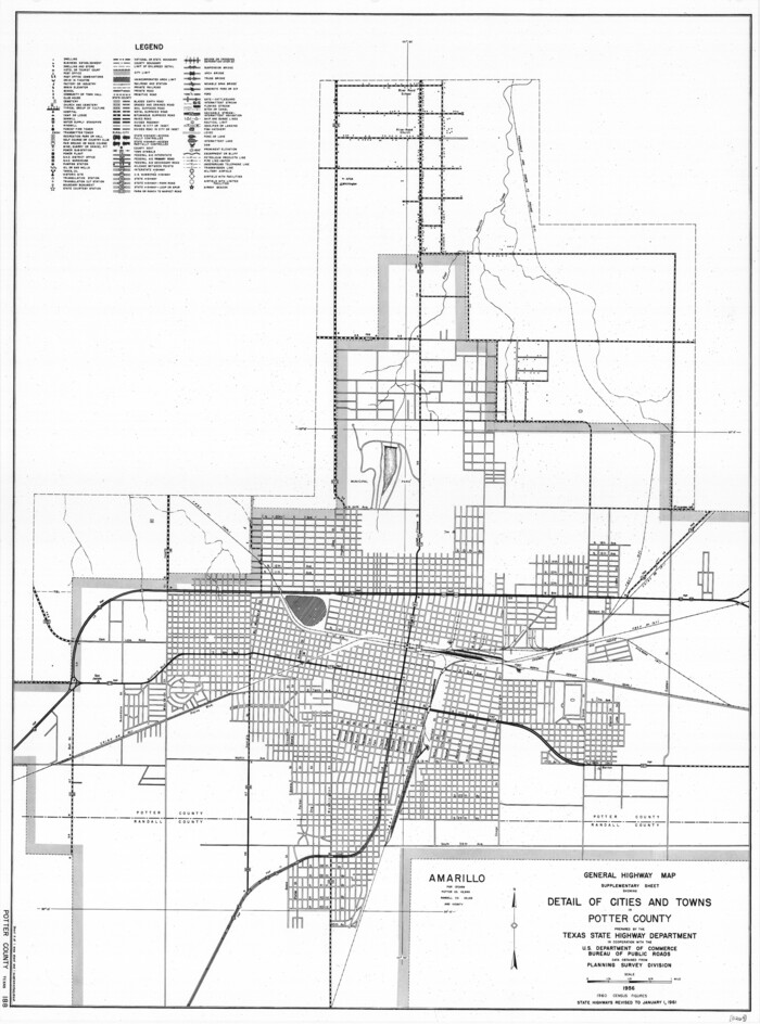
Print $20.00
General Highway Map. Detail of Cities and Towns in Potter County, Texas [Amarillo and vicinity]
1961
Size: 24.4 x 18.1 inches
79632
Potter County Working Sketch Graphic Index

Print $20.00
- Digital $50.00
Potter County Working Sketch Graphic Index
1960
Size: 42.3 x 33.1 inches
76669
Potter County Rolled Sketch 12
Print $20.00
- Digital $50.00
Potter County Rolled Sketch 12
2004
-
Size
18.8 x 24.7 inches
-
Map/Doc
82480
-
Creation Date
2004
Potter County Rolled Sketch 13
Print $20.00
- Digital $50.00
Potter County Rolled Sketch 13
2004
-
Size
18.4 x 23.4 inches
-
Map/Doc
82476
-
Creation Date
2004
Potter County Rolled Sketch 13
Print $20.00
- Digital $50.00
Potter County Rolled Sketch 13
2004
-
Size
18.7 x 23.2 inches
-
Map/Doc
82477
-
Creation Date
2004
Potter County Rolled Sketch 13
Print $20.00
- Digital $50.00
Potter County Rolled Sketch 13
2004
-
Size
19.3 x 23.5 inches
-
Map/Doc
82478
-
Creation Date
2004
Potter County Rolled Sketch 13
Print $20.00
- Digital $50.00
Potter County Rolled Sketch 13
2004
-
Size
19.2 x 23.2 inches
-
Map/Doc
82479
-
Creation Date
2004
Potter County Rolled Sketch 11
Print $20.00
- Digital $50.00
Potter County Rolled Sketch 11
1986
-
Size
21.6 x 27.4 inches
-
Map/Doc
7324
-
Creation Date
1986
Hartley County Working Sketch 8
Print $20.00
- Digital $50.00
Hartley County Working Sketch 8
1982
-
Size
34.0 x 32.6 inches
-
Map/Doc
66058
-
Creation Date
1982
Moore County Working Sketch 17
Print $20.00
- Digital $50.00
Moore County Working Sketch 17
1982
-
Size
37.0 x 36.2 inches
-
Map/Doc
71199
-
Creation Date
1982
Oldham County Working Sketch 7
Print $20.00
- Digital $50.00
Oldham County Working Sketch 7
1982
-
Size
33.4 x 35.6 inches
-
Map/Doc
71329
-
Creation Date
1982
Potter County Working Sketch 14
Print $20.00
- Digital $50.00
Potter County Working Sketch 14
1982
-
Size
33.7 x 32.6 inches
-
Map/Doc
71674
-
Creation Date
1982
Moore County Rolled Sketch 14A
Print $20.00
- Digital $50.00
Moore County Rolled Sketch 14A
1981
-
Size
21.8 x 27.5 inches
-
Map/Doc
6831
-
Creation Date
1981
Oldham County Rolled Sketch 12
Print $20.00
- Digital $50.00
Oldham County Rolled Sketch 12
1981
-
Size
25.2 x 38.0 inches
-
Map/Doc
7177
-
Creation Date
1981
Oldham County Working Sketch 6
Print $40.00
- Digital $50.00
Oldham County Working Sketch 6
1981
-
Size
32.4 x 50.4 inches
-
Map/Doc
71328
-
Creation Date
1981
Potter County Working Sketch 13
Print $20.00
- Digital $50.00
Potter County Working Sketch 13
1980
-
Size
19.5 x 26.9 inches
-
Map/Doc
71673
-
Creation Date
1980
Potter County Working Sketch 12
Print $40.00
- Digital $50.00
Potter County Working Sketch 12
1972
-
Size
64.4 x 42.4 inches
-
Map/Doc
71672
-
Creation Date
1972
Potter County Working Sketch 11
Print $20.00
- Digital $50.00
Potter County Working Sketch 11
1972
-
Size
27.4 x 26.4 inches
-
Map/Doc
71671
-
Creation Date
1972
Moore County Working Sketch 13
Print $40.00
- Digital $50.00
Moore County Working Sketch 13
1967
-
Size
38.2 x 87.5 inches
-
Map/Doc
71195
-
Creation Date
1967
Potter County Working Sketch 9
Print $40.00
- Digital $50.00
Potter County Working Sketch 9
1966
-
Size
46.4 x 48.6 inches
-
Map/Doc
71669
-
Creation Date
1966
Potter County Working Sketch 10
Print $20.00
- Digital $50.00
Potter County Working Sketch 10
1964
-
Size
32.6 x 25.0 inches
-
Map/Doc
71670
-
Creation Date
1964
Potter County Rolled Sketch 10
Print $20.00
- Digital $50.00
Potter County Rolled Sketch 10
1963
-
Size
31.8 x 43.3 inches
-
Map/Doc
7323
-
Creation Date
1963
Potter County Sketch File 22
Print $30.00
- Digital $50.00
Potter County Sketch File 22
1962
-
Size
14.2 x 8.6 inches
-
Map/Doc
34415
-
Creation Date
1962
Potter County Working Sketch 8
Print $40.00
- Digital $50.00
Potter County Working Sketch 8
1961
-
Size
68.7 x 37.2 inches
-
Map/Doc
71668
-
Creation Date
1961
General Highway Map, Potter County, Texas
Print $20.00
General Highway Map, Potter County, Texas
1961
-
Size
24.5 x 18.2 inches
-
Map/Doc
79631
-
Creation Date
1961
General Highway Map. Detail of Cities and Towns in Potter County, Texas [Amarillo and vicinity]
Print $20.00
General Highway Map. Detail of Cities and Towns in Potter County, Texas [Amarillo and vicinity]
1961
-
Size
24.4 x 18.1 inches
-
Map/Doc
79632
-
Creation Date
1961
Potter County

Print $20.00
- Digital $50.00
Potter County
1960
-
Size
42.6 x 34.6 inches
-
Map/Doc
66985
-
Creation Date
1960
Potter County

Print $20.00
- Digital $50.00
Potter County
1960
-
Size
42.5 x 34.6 inches
-
Map/Doc
73264
-
Creation Date
1960
Potter County

Print $20.00
- Digital $50.00
Potter County
1960
-
Size
40.0 x 32.3 inches
-
Map/Doc
77397
-
Creation Date
1960
Potter County

Print $20.00
- Digital $50.00
Potter County
1960
-
Size
43.5 x 35.6 inches
-
Map/Doc
95615
-
Creation Date
1960
Potter County Working Sketch Graphic Index
Print $20.00
- Digital $50.00
Potter County Working Sketch Graphic Index
1960
-
Size
42.3 x 33.1 inches
-
Map/Doc
76669
-
Creation Date
1960