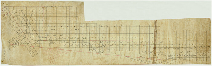
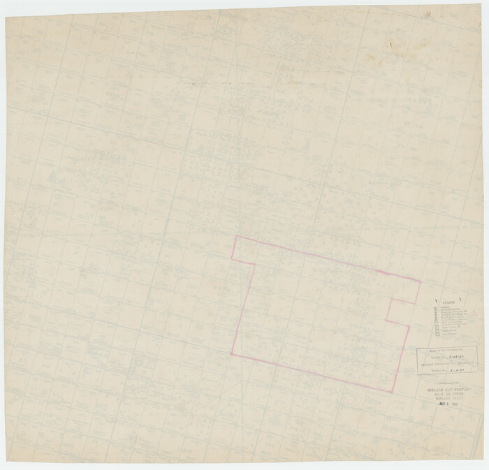
[Upton County Sketch]
Print $40.00
- Digital $50.00
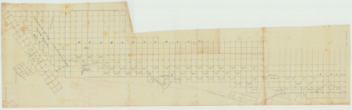
[Upton County Sketch]
Size: 19.2 x 60.3 inches
5043
[Upton County Sketch]
Print $40.00
- Digital $50.00
[Upton County Sketch]
Size: 19.1 x 60.8 inches
76176
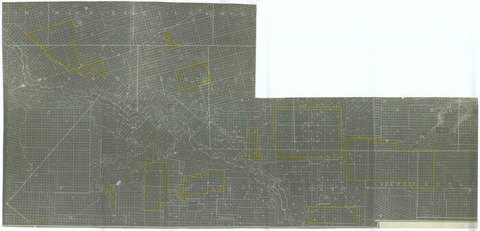
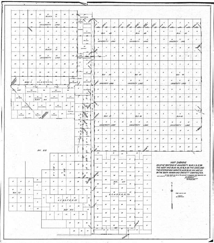
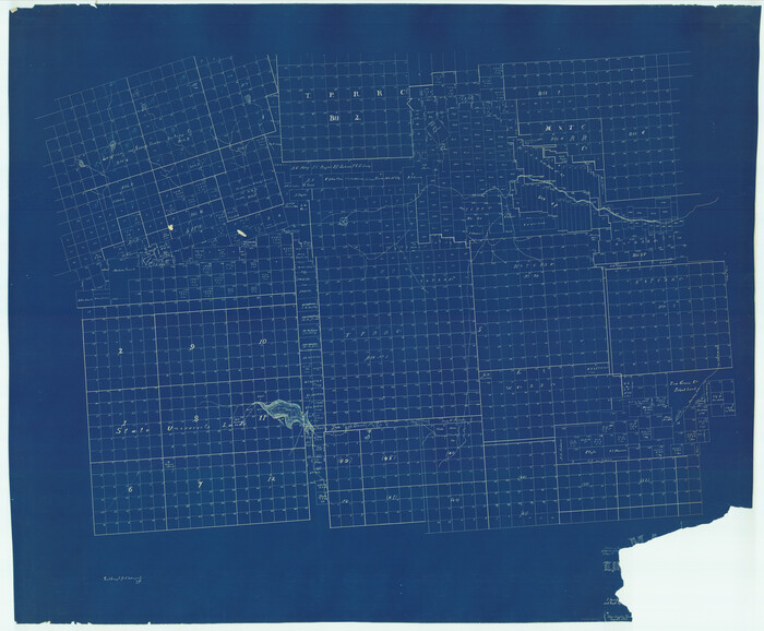
[University Land in Loving, Ward, Winkler, Pecos, Crane, Ector, Upton, Crockett, Schleicher, Irion and Reagan Counties]
Print $40.00
- Digital $50.00
[University Land in Loving, Ward, Winkler, Pecos, Crane, Ector, Upton, Crockett, Schleicher, Irion and Reagan Counties]
1938
Size: 37.9 x 78.5 inches
2424
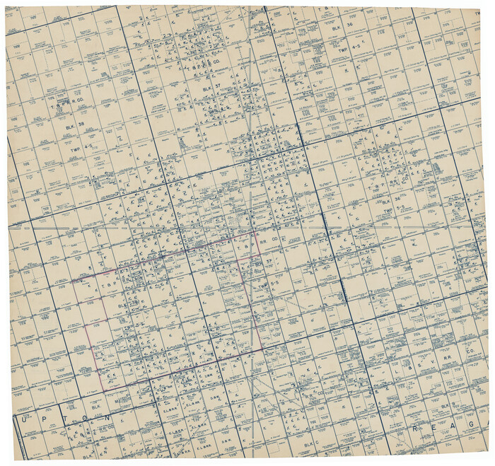
[Township 5-S, Blocks 36, 37 & 38]
Print $20.00
- Digital $50.00
[Township 5-S, Blocks 36, 37 & 38]
1952
Size: 27.6 x 26.5 inches
92291
[Township 5-S, Blocks 36, 37 & 38]
Print $20.00
- Digital $50.00
[Township 5-S, Blocks 36, 37 & 38]
1952
Size: 27.7 x 26.6 inches
92292
[T.& P.R.R.Co., Block 1]
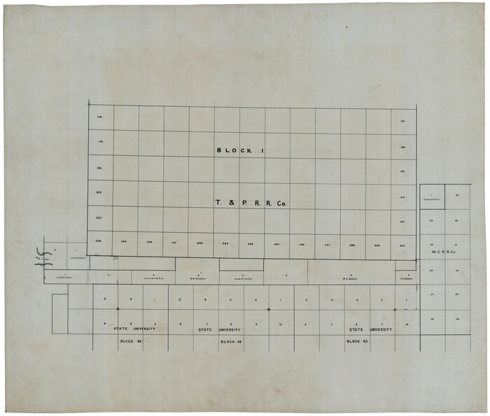
Print $20.00
- Digital $50.00
[T.& P.R.R.Co., Block 1]
Size: 37.5 x 31.6 inches
92963
[Sketch in Reagan, Irion and Tom Green Counties]
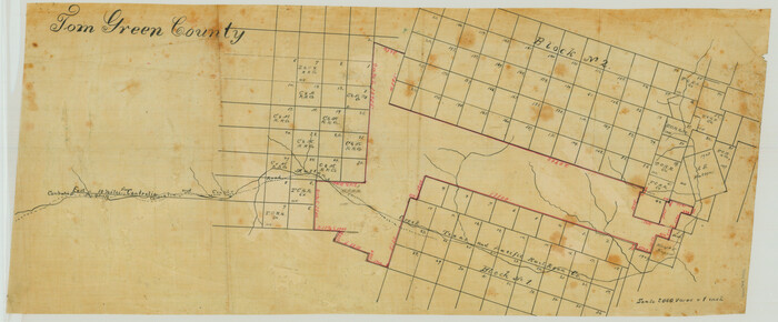
Print $20.00
- Digital $50.00
[Sketch in Reagan, Irion and Tom Green Counties]
Size: 12.5 x 30.1 inches
75551
[Sketch for Mineral Applications 26885-6 - Reagan and Crockett Cos., W. H. Bland]
Print $20.00
- Digital $50.00
[Sketch for Mineral Applications 26885-6 - Reagan and Crockett Cos., W. H. Bland]
1932
Size: 41.5 x 36.6 inches
2854
[Map of Tom Green County]
Print $40.00
- Digital $50.00
[Map of Tom Green County]
1933
Size: 50.0 x 60.6 inches
82061
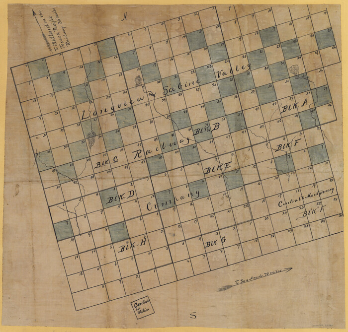
[Longview and Sabine Valley Railway Company Blocks in Reagan & Upton Counties, Texas]
Print $20.00
- Digital $50.00
[Longview and Sabine Valley Railway Company Blocks in Reagan & Upton Counties, Texas]
Size: 17.5 x 18.3 inches
75789
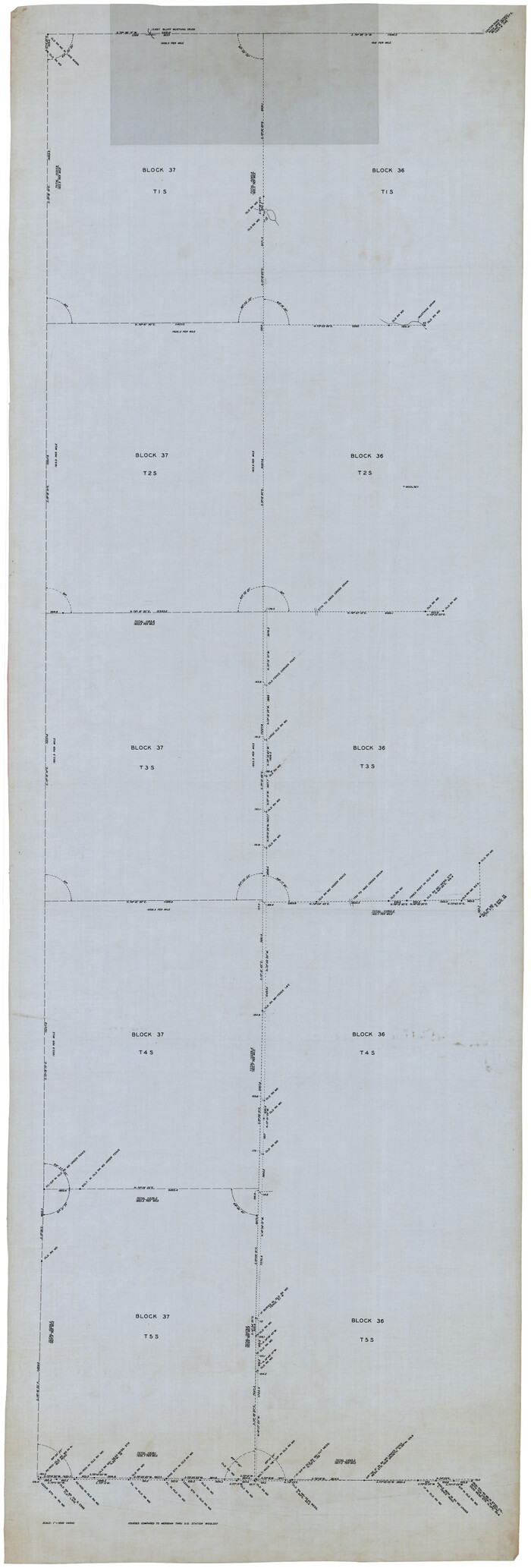
[Blocks 36 and 37, Townships 1S-5S]
Print $40.00
- Digital $50.00
[Blocks 36 and 37, Townships 1S-5S]
Size: 28.9 x 83.7 inches
93213
Working Sketch compiled from original field notes showing surveys in Reagan and Irion Counties located by Frank Lerch in 1883 and 1884, also adjacent blocks and surveys (previously located by other surveyors) called for in his Field Notes

Print $20.00
- Digital $50.00
Working Sketch compiled from original field notes showing surveys in Reagan and Irion Counties located by Frank Lerch in 1883 and 1884, also adjacent blocks and surveys (previously located by other surveyors) called for in his Field Notes
1883
Size: 35.8 x 20.0 inches
91749
Working Sketch Compiled From Original Field Notes Showing Surveys in Reagan and Irion Counties

Print $20.00
- Digital $50.00
Working Sketch Compiled From Original Field Notes Showing Surveys in Reagan and Irion Counties
Size: 36.2 x 20.2 inches
92331
Water-Shed of the Colorado River

Print $40.00
- Digital $50.00
Water-Shed of the Colorado River
1925
Size: 37.1 x 79.8 inches
65261
Upton County Working Sketch 24

Print $20.00
- Digital $50.00
Upton County Working Sketch 24
1953
Size: 36.7 x 39.2 inches
69520
Upton County Working Sketch 15

Print $40.00
- Digital $50.00
Upton County Working Sketch 15
1940
Size: 28.4 x 48.6 inches
69511
Upton County Sketch File 4

Print $40.00
- Digital $50.00
Upton County Sketch File 4
1886
Size: 19.5 x 9.0 inches
12510
Upton County Sketch File 36

Print $14.00
- Digital $50.00
Upton County Sketch File 36
1952
Size: 11.3 x 8.8 inches
38893
Upton County Sketch File 2

Print $40.00
- Digital $50.00
Upton County Sketch File 2
Size: 38.5 x 55.4 inches
10413
Upton County Rolled Sketch 36A

Print $40.00
- Digital $50.00
Upton County Rolled Sketch 36A
1952
Size: 43.5 x 65.8 inches
10661
Upton County Rolled Sketch 36

Print $40.00
- Digital $50.00
Upton County Rolled Sketch 36
1952
Size: 42.9 x 64.2 inches
10051
Upton County Rolled Sketch 31

Print $40.00
- Digital $50.00
Upton County Rolled Sketch 31
Size: 27.2 x 53.4 inches
10048
Upton County Rolled Sketch 2

Print $20.00
- Digital $50.00
Upton County Rolled Sketch 2
1884
Size: 26.2 x 36.1 inches
8065
University of Texas System University Lands

Print $20.00
- Digital $50.00
University of Texas System University Lands
1936
Size: 23.2 x 17.6 inches
93236
University of Texas System University Lands

Print $20.00
- Digital $50.00
University of Texas System University Lands
1937
Size: 23.3 x 17.6 inches
93237
University Lands, Blocks 38 to 57, Crockett, Reagan, Irion, Schleicher Counties

Print $40.00
- Digital $50.00
University Lands, Blocks 38 to 57, Crockett, Reagan, Irion, Schleicher Counties
Size: 34.0 x 53.0 inches
62946
University Lands, Blocks 1-13 & Block 58, Crockett, Reagan & Upton Counties

Print $20.00
- Digital $50.00
University Lands, Blocks 1-13 & Block 58, Crockett, Reagan & Upton Counties
1936
Size: 36.9 x 42.0 inches
2409
University Lands Blocks 38 to 57, Crockett-Reagan-Irion-Schleicher-Counties

Print $40.00
- Digital $50.00
University Lands Blocks 38 to 57, Crockett-Reagan-Irion-Schleicher-Counties
1937
Size: 34.2 x 52.7 inches
2444
University Lands Blocks 38 to 57, Crockett-Reagan-Irion-Schleicher-Counties

Print $40.00
- Digital $50.00
University Lands Blocks 38 to 57, Crockett-Reagan-Irion-Schleicher-Counties
Size: 35.1 x 53.6 inches
62945
University Lands Blocks 1-13 & Block 58, Crockett, Reagan & Upton Counties

Print $20.00
- Digital $50.00
University Lands Blocks 1-13 & Block 58, Crockett, Reagan & Upton Counties
1936
Size: 37.3 x 42.0 inches
2445
[Upton County Sketch]
Print $40.00
- Digital $50.00
[Upton County Sketch]
-
Size
19.2 x 60.3 inches
-
Map/Doc
5043
[Upton County Sketch]
Print $40.00
- Digital $50.00
[Upton County Sketch]
-
Size
19.1 x 60.8 inches
-
Map/Doc
76176
[University Land in Loving, Ward, Winkler, Pecos, Crane, Ector, Upton, Crockett, Schleicher, Irion and Reagan Counties]
Print $40.00
- Digital $50.00
[University Land in Loving, Ward, Winkler, Pecos, Crane, Ector, Upton, Crockett, Schleicher, Irion and Reagan Counties]
1938
-
Size
37.9 x 78.5 inches
-
Map/Doc
2424
-
Creation Date
1938
[Township 5-S, Blocks 36, 37 & 38]
Print $20.00
- Digital $50.00
[Township 5-S, Blocks 36, 37 & 38]
1952
-
Size
27.6 x 26.5 inches
-
Map/Doc
92291
-
Creation Date
1952
[Township 5-S, Blocks 36, 37 & 38]
Print $20.00
- Digital $50.00
[Township 5-S, Blocks 36, 37 & 38]
1952
-
Size
27.7 x 26.6 inches
-
Map/Doc
92292
-
Creation Date
1952
[T.& P.R.R.Co., Block 1]
Print $20.00
- Digital $50.00
[T.& P.R.R.Co., Block 1]
-
Size
37.5 x 31.6 inches
-
Map/Doc
92963
[Sketch in Reagan, Irion and Tom Green Counties]
Print $20.00
- Digital $50.00
[Sketch in Reagan, Irion and Tom Green Counties]
-
Size
12.5 x 30.1 inches
-
Map/Doc
75551
[Sketch for Mineral Applications 26885-6 - Reagan and Crockett Cos., W. H. Bland]
Print $20.00
- Digital $50.00
[Sketch for Mineral Applications 26885-6 - Reagan and Crockett Cos., W. H. Bland]
1932
-
Size
41.5 x 36.6 inches
-
Map/Doc
2854
-
Creation Date
1932
[Map of Tom Green County]
Print $40.00
- Digital $50.00
[Map of Tom Green County]
1933
-
Size
50.0 x 60.6 inches
-
Map/Doc
82061
-
Creation Date
1933
[Longview and Sabine Valley Railway Company Blocks in Reagan & Upton Counties, Texas]
Print $20.00
- Digital $50.00
[Longview and Sabine Valley Railway Company Blocks in Reagan & Upton Counties, Texas]
-
Size
17.5 x 18.3 inches
-
Map/Doc
75789
[Blocks 36 and 37, Townships 1S-5S]
Print $40.00
- Digital $50.00
[Blocks 36 and 37, Townships 1S-5S]
-
Size
28.9 x 83.7 inches
-
Map/Doc
93213
Working Sketch compiled from original field notes showing surveys in Reagan and Irion Counties located by Frank Lerch in 1883 and 1884, also adjacent blocks and surveys (previously located by other surveyors) called for in his Field Notes
Print $20.00
- Digital $50.00
Working Sketch compiled from original field notes showing surveys in Reagan and Irion Counties located by Frank Lerch in 1883 and 1884, also adjacent blocks and surveys (previously located by other surveyors) called for in his Field Notes
1883
-
Size
35.8 x 20.0 inches
-
Map/Doc
91749
-
Creation Date
1883
Working Sketch Compiled From Original Field Notes Showing Surveys in Reagan and Irion Counties
Print $20.00
- Digital $50.00
Working Sketch Compiled From Original Field Notes Showing Surveys in Reagan and Irion Counties
-
Size
36.2 x 20.2 inches
-
Map/Doc
92331
Water-Shed of the Colorado River
Print $40.00
- Digital $50.00
Water-Shed of the Colorado River
1925
-
Size
37.1 x 79.8 inches
-
Map/Doc
65261
-
Creation Date
1925
Upton County Working Sketch 24
Print $20.00
- Digital $50.00
Upton County Working Sketch 24
1953
-
Size
36.7 x 39.2 inches
-
Map/Doc
69520
-
Creation Date
1953
Upton County Working Sketch 15
Print $40.00
- Digital $50.00
Upton County Working Sketch 15
1940
-
Size
28.4 x 48.6 inches
-
Map/Doc
69511
-
Creation Date
1940
Upton County Sketch File 4
Print $40.00
- Digital $50.00
Upton County Sketch File 4
1886
-
Size
19.5 x 9.0 inches
-
Map/Doc
12510
-
Creation Date
1886
Upton County Sketch File 36
Print $14.00
- Digital $50.00
Upton County Sketch File 36
1952
-
Size
11.3 x 8.8 inches
-
Map/Doc
38893
-
Creation Date
1952
Upton County Sketch File 2
Print $40.00
- Digital $50.00
Upton County Sketch File 2
-
Size
38.5 x 55.4 inches
-
Map/Doc
10413
Upton County Rolled Sketch 36A
Print $40.00
- Digital $50.00
Upton County Rolled Sketch 36A
1952
-
Size
43.5 x 65.8 inches
-
Map/Doc
10661
-
Creation Date
1952
Upton County Rolled Sketch 36
Print $40.00
- Digital $50.00
Upton County Rolled Sketch 36
1952
-
Size
42.9 x 64.2 inches
-
Map/Doc
10051
-
Creation Date
1952
Upton County Rolled Sketch 31
Print $40.00
- Digital $50.00
Upton County Rolled Sketch 31
-
Size
27.2 x 53.4 inches
-
Map/Doc
10048
Upton County Rolled Sketch 2
Print $20.00
- Digital $50.00
Upton County Rolled Sketch 2
1884
-
Size
26.2 x 36.1 inches
-
Map/Doc
8065
-
Creation Date
1884
University of Texas System University Lands
Print $20.00
- Digital $50.00
University of Texas System University Lands
1936
-
Size
23.2 x 17.6 inches
-
Map/Doc
93236
-
Creation Date
1936
University of Texas System University Lands
Print $20.00
- Digital $50.00
University of Texas System University Lands
1937
-
Size
23.3 x 17.6 inches
-
Map/Doc
93237
-
Creation Date
1937
University Lands, Blocks 38 to 57, Crockett, Reagan, Irion, Schleicher Counties
Print $40.00
- Digital $50.00
University Lands, Blocks 38 to 57, Crockett, Reagan, Irion, Schleicher Counties
-
Size
34.0 x 53.0 inches
-
Map/Doc
62946
University Lands, Blocks 1-13 & Block 58, Crockett, Reagan & Upton Counties
Print $20.00
- Digital $50.00
University Lands, Blocks 1-13 & Block 58, Crockett, Reagan & Upton Counties
1936
-
Size
36.9 x 42.0 inches
-
Map/Doc
2409
-
Creation Date
1936
University Lands Blocks 38 to 57, Crockett-Reagan-Irion-Schleicher-Counties
Print $40.00
- Digital $50.00
University Lands Blocks 38 to 57, Crockett-Reagan-Irion-Schleicher-Counties
1937
-
Size
34.2 x 52.7 inches
-
Map/Doc
2444
-
Creation Date
1937
University Lands Blocks 38 to 57, Crockett-Reagan-Irion-Schleicher-Counties
Print $40.00
- Digital $50.00
University Lands Blocks 38 to 57, Crockett-Reagan-Irion-Schleicher-Counties
-
Size
35.1 x 53.6 inches
-
Map/Doc
62945
University Lands Blocks 1-13 & Block 58, Crockett, Reagan & Upton Counties
Print $20.00
- Digital $50.00
University Lands Blocks 1-13 & Block 58, Crockett, Reagan & Upton Counties
1936
-
Size
37.3 x 42.0 inches
-
Map/Doc
2445
-
Creation Date
1936