Rusk County Sketch File 26

Print $20.00
Rusk County Sketch File 26
1932
Size: 38.1 x 22.6 inches
10595
Rusk County Sketch File 32

Print $20.00
Rusk County Sketch File 32
1949
Size: 33.5 x 28.4 inches
10596
Rusk County Sketch File 34

Print $20.00
Rusk County Sketch File 34
1949
Size: 33.4 x 28.2 inches
10597
Rusk County Rolled Sketch 15

Print $40.00
- Digital $50.00
Rusk County Rolled Sketch 15
2000
Size: 62.4 x 21.2 inches
10636
Rusk County Rolled Sketch 5

Print $40.00
- Digital $50.00
Rusk County Rolled Sketch 5
1948
Size: 36.9 x 49.5 inches
10744
Rusk County Sketch File 25

Print $20.00
Rusk County Sketch File 25
1932
Size: 20.5 x 20.3 inches
12272
Rusk County Sketch File 27B

Print $20.00
Rusk County Sketch File 27B
1936
Size: 15.4 x 19.9 inches
12273
Rusk County Sketch File 36

Print $20.00
Rusk County Sketch File 36
1950
Size: 23.8 x 18.0 inches
12274
Rusk County Sketch File 37

Print $20.00
Rusk County Sketch File 37
1951
Size: 23.3 x 26.2 inches
12275
Rusk County Sketch File 40

Print $20.00
Rusk County Sketch File 40
1951
Size: 23.2 x 26.6 inches
12276
Rusk County Sketch File 41

Print $20.00
Rusk County Sketch File 41
1951
Size: 23.1 x 26.2 inches
12277
Rusk County Sketch File 43

Print $20.00
Rusk County Sketch File 43
1951
Size: 23.5 x 26.6 inches
12278
Rusk County Sketch File X

Print $20.00
Rusk County Sketch File X
1844
Size: 18.3 x 22.4 inches
12279
Cherokee County Sketch File 3

Print $4.00
- Digital $50.00
Cherokee County Sketch File 3
1849
Size: 7.5 x 11.0 inches
18115
Gregg County Sketch File 1A

Print $6.00
- Digital $50.00
Gregg County Sketch File 1A
1847
Size: 8.3 x 7.6 inches
24535
Gregg County Sketch File 1D

Print $4.00
- Digital $50.00
Gregg County Sketch File 1D
1848
Size: 12.7 x 8.5 inches
24543
Gregg County Sketch File 1E

Print $4.00
- Digital $50.00
Gregg County Sketch File 1E
1849
Size: 12.6 x 8.2 inches
24545
Gregg County Sketch File 1F

Print $4.00
- Digital $50.00
Gregg County Sketch File 1F
1850
Size: 12.2 x 7.8 inches
24547
Gregg County Sketch File 1H

Print $2.00
- Digital $50.00
Gregg County Sketch File 1H
Size: 5.8 x 5.4 inches
24550
Gregg County Sketch File 2a

Print $8.00
- Digital $50.00
Gregg County Sketch File 2a
1847
Size: 10.1 x 15.9 inches
24566
Gregg County Sketch File 8

Print $28.00
- Digital $50.00
Gregg County Sketch File 8
1931
Size: 12.9 x 8.3 inches
24582
Nacogdoches County Sketch File 20

Print $26.00
- Digital $50.00
Nacogdoches County Sketch File 20
Size: 12.6 x 7.9 inches
32275
Panola County Sketch File 4

Print $4.00
- Digital $50.00
Panola County Sketch File 4
1860
Size: 8.9 x 8.9 inches
33449
Panola County Sketch File 4a

Print $4.00
- Digital $50.00
Panola County Sketch File 4a
1857
Size: 12.2 x 7.6 inches
33451
Panola County Sketch File 13

Print $4.00
- Digital $50.00
Panola County Sketch File 13
1850
Size: 14.1 x 7.8 inches
33470
[Surveys in the Nacogdoches District, Rusk County]
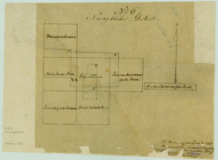
Print $2.00
- Digital $50.00
[Surveys in the Nacogdoches District, Rusk County]
Size: 6.0 x 8.2 inches
339

Rusk County Sketch File 26
Print $20.00
Rusk County Sketch File 26
1932
-
Size
38.1 x 22.6 inches
-
Map/Doc
10595
-
Creation Date
1932
Rusk County Sketch File 32
Print $20.00
Rusk County Sketch File 32
1949
-
Size
33.5 x 28.4 inches
-
Map/Doc
10596
-
Creation Date
1949
Rusk County Sketch File 34
Print $20.00
Rusk County Sketch File 34
1949
-
Size
33.4 x 28.2 inches
-
Map/Doc
10597
-
Creation Date
1949
Rusk County Rolled Sketch 15
Print $40.00
- Digital $50.00
Rusk County Rolled Sketch 15
2000
-
Size
62.4 x 21.2 inches
-
Map/Doc
10636
-
Creation Date
2000
Rusk County Rolled Sketch 5
Print $40.00
- Digital $50.00
Rusk County Rolled Sketch 5
1948
-
Size
36.9 x 49.5 inches
-
Map/Doc
10744
-
Creation Date
1948
Rusk County Sketch File 25
Print $20.00
Rusk County Sketch File 25
1932
-
Size
20.5 x 20.3 inches
-
Map/Doc
12272
-
Creation Date
1932
Rusk County Sketch File 27B
Print $20.00
Rusk County Sketch File 27B
1936
-
Size
15.4 x 19.9 inches
-
Map/Doc
12273
-
Creation Date
1936
Rusk County Sketch File 36
Print $20.00
Rusk County Sketch File 36
1950
-
Size
23.8 x 18.0 inches
-
Map/Doc
12274
-
Creation Date
1950
Rusk County Sketch File 37
Print $20.00
Rusk County Sketch File 37
1951
-
Size
23.3 x 26.2 inches
-
Map/Doc
12275
-
Creation Date
1951
Rusk County Sketch File 40
Print $20.00
Rusk County Sketch File 40
1951
-
Size
23.2 x 26.6 inches
-
Map/Doc
12276
-
Creation Date
1951
Rusk County Sketch File 41
Print $20.00
Rusk County Sketch File 41
1951
-
Size
23.1 x 26.2 inches
-
Map/Doc
12277
-
Creation Date
1951
Rusk County Sketch File 43
Print $20.00
Rusk County Sketch File 43
1951
-
Size
23.5 x 26.6 inches
-
Map/Doc
12278
-
Creation Date
1951
Rusk County Sketch File X
Print $20.00
Rusk County Sketch File X
1844
-
Size
18.3 x 22.4 inches
-
Map/Doc
12279
-
Creation Date
1844
Rusk Co.

Print $40.00
- Digital $50.00
Rusk Co.
1895
-
Size
49.5 x 33.5 inches
-
Map/Doc
16804
-
Creation Date
1895
Cherokee County Sketch File 3
Print $4.00
- Digital $50.00
Cherokee County Sketch File 3
1849
-
Size
7.5 x 11.0 inches
-
Map/Doc
18115
-
Creation Date
1849
Gregg County Sketch File 1A
Print $6.00
- Digital $50.00
Gregg County Sketch File 1A
1847
-
Size
8.3 x 7.6 inches
-
Map/Doc
24535
-
Creation Date
1847
Gregg County Sketch File 1D
Print $4.00
- Digital $50.00
Gregg County Sketch File 1D
1848
-
Size
12.7 x 8.5 inches
-
Map/Doc
24543
-
Creation Date
1848
Gregg County Sketch File 1E
Print $4.00
- Digital $50.00
Gregg County Sketch File 1E
1849
-
Size
12.6 x 8.2 inches
-
Map/Doc
24545
-
Creation Date
1849
Gregg County Sketch File 1F
Print $4.00
- Digital $50.00
Gregg County Sketch File 1F
1850
-
Size
12.2 x 7.8 inches
-
Map/Doc
24547
-
Creation Date
1850
Gregg County Sketch File 1H
Print $2.00
- Digital $50.00
Gregg County Sketch File 1H
-
Size
5.8 x 5.4 inches
-
Map/Doc
24550
Gregg County Sketch File 2a
Print $8.00
- Digital $50.00
Gregg County Sketch File 2a
1847
-
Size
10.1 x 15.9 inches
-
Map/Doc
24566
-
Creation Date
1847
Gregg County Sketch File 8
Print $28.00
- Digital $50.00
Gregg County Sketch File 8
1931
-
Size
12.9 x 8.3 inches
-
Map/Doc
24582
-
Creation Date
1931
Nacogdoches County Sketch File 20
Print $26.00
- Digital $50.00
Nacogdoches County Sketch File 20
-
Size
12.6 x 7.9 inches
-
Map/Doc
32275
Panola County Sketch File 4
Print $4.00
- Digital $50.00
Panola County Sketch File 4
1860
-
Size
8.9 x 8.9 inches
-
Map/Doc
33449
-
Creation Date
1860
Panola County Sketch File 4a
Print $4.00
- Digital $50.00
Panola County Sketch File 4a
1857
-
Size
12.2 x 7.6 inches
-
Map/Doc
33451
-
Creation Date
1857
Panola County Sketch File 13
Print $4.00
- Digital $50.00
Panola County Sketch File 13
1850
-
Size
14.1 x 7.8 inches
-
Map/Doc
33470
-
Creation Date
1850
[Surveys in the Nacogdoches District, Rusk County]
Print $2.00
- Digital $50.00
[Surveys in the Nacogdoches District, Rusk County]
-
Size
6.0 x 8.2 inches
-
Map/Doc
339
Rusk County Sketch File 6

Print $4.00
Rusk County Sketch File 6
1848
-
Size
6.3 x 7.9 inches
-
Map/Doc
35499
-
Creation Date
1848
Rusk County Sketch File 8

Print $4.00
Rusk County Sketch File 8
1856
-
Size
12.7 x 8.2 inches
-
Map/Doc
35503
-
Creation Date
1856