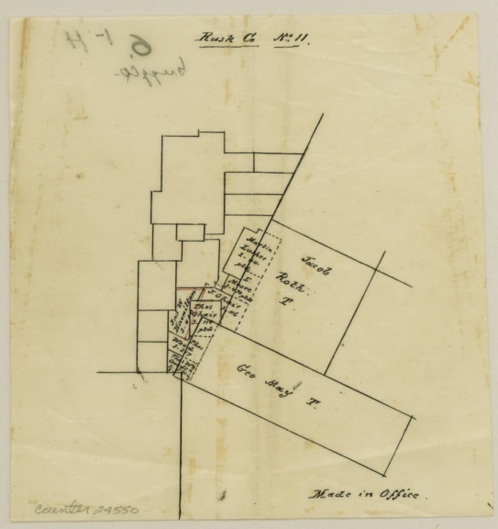
Gregg County Sketch File 1H
[Sketch of surveys west of Jacob Roth]
-
Map/Doc
24550
-
Collection
General Map Collection
-
People and Organizations
Pressler (Surveyor/Engineer)
-
Counties
Gregg Rusk
-
Subjects
Surveying Sketch File
-
Height x Width
5.8 x 5.4 inches
14.7 x 13.7 cm
-
Medium
paper, manuscript
Part of: General Map Collection
Flight Mission No. CGI-3N, Frame 162, Cameron County

Print $20.00
- Digital $50.00
Flight Mission No. CGI-3N, Frame 162, Cameron County
1954
Size 18.6 x 22.3 inches
Map/Doc 84626
Presidio County Working Sketch 98

Print $20.00
- Digital $50.00
Presidio County Working Sketch 98
1978
Size 30.9 x 31.7 inches
Map/Doc 71775
Edwards County Working Sketch 58

Print $20.00
- Digital $50.00
Edwards County Working Sketch 58
1953
Size 22.4 x 29.8 inches
Map/Doc 68934
Flight Mission No. DQO-8K, Frame 145, Galveston County

Print $20.00
- Digital $50.00
Flight Mission No. DQO-8K, Frame 145, Galveston County
1952
Size 18.6 x 22.5 inches
Map/Doc 85207
Liberty County Working Sketch 49b

Print $20.00
- Digital $50.00
Liberty County Working Sketch 49b
1955
Size 28.0 x 31.0 inches
Map/Doc 70509
Collingsworth County Working Sketch 2

Print $40.00
- Digital $50.00
Collingsworth County Working Sketch 2
1957
Size 44.2 x 122.7 inches
Map/Doc 68090
Part of Laguna Madre in Kenedy and Willacy Counties, showing Subdivision for Mineral Development

Print $40.00
- Digital $50.00
Part of Laguna Madre in Kenedy and Willacy Counties, showing Subdivision for Mineral Development
1946
Size 49.1 x 30.0 inches
Map/Doc 1924
Brewster County Working Sketch 109

Print $20.00
- Digital $50.00
Brewster County Working Sketch 109
1981
Size 25.2 x 37.0 inches
Map/Doc 67709
Wharton County Boundary File 1a

Print $12.00
- Digital $50.00
Wharton County Boundary File 1a
Size 11.7 x 9.2 inches
Map/Doc 59851
Yoakum County Sketch File 1

Print $10.00
- Digital $50.00
Yoakum County Sketch File 1
Size 9.4 x 8.3 inches
Map/Doc 40697
Wharton County Rolled Sketch 12

Print $20.00
- Digital $50.00
Wharton County Rolled Sketch 12
1986
Size 31.1 x 23.7 inches
Map/Doc 8237
Jeff Davis County Sketch File 3

Print $22.00
- Digital $50.00
Jeff Davis County Sketch File 3
Size 12.3 x 8.6 inches
Map/Doc 27892
You may also like
Falls County Working Sketch 3

Print $20.00
- Digital $50.00
Falls County Working Sketch 3
1922
Size 34.0 x 27.8 inches
Map/Doc 69178
Lamb County Working Sketch 1

Print $20.00
- Digital $50.00
Lamb County Working Sketch 1
1917
Size 40.2 x 43.4 inches
Map/Doc 70274

Flight Mission No. DCL-7C, Frame 106, Kenedy County

Print $20.00
- Digital $50.00
Flight Mission No. DCL-7C, Frame 106, Kenedy County
1943
Size 18.5 x 22.3 inches
Map/Doc 86071
Webb County Working Sketch 36

Print $40.00
- Digital $50.00
Webb County Working Sketch 36
1940
Size 38.4 x 67.3 inches
Map/Doc 72401
[Surveys in Austin's Colony along New Year's Creek]
![204, [Surveys in Austin's Colony along New Year's Creek], General Map Collection](https://historictexasmaps.com/wmedia_w700/maps/204.tif.jpg)
Print $20.00
- Digital $50.00
[Surveys in Austin's Colony along New Year's Creek]
1828
Size 12.9 x 15.5 inches
Map/Doc 204
Smith County Rolled Sketch 8

Print $20.00
- Digital $50.00
Smith County Rolled Sketch 8
2006
Size 24.7 x 37.0 inches
Map/Doc 95411
Presidio County Working Sketch 74

Print $20.00
- Digital $50.00
Presidio County Working Sketch 74
1962
Size 45.9 x 35.2 inches
Map/Doc 71751
Clay County Rolled Sketch 4A

Print $20.00
- Digital $50.00
Clay County Rolled Sketch 4A
1949
Size 22.0 x 24.0 inches
Map/Doc 5498

Gonzales County

Print $20.00
- Digital $50.00
Gonzales County
1853
Size 23.4 x 22.4 inches
Map/Doc 3591
