Austin County Sketch File 16

Print $74.00
- Digital $50.00
Austin County Sketch File 16
Size: 14.3 x 8.8 inches
13888
Brazos River, Howth Sheet

Print $6.00
- Digital $50.00
Brazos River, Howth Sheet
1936
Size: 30.5 x 30.9 inches
65276
Brazos River, Widths of Floodways/Brazos and Navasota Rivers

Print $20.00
- Digital $50.00
Brazos River, Widths of Floodways/Brazos and Navasota Rivers
1921
Size: 38.1 x 24.5 inches
65292
English Field Notes of the Spanish Archives - Book 1

English Field Notes of the Spanish Archives - Book 1
1833
96527
English Field Notes of the Spanish Archives - Book 12

English Field Notes of the Spanish Archives - Book 12
1832
96538
English Field Notes of the Spanish Archives - Book 2

English Field Notes of the Spanish Archives - Book 2
1835
96528
English Field Notes of the Spanish Archives - Book 4 & W

English Field Notes of the Spanish Archives - Book 4 & W
1836
96530
English Field Notes of the Spanish Archives - Book 5

English Field Notes of the Spanish Archives - Book 5
1835
96531
English Field Notes of the Spanish Archives - Book 8

English Field Notes of the Spanish Archives - Book 8
1835
96534
English Field Notes of the Spanish Archives - Book 9

English Field Notes of the Spanish Archives - Book 9
1835
96535
English Field Notes of the Spanish Archives - Books BTB, GA, BT, and X

English Field Notes of the Spanish Archives - Books BTB, GA, BT, and X
1835
96554
English Field Notes of the Spanish Archives - Books TJG, DB, A, A2, B, B2, WB, and WR

English Field Notes of the Spanish Archives - Books TJG, DB, A, A2, B, B2, WB, and WR
1835
96553
Fort Bend County Rolled Sketch 30 1/2

Print $20.00
- Digital $50.00
Fort Bend County Rolled Sketch 30 1/2
Size: 20.1 x 26.5 inches
5902
Fort Bend County Sketch File 18a

Print $42.00
- Digital $50.00
Fort Bend County Sketch File 18a
1890
Size: 14.7 x 8.7 inches
22940
Fort Bend County Sketch File 8

Print $6.00
- Digital $50.00
Fort Bend County Sketch File 8
Size: 6.3 x 4.2 inches
22894
Fort Bend County Working Sketch 11

Print $20.00
- Digital $50.00
Fort Bend County Working Sketch 11
1938
Size: 33.2 x 29.1 inches
69217
General Highway Map, Waller County, Texas

Print $20.00
General Highway Map, Waller County, Texas
1939
Size: 25.1 x 18.5 inches
79270
General Highway Map, Waller County, Texas

Print $20.00
General Highway Map, Waller County, Texas
1961
Size: 24.9 x 18.2 inches
79700
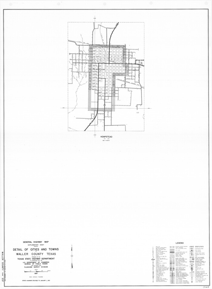
General Highway Map. Detail of Cities and Towns in Waller County, Texas [Hempstead and vicinity]
Print $20.00
General Highway Map. Detail of Cities and Towns in Waller County, Texas [Hempstead and vicinity]
1961
Size: 24.8 x 18.2 inches
79701
Grimes County Working Sketch 7

Print $20.00
- Digital $50.00
Grimes County Working Sketch 7
1963
Size: 27.2 x 33.0 inches
63298
Harris County Rolled Sketch 28

Print $20.00
- Digital $50.00
Harris County Rolled Sketch 28
Size: 29.8 x 47.3 inches
6095
Harris County Rolled Sketch 28(1)

Print $39.00
- Digital $50.00
Harris County Rolled Sketch 28(1)
Size: 10.0 x 15.3 inches
45770
Harris County Rolled Sketch 30

Print $20.00
- Digital $50.00
Harris County Rolled Sketch 30
1889
Size: 30.4 x 35.1 inches
6096
Harris County Rolled Sketch 97

Print $20.00
- Digital $50.00
Harris County Rolled Sketch 97
Size: 18.8 x 23.6 inches
6135
Harris County Sketch File 100

Print $518.00
- Digital $50.00
Harris County Sketch File 100
1991
Size: 11.5 x 8.8 inches
25674
Harris County Sketch File 15

Print $4.00
- Digital $50.00
Harris County Sketch File 15
Size: 8.0 x 8.9 inches
25359
Harris County Sketch File 18

Print $6.00
- Digital $50.00
Harris County Sketch File 18
1860
Size: 8.0 x 3.4 inches
25363
Map of Taylor, Bastrop & Houston Railroad in Austin County

Print $20.00
- Digital $50.00
Map of Taylor, Bastrop & Houston Railroad in Austin County
Size: 14.6 x 25.1 inches
64480
Map of Waller County

Print $20.00
- Digital $50.00
Map of Waller County
1897
Size: 46.7 x 28.9 inches
16915
Austin County

Print $20.00
- Digital $50.00
Austin County
1873
-
Size
23.8 x 25.8 inches
-
Map/Doc
3254
-
Creation Date
1873
Austin County Sketch File 16
Print $74.00
- Digital $50.00
Austin County Sketch File 16
-
Size
14.3 x 8.8 inches
-
Map/Doc
13888
Brazos River, Howth Sheet
Print $6.00
- Digital $50.00
Brazos River, Howth Sheet
1936
-
Size
30.5 x 30.9 inches
-
Map/Doc
65276
-
Creation Date
1936
Brazos River, Widths of Floodways/Brazos and Navasota Rivers
Print $20.00
- Digital $50.00
Brazos River, Widths of Floodways/Brazos and Navasota Rivers
1921
-
Size
38.1 x 24.5 inches
-
Map/Doc
65292
-
Creation Date
1921
English Field Notes of the Spanish Archives - Book 1
English Field Notes of the Spanish Archives - Book 1
1833
-
Map/Doc
96527
-
Creation Date
1833
English Field Notes of the Spanish Archives - Book 12
English Field Notes of the Spanish Archives - Book 12
1832
-
Map/Doc
96538
-
Creation Date
1832
English Field Notes of the Spanish Archives - Book 2
English Field Notes of the Spanish Archives - Book 2
1835
-
Map/Doc
96528
-
Creation Date
1835
English Field Notes of the Spanish Archives - Book 4 & W
English Field Notes of the Spanish Archives - Book 4 & W
1836
-
Map/Doc
96530
-
Creation Date
1836
English Field Notes of the Spanish Archives - Book 5
English Field Notes of the Spanish Archives - Book 5
1835
-
Map/Doc
96531
-
Creation Date
1835
English Field Notes of the Spanish Archives - Book 8
English Field Notes of the Spanish Archives - Book 8
1835
-
Map/Doc
96534
-
Creation Date
1835
English Field Notes of the Spanish Archives - Book 9
English Field Notes of the Spanish Archives - Book 9
1835
-
Map/Doc
96535
-
Creation Date
1835
English Field Notes of the Spanish Archives - Books BTB, GA, BT, and X
English Field Notes of the Spanish Archives - Books BTB, GA, BT, and X
1835
-
Map/Doc
96554
-
Creation Date
1835
English Field Notes of the Spanish Archives - Books TJG, DB, A, A2, B, B2, WB, and WR
English Field Notes of the Spanish Archives - Books TJG, DB, A, A2, B, B2, WB, and WR
1835
-
Map/Doc
96553
-
Creation Date
1835
Fort Bend County Rolled Sketch 30 1/2
Print $20.00
- Digital $50.00
Fort Bend County Rolled Sketch 30 1/2
-
Size
20.1 x 26.5 inches
-
Map/Doc
5902
Fort Bend County Sketch File 18a
Print $42.00
- Digital $50.00
Fort Bend County Sketch File 18a
1890
-
Size
14.7 x 8.7 inches
-
Map/Doc
22940
-
Creation Date
1890
Fort Bend County Sketch File 8
Print $6.00
- Digital $50.00
Fort Bend County Sketch File 8
-
Size
6.3 x 4.2 inches
-
Map/Doc
22894
Fort Bend County Working Sketch 11
Print $20.00
- Digital $50.00
Fort Bend County Working Sketch 11
1938
-
Size
33.2 x 29.1 inches
-
Map/Doc
69217
-
Creation Date
1938
General Highway Map, Waller County, Texas
Print $20.00
General Highway Map, Waller County, Texas
1939
-
Size
25.1 x 18.5 inches
-
Map/Doc
79270
-
Creation Date
1939
General Highway Map, Waller County, Texas
Print $20.00
General Highway Map, Waller County, Texas
1961
-
Size
24.9 x 18.2 inches
-
Map/Doc
79700
-
Creation Date
1961
General Highway Map. Detail of Cities and Towns in Waller County, Texas [Hempstead and vicinity]
Print $20.00
General Highway Map. Detail of Cities and Towns in Waller County, Texas [Hempstead and vicinity]
1961
-
Size
24.8 x 18.2 inches
-
Map/Doc
79701
-
Creation Date
1961
Grimes County Working Sketch 7
Print $20.00
- Digital $50.00
Grimes County Working Sketch 7
1963
-
Size
27.2 x 33.0 inches
-
Map/Doc
63298
-
Creation Date
1963
Harris County Rolled Sketch 28
Print $20.00
- Digital $50.00
Harris County Rolled Sketch 28
-
Size
29.8 x 47.3 inches
-
Map/Doc
6095
Harris County Rolled Sketch 28(1)
Print $39.00
- Digital $50.00
Harris County Rolled Sketch 28(1)
-
Size
10.0 x 15.3 inches
-
Map/Doc
45770
Harris County Rolled Sketch 30
Print $20.00
- Digital $50.00
Harris County Rolled Sketch 30
1889
-
Size
30.4 x 35.1 inches
-
Map/Doc
6096
-
Creation Date
1889
Harris County Rolled Sketch 97
Print $20.00
- Digital $50.00
Harris County Rolled Sketch 97
-
Size
18.8 x 23.6 inches
-
Map/Doc
6135
Harris County Sketch File 100
Print $518.00
- Digital $50.00
Harris County Sketch File 100
1991
-
Size
11.5 x 8.8 inches
-
Map/Doc
25674
-
Creation Date
1991
Harris County Sketch File 15
Print $4.00
- Digital $50.00
Harris County Sketch File 15
-
Size
8.0 x 8.9 inches
-
Map/Doc
25359
Harris County Sketch File 18
Print $6.00
- Digital $50.00
Harris County Sketch File 18
1860
-
Size
8.0 x 3.4 inches
-
Map/Doc
25363
-
Creation Date
1860
Map of Taylor, Bastrop & Houston Railroad in Austin County
Print $20.00
- Digital $50.00
Map of Taylor, Bastrop & Houston Railroad in Austin County
-
Size
14.6 x 25.1 inches
-
Map/Doc
64480
Map of Waller County
Print $20.00
- Digital $50.00
Map of Waller County
1897
-
Size
46.7 x 28.9 inches
-
Map/Doc
16915
-
Creation Date
1897