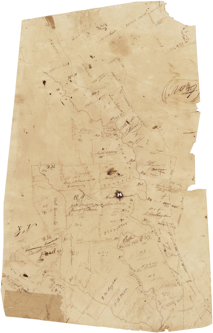
[Surveys in Austin's Colony along the San Bernardo River, West Bernardo River, and Lone Tree Creek]
Print $20.00
- Digital $50.00
[Surveys in Austin's Colony along the San Bernardo River, West Bernardo River, and Lone Tree Creek]
1830
Size: 28.3 x 17.8 inches
194
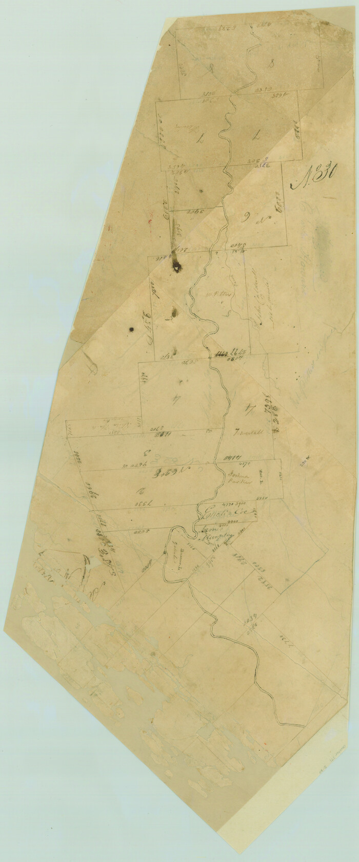
[Surveys in Austin's Colony along the Colorado River]
Print $20.00
- Digital $50.00
[Surveys in Austin's Colony along the Colorado River]
1830
Size: 30.5 x 12.7 inches
171
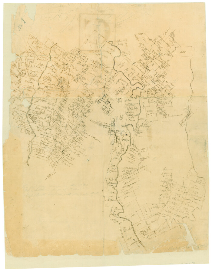
[Surveys along the Colorado and Navidad Rivers]
Print $20.00
- Digital $50.00
[Surveys along the Colorado and Navidad Rivers]
1840
Size: 28.6 x 22.5 inches
60
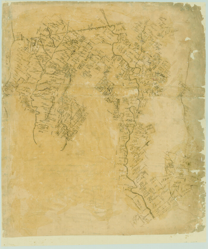
[Surveys along the Colorado River]
Print $20.00
- Digital $50.00
[Surveys along the Colorado River]
Size: 28.6 x 24.0 inches
49
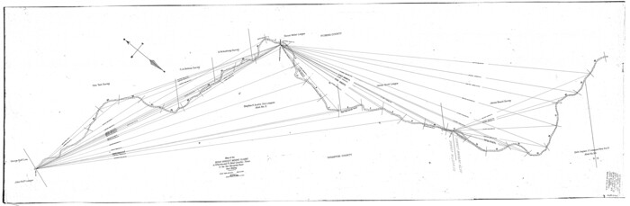
[Sketch for Mineral Application 19560 - 19588 - San Bernard River]
Print $40.00
- Digital $50.00
[Sketch for Mineral Application 19560 - 19588 - San Bernard River]
1928
Size: 33.0 x 98.6 inches
65579
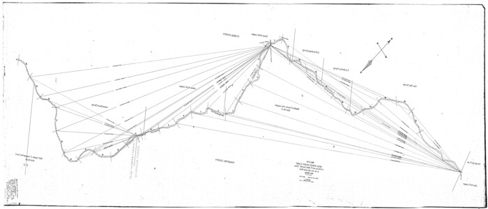
[Sketch for Mineral Application 19560 - 19588 - San Bernard River]
Print $40.00
- Digital $50.00
[Sketch for Mineral Application 19560 - 19588 - San Bernard River]
1928
Size: 98.2 x 33.1 inches
65580
[Sketch for Mineral Application 19560 - 19588 - San Bernard River]
Print $40.00
- Digital $50.00
[Sketch for Mineral Application 19560 - 19588 - San Bernard River]
Size: 32.7 x 97.6 inches
65659
[Sketch for Mineral Application 19560 - 19588 - San Bernard River]
Print $40.00
- Digital $50.00
[Sketch for Mineral Application 19560 - 19588 - San Bernard River]
Size: 98.0 x 33.0 inches
65660
[Sketch for Mineral Application 19560 - 19588 - San Bernard River]
Print $40.00
- Digital $50.00
[Sketch for Mineral Application 19560 - 19588 - San Bernard River]
Size: 32.3 x 98.5 inches
65661
[Sketch for Mineral Application 19560 - 19588 - San Bernard River]
Print $40.00
- Digital $50.00
[Sketch for Mineral Application 19560 - 19588 - San Bernard River]
Size: 31.6 x 73.6 inches
65662
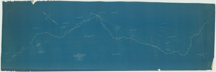
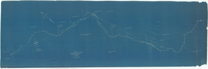
[San Antonio & Aransas Pass R.R. Right of Way from Eagle Lake to Brazos River]
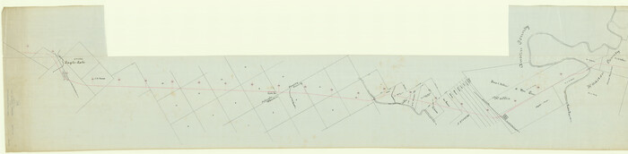
Print $40.00
- Digital $50.00
[San Antonio & Aransas Pass R.R. Right of Way from Eagle Lake to Brazos River]
1895
Size: 30.8 x 124.9 inches
64256
[New York, Texas & Mexican Railway]
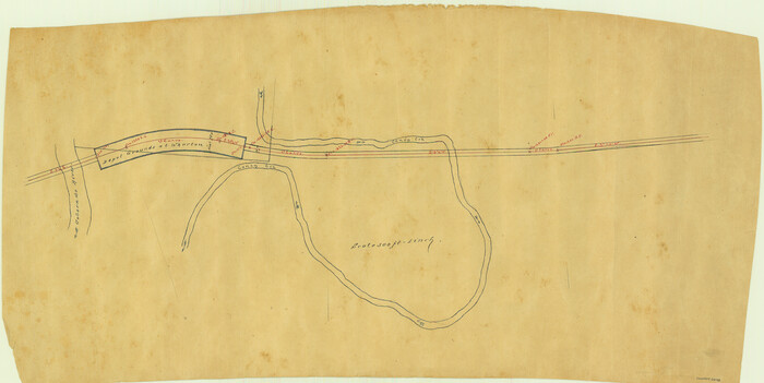
Print $20.00
- Digital $50.00
[New York, Texas & Mexican Railway]
Size: 12.1 x 24.1 inches
64148
Working Sketch in Matagorda County

Print $20.00
- Digital $50.00
Working Sketch in Matagorda County
1890
Size: 36.6 x 22.7 inches
4479
Wharton County Working Sketch Graphic Index

Print $20.00
- Digital $50.00
Wharton County Working Sketch Graphic Index
1946
Size: 41.7 x 47.5 inches
76737
Wharton County Working Sketch 9

Print $3.00
- Digital $50.00
Wharton County Working Sketch 9
1982
Size: 12.4 x 10.4 inches
72473
Wharton County Working Sketch 8

Print $20.00
- Digital $50.00
Wharton County Working Sketch 8
1983
Size: 37.2 x 32.3 inches
72472
Wharton County Working Sketch 7

Print $20.00
- Digital $50.00
Wharton County Working Sketch 7
1989
Size: 27.7 x 24.9 inches
72471
Wharton County Working Sketch 6

Print $20.00
- Digital $50.00
Wharton County Working Sketch 6
1990
Size: 24.7 x 21.1 inches
72470
Wharton County Working Sketch 5

Print $20.00
- Digital $50.00
Wharton County Working Sketch 5
Size: 20.2 x 15.6 inches
72469
Wharton County Working Sketch 4

Print $20.00
- Digital $50.00
Wharton County Working Sketch 4
Size: 16.3 x 21.3 inches
72468
Wharton County Working Sketch 3

Print $20.00
- Digital $50.00
Wharton County Working Sketch 3
Size: 17.5 x 16.4 inches
72467
Wharton County Working Sketch 25

Print $20.00
- Digital $50.00
Wharton County Working Sketch 25
1993
Size: 20.0 x 25.5 inches
72489
Wharton County Working Sketch 24

Print $20.00
- Digital $50.00
Wharton County Working Sketch 24
1909
Size: 13.3 x 14.2 inches
72488
Wharton County Working Sketch 23

Print $20.00
- Digital $50.00
Wharton County Working Sketch 23
1919
Size: 22.0 x 36.0 inches
72487
Wharton County Working Sketch 22

Print $20.00
- Digital $50.00
Wharton County Working Sketch 22
1919
Size: 22.1 x 17.7 inches
72486
Wharton County Working Sketch 21

Print $20.00
- Digital $50.00
Wharton County Working Sketch 21
1937
Size: 16.9 x 20.8 inches
72485
Wharton County Working Sketch 20

Print $20.00
- Digital $50.00
Wharton County Working Sketch 20
1938
Size: 39.1 x 42.2 inches
72484
Wharton County Working Sketch 2

Print $20.00
- Digital $50.00
Wharton County Working Sketch 2
Size: 29.3 x 37.3 inches
72466
Wharton County Working Sketch 19

Print $20.00
- Digital $50.00
Wharton County Working Sketch 19
1940
Size: 21.4 x 23.0 inches
72483
Wharton County Working Sketch 18

Print $20.00
- Digital $50.00
Wharton County Working Sketch 18
1948
Size: 19.3 x 17.0 inches
72482
[Surveys in Austin's Colony along the San Bernardo River, West Bernardo River, and Lone Tree Creek]
Print $20.00
- Digital $50.00
[Surveys in Austin's Colony along the San Bernardo River, West Bernardo River, and Lone Tree Creek]
1830
-
Size
28.3 x 17.8 inches
-
Map/Doc
194
-
Creation Date
1830
[Surveys in Austin's Colony along the Colorado River]
Print $20.00
- Digital $50.00
[Surveys in Austin's Colony along the Colorado River]
1830
-
Size
30.5 x 12.7 inches
-
Map/Doc
171
-
Creation Date
1830
[Surveys along the Colorado and Navidad Rivers]
Print $20.00
- Digital $50.00
[Surveys along the Colorado and Navidad Rivers]
1840
-
Size
28.6 x 22.5 inches
-
Map/Doc
60
-
Creation Date
1840
[Surveys along the Colorado River]
Print $20.00
- Digital $50.00
[Surveys along the Colorado River]
-
Size
28.6 x 24.0 inches
-
Map/Doc
49
[Sketch for Mineral Application 19560 - 19588 - San Bernard River]
Print $40.00
- Digital $50.00
[Sketch for Mineral Application 19560 - 19588 - San Bernard River]
1928
-
Size
33.0 x 98.6 inches
-
Map/Doc
65579
-
Creation Date
1928
[Sketch for Mineral Application 19560 - 19588 - San Bernard River]
Print $40.00
- Digital $50.00
[Sketch for Mineral Application 19560 - 19588 - San Bernard River]
1928
-
Size
98.2 x 33.1 inches
-
Map/Doc
65580
-
Creation Date
1928
[Sketch for Mineral Application 19560 - 19588 - San Bernard River]
Print $40.00
- Digital $50.00
[Sketch for Mineral Application 19560 - 19588 - San Bernard River]
-
Size
32.7 x 97.6 inches
-
Map/Doc
65659
[Sketch for Mineral Application 19560 - 19588 - San Bernard River]
Print $40.00
- Digital $50.00
[Sketch for Mineral Application 19560 - 19588 - San Bernard River]
-
Size
98.0 x 33.0 inches
-
Map/Doc
65660
[Sketch for Mineral Application 19560 - 19588 - San Bernard River]
Print $40.00
- Digital $50.00
[Sketch for Mineral Application 19560 - 19588 - San Bernard River]
-
Size
32.3 x 98.5 inches
-
Map/Doc
65661
[Sketch for Mineral Application 19560 - 19588 - San Bernard River]
Print $40.00
- Digital $50.00
[Sketch for Mineral Application 19560 - 19588 - San Bernard River]
-
Size
31.6 x 73.6 inches
-
Map/Doc
65662
[San Antonio & Aransas Pass R.R. Right of Way from Eagle Lake to Brazos River]
Print $40.00
- Digital $50.00
[San Antonio & Aransas Pass R.R. Right of Way from Eagle Lake to Brazos River]
1895
-
Size
30.8 x 124.9 inches
-
Map/Doc
64256
-
Creation Date
1895
[New York, Texas & Mexican Railway]
Print $20.00
- Digital $50.00
[New York, Texas & Mexican Railway]
-
Size
12.1 x 24.1 inches
-
Map/Doc
64148
Working Sketch in Matagorda County
Print $20.00
- Digital $50.00
Working Sketch in Matagorda County
1890
-
Size
36.6 x 22.7 inches
-
Map/Doc
4479
-
Creation Date
1890
Wharton County Working Sketch Graphic Index
Print $20.00
- Digital $50.00
Wharton County Working Sketch Graphic Index
1946
-
Size
41.7 x 47.5 inches
-
Map/Doc
76737
-
Creation Date
1946
Wharton County Working Sketch 9
Print $3.00
- Digital $50.00
Wharton County Working Sketch 9
1982
-
Size
12.4 x 10.4 inches
-
Map/Doc
72473
-
Creation Date
1982
Wharton County Working Sketch 8
Print $20.00
- Digital $50.00
Wharton County Working Sketch 8
1983
-
Size
37.2 x 32.3 inches
-
Map/Doc
72472
-
Creation Date
1983
Wharton County Working Sketch 7
Print $20.00
- Digital $50.00
Wharton County Working Sketch 7
1989
-
Size
27.7 x 24.9 inches
-
Map/Doc
72471
-
Creation Date
1989
Wharton County Working Sketch 6
Print $20.00
- Digital $50.00
Wharton County Working Sketch 6
1990
-
Size
24.7 x 21.1 inches
-
Map/Doc
72470
-
Creation Date
1990
Wharton County Working Sketch 5
Print $20.00
- Digital $50.00
Wharton County Working Sketch 5
-
Size
20.2 x 15.6 inches
-
Map/Doc
72469
Wharton County Working Sketch 4
Print $20.00
- Digital $50.00
Wharton County Working Sketch 4
-
Size
16.3 x 21.3 inches
-
Map/Doc
72468
Wharton County Working Sketch 3
Print $20.00
- Digital $50.00
Wharton County Working Sketch 3
-
Size
17.5 x 16.4 inches
-
Map/Doc
72467
Wharton County Working Sketch 25
Print $20.00
- Digital $50.00
Wharton County Working Sketch 25
1993
-
Size
20.0 x 25.5 inches
-
Map/Doc
72489
-
Creation Date
1993
Wharton County Working Sketch 24
Print $20.00
- Digital $50.00
Wharton County Working Sketch 24
1909
-
Size
13.3 x 14.2 inches
-
Map/Doc
72488
-
Creation Date
1909
Wharton County Working Sketch 23
Print $20.00
- Digital $50.00
Wharton County Working Sketch 23
1919
-
Size
22.0 x 36.0 inches
-
Map/Doc
72487
-
Creation Date
1919
Wharton County Working Sketch 22
Print $20.00
- Digital $50.00
Wharton County Working Sketch 22
1919
-
Size
22.1 x 17.7 inches
-
Map/Doc
72486
-
Creation Date
1919
Wharton County Working Sketch 21
Print $20.00
- Digital $50.00
Wharton County Working Sketch 21
1937
-
Size
16.9 x 20.8 inches
-
Map/Doc
72485
-
Creation Date
1937
Wharton County Working Sketch 20
Print $20.00
- Digital $50.00
Wharton County Working Sketch 20
1938
-
Size
39.1 x 42.2 inches
-
Map/Doc
72484
-
Creation Date
1938
Wharton County Working Sketch 2
Print $20.00
- Digital $50.00
Wharton County Working Sketch 2
-
Size
29.3 x 37.3 inches
-
Map/Doc
72466
Wharton County Working Sketch 19
Print $20.00
- Digital $50.00
Wharton County Working Sketch 19
1940
-
Size
21.4 x 23.0 inches
-
Map/Doc
72483
-
Creation Date
1940
Wharton County Working Sketch 18
Print $20.00
- Digital $50.00
Wharton County Working Sketch 18
1948
-
Size
19.3 x 17.0 inches
-
Map/Doc
72482
-
Creation Date
1948