[Sketch for Mineral Application 36425 - Jefferson County, Ley C. Moore]
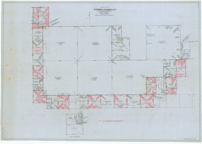
Print $40.00
- Digital $50.00
[Sketch for Mineral Application 36425 - Jefferson County, Ley C. Moore]
1942
Size: 35.0 x 49.3 inches
65615
[Sketch for Mineral Application 36425 - Jefferson County, Ley C. Moore]
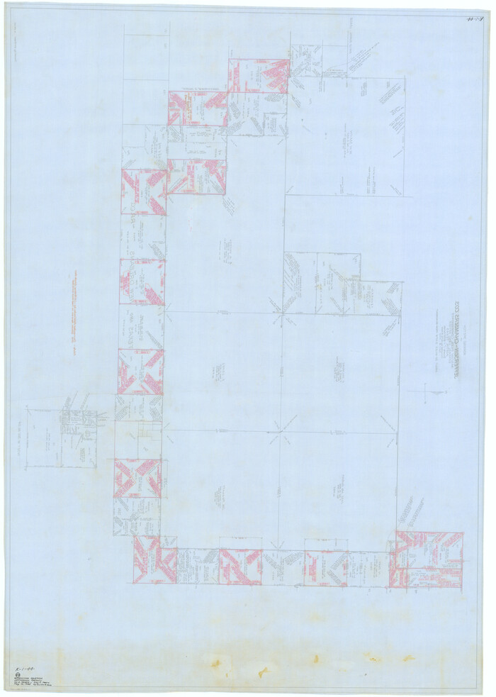
Print $40.00
- Digital $50.00
[Sketch for Mineral Application 36425 - Jefferson County, Ley C. Moore]
1942
Size: 49.2 x 35.0 inches
65616
[Sketch for Mineral Application 35981 - Liberty County, John Mecom]
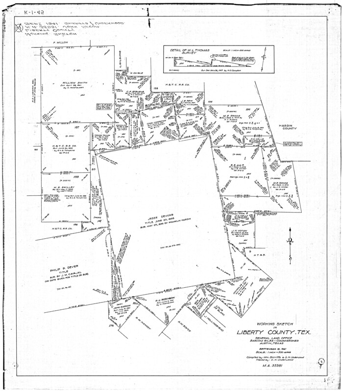
Print $20.00
- Digital $50.00
[Sketch for Mineral Application 35981 - Liberty County, John Mecom]
1941
Size: 30.2 x 26.5 inches
65617
[Sketch for Mineral Application 35981 - Liberty County, John Mecom]
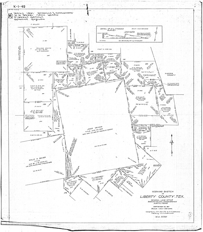
Print $20.00
- Digital $50.00
[Sketch for Mineral Application 35981 - Liberty County, John Mecom]
1941
Size: 30.1 x 26.4 inches
65618
[Sketch for Mineral Application 35811 - Liberty County, John Mecom]
Print $4.00
- Digital $50.00
[Sketch for Mineral Application 35811 - Liberty County, John Mecom]
1941
Size: 24.9 x 20.0 inches
65619
[Sketch for Mineral Application 35811 - Liberty County, John Mecom]
Print $4.00
- Digital $50.00
[Sketch for Mineral Application 35811 - Liberty County, John Mecom]
1941
Size: 24.8 x 19.7 inches
65620
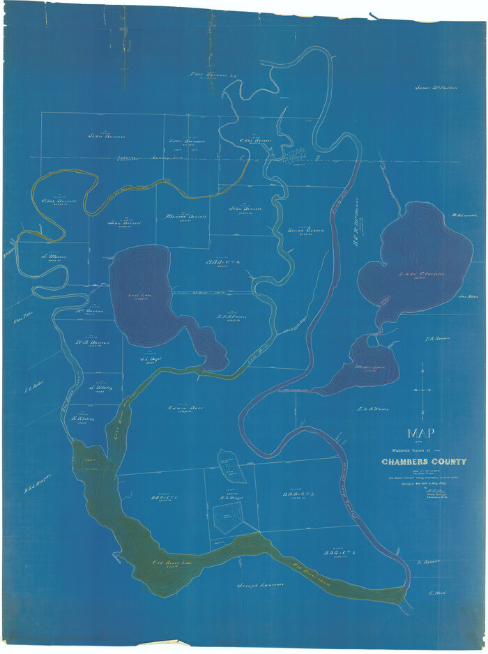
[Sketch for Mineral Application 13441 - Trinity River, Miller's Lake, Charlotte Lake, Florence Dunn]
Print $40.00
- Digital $50.00
[Sketch for Mineral Application 13441 - Trinity River, Miller's Lake, Charlotte Lake, Florence Dunn]
1925
Size: 104.1 x 43.3 inches
65657
[Sketch for Mineral Application 13441 - Trinity River, Miller's Lake, Charlotte Lake, Florence Dunn]
Print $40.00
- Digital $50.00
[Sketch for Mineral Application 13441 - Trinity River, Miller's Lake, Charlotte Lake, Florence Dunn]
1925
Size: 103.6 x 43.1 inches
65658
[Sketch for Mineral Application 13436 - 13441]
Print $40.00
- Digital $50.00
[Sketch for Mineral Application 13436 - 13441]
1925
Size: 56.8 x 42.4 inches
65581
[Sketch for Mineral Application 13436 - 13441]
Print $40.00
- Digital $50.00
[Sketch for Mineral Application 13436 - 13441]
1925
Size: 56.8 x 42.5 inches
65582
[Sketch for M-12871 to M-13240 - Presidio County]
Print $20.00
- Digital $50.00
[Sketch for M-12871 to M-13240 - Presidio County]
1927
Size: 33.0 x 30.5 inches
65649
[Sketch for M-12871 to M-13240 - Presidio County]
Print $20.00
- Digital $50.00
[Sketch for M-12871 to M-13240 - Presidio County]
1927
Size: 30.6 x 33.0 inches
65650
[Oil and Gas Fields in West Texas]
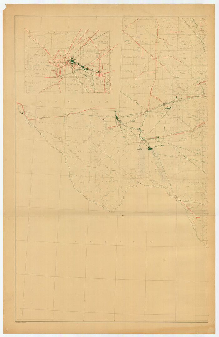
Print $40.00
- Digital $50.00
[Oil and Gas Fields in West Texas]
Size: 38.5 x 59.2 inches
89884
The Oil and Gas Journal's Oil Map of Texas

Print $20.00
- Digital $50.00
The Oil and Gas Journal's Oil Map of Texas
1938
Size: 38.3 x 39.4 inches
96970
Texas-Louisiana Gulf Coastal Region showing Oil & Gas Fields & Prospects, Pipe Lines, Refineries & Principal Highways

Print $20.00
- Digital $50.00
Texas-Louisiana Gulf Coastal Region showing Oil & Gas Fields & Prospects, Pipe Lines, Refineries & Principal Highways
1933
Size: 22.4 x 44.2 inches
96874
Texas Oil and Gas Fields and Truck Pipe Line Systems

Print $20.00
Texas Oil and Gas Fields and Truck Pipe Line Systems
1926
Size: 21.7 x 30.8 inches
79327
Texas Land Commissioner George P. Bush's Energy Map of Texas Showing Significant Events and Well & Pipeline Locations Between 1543 and 2015

Print $20.00
- Digital $50.00
Texas Land Commissioner George P. Bush's Energy Map of Texas Showing Significant Events and Well & Pipeline Locations Between 1543 and 2015
2015
Size: 33.3 x 36.3 inches
93978
Souvenir - Opening and Dedication of the General Oil Company's New West Texas Oil Field

Souvenir - Opening and Dedication of the General Oil Company's New West Texas Oil Field
1920
97263
Selected List of Wells accompanying Map of Wyoming showing Test Wells for Oil and Gas, Anticlinal Axes, Oil and Gas Fields, Pipelines, Unit Areas, and Land 3 District Boundaries, 1949

Print $20.00
- Digital $50.00
Selected List of Wells accompanying Map of Wyoming showing Test Wells for Oil and Gas, Anticlinal Axes, Oil and Gas Fields, Pipelines, Unit Areas, and Land 3 District Boundaries, 1949
1949
Size: 26.2 x 41.5 inches
89690
Revised map of Jefferson County, Texas showing land surveys, railroads and water ways

Print $20.00
- Digital $50.00
Revised map of Jefferson County, Texas showing land surveys, railroads and water ways
1898
Size: 27.2 x 24.1 inches
95912
Report of Construction re: MA 46948, H. C. Henson

Print $2.00
- Digital $50.00
Report of Construction re: MA 46948, H. C. Henson
1954
Size: 11.1 x 8.9 inches
62571

Oil and Gas Fields of the State of Texas

Print $40.00
- Digital $50.00
Oil and Gas Fields of the State of Texas
1931
Size: 38.4 x 59.2 inches
89885
Oil and Gas Fields in the State of Texas

Print $40.00
Oil and Gas Fields in the State of Texas
1927
Size: 58.2 x 38.1 inches
76303
Oil and Gas Fields in the State of Texas

Print $40.00
Oil and Gas Fields in the State of Texas
1927
Size: 58.0 x 38.0 inches
76304
Oil Map of Texas and Oklahoma showing the location and approximate area of the Oil and Gas Fields

Print $20.00
- Digital $50.00
Oil Map of Texas and Oklahoma showing the location and approximate area of the Oil and Gas Fields
1920
Size: 20.8 x 23.9 inches
95897
Oil Fields of the Texas-Louisiana Gulf Coastal Plain

Oil Fields of the Texas-Louisiana Gulf Coastal Plain
1903
97518
Oil Development and Structural Map showing Schott, Mirando and other oil fields of the Laredo District with present and proposed development.

Print $20.00
- Digital $50.00
Oil Development and Structural Map showing Schott, Mirando and other oil fields of the Laredo District with present and proposed development.
1920
Size: 11.3 x 8.9 inches
94107
New Oil and Geological Map of Texas showing Oil Fields, Pipe Lines, Refineries, Geological Formations, Etc.

Print $20.00
- Digital $50.00
New Oil and Geological Map of Texas showing Oil Fields, Pipe Lines, Refineries, Geological Formations, Etc.
1920
Size: 22.5 x 31.3 inches
96633
Mineral Locality Map of Texas Showing Occurances of Useful Minerals, Rocks, Oil and Gas, and Other Geologic Substances

Print $40.00
- Digital $50.00
Mineral Locality Map of Texas Showing Occurances of Useful Minerals, Rocks, Oil and Gas, and Other Geologic Substances
1945
Size: 43.8 x 53.0 inches
94140
[Sketch for Mineral Application 36425 - Jefferson County, Ley C. Moore]
Print $40.00
- Digital $50.00
[Sketch for Mineral Application 36425 - Jefferson County, Ley C. Moore]
1942
-
Size
35.0 x 49.3 inches
-
Map/Doc
65615
-
Creation Date
1942
[Sketch for Mineral Application 36425 - Jefferson County, Ley C. Moore]
Print $40.00
- Digital $50.00
[Sketch for Mineral Application 36425 - Jefferson County, Ley C. Moore]
1942
-
Size
49.2 x 35.0 inches
-
Map/Doc
65616
-
Creation Date
1942
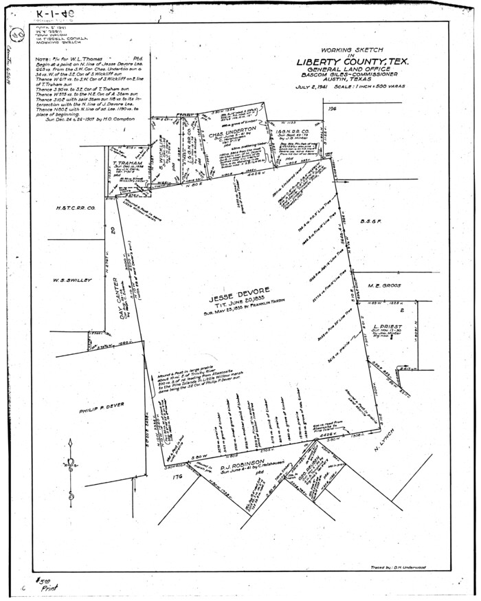
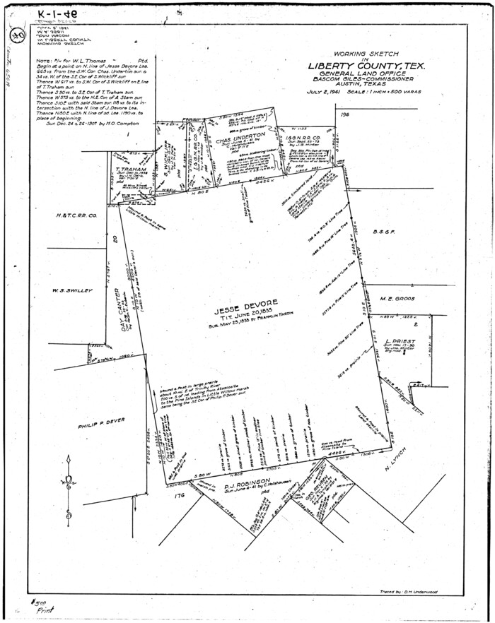
[Sketch for Mineral Application 35981 - Liberty County, John Mecom]
Print $20.00
- Digital $50.00
[Sketch for Mineral Application 35981 - Liberty County, John Mecom]
1941
-
Size
30.2 x 26.5 inches
-
Map/Doc
65617
-
Creation Date
1941
[Sketch for Mineral Application 35981 - Liberty County, John Mecom]
Print $20.00
- Digital $50.00
[Sketch for Mineral Application 35981 - Liberty County, John Mecom]
1941
-
Size
30.1 x 26.4 inches
-
Map/Doc
65618
-
Creation Date
1941
[Sketch for Mineral Application 35811 - Liberty County, John Mecom]
Print $4.00
- Digital $50.00
[Sketch for Mineral Application 35811 - Liberty County, John Mecom]
1941
-
Size
24.9 x 20.0 inches
-
Map/Doc
65619
-
Creation Date
1941
[Sketch for Mineral Application 35811 - Liberty County, John Mecom]
Print $4.00
- Digital $50.00
[Sketch for Mineral Application 35811 - Liberty County, John Mecom]
1941
-
Size
24.8 x 19.7 inches
-
Map/Doc
65620
-
Creation Date
1941
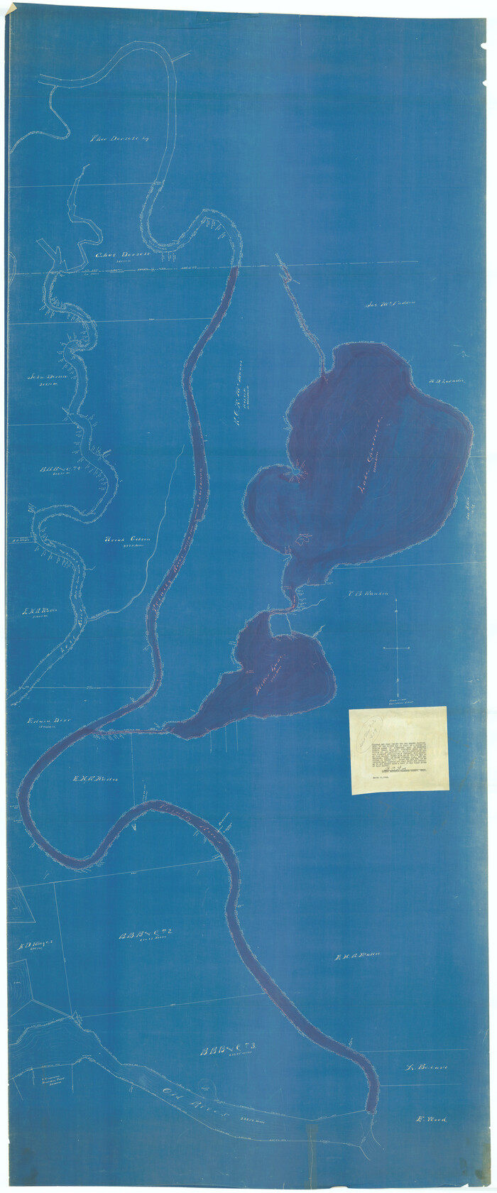
[Sketch for Mineral Application 13441 - Trinity River, Miller's Lake, Charlotte Lake, Florence Dunn]
Print $40.00
- Digital $50.00
[Sketch for Mineral Application 13441 - Trinity River, Miller's Lake, Charlotte Lake, Florence Dunn]
1925
-
Size
104.1 x 43.3 inches
-
Map/Doc
65657
-
Creation Date
1925
[Sketch for Mineral Application 13441 - Trinity River, Miller's Lake, Charlotte Lake, Florence Dunn]
Print $40.00
- Digital $50.00
[Sketch for Mineral Application 13441 - Trinity River, Miller's Lake, Charlotte Lake, Florence Dunn]
1925
-
Size
103.6 x 43.1 inches
-
Map/Doc
65658
-
Creation Date
1925
[Sketch for Mineral Application 13436 - 13441]
Print $40.00
- Digital $50.00
[Sketch for Mineral Application 13436 - 13441]
1925
-
Size
56.8 x 42.4 inches
-
Map/Doc
65581
-
Creation Date
1925
[Sketch for Mineral Application 13436 - 13441]
Print $40.00
- Digital $50.00
[Sketch for Mineral Application 13436 - 13441]
1925
-
Size
56.8 x 42.5 inches
-
Map/Doc
65582
-
Creation Date
1925
[Sketch for M-12871 to M-13240 - Presidio County]
Print $20.00
- Digital $50.00
[Sketch for M-12871 to M-13240 - Presidio County]
1927
-
Size
33.0 x 30.5 inches
-
Map/Doc
65649
-
Creation Date
1927
[Sketch for M-12871 to M-13240 - Presidio County]
Print $20.00
- Digital $50.00
[Sketch for M-12871 to M-13240 - Presidio County]
1927
-
Size
30.6 x 33.0 inches
-
Map/Doc
65650
-
Creation Date
1927
[Oil and Gas Fields in West Texas]
Print $40.00
- Digital $50.00
[Oil and Gas Fields in West Texas]
-
Size
38.5 x 59.2 inches
-
Map/Doc
89884
The Oil and Gas Journal's Oil Map of Texas
Print $20.00
- Digital $50.00
The Oil and Gas Journal's Oil Map of Texas
1938
-
Size
38.3 x 39.4 inches
-
Map/Doc
96970
-
Creation Date
1938
Texas-Louisiana Gulf Coastal Region showing Oil & Gas Fields & Prospects, Pipe Lines, Refineries & Principal Highways
Print $20.00
- Digital $50.00
Texas-Louisiana Gulf Coastal Region showing Oil & Gas Fields & Prospects, Pipe Lines, Refineries & Principal Highways
1933
-
Size
22.4 x 44.2 inches
-
Map/Doc
96874
-
Creation Date
1933
Texas Oil and Gas Fields and Truck Pipe Line Systems
Print $20.00
Texas Oil and Gas Fields and Truck Pipe Line Systems
1926
-
Size
21.7 x 30.8 inches
-
Map/Doc
79327
-
Creation Date
1926
Texas Land Commissioner George P. Bush's Energy Map of Texas Showing Significant Events and Well & Pipeline Locations Between 1543 and 2015
Print $20.00
- Digital $50.00
Texas Land Commissioner George P. Bush's Energy Map of Texas Showing Significant Events and Well & Pipeline Locations Between 1543 and 2015
2015
-
Size
33.3 x 36.3 inches
-
Map/Doc
93978
-
Creation Date
2015
Souvenir - Opening and Dedication of the General Oil Company's New West Texas Oil Field
Souvenir - Opening and Dedication of the General Oil Company's New West Texas Oil Field
1920
-
Map/Doc
97263
-
Creation Date
1920
Selected List of Wells accompanying Map of Wyoming showing Test Wells for Oil and Gas, Anticlinal Axes, Oil and Gas Fields, Pipelines, Unit Areas, and Land 3 District Boundaries, 1949
Print $20.00
- Digital $50.00
Selected List of Wells accompanying Map of Wyoming showing Test Wells for Oil and Gas, Anticlinal Axes, Oil and Gas Fields, Pipelines, Unit Areas, and Land 3 District Boundaries, 1949
1949
-
Size
26.2 x 41.5 inches
-
Map/Doc
89690
-
Creation Date
1949
Revised map of Jefferson County, Texas showing land surveys, railroads and water ways
Print $20.00
- Digital $50.00
Revised map of Jefferson County, Texas showing land surveys, railroads and water ways
1898
-
Size
27.2 x 24.1 inches
-
Map/Doc
95912
-
Creation Date
1898
Report of Construction re: MA 46948, H. C. Henson
Print $2.00
- Digital $50.00
Report of Construction re: MA 46948, H. C. Henson
1954
-
Size
11.1 x 8.9 inches
-
Map/Doc
62571
-
Creation Date
1954
Oil and Gas Fields of the State of Texas
Print $40.00
- Digital $50.00
Oil and Gas Fields of the State of Texas
1931
-
Size
38.4 x 59.2 inches
-
Map/Doc
89885
-
Creation Date
1931
Oil and Gas Fields in the State of Texas
Print $40.00
Oil and Gas Fields in the State of Texas
1927
-
Size
58.2 x 38.1 inches
-
Map/Doc
76303
-
Creation Date
1927
Oil and Gas Fields in the State of Texas
Print $40.00
Oil and Gas Fields in the State of Texas
1927
-
Size
58.0 x 38.0 inches
-
Map/Doc
76304
-
Creation Date
1927
Oil Map of Texas and Oklahoma showing the location and approximate area of the Oil and Gas Fields
Print $20.00
- Digital $50.00
Oil Map of Texas and Oklahoma showing the location and approximate area of the Oil and Gas Fields
1920
-
Size
20.8 x 23.9 inches
-
Map/Doc
95897
-
Creation Date
1920
Oil Fields of the Texas-Louisiana Gulf Coastal Plain
Oil Fields of the Texas-Louisiana Gulf Coastal Plain
1903
-
Map/Doc
97518
-
Creation Date
1903
Oil Development and Structural Map showing Schott, Mirando and other oil fields of the Laredo District with present and proposed development.
Print $20.00
- Digital $50.00
Oil Development and Structural Map showing Schott, Mirando and other oil fields of the Laredo District with present and proposed development.
1920
-
Size
11.3 x 8.9 inches
-
Map/Doc
94107
-
Creation Date
1920
New Oil and Geological Map of Texas showing Oil Fields, Pipe Lines, Refineries, Geological Formations, Etc.
Print $20.00
- Digital $50.00
New Oil and Geological Map of Texas showing Oil Fields, Pipe Lines, Refineries, Geological Formations, Etc.
1920
-
Size
22.5 x 31.3 inches
-
Map/Doc
96633
-
Creation Date
1920
Mineral Locality Map of Texas Showing Occurances of Useful Minerals, Rocks, Oil and Gas, and Other Geologic Substances
Print $40.00
- Digital $50.00
Mineral Locality Map of Texas Showing Occurances of Useful Minerals, Rocks, Oil and Gas, and Other Geologic Substances
1945
-
Size
43.8 x 53.0 inches
-
Map/Doc
94140
-
Creation Date
1945