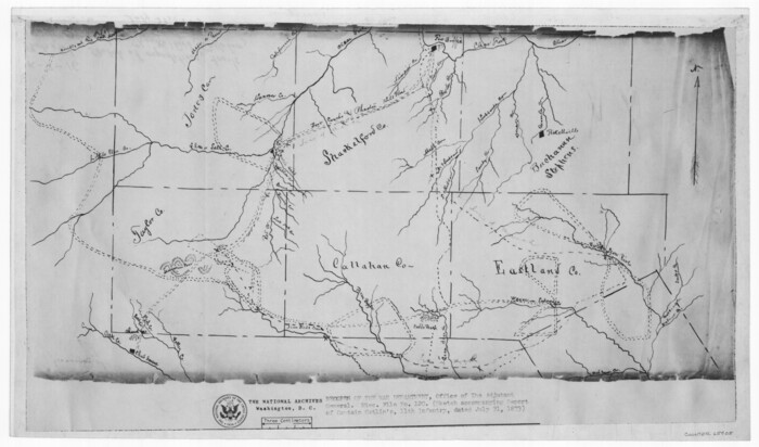
[Sketch of expeditions, trails in Jones, Taylor, Shackelford, Callahan, Buchanan/Stephens and Eastland Counties]
1873
[Sketch of expeditions, trails in Jones, Taylor, Shackelford, Callahan, Buchanan/Stephens and Eastland Counties]
1873
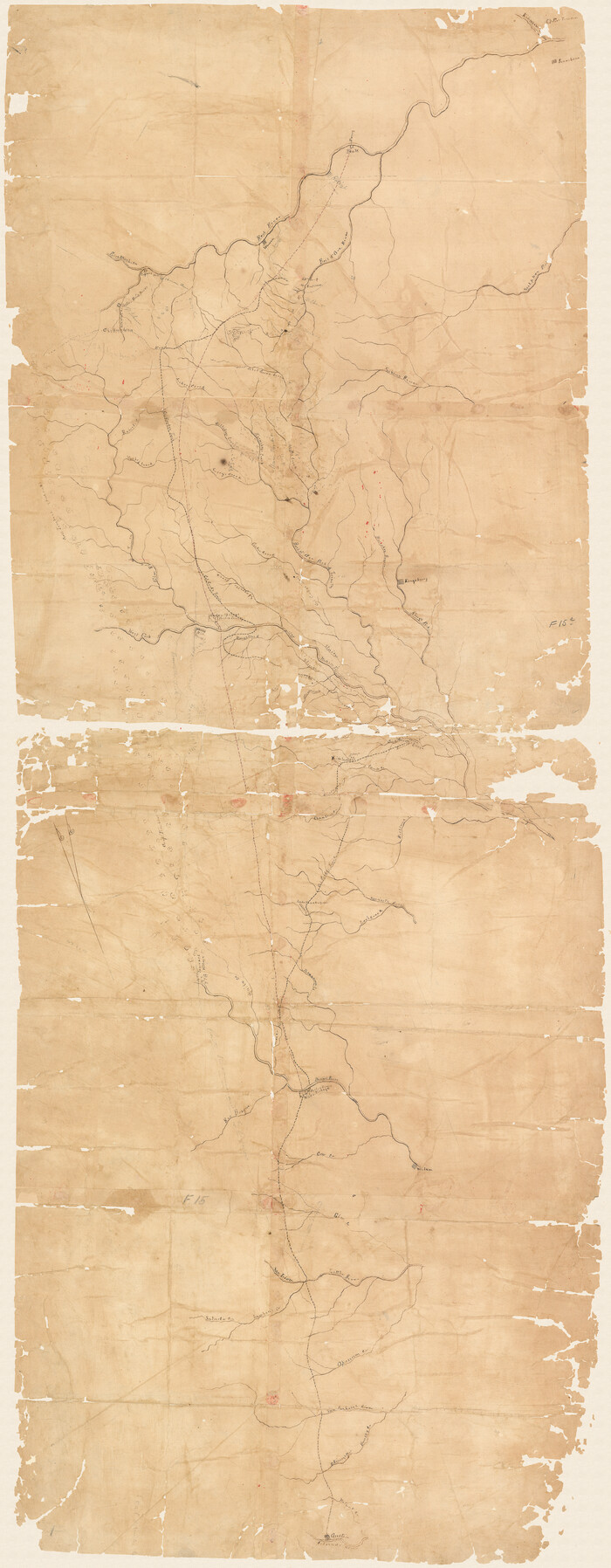
[Sketch of Col. Cooke's Military Road expedition from Red River to Austin]
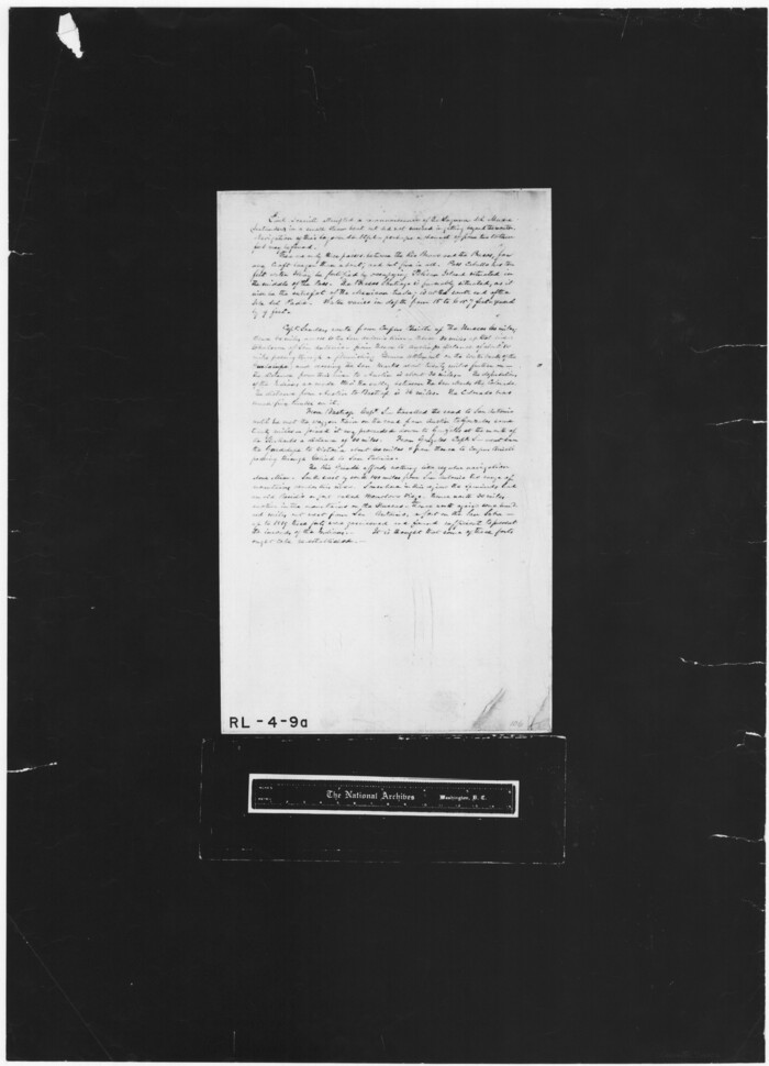
[Reconnaissance report of Lieut. Scariott around Laguna del Madre and up to Fort San Saba]
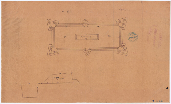
[Plan for Fort Waul near Gonzales, Texas]
1863
[Movements & Objectives of the 143rd & 144th Infantry on October 9-11, 1918, Appendix E, Nos.2 and 3] - Verso
1918
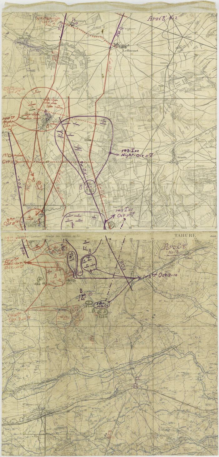
[Movements & Objectives of the 143rd & 144th Infantry on October 9-11, 1918, Appendix E, Nos.2 and 3]
1918
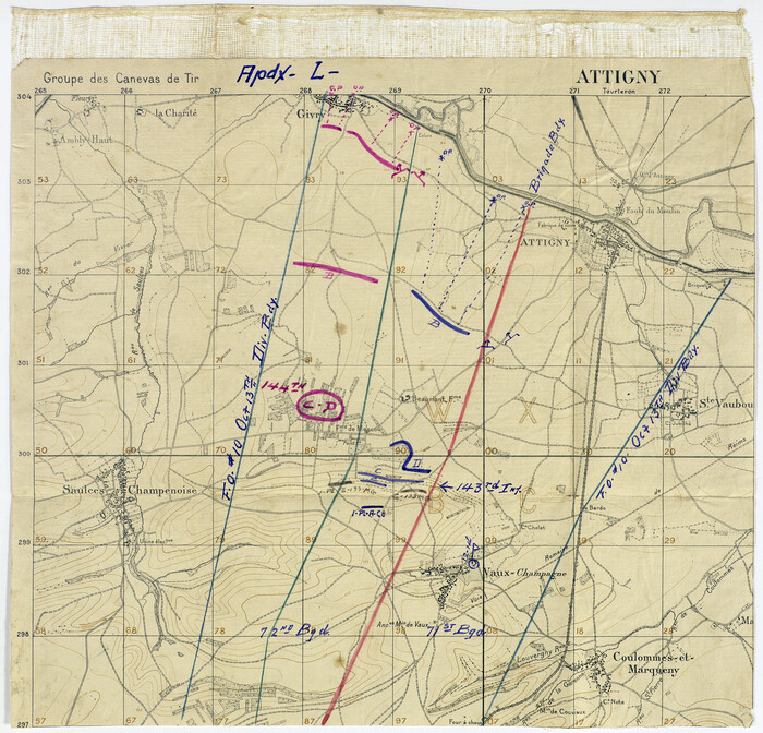
[Movements & Objectives of the 143rd & 144th Infantry on October 13, 1918, Appendix L]
1918
[Movements & Objectives of the 143rd & 144th Infantry on October 12-13, 1918] - Verso
1918
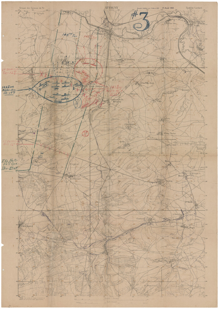
[Movements & Objectives of the 143rd & 144th Infantry on October 12-13, 1918]
1918
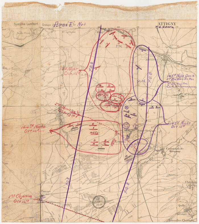
[Movements & Objectives of the 143rd & 144th Infantry on October 12-13, 1918, Appendix E, No.1]
1918
[Movements & Objectives of the 143rd & 144th Infantry and many other divisions and regiments, 1918] - Verso
1918
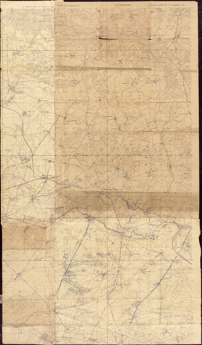
[Movements & Objectives of the 143rd & 144th Infantry and many other divisions and regiments, 1918]
1918
[Movements & Objectives of the 143rd & 144th Infantry & 133rd Machine Gun Battalion on October 8-9, 1918, Appendix E, No. 4] - Verso
1918
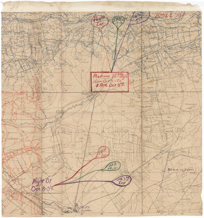
[Movements & Objectives of the 143rd & 144th Infantry & 133rd Machine Gun Battalion on October 8-9, 1918, Appendix E, No. 4]
1918
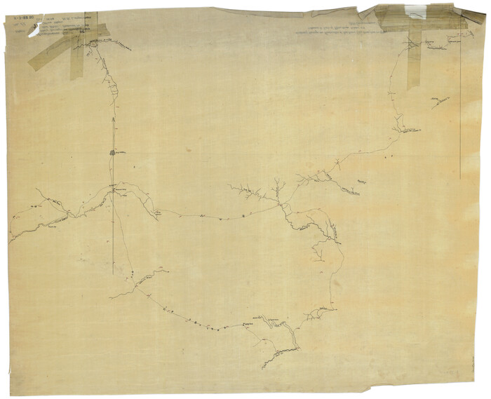
[Military surveys on headwaters of Red River]
1878
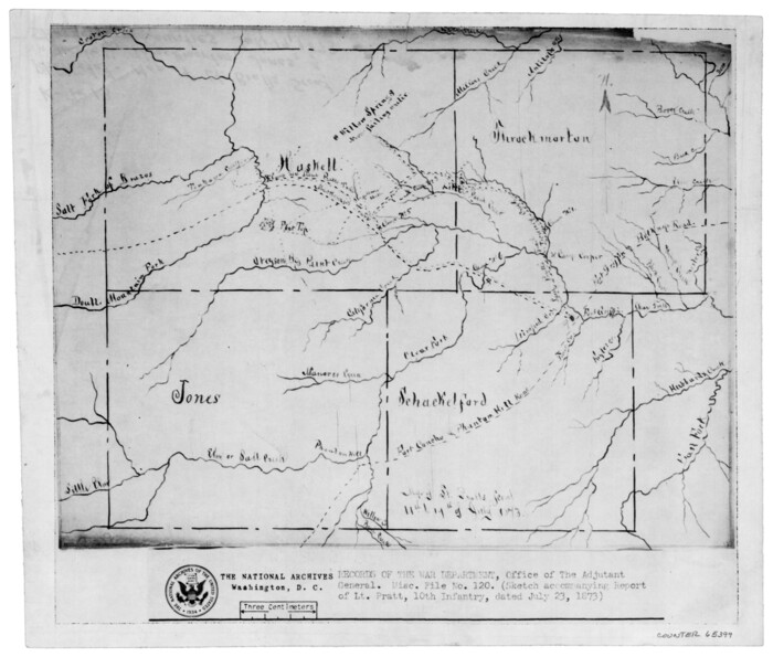
[Map of Lt. Brulls scout in Haskell, Throckmorton, Jones and Shackelford Counties]
1873
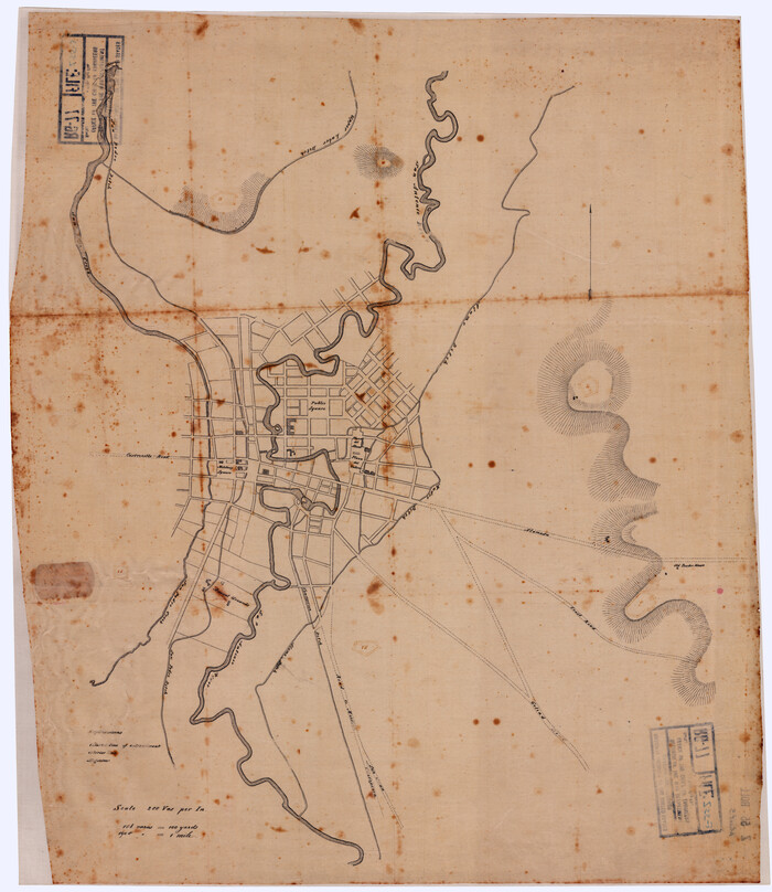
[Map of Area near Alamo showing proposed fortifications]
1863
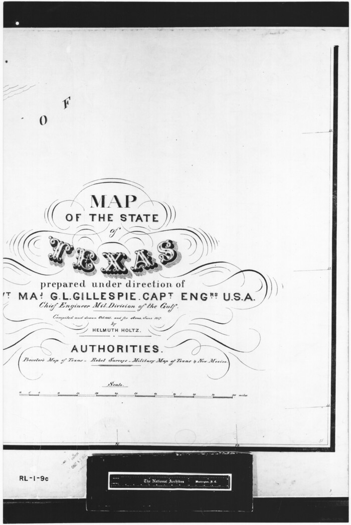
[Gulf Coast portion of] Map of the State of Texas
1865
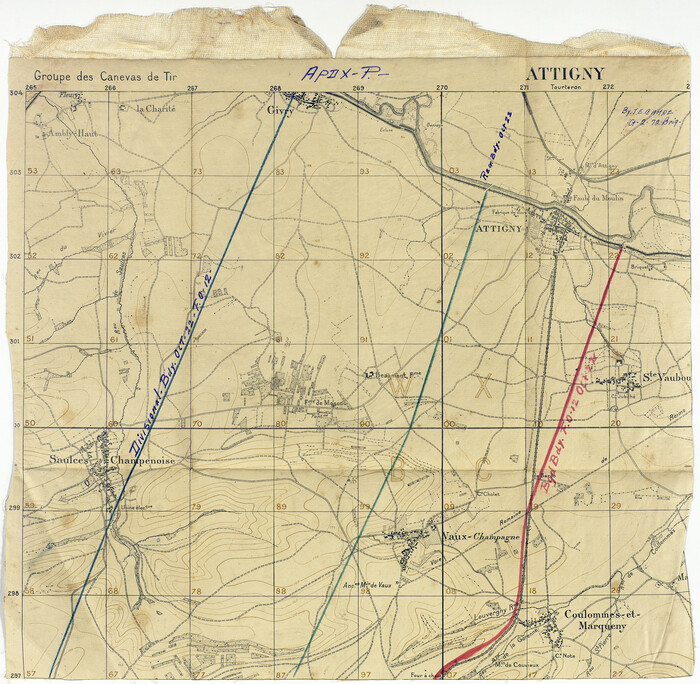
[Divisional Boundary and Brigade Boundary on October 22, 1918, Appendix P]
1918
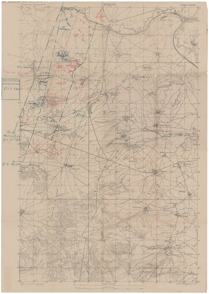
[Defensive Positions of the 143rd & 144th Infantry on October 14, 1918]
1918
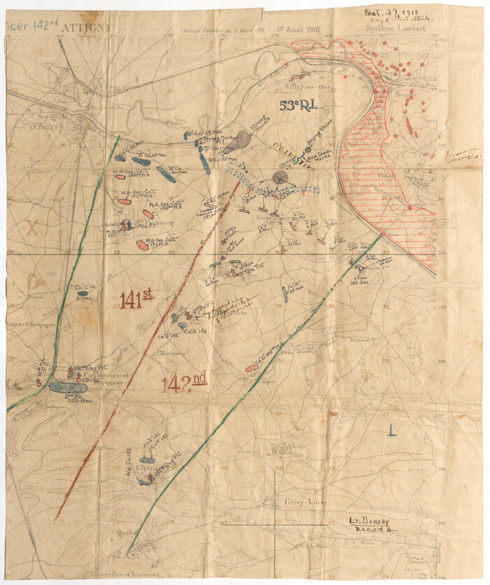
[1/4 of a WWI French map of Attigny used by the 142nd Infantry for planning purposes for the Battle of Forest Ferme (farm)]
1918
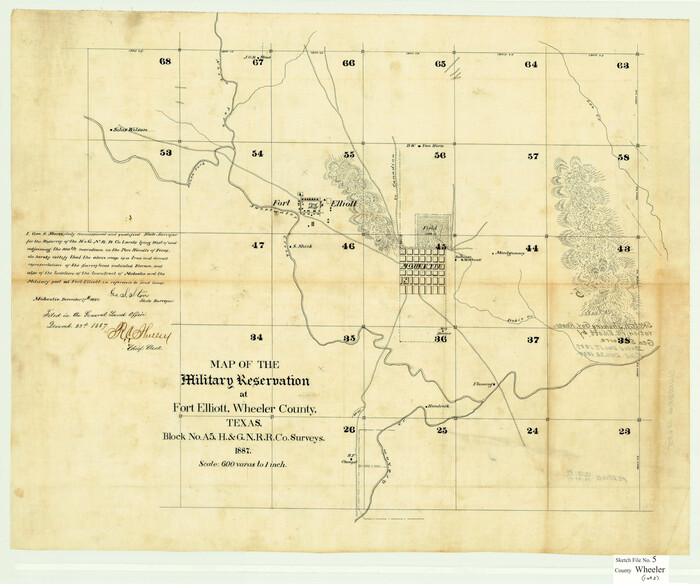
Wheeler County Sketch File 5
1887
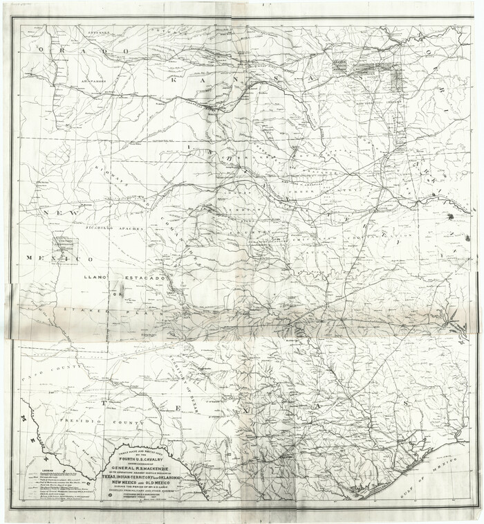
Trails made and routes used by the Fourth U.S. Cavalry under command of General R.S. Mackenzie in its operations against hostile indians in Texas, Indian-Territory (now Oklahoma), New Mexico and Old Mexico during the period of 1871-2-3-4 and 5
1927
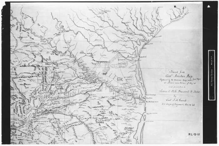
Traced from Genl. Arista's map captured by the American Army under Genl. Taylor at Resaca de la Palma 9th May '46 and presented to James K. Polk, President U. States
1846

Traced from Genl. Arista's map captured by the American Army under Genl. Taylor at Resaca de la Palma 9th May '46 and presented to James K. Polk, President U. States
1846

Traced from Genl. Arista's map captured by the American Army under Genl. Taylor at Resaca de la Palma 9th May '46 and presented to James K. Polk, President U. States
1846
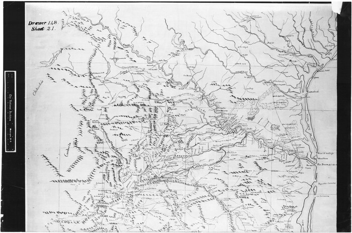
Traced from Genl. Arista's map captured by the American Army under Genl. Taylor at Resaca de la Palma 9th May '46 and presented to James K. Polk, President U. States
1846

Trace of a copy of the map captured at the battle of Resaca de la Palma
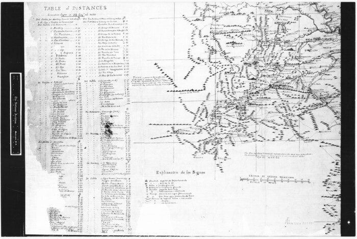
Trace of a copy of the map captured at the battle of Resaca de la Palma
![65405, [Sketch of expeditions, trails in Jones, Taylor, Shackelford, Callahan, Buchanan/Stephens and Eastland Counties], General Map Collection](https://historictexasmaps.com/wmedia_w700/maps/65405.tif.jpg)
[Sketch of expeditions, trails in Jones, Taylor, Shackelford, Callahan, Buchanan/Stephens and Eastland Counties]
1873
-
Size
10.8 x 18.3 inches
-
Map/Doc
65405
-
Creation Date
1873
![65406, [Sketch of expeditions, trails in Jones, Taylor, Shackelford, Callahan, Buchanan/Stephens and Eastland Counties], General Map Collection](https://historictexasmaps.com/wmedia_w700/maps/65406.tif.jpg)
[Sketch of expeditions, trails in Jones, Taylor, Shackelford, Callahan, Buchanan/Stephens and Eastland Counties]
1873
-
Size
10.7 x 18.1 inches
-
Map/Doc
65406
-
Creation Date
1873
![82272, [Sketch of Col. Cooke's Military Road expedition from Red River to Austin], General Map Collection](https://historictexasmaps.com/wmedia_w700/maps/82272-1.tif.jpg)
[Sketch of Col. Cooke's Military Road expedition from Red River to Austin]
-
Size
61.0 x 24.1 inches
-
Map/Doc
82272
![73006, [Reconnaissance report of Lieut. Scariott around Laguna del Madre and up to Fort San Saba], General Map Collection](https://historictexasmaps.com/wmedia_w700/maps/73006.tif.jpg)
[Reconnaissance report of Lieut. Scariott around Laguna del Madre and up to Fort San Saba]
-
Size
25.2 x 18.2 inches
-
Map/Doc
73006
![88600, [Plan for Fort Waul near Gonzales, Texas], National Archives Digital Map Collection](https://historictexasmaps.com/wmedia_w700/maps/88600.tif.jpg)
[Plan for Fort Waul near Gonzales, Texas]
1863
-
Size
12.3 x 20.3 inches
-
Map/Doc
88600
-
Creation Date
1863
![94132, [Movements & Objectives of the 143rd & 144th Infantry on October 9-11, 1918, Appendix E, Nos.2 and 3] - Verso, Non-GLO Digital Images](https://historictexasmaps.com/wmedia_w700/maps/94132-1.tif.jpg)
[Movements & Objectives of the 143rd & 144th Infantry on October 9-11, 1918, Appendix E, Nos.2 and 3] - Verso
1918
-
Size
41.9 x 20.2 inches
-
Map/Doc
94132
-
Creation Date
1918
![94131, [Movements & Objectives of the 143rd & 144th Infantry on October 9-11, 1918, Appendix E, Nos.2 and 3], Non-GLO Digital Images](https://historictexasmaps.com/wmedia_w700/maps/94131-1.tif.jpg)
[Movements & Objectives of the 143rd & 144th Infantry on October 9-11, 1918, Appendix E, Nos.2 and 3]
1918
-
Size
41.6 x 19.9 inches
-
Map/Doc
94131
-
Creation Date
1918
![94124, [Movements & Objectives of the 143rd & 144th Infantry on October 13, 1918, Appendix L], Non-GLO Digital Images](https://historictexasmaps.com/wmedia_w700/maps/94124-1.tif.jpg)
[Movements & Objectives of the 143rd & 144th Infantry on October 13, 1918, Appendix L]
1918
-
Size
16.1 x 16.8 inches
-
Map/Doc
94124
-
Creation Date
1918
![94136, [Movements & Objectives of the 143rd & 144th Infantry on October 12-13, 1918] - Verso, Non-GLO Digital Images](https://historictexasmaps.com/wmedia_w700/maps/94136-1.tif.jpg)
[Movements & Objectives of the 143rd & 144th Infantry on October 12-13, 1918] - Verso
1918
-
Size
42.4 x 30.0 inches
-
Map/Doc
94136
-
Creation Date
1918
![94135, [Movements & Objectives of the 143rd & 144th Infantry on October 12-13, 1918], Non-GLO Digital Images](https://historictexasmaps.com/wmedia_w700/maps/94135-1.tif.jpg)
[Movements & Objectives of the 143rd & 144th Infantry on October 12-13, 1918]
1918
-
Size
42.4 x 30.0 inches
-
Map/Doc
94135
-
Creation Date
1918
![94126, [Movements & Objectives of the 143rd & 144th Infantry on October 12-13, 1918, Appendix E, No.1], Non-GLO Digital Images](https://historictexasmaps.com/wmedia_w700/maps/94126-1.tif.jpg)
[Movements & Objectives of the 143rd & 144th Infantry on October 12-13, 1918, Appendix E, No.1]
1918
-
Size
22.5 x 20.0 inches
-
Map/Doc
94126
-
Creation Date
1918
![94139, [Movements & Objectives of the 143rd & 144th Infantry and many other divisions and regiments, 1918] - Verso, Non-GLO Digital Images](https://historictexasmaps.com/wmedia_w700/maps/94139-1.tif.jpg)
[Movements & Objectives of the 143rd & 144th Infantry and many other divisions and regiments, 1918] - Verso
1918
-
Size
37.2 x 63.9 inches
-
Map/Doc
94139
-
Creation Date
1918
![94138, [Movements & Objectives of the 143rd & 144th Infantry and many other divisions and regiments, 1918], Non-GLO Digital Images](https://historictexasmaps.com/wmedia_w700/maps/94138-1.tif.jpg)
[Movements & Objectives of the 143rd & 144th Infantry and many other divisions and regiments, 1918]
1918
-
Size
64.2 x 37.5 inches
-
Map/Doc
94138
-
Creation Date
1918
![94134, [Movements & Objectives of the 143rd & 144th Infantry & 133rd Machine Gun Battalion on October 8-9, 1918, Appendix E, No. 4] - Verso, Non-GLO Digital Images](https://historictexasmaps.com/wmedia_w700/maps/94134-1.tif.jpg)
[Movements & Objectives of the 143rd & 144th Infantry & 133rd Machine Gun Battalion on October 8-9, 1918, Appendix E, No. 4] - Verso
1918
-
Size
21.5 x 20.0 inches
-
Map/Doc
94134
-
Creation Date
1918
![94133, [Movements & Objectives of the 143rd & 144th Infantry & 133rd Machine Gun Battalion on October 8-9, 1918, Appendix E, No. 4], Non-GLO Digital Images](https://historictexasmaps.com/wmedia_w700/maps/94133-1.tif.jpg)
[Movements & Objectives of the 143rd & 144th Infantry & 133rd Machine Gun Battalion on October 8-9, 1918, Appendix E, No. 4]
1918
-
Size
21.5 x 20.2 inches
-
Map/Doc
94133
-
Creation Date
1918
![3099, [Military surveys on headwaters of Red River], General Map Collection](https://historictexasmaps.com/wmedia_w700/maps/3099-1.tif.jpg)
[Military surveys on headwaters of Red River]
1878
-
Size
31.6 x 39.0 inches
-
Map/Doc
3099
-
Creation Date
1878
![65399, [Map of Lt. Brulls scout in Haskell, Throckmorton, Jones and Shackelford Counties], General Map Collection](https://historictexasmaps.com/wmedia_w700/maps/65399-1.tif.jpg)
[Map of Lt. Brulls scout in Haskell, Throckmorton, Jones and Shackelford Counties]
1873
-
Size
10.1 x 11.9 inches
-
Map/Doc
65399
-
Creation Date
1873
![88603, [Map of Area near Alamo showing proposed fortifications], National Archives Digital Map Collection](https://historictexasmaps.com/wmedia_w700/maps/88603.tif.jpg)
[Map of Area near Alamo showing proposed fortifications]
1863
-
Size
31.9 x 27.7 inches
-
Map/Doc
88603
-
Creation Date
1863
![72706, [Gulf Coast portion of] Map of the State of Texas, General Map Collection](https://historictexasmaps.com/wmedia_w700/maps/72706.tif.jpg)
[Gulf Coast portion of] Map of the State of Texas
1865
-
Size
27.2 x 18.2 inches
-
Map/Doc
72706
-
Creation Date
1865
![94125, [Divisional Boundary and Brigade Boundary on October 22, 1918, Appendix P], Non-GLO Digital Images](https://historictexasmaps.com/wmedia_w700/maps/94125-1.tif.jpg)
[Divisional Boundary and Brigade Boundary on October 22, 1918, Appendix P]
1918
-
Size
16.2 x 16.7 inches
-
Map/Doc
94125
-
Creation Date
1918
![94137, [Defensive Positions of the 143rd & 144th Infantry on October 14, 1918], Non-GLO Digital Images](https://historictexasmaps.com/wmedia_w700/maps/94137-1.tif.jpg)
[Defensive Positions of the 143rd & 144th Infantry on October 14, 1918]
1918
-
Size
42.2 x 30.0 inches
-
Map/Doc
94137
-
Creation Date
1918
![96642, [1/4 of a WWI French map of Attigny used by the 142nd Infantry for planning purposes for the Battle of Forest Ferme (farm)], Non-GLO Digital Images](https://historictexasmaps.com/wmedia_w700/maps/96642.tif.jpg)
[1/4 of a WWI French map of Attigny used by the 142nd Infantry for planning purposes for the Battle of Forest Ferme (farm)]
1918
-
Size
21.1 x 17.7 inches
-
Map/Doc
96642
-
Creation Date
1918

Wheeler County Sketch File 5
1887
-
Size
20.2 x 24.2 inches
-
Map/Doc
12675
-
Creation Date
1887

Trails made and routes used by the Fourth U.S. Cavalry under command of General R.S. Mackenzie in its operations against hostile indians in Texas, Indian-Territory (now Oklahoma), New Mexico and Old Mexico during the period of 1871-2-3-4 and 5
1927
-
Size
37.0 x 34.2 inches
-
Map/Doc
62973
-
Creation Date
1927

Traced from Genl. Arista's map captured by the American Army under Genl. Taylor at Resaca de la Palma 9th May '46 and presented to James K. Polk, President U. States
1846
-
Size
18.4 x 27.6 inches
-
Map/Doc
73059
-
Creation Date
1846

Traced from Genl. Arista's map captured by the American Army under Genl. Taylor at Resaca de la Palma 9th May '46 and presented to James K. Polk, President U. States
1846
-
Size
18.2 x 27.3 inches
-
Map/Doc
73060
-
Creation Date
1846

Traced from Genl. Arista's map captured by the American Army under Genl. Taylor at Resaca de la Palma 9th May '46 and presented to James K. Polk, President U. States
1846
-
Size
18.2 x 27.4 inches
-
Map/Doc
73061
-
Creation Date
1846

Traced from Genl. Arista's map captured by the American Army under Genl. Taylor at Resaca de la Palma 9th May '46 and presented to James K. Polk, President U. States
1846
-
Size
18.1 x 27.3 inches
-
Map/Doc
73062
-
Creation Date
1846

Trace of a copy of the map captured at the battle of Resaca de la Palma
-
Size
18.3 x 27.6 inches
-
Map/Doc
73053

Trace of a copy of the map captured at the battle of Resaca de la Palma
-
Size
18.3 x 27.3 inches
-
Map/Doc
73054