124 results

"The Spirit of the Alamo Lives On"
95290 (3).tif
Price $20.00

"The Spirit of the Alamo Lives On"

2009

Size: 24.0 x 36.0 inches
95290
Texas Land Commissioner Jerry Patterson's Great Military Map of Texas showing Significant Conflicts and Events between 1685 and 1916
83432.tif
Print $20.00 - Digital $50.00

Texas Land Commissioner Jerry Patterson's Great Military Map of Texas showing Significant Conflicts and Events between 1685 and 1916

2006

Size: 36.7 x 24.8 inches
83432
170th Anniversary Land Commissioners of the Texas General Land Office
87177.tif
Print $20.00 - Digital $50.00

170th Anniversary Land Commissioners of the Texas General Land Office

2006
Size: 36.4 x 24.1 inches
87177
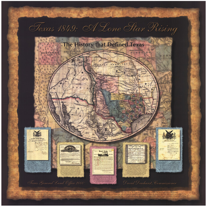
Texas 1849: A Lone Star Rising
78270.tif
Print $20.00 - Digital $50.00

Texas 1849: A Lone Star Rising

2000

Size: 40.6 x 40.7 inches
78270
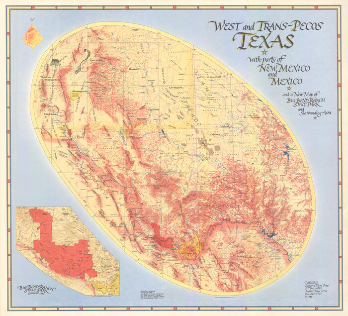
West and Trans-Pecos Texas with parts of New Mexico and Mexico and a New Map of Big Bend Ranch State Park and Surrounding Area
89070.tif
Print $32.48

West and Trans-Pecos Texas with parts of New Mexico and Mexico and a New Map of Big Bend Ranch State Park and Surrounding Area

1988

Size: 28.0 x 31.0 inches
89070
Natural Heritage of Texas
10786.tif
Print $40.00 - Digital $50.00

Natural Heritage of Texas

1986

Size: 54.3 x 56.0 inches
10786
Revolutionary Map of Texas, 1836
89022.tif
Print $27.06

Revolutionary Map of Texas, 1836

1986

Size: 32.7 x 26.7 inches
89022
Commemorative Map of the Republic of Texas, 1845
89023.tif
Print $27.06

Commemorative Map of the Republic of Texas, 1845

1986

Size: 32.7 x 26.7 inches
89023
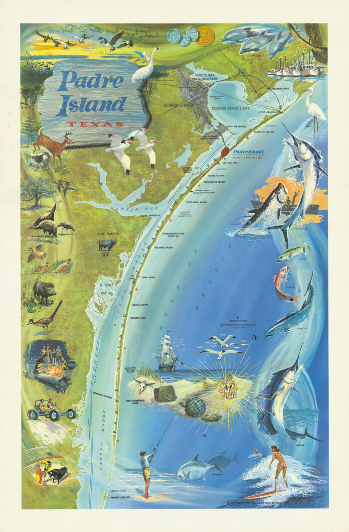
Padre Island, Texas
97196.tif

Padre Island, Texas

1968

Size: 29.8 x 19.5 inches
97196
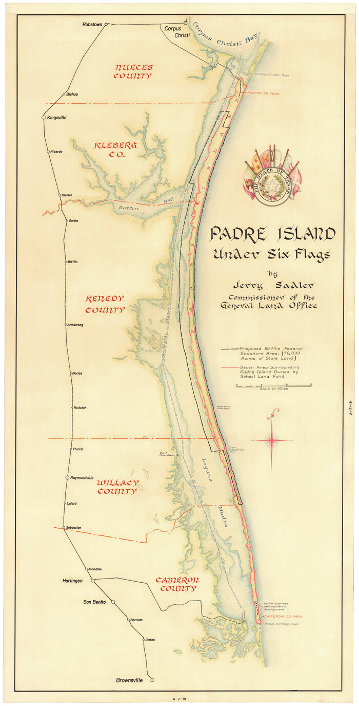
Padre Island Under Six Flags
3123-1.tif
Print $40.00 - Digital $50.00

Padre Island Under Six Flags

1962

Size: 59.3 x 30.3 inches
3123
Padre Island Under Six Flags
3126.tif
Print $40.00 - Digital $50.00

Padre Island Under Six Flags

1962

Size: 63.7 x 36.9 inches
3126
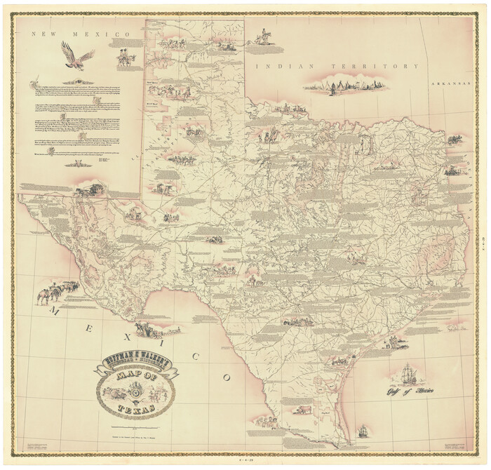
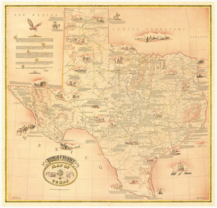
Hoffman and Walker's Pictorial, Historical Map of Texas
2122.tif

Hoffman and Walker's Pictorial, Historical Map of Texas

1960

Size: 44.0 x 45.5 inches
2122
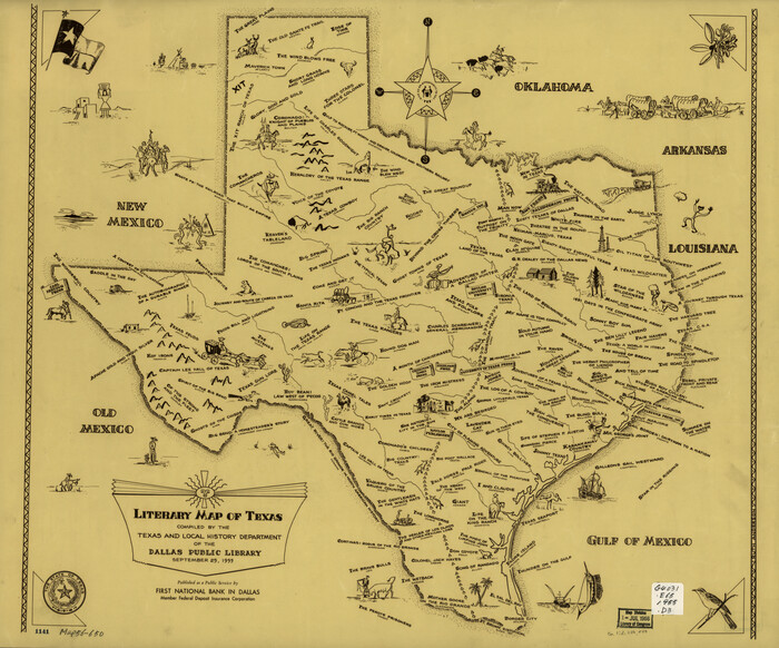
Literary Map of Texas
93563.tif

Literary Map of Texas

1955

Size: 23.2 x 28.0 inches
93563
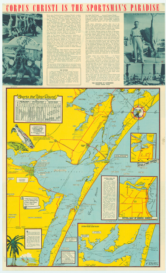
Corpus Christi is the Sportsman's Paradise
79324.tif
Print $20.00

Corpus Christi is the Sportsman's Paradise

1942

Size: 26.7 x 16.3 inches
79324
Corpus Christi is the Sportsman's Paradise
79331.tif
Print $20.00

Corpus Christi is the Sportsman's Paradise

1942

Size: 26.8 x 16.4 inches
79331
A Map of Texas published by the Dallas Morning News for the Texas Almanac and State Industrial Guide
94293.tif

A Map of Texas published by the Dallas Morning News for the Texas Almanac and State Industrial Guide

1936

Size: 20.3 x 26.1 inches
94293
Texas for Tourists, a highway and reference map published by the Dallas Morning News for the Texas Almanac and State Industrial Guide
94294.tif

Texas for Tourists, a highway and reference map published by the Dallas Morning News for the Texas Almanac and State Industrial Guide

1936

Size: 20.3 x 26.4 inches
94294
Map of East Texas Oil Field
93949.tif
Print $20.00 - Digital $50.00

Map of East Texas Oil Field

1933

Size: 16.5 x 17.8 inches
93949
A Historical Map of Texas
93628.tif

A Historical Map of Texas

1930

Size: 26.9 x 28.3 inches
93628
Aeroplane view of business district Amarillo, Texas
93467.tif
Print $20.00

Aeroplane view of business district Amarillo, Texas

1912

Size: 18.9 x 21.4 inches
93467
City and Harbor of Port Arthur Texas, Bird's Eye View Looking South to the Gulf of Mexico
93483.tif
Print $20.00

City and Harbor of Port Arthur Texas, Bird's Eye View Looking South to the Gulf of Mexico

1912

Size: 17.4 x 39.9 inches
93483
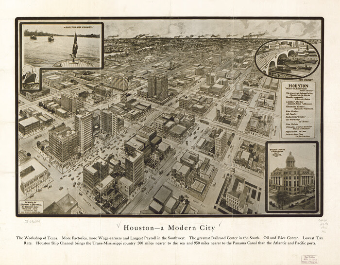
Houston - a Modern City
93482.tif
Print $20.00

Houston - a Modern City

1912

Size: 18.2 x 23.4 inches
93482
Partial View of Austin, Texas
76205.tif
Print $20.00

Partial View of Austin, Texas

1895

Size: 28.4 x 41.8 inches
76205
Map of Hyde Park
76206.tif
Print $20.00 - Digital $50.00

Map of Hyde Park

1895

Size: 41.7 x 28.8 inches
76206
Perspective Map of the City of Laredo, Texas, the Gateway to and from Mexico
89098.tif
Print $20.00

Perspective Map of the City of Laredo, Texas, the Gateway to and from Mexico

1892

Size: 22.1 x 34.2 inches
89098
Waco, Texas 1892
93469-1.tif
Print $20.00

Waco, Texas 1892

1892

Size: 14.5 x 23.9 inches
93469
Dallas, Texas. With the Projected River and Navigation Improvements. Viewed from Above the Sister City of Oak Cliff
93474.tif
Print $20.00

Dallas, Texas. With the Projected River and Navigation Improvements. Viewed from Above the Sister City of Oak Cliff

1892

Size: 20.9 x 29.7 inches
93474
Perspective Map of the City of Laredo, Texas, the Gateway to and from Mexico
93478.tif
Print $20.00

Perspective Map of the City of Laredo, Texas, the Gateway to and from Mexico

1892

Size: 24.0 x 36.7 inches
93478
Greenville, Hunt County, Texas
79749.tif
Print $20.00

Greenville, Hunt County, Texas

1891

Size: 21.9 x 36.5 inches
79749
Perspective Map of Fort Worth, Tex.
89083.tif
Print $20.00

Perspective Map of Fort Worth, Tex.

1891

Size: 19.9 x 33.0 inches
89083
"The Spirit of the Alamo Lives On"
The Spirit of the Alamo Lives On
Print $20.00

"The Spirit of the Alamo Lives On"

2009

Created by artist George L. Skypeck, "The Spirit of the Alamo Lives On" commemorates the storied...

  • Size

    24.0 x 36.0 inches

  • Map/Doc

    95290

  • Creation Date

    2009

Texas Land Commissioner Jerry Patterson's Great Military Map of Texas showing Significant Conflicts and Events between 1685 and 1916
83432, Texas Land Commissioner Jerry Patterson's Great Military Map of Texas showing Significant Conflicts and Events between 1685 and 1916, General Map Collection
Print $20.00 - Digital $50.00

Texas Land Commissioner Jerry Patterson's Great Military Map of Texas showing Significant Conflicts and Events between 1685 and 1916

2006

  • Size

    36.7 x 24.8 inches

  • Map/Doc

    83432

  • Creation Date

    2006

170th Anniversary Land Commissioners of the Texas General Land Office
87177, 170th Anniversary Land Commissioners of the Texas General Land Office, General Map Collection
Print $20.00 - Digital $50.00

170th Anniversary Land Commissioners of the Texas General Land Office

2006

  • Size

    36.4 x 24.1 inches

  • Map/Doc

    87177

  • Creation Date

    2006

Texas 1849: A Lone Star Rising
78270, Texas 1849: A Lone Star Rising, General Map Collection
Print $20.00 - Digital $50.00

Texas 1849: A Lone Star Rising

2000

  • Size

    40.6 x 40.7 inches

  • Map/Doc

    78270

  • Creation Date

    2000

West and Trans-Pecos Texas with parts of New Mexico and Mexico and a New Map of Big Bend Ranch State Park and Surrounding Area
89070, West and Trans-Pecos Texas with parts of New Mexico and Mexico and a New Map of Big Bend Ranch State Park and Surrounding Area, General Map Collection
Print $32.48

West and Trans-Pecos Texas with parts of New Mexico and Mexico and a New Map of Big Bend Ranch State Park and Surrounding Area

1988

  • Size

    28.0 x 31.0 inches

  • Map/Doc

    89070

  • Creation Date

    1988

Natural Heritage of Texas
10786, Natural Heritage of Texas, General Map Collection - 1
Print $40.00 - Digital $50.00

Natural Heritage of Texas

1986

  • Size

    54.3 x 56.0 inches

  • Map/Doc

    10786

  • Creation Date

    1986

Revolutionary Map of Texas, 1836
89022, Revolutionary Map of Texas, 1836, General Map Collection
Print $27.06

Revolutionary Map of Texas, 1836

1986

  • Size

    32.7 x 26.7 inches

  • Map/Doc

    89022

  • Creation Date

    1986

Commemorative Map of the Republic of Texas, 1845
89023, Commemorative Map of the Republic of Texas, 1845, General Map Collection
Print $27.06

Commemorative Map of the Republic of Texas, 1845

1986

  • Size

    32.7 x 26.7 inches

  • Map/Doc

    89023

  • Creation Date

    1986

Padre Island, Texas
97196, Padre Island, Texas, General Map Collection

Padre Island, Texas

1968

  • Size

    29.8 x 19.5 inches

  • Map/Doc

    97196

  • Creation Date

    1968

Padre Island Under Six Flags
3123, Padre Island Under Six Flags, General Map Collection
Print $40.00 - Digital $50.00

Padre Island Under Six Flags

1962

  • Size

    59.3 x 30.3 inches

  • Map/Doc

    3123

  • Creation Date

    1962

Padre Island Under Six Flags
3126, Padre Island Under Six Flags, General Map Collection
Print $40.00 - Digital $50.00

Padre Island Under Six Flags

1962

  • Size

    63.7 x 36.9 inches

  • Map/Doc

    3126

  • Creation Date

    1962

Hoffman and Walker's Pictorial, Historical Map of Texas
2122, Hoffman and Walker's Pictorial, Historical Map of Texas, General Map Collection

Hoffman and Walker's Pictorial, Historical Map of Texas

1960
  • Size

    44.0 x 45.5 inches

  • Map/Doc

    2122

  • Creation Date

    1960

Literary Map of Texas
93563, Literary Map of Texas, Library of Congress

Literary Map of Texas

1955

  • Size

    23.2 x 28.0 inches

  • Map/Doc

    93563

  • Creation Date

    1955

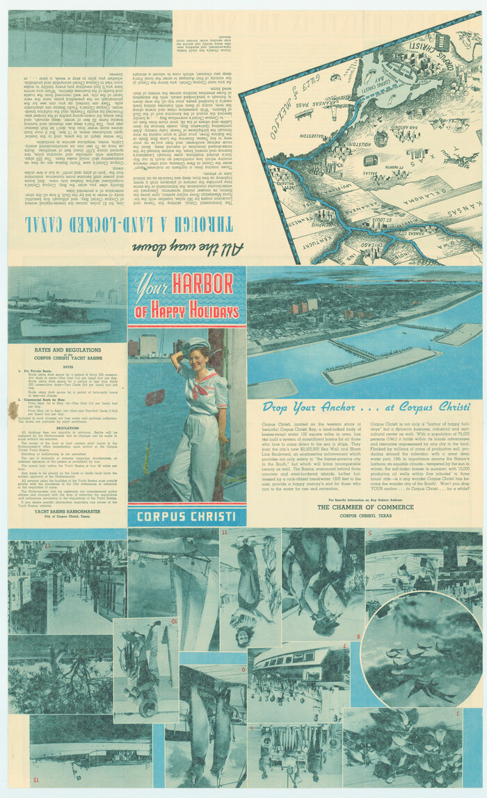
Corpus Christi is the Sportsman's Paradise
79324, Corpus Christi is the Sportsman's Paradise, Texas State Library and Archives
Print $20.00

Corpus Christi is the Sportsman's Paradise

1942
  • Size

    26.7 x 16.3 inches

  • Map/Doc

    79324

  • Creation Date

    1942

Corpus Christi is the Sportsman's Paradise
79331, Corpus Christi is the Sportsman's Paradise, Texas State Library and Archives
Print $20.00

Corpus Christi is the Sportsman's Paradise

1942

  • Size

    26.8 x 16.4 inches

  • Map/Doc

    79331

  • Creation Date

    1942

A Map of Texas published by the Dallas Morning News for the Texas Almanac and State Industrial Guide
94293, A Map of Texas published by the Dallas Morning News for the Texas Almanac and State Industrial Guide, General Map Collection

A Map of Texas published by the Dallas Morning News for the Texas Almanac and State Industrial Guide

1936

  • Size

    20.3 x 26.1 inches

  • Map/Doc

    94293

  • Creation Date

    1936

Texas for Tourists, a highway and reference map published by the Dallas Morning News for the Texas Almanac and State Industrial Guide
94294, Texas for Tourists, a highway and reference map published by the Dallas Morning News for the Texas Almanac and State Industrial Guide, General Map Collection

Texas for Tourists, a highway and reference map published by the Dallas Morning News for the Texas Almanac and State Industrial Guide

1936
  • Size

    20.3 x 26.4 inches

  • Map/Doc

    94294

  • Creation Date

    1936

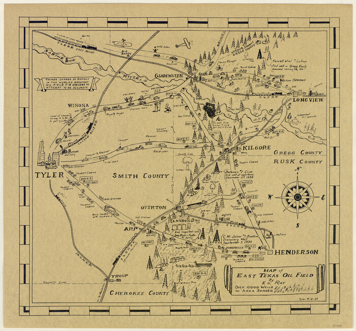
Map of East Texas Oil Field
93949, Map of East Texas Oil Field, Texana Foundation Collection
Print $20.00 - Digital $50.00

Map of East Texas Oil Field

1933

  • Size

    16.5 x 17.8 inches

  • Map/Doc

    93949

  • Creation Date

    1933

A Historical Map of Texas
93628, A Historical Map of Texas, General Map Collection

A Historical Map of Texas

1930

  • Size

    26.9 x 28.3 inches

  • Map/Doc

    93628

  • Creation Date

    1930

Aeroplane view of business district Amarillo, Texas
93467, Aeroplane view of business district Amarillo, Texas, Library of Congress
Print $20.00

Aeroplane view of business district Amarillo, Texas

1912

  • Size

    18.9 x 21.4 inches

  • Map/Doc

    93467

  • Creation Date

    1912

City and Harbor of Port Arthur Texas, Bird's Eye View Looking South to the Gulf of Mexico
93483, City and Harbor of Port Arthur Texas, Bird's Eye View Looking South to the Gulf of Mexico, Library of Congress
Print $20.00

City and Harbor of Port Arthur Texas, Bird's Eye View Looking South to the Gulf of Mexico

1912

  • Size

    17.4 x 39.9 inches

  • Map/Doc

    93483

  • Creation Date

    1912

Houston - a Modern City
93482, Houston - a Modern City, Library of Congress
Print $20.00

Houston - a Modern City

1912

  • Size

    18.2 x 23.4 inches

  • Map/Doc

    93482

  • Creation Date

    1912

Partial View of Austin, Texas
76205, Partial View of Austin, Texas, Texas State Library and Archives
Print $20.00

Partial View of Austin, Texas

1895

  • Size

    28.4 x 41.8 inches

  • Map/Doc

    76205

  • Creation Date

    1895

Map of Hyde Park
76206, Map of Hyde Park, Texas State Library and Archives
Print $20.00 - Digital $50.00

Map of Hyde Park

1895

  • Size

    41.7 x 28.8 inches

  • Map/Doc

    76206

  • Creation Date

    1895

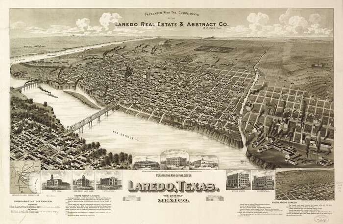
Perspective Map of the City of Laredo, Texas, the Gateway to and from Mexico
89098, Perspective Map of the City of Laredo, Texas, the Gateway to and from Mexico, Non-GLO Digital Images
Print $20.00

Perspective Map of the City of Laredo, Texas, the Gateway to and from Mexico

1892

  • Size

    22.1 x 34.2 inches

  • Map/Doc

    89098

  • Creation Date

    1892

Waco, Texas 1892
93469, Waco, Texas 1892
Print $20.00

Waco, Texas 1892

1892

  • Size

    14.5 x 23.9 inches

  • Map/Doc

    93469

  • Creation Date

    1892

Dallas, Texas. With the Projected River and Navigation Improvements. Viewed from Above the Sister City of Oak Cliff
93474, Dallas, Texas. With the Projected River and Navigation Improvements. Viewed from Above the Sister City of Oak Cliff, Library of Congress
Print $20.00

Dallas, Texas. With the Projected River and Navigation Improvements. Viewed from Above the Sister City of Oak Cliff

1892
  • Size

    20.9 x 29.7 inches

  • Map/Doc

    93474

  • Creation Date

    1892

Perspective Map of the City of Laredo, Texas, the Gateway to and from Mexico
93478, Perspective Map of the City of Laredo, Texas, the Gateway to and from Mexico, Library of Congress
Print $20.00

Perspective Map of the City of Laredo, Texas, the Gateway to and from Mexico

1892

  • Size

    24.0 x 36.7 inches

  • Map/Doc

    93478

  • Creation Date

    1892

Greenville, Hunt County, Texas
79749, Greenville, Hunt County, Texas, Texas State Library and Archives
Print $20.00

Greenville, Hunt County, Texas

1891

  • Size

    21.9 x 36.5 inches

  • Map/Doc

    79749

  • Creation Date

    1891

Perspective Map of Fort Worth, Tex.
89083, Perspective Map of Fort Worth, Tex., Non-GLO Digital Images
Print $20.00

Perspective Map of Fort Worth, Tex.

1891

  • Size

    19.9 x 33.0 inches

  • Map/Doc

    89083

  • Creation Date

    1891