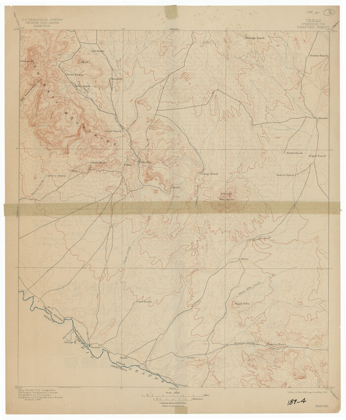
[USGS Topo Quad map of Shafter Sheet, Presidio County]
Print $20.00
- Digital $50.00
[USGS Topo Quad map of Shafter Sheet, Presidio County]
1895
Size: 16.9 x 20.5 inches
91754
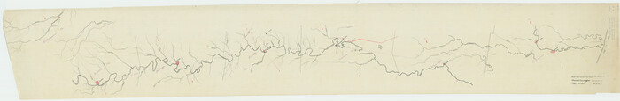
[Traverse up the Brazos and Colorado River showing distance from county site to county site]
Print $40.00
- Digital $50.00
[Traverse up the Brazos and Colorado River showing distance from county site to county site]
1871
Size: 16.2 x 98.8 inches
2054
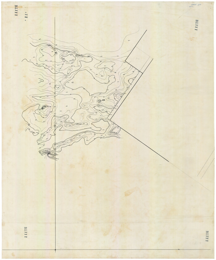
[Topographical Map]
Print $20.00
- Digital $50.00
[Topographical Map]
Size: 31.2 x 37.5 inches
92543
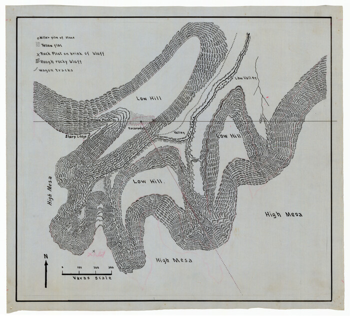
[Sketch showing topography in vicinity of Yellow Point]
Print $20.00
- Digital $50.00
[Sketch showing topography in vicinity of Yellow Point]
Size: 21.4 x 19.2 inches
92137
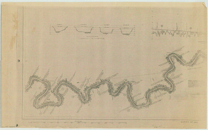
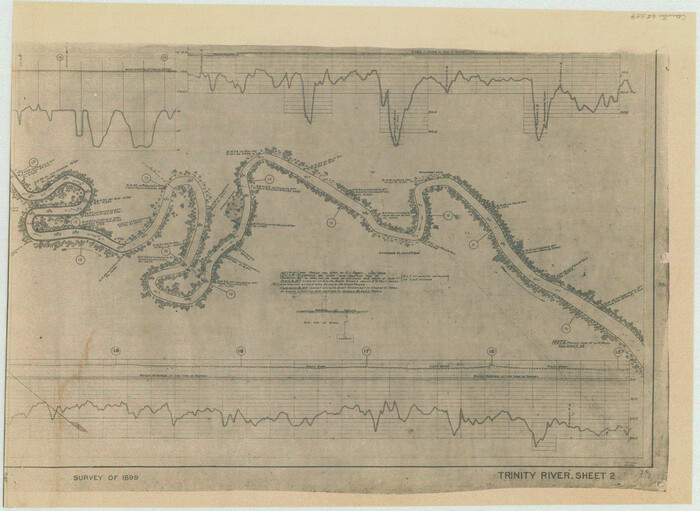
[Plat of Trinity River w/ Midstream Profile in Liberty County by US Government 1899]
Print $20.00
- Digital $50.00
[Plat of Trinity River w/ Midstream Profile in Liberty County by US Government 1899]
1899
Size: 11.5 x 18.3 inches
65335
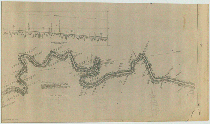
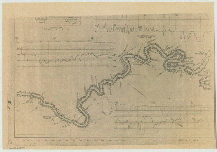
[Plat of Trinity River w/ Midstream Profile in Liberty County by US Government 1899]
Print $20.00
- Digital $50.00
[Plat of Trinity River w/ Midstream Profile in Liberty County by US Government 1899]
1899
Size: 10.8 x 18.3 inches
65336
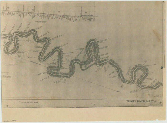
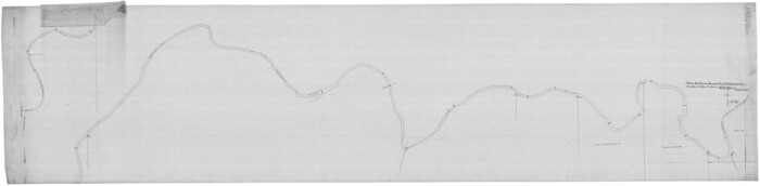
[Plat of Trinity River w/ Midstream Profile in Liberty County by US Government 1899]
Print $20.00
- Digital $50.00
[Plat of Trinity River w/ Midstream Profile in Liberty County by US Government 1899]
1899
Size: 12.3 x 16.7 inches
65337
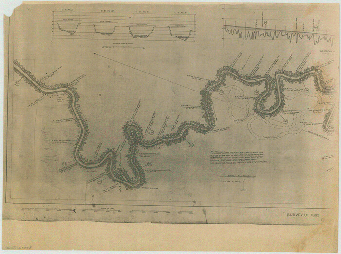
[Plat of Trinity River w/ Midstream Profile in Liberty County by US Government 1899]
Print $20.00
- Digital $50.00
[Plat of Trinity River w/ Midstream Profile in Liberty County by US Government 1899]
1899
Size: 12.5 x 16.8 inches
65338
[Plat of Trinity River w/ Midstream Profile in Liberty County by US Government 1899]
Print $20.00
- Digital $50.00
[Plat of Trinity River w/ Midstream Profile in Liberty County by US Government 1899]
1899
Size: 12.8 x 17.6 inches
65339
[Plat of Trinity River w/ Midstream Profile in Liberty County by US Government 1899]
Print $20.00
- Digital $50.00
[Plat of Trinity River w/ Midstream Profile in Liberty County by US Government 1899]
1899
Size: 12.8 x 18.2 inches
65340
[Plat of Colorado River Survey, McCulloch County]
Print $40.00
- Digital $50.00
[Plat of Colorado River Survey, McCulloch County]
1918
Size: 40.3 x 159.2 inches
2462
[Neches River Bed, Plat and Calculations]
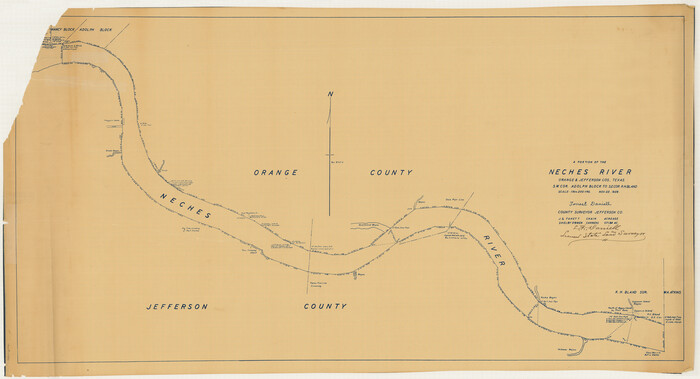
Print $40.00
- Digital $50.00
[Neches River Bed, Plat and Calculations]
1928
Size: 27.3 x 51.0 inches
2466
[Neches River Bed, Plat and Calculations]
Print $20.00
- Digital $50.00
[Neches River Bed, Plat and Calculations]
1928
Size: 25.6 x 37.2 inches
77100
[Neches River Bed, Plat and Calculations]
Print $20.00
- Digital $50.00
[Neches River Bed, Plat and Calculations]
1928
Size: 23.2 x 19.8 inches
77101
[Movements & Objectives of the 143rd & 144th Infantry on October 9-11, 1918, Appendix E, Nos.2 and 3] - Verso
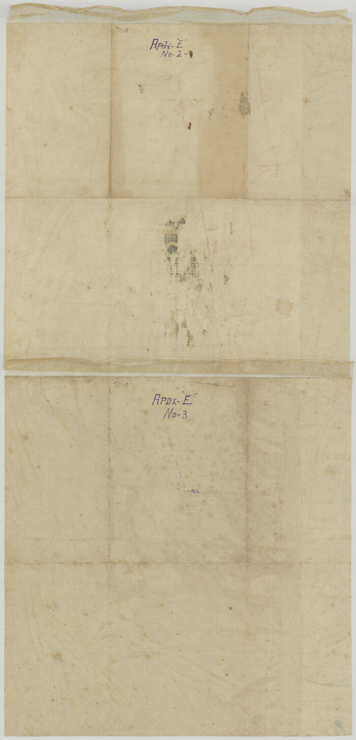
Print $20.00
[Movements & Objectives of the 143rd & 144th Infantry on October 9-11, 1918, Appendix E, Nos.2 and 3] - Verso
1918
Size: 41.9 x 20.2 inches
94132
[Movements & Objectives of the 143rd & 144th Infantry on October 9-11, 1918, Appendix E, Nos.2 and 3]
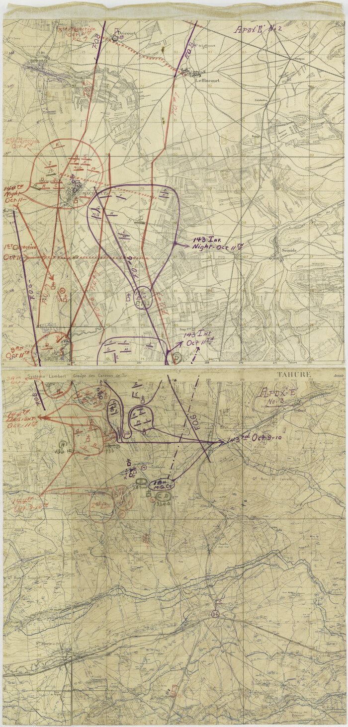
Print $20.00
[Movements & Objectives of the 143rd & 144th Infantry on October 9-11, 1918, Appendix E, Nos.2 and 3]
1918
Size: 41.6 x 19.9 inches
94131
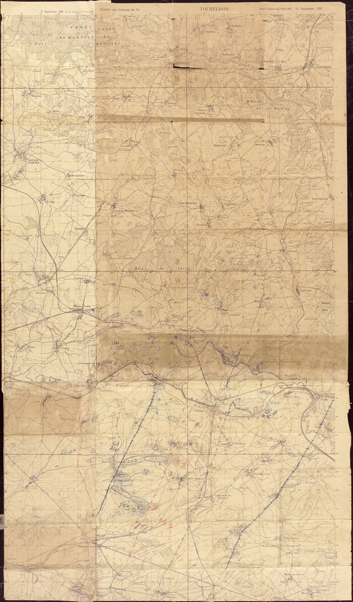
[Movements & Objectives of the 143rd & 144th Infantry on October 13, 1918, Appendix L]
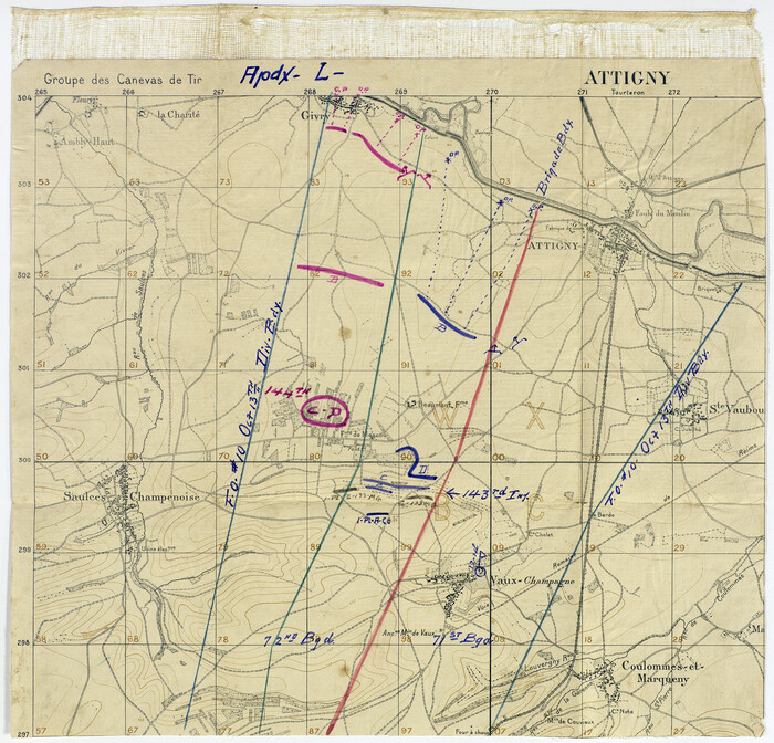
Print $20.00
[Movements & Objectives of the 143rd & 144th Infantry on October 13, 1918, Appendix L]
1918
Size: 16.1 x 16.8 inches
94124
[Movements & Objectives of the 143rd & 144th Infantry on October 12-13, 1918] - Verso
Print $20.00
[Movements & Objectives of the 143rd & 144th Infantry on October 12-13, 1918] - Verso
1918
Size: 42.4 x 30.0 inches
94136
[Movements & Objectives of the 143rd & 144th Infantry on October 12-13, 1918]
Print $20.00
[Movements & Objectives of the 143rd & 144th Infantry on October 12-13, 1918]
1918
Size: 42.4 x 30.0 inches
94135
[Movements & Objectives of the 143rd & 144th Infantry on October 12-13, 1918, Appendix E, No.1]
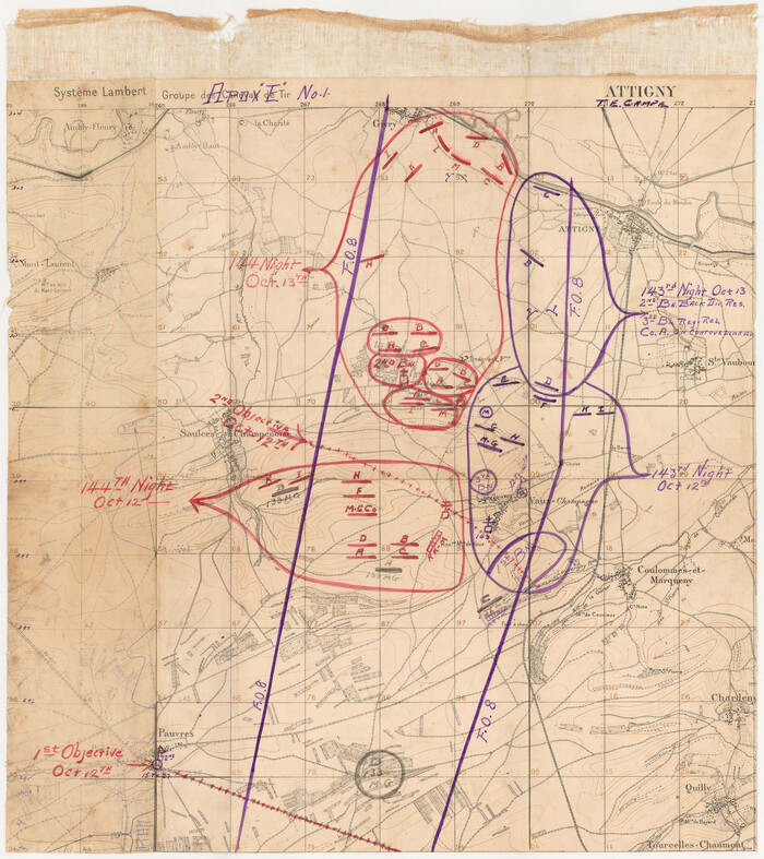
Print $20.00
[Movements & Objectives of the 143rd & 144th Infantry on October 12-13, 1918, Appendix E, No.1]
1918
Size: 22.5 x 20.0 inches
94126
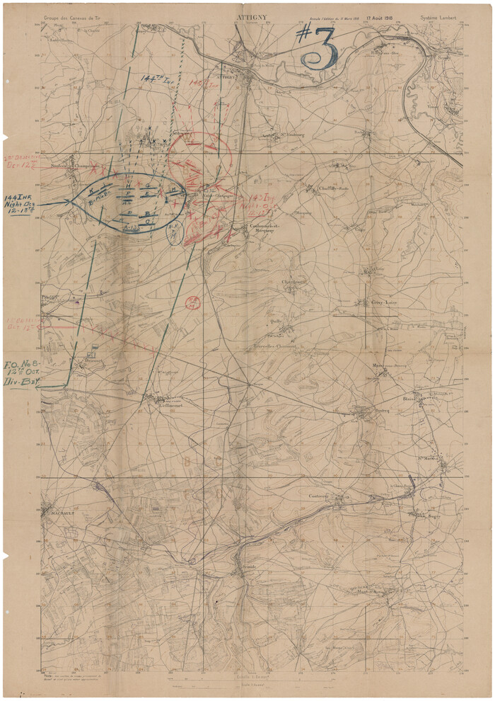
[Movements & Objectives of the 143rd & 144th Infantry and many other divisions and regiments, 1918] - Verso

Print $40.00
[Movements & Objectives of the 143rd & 144th Infantry and many other divisions and regiments, 1918] - Verso
1918
Size: 37.2 x 63.9 inches
94139
[Movements & Objectives of the 143rd & 144th Infantry and many other divisions and regiments, 1918]
Print $40.00
[Movements & Objectives of the 143rd & 144th Infantry and many other divisions and regiments, 1918]
1918
Size: 64.2 x 37.5 inches
94138
[Movements & Objectives of the 143rd & 144th Infantry & 133rd Machine Gun Battalion on October 8-9, 1918, Appendix E, No. 4] - Verso
Print $20.00
[Movements & Objectives of the 143rd & 144th Infantry & 133rd Machine Gun Battalion on October 8-9, 1918, Appendix E, No. 4] - Verso
1918
Size: 21.5 x 20.0 inches
94134
[Movements & Objectives of the 143rd & 144th Infantry & 133rd Machine Gun Battalion on October 8-9, 1918, Appendix E, No. 4]
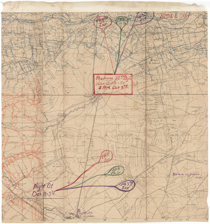
Print $20.00
[Movements & Objectives of the 143rd & 144th Infantry & 133rd Machine Gun Battalion on October 8-9, 1918, Appendix E, No. 4]
1918
Size: 21.5 x 20.2 inches
94133
[Divisional Boundary and Brigade Boundary on October 22, 1918, Appendix P]
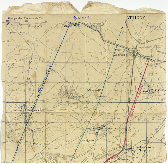
Print $20.00
[Divisional Boundary and Brigade Boundary on October 22, 1918, Appendix P]
1918
Size: 16.2 x 16.7 inches
94125
[Defensive Positions of the 143rd & 144th Infantry on October 14, 1918]
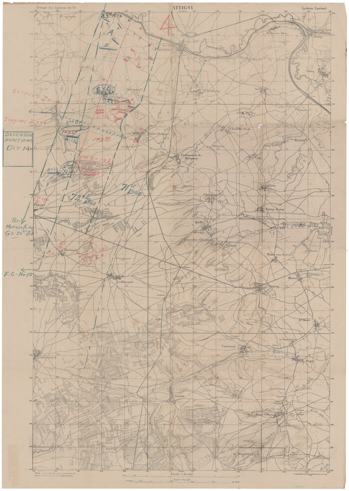
Print $20.00
[Defensive Positions of the 143rd & 144th Infantry on October 14, 1918]
1918
Size: 42.2 x 30.0 inches
94137
[1/4 of a WWI French map of Attigny used by the 142nd Infantry for planning purposes for the Battle of Forest Ferme (farm)]
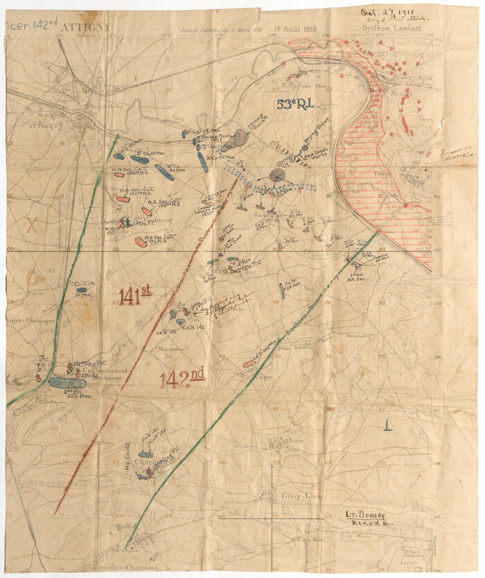
Print $20.00
[1/4 of a WWI French map of Attigny used by the 142nd Infantry for planning purposes for the Battle of Forest Ferme (farm)]
1918
Size: 21.1 x 17.7 inches
96642
Wayland Crossing Sheet Robertson, Limestone and Leon Counties, Navasota River

Print $20.00
- Digital $50.00
Wayland Crossing Sheet Robertson, Limestone and Leon Counties, Navasota River
1934
Size: 43.9 x 40.9 inches
65072
Water-Shed of the Sulphur River in Texas Drainage Area

Print $4.00
- Digital $50.00
Water-Shed of the Sulphur River in Texas Drainage Area
1925
Size: 16.6 x 28.4 inches
65154
Water-Shed of the Pease River Drainage Area

Print $6.00
- Digital $50.00
Water-Shed of the Pease River Drainage Area
Size: 14.9 x 31.0 inches
65102
[USGS Topo Quad map of Shafter Sheet, Presidio County]
Print $20.00
- Digital $50.00
[USGS Topo Quad map of Shafter Sheet, Presidio County]
1895
-
Size
16.9 x 20.5 inches
-
Map/Doc
91754
-
Creation Date
1895
[Traverse up the Brazos and Colorado River showing distance from county site to county site]
Print $40.00
- Digital $50.00
[Traverse up the Brazos and Colorado River showing distance from county site to county site]
1871
-
Size
16.2 x 98.8 inches
-
Map/Doc
2054
-
Creation Date
1871
[Topographical Map]
Print $20.00
- Digital $50.00
[Topographical Map]
-
Size
31.2 x 37.5 inches
-
Map/Doc
92543
[Sketch showing topography in vicinity of Yellow Point]
Print $20.00
- Digital $50.00
[Sketch showing topography in vicinity of Yellow Point]
-
Size
21.4 x 19.2 inches
-
Map/Doc
92137
[Plat of Trinity River w/ Midstream Profile in Liberty County by US Government 1899]
Print $20.00
- Digital $50.00
[Plat of Trinity River w/ Midstream Profile in Liberty County by US Government 1899]
1899
-
Size
11.5 x 18.3 inches
-
Map/Doc
65335
-
Creation Date
1899
[Plat of Trinity River w/ Midstream Profile in Liberty County by US Government 1899]
Print $20.00
- Digital $50.00
[Plat of Trinity River w/ Midstream Profile in Liberty County by US Government 1899]
1899
-
Size
10.8 x 18.3 inches
-
Map/Doc
65336
-
Creation Date
1899
[Plat of Trinity River w/ Midstream Profile in Liberty County by US Government 1899]
Print $20.00
- Digital $50.00
[Plat of Trinity River w/ Midstream Profile in Liberty County by US Government 1899]
1899
-
Size
12.3 x 16.7 inches
-
Map/Doc
65337
-
Creation Date
1899
[Plat of Trinity River w/ Midstream Profile in Liberty County by US Government 1899]
Print $20.00
- Digital $50.00
[Plat of Trinity River w/ Midstream Profile in Liberty County by US Government 1899]
1899
-
Size
12.5 x 16.8 inches
-
Map/Doc
65338
-
Creation Date
1899
[Plat of Trinity River w/ Midstream Profile in Liberty County by US Government 1899]
Print $20.00
- Digital $50.00
[Plat of Trinity River w/ Midstream Profile in Liberty County by US Government 1899]
1899
-
Size
12.8 x 17.6 inches
-
Map/Doc
65339
-
Creation Date
1899
[Plat of Trinity River w/ Midstream Profile in Liberty County by US Government 1899]
Print $20.00
- Digital $50.00
[Plat of Trinity River w/ Midstream Profile in Liberty County by US Government 1899]
1899
-
Size
12.8 x 18.2 inches
-
Map/Doc
65340
-
Creation Date
1899
[Plat of Colorado River Survey, McCulloch County]
Print $40.00
- Digital $50.00
[Plat of Colorado River Survey, McCulloch County]
1918
-
Size
40.3 x 159.2 inches
-
Map/Doc
2462
-
Creation Date
1918
[Neches River Bed, Plat and Calculations]
Print $40.00
- Digital $50.00
[Neches River Bed, Plat and Calculations]
1928
-
Size
27.3 x 51.0 inches
-
Map/Doc
2466
-
Creation Date
1928
[Neches River Bed, Plat and Calculations]
Print $20.00
- Digital $50.00
[Neches River Bed, Plat and Calculations]
1928
-
Size
25.6 x 37.2 inches
-
Map/Doc
77100
-
Creation Date
1928
[Neches River Bed, Plat and Calculations]
Print $20.00
- Digital $50.00
[Neches River Bed, Plat and Calculations]
1928
-
Size
23.2 x 19.8 inches
-
Map/Doc
77101
-
Creation Date
1928
[Movements & Objectives of the 143rd & 144th Infantry on October 9-11, 1918, Appendix E, Nos.2 and 3] - Verso
Print $20.00
[Movements & Objectives of the 143rd & 144th Infantry on October 9-11, 1918, Appendix E, Nos.2 and 3] - Verso
1918
-
Size
41.9 x 20.2 inches
-
Map/Doc
94132
-
Creation Date
1918
[Movements & Objectives of the 143rd & 144th Infantry on October 9-11, 1918, Appendix E, Nos.2 and 3]
Print $20.00
[Movements & Objectives of the 143rd & 144th Infantry on October 9-11, 1918, Appendix E, Nos.2 and 3]
1918
-
Size
41.6 x 19.9 inches
-
Map/Doc
94131
-
Creation Date
1918
[Movements & Objectives of the 143rd & 144th Infantry on October 13, 1918, Appendix L]
Print $20.00
[Movements & Objectives of the 143rd & 144th Infantry on October 13, 1918, Appendix L]
1918
-
Size
16.1 x 16.8 inches
-
Map/Doc
94124
-
Creation Date
1918
[Movements & Objectives of the 143rd & 144th Infantry on October 12-13, 1918] - Verso
Print $20.00
[Movements & Objectives of the 143rd & 144th Infantry on October 12-13, 1918] - Verso
1918
-
Size
42.4 x 30.0 inches
-
Map/Doc
94136
-
Creation Date
1918
[Movements & Objectives of the 143rd & 144th Infantry on October 12-13, 1918]
Print $20.00
[Movements & Objectives of the 143rd & 144th Infantry on October 12-13, 1918]
1918
-
Size
42.4 x 30.0 inches
-
Map/Doc
94135
-
Creation Date
1918
[Movements & Objectives of the 143rd & 144th Infantry on October 12-13, 1918, Appendix E, No.1]
Print $20.00
[Movements & Objectives of the 143rd & 144th Infantry on October 12-13, 1918, Appendix E, No.1]
1918
-
Size
22.5 x 20.0 inches
-
Map/Doc
94126
-
Creation Date
1918
[Movements & Objectives of the 143rd & 144th Infantry and many other divisions and regiments, 1918] - Verso
Print $40.00
[Movements & Objectives of the 143rd & 144th Infantry and many other divisions and regiments, 1918] - Verso
1918
-
Size
37.2 x 63.9 inches
-
Map/Doc
94139
-
Creation Date
1918
[Movements & Objectives of the 143rd & 144th Infantry and many other divisions and regiments, 1918]
Print $40.00
[Movements & Objectives of the 143rd & 144th Infantry and many other divisions and regiments, 1918]
1918
-
Size
64.2 x 37.5 inches
-
Map/Doc
94138
-
Creation Date
1918
[Movements & Objectives of the 143rd & 144th Infantry & 133rd Machine Gun Battalion on October 8-9, 1918, Appendix E, No. 4] - Verso
Print $20.00
[Movements & Objectives of the 143rd & 144th Infantry & 133rd Machine Gun Battalion on October 8-9, 1918, Appendix E, No. 4] - Verso
1918
-
Size
21.5 x 20.0 inches
-
Map/Doc
94134
-
Creation Date
1918
[Movements & Objectives of the 143rd & 144th Infantry & 133rd Machine Gun Battalion on October 8-9, 1918, Appendix E, No. 4]
Print $20.00
[Movements & Objectives of the 143rd & 144th Infantry & 133rd Machine Gun Battalion on October 8-9, 1918, Appendix E, No. 4]
1918
-
Size
21.5 x 20.2 inches
-
Map/Doc
94133
-
Creation Date
1918
[Divisional Boundary and Brigade Boundary on October 22, 1918, Appendix P]
Print $20.00
[Divisional Boundary and Brigade Boundary on October 22, 1918, Appendix P]
1918
-
Size
16.2 x 16.7 inches
-
Map/Doc
94125
-
Creation Date
1918
[Defensive Positions of the 143rd & 144th Infantry on October 14, 1918]
Print $20.00
[Defensive Positions of the 143rd & 144th Infantry on October 14, 1918]
1918
-
Size
42.2 x 30.0 inches
-
Map/Doc
94137
-
Creation Date
1918
[1/4 of a WWI French map of Attigny used by the 142nd Infantry for planning purposes for the Battle of Forest Ferme (farm)]
Print $20.00
[1/4 of a WWI French map of Attigny used by the 142nd Infantry for planning purposes for the Battle of Forest Ferme (farm)]
1918
-
Size
21.1 x 17.7 inches
-
Map/Doc
96642
-
Creation Date
1918
Wayland Crossing Sheet Robertson, Limestone and Leon Counties, Navasota River
Print $20.00
- Digital $50.00
Wayland Crossing Sheet Robertson, Limestone and Leon Counties, Navasota River
1934
-
Size
43.9 x 40.9 inches
-
Map/Doc
65072
-
Creation Date
1934
Water-Shed of the Sulphur River in Texas Drainage Area
Print $4.00
- Digital $50.00
Water-Shed of the Sulphur River in Texas Drainage Area
1925
-
Size
16.6 x 28.4 inches
-
Map/Doc
65154
-
Creation Date
1925
Water-Shed of the Pease River Drainage Area
Print $6.00
- Digital $50.00
Water-Shed of the Pease River Drainage Area
-
Size
14.9 x 31.0 inches
-
Map/Doc
65102