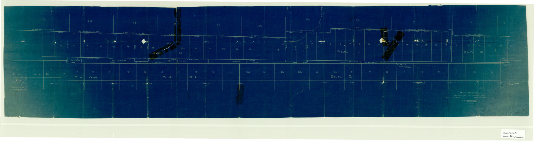
Terry County Sketch File 5
[Map showing vacancy in Terry County in the north part of the county]
-
Map/Doc
10391
-
Collection
General Map Collection
-
Object Dates
10/12/1916 (Creation Date)
-
People and Organizations
W.R. Standefer (Surveyor/Engineer)
-
Counties
Terry
-
Subjects
Surveying Sketch File
-
Height x Width
15.6 x 58.6 inches
39.6 x 148.8 cm
-
Medium
blueprint/diazo
-
Scale
1" = 1000 varas
Part of: General Map Collection
Pecos County Rolled Sketch 93

Print $40.00
- Digital $50.00
Pecos County Rolled Sketch 93
Size 50.3 x 42.8 inches
Map/Doc 9711
Blanco County Boundary File 5

Print $100.00
- Digital $50.00
Blanco County Boundary File 5
Size 17.1 x 14.1 inches
Map/Doc 50555
Uvalde County Sketch File 22

Print $30.00
- Digital $50.00
Uvalde County Sketch File 22
1919
Size 9.7 x 8.6 inches
Map/Doc 39008
Cottle County Sketch File 9

Print $6.00
- Digital $50.00
Cottle County Sketch File 9
1893
Size 16.4 x 10.8 inches
Map/Doc 19487
Jefferson County Rolled Sketch 5

Print $20.00
- Digital $50.00
Jefferson County Rolled Sketch 5
1913
Size 47.0 x 40.7 inches
Map/Doc 9270
Liberty County Sketch File 3

Print $2.00
- Digital $50.00
Liberty County Sketch File 3
1847
Size 13.7 x 8.3 inches
Map/Doc 29884
Walker County Boundary File 1

Print $54.00
- Digital $50.00
Walker County Boundary File 1
Size 14.4 x 8.9 inches
Map/Doc 59655
Kleberg County Rolled Sketch 10-34

Print $20.00
- Digital $50.00
Kleberg County Rolled Sketch 10-34
1952
Size 38.2 x 32.3 inches
Map/Doc 9384
Trinity County Rolled Sketch 1

Print $20.00
- Digital $50.00
Trinity County Rolled Sketch 1
Size 23.0 x 34.7 inches
Map/Doc 8051
Mitchell County Working Sketch 4, draft

Print $40.00
- Digital $50.00
Mitchell County Working Sketch 4, draft
Size 25.7 x 59.5 inches
Map/Doc 78202
Wood County Sketch File 15

Print $5.00
- Digital $50.00
Wood County Sketch File 15
1835
Size 11.0 x 16.3 inches
Map/Doc 40694
McMullen County Working Sketch 36

Print $20.00
- Digital $50.00
McMullen County Working Sketch 36
1963
Size 40.1 x 41.5 inches
Map/Doc 70737
You may also like
Newton County Rolled Sketch 6

Print $20.00
- Digital $50.00
Newton County Rolled Sketch 6
Size 24.9 x 45.7 inches
Map/Doc 6842
Wilson County Sketch File 4

Print $28.00
- Digital $50.00
Wilson County Sketch File 4
1851
Size 8.4 x 7.7 inches
Map/Doc 40404
Travis County Working Sketch 20

Print $20.00
- Digital $50.00
Travis County Working Sketch 20
1945
Size 28.5 x 31.9 inches
Map/Doc 69404
Jim Hogg County Rolled Sketch 6

Print $40.00
- Digital $50.00
Jim Hogg County Rolled Sketch 6
1943
Size 51.9 x 38.4 inches
Map/Doc 9322
Jeff Davis County Sketch File 11

Print $20.00
- Digital $50.00
Jeff Davis County Sketch File 11
Size 17.7 x 29.9 inches
Map/Doc 11858
Sketch of Bull Pasture

Print $3.00
- Digital $50.00
Sketch of Bull Pasture
Size 9.3 x 12.1 inches
Map/Doc 91450
Glasscock County Sketch File 2

Print $20.00
- Digital $50.00
Glasscock County Sketch File 2
1931
Size 35.1 x 16.2 inches
Map/Doc 11559
Brazos River, Brazos River Sheet 1

Print $4.00
- Digital $50.00
Brazos River, Brazos River Sheet 1
1926
Size 21.5 x 25.4 inches
Map/Doc 65293
Cameron County

Print $20.00
- Digital $50.00
Cameron County
1913
Size 30.0 x 33.8 inches
Map/Doc 1793

Brewster County Sketch File NS-9

Print $40.00
- Digital $50.00
Brewster County Sketch File NS-9
1944
Size 14.2 x 8.9 inches
Map/Doc 16135
English Field Notes of the Spanish Archives - Book 3

English Field Notes of the Spanish Archives - Book 3
1835
Map/Doc 96529