![10773, [San Antonio del Encinal Survey and Surveys West Thereof, Brooks County, Texas], Maddox Collection](https://historictexasmaps.com/wmedia_w1800h1800/maps/10773-1.tif.jpg)
[San Antonio del Encinal Survey and Surveys West Thereof, Brooks County, Texas]
-
Map/Doc
10773
-
Collection
Maddox Collection
-
Counties
Brooks
-
Height x Width
18.6 x 24.6 inches
47.2 x 62.5 cm
-
Medium
blueprint/diazo
Part of: Maddox Collection
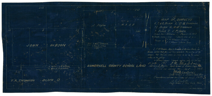
Map of Surveys 6, 7, & 8, Block 1, D.B. Gardner 7 1/2, Block L, D.B. Gardner 7, Block T, J.P. Goen
Print $20.00
- Digital $50.00
Map of Surveys 6, 7, & 8, Block 1, D.B. Gardner 7 1/2, Block L, D.B. Gardner 7, Block T, J.P. Goen
1917
Size 11.0 x 22.6 inches
Map/Doc 10762
[Sketch of Plans and Bill of Material for 38' x 40' Texas Highway Dept. Warehouse]
![450, [Sketch of Plans and Bill of Material for 38' x 40' Texas Highway Dept. Warehouse], Maddox Collection](https://historictexasmaps.com/wmedia_w700/maps/450.tif.jpg)
Print $20.00
- Digital $50.00
[Sketch of Plans and Bill of Material for 38' x 40' Texas Highway Dept. Warehouse]
Size 23.7 x 22.8 inches
Map/Doc 450
Skeleton Map of Nueces County

Print $20.00
- Digital $50.00
Skeleton Map of Nueces County
1907
Size 32.4 x 37.3 inches
Map/Doc 593
Camp County, Texas

Print $3.00
- Digital $50.00
Camp County, Texas
1879
Size 9.6 x 16.8 inches
Map/Doc 512
Map of Tyler County, Texas

Print $20.00
- Digital $50.00
Map of Tyler County, Texas
1879
Size 28.6 x 22.8 inches
Map/Doc 720
Sketch of a part of Galveston Island

Print $3.00
- Digital $50.00
Sketch of a part of Galveston Island
Size 10.8 x 13.8 inches
Map/Doc 430
Castro County, Texas

Print $20.00
- Digital $50.00
Castro County, Texas
1883
Size 20.8 x 18.7 inches
Map/Doc 682
[Map of Zalsamora Pasture and surrounding area]
![408, [Map of Zalsamora Pasture and surrounding area], Maddox Collection](https://historictexasmaps.com/wmedia_w700/maps/408.tif.jpg)
Print $20.00
- Digital $50.00
[Map of Zalsamora Pasture and surrounding area]
Size 33.3 x 24.4 inches
Map/Doc 408
[Map of the San Antonio del Encinal as Corrected]
![4459, [Map of the San Antonio del Encinal as Corrected], Maddox Collection](https://historictexasmaps.com/wmedia_w700/maps/4459.tif.jpg)
Print $20.00
- Digital $50.00
[Map of the San Antonio del Encinal as Corrected]
Size 28.5 x 30.7 inches
Map/Doc 4459
Sketch of Block B, GH & H RR & Blk C, CT RR Co, with surrounding & conflicting surveys in Knox & Baylor Counties

Print $20.00
- Digital $50.00
Sketch of Block B, GH & H RR & Blk C, CT RR Co, with surrounding & conflicting surveys in Knox & Baylor Counties
Size 24.9 x 17.9 inches
Map/Doc 75784
Survey in South Austin for Mr. R.N. Graham

Print $20.00
- Digital $50.00
Survey in South Austin for Mr. R.N. Graham
1915
Size 22.6 x 33.8 inches
Map/Doc 564
Working Sketch in Cottle, Foard & Hardeman Counties

Print $20.00
- Digital $50.00
Working Sketch in Cottle, Foard & Hardeman Counties
1917
Size 26.9 x 28.0 inches
Map/Doc 4485
You may also like
Zavala County Working Sketch 3

Print $20.00
- Digital $50.00
Zavala County Working Sketch 3
1912
Size 37.1 x 46.9 inches
Map/Doc 62078
Presidio County Rolled Sketch 71

Print $20.00
- Digital $50.00
Presidio County Rolled Sketch 71
1941
Size 31.7 x 42.9 inches
Map/Doc 7361
Map Showing Lands Surveyed by Sylvan Sanders, Block D

Print $20.00
- Digital $50.00
Map Showing Lands Surveyed by Sylvan Sanders, Block D
Size 28.9 x 24.2 inches
Map/Doc 92441
Kaufman County Boundary File 1

Print $8.00
- Digital $50.00
Kaufman County Boundary File 1
Size 7.7 x 3.6 inches
Map/Doc 55903
[Texas & Pacific Block 32, T-4-N showing ties to triangulation stations]
![90142, [Texas & Pacific Block 32, T-4-N showing ties to triangulation stations], Twichell Survey Records](https://historictexasmaps.com/wmedia_w700/maps/90142-1.tif.jpg)
Print $20.00
- Digital $50.00
[Texas & Pacific Block 32, T-4-N showing ties to triangulation stations]
Size 20.4 x 11.6 inches
Map/Doc 90142
Township No. 1 South Range No. 24 West of the Indian Meridian

Print $20.00
- Digital $50.00
Township No. 1 South Range No. 24 West of the Indian Meridian
1875
Size 19.2 x 24.4 inches
Map/Doc 75173
Wichita County Working Sketch 16

Print $20.00
- Digital $50.00
Wichita County Working Sketch 16
1939
Size 21.4 x 34.7 inches
Map/Doc 72526
Polk County Sketch File 45

Print $4.00
- Digital $50.00
Polk County Sketch File 45
Size 11.3 x 8.8 inches
Map/Doc 34376
General Highway Map, Kenedy County, Texas

Print $20.00
General Highway Map, Kenedy County, Texas
1961
Size 18.0 x 24.6 inches
Map/Doc 79446
Shackelford County Working Sketch 4

Print $20.00
- Digital $50.00
Shackelford County Working Sketch 4
1935
Size 24.8 x 36.7 inches
Map/Doc 63844
Current Miscellaneous File 106

Print $36.00
- Digital $50.00
Current Miscellaneous File 106
Size 8.6 x 11.3 inches
Map/Doc 74689
Map of North Alamosa Pasture

Print $20.00
- Digital $50.00
Map of North Alamosa Pasture
Size 17.7 x 15.7 inches
Map/Doc 91431