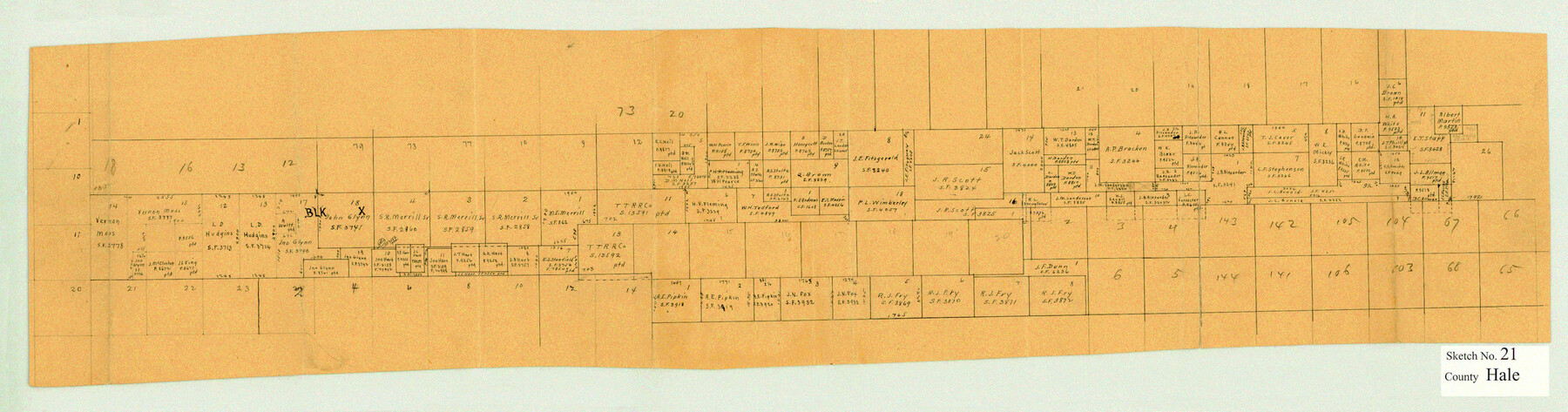
Hale County Sketch File 21
Sketch showing scrap sales in Southern part of Hale Co.
-
Map/Doc
11597
-
Collection
General Map Collection
-
Counties
Hale
-
Subjects
Surveying Sketch File
-
Height x Width
7.0 x 26.6 inches
17.8 x 67.6 cm
-
Medium
paper, manuscript
Part of: General Map Collection
Randall County Rolled Sketch 8

Print $20.00
- Digital $50.00
Randall County Rolled Sketch 8
Size 32.9 x 40.6 inches
Map/Doc 7429
Hunt County Boundary File 2

Print $6.00
- Digital $50.00
Hunt County Boundary File 2
Size 13.0 x 8.1 inches
Map/Doc 55189
Starr County Working Sketch Graphic Index

Print $40.00
- Digital $50.00
Starr County Working Sketch Graphic Index
1977
Size 43.0 x 55.5 inches
Map/Doc 76701
Nueces County Rolled Sketch 36

Print $199.00
- Digital $50.00
Nueces County Rolled Sketch 36
Size 10.7 x 15.2 inches
Map/Doc 47617
Flight Mission No. DCL-4C, Frame 95, Kenedy County

Print $20.00
- Digital $50.00
Flight Mission No. DCL-4C, Frame 95, Kenedy County
1943
Size 18.7 x 22.3 inches
Map/Doc 85816
Hansford County Working Sketch 4

Print $20.00
- Digital $50.00
Hansford County Working Sketch 4
1940
Size 27.6 x 25.4 inches
Map/Doc 63376
Aransas County Sketch File 14a

Print $40.00
- Digital $50.00
Aransas County Sketch File 14a
1891
Size 16.7 x 15.8 inches
Map/Doc 10821
Pecos County Sketch File 63

Print $94.00
- Digital $50.00
Pecos County Sketch File 63
1919
Size 8.1 x 13.9 inches
Map/Doc 33792
Kimble County Rolled Sketch 19

Print $20.00
- Digital $50.00
Kimble County Rolled Sketch 19
Size 38.8 x 33.6 inches
Map/Doc 9339
Dimmit County Sketch File 49

Print $20.00
- Digital $50.00
Dimmit County Sketch File 49
1909
Size 17.3 x 26.8 inches
Map/Doc 11358
Liberty County Sketch File 31

Print $4.00
- Digital $50.00
Liberty County Sketch File 31
Size 12.1 x 7.7 inches
Map/Doc 29959
Matagorda County Sketch File 37

Print $4.00
- Digital $50.00
Matagorda County Sketch File 37
Size 11.3 x 8.8 inches
Map/Doc 30830
You may also like
Schleicher County Sketch File 20

Print $20.00
- Digital $50.00
Schleicher County Sketch File 20
1936
Size 16.8 x 17.4 inches
Map/Doc 12301
Map of subdivision of submerged land in the Gulf of Mexico fronting on Matagorda Island and Peninsula

Print $40.00
- Digital $50.00
Map of subdivision of submerged land in the Gulf of Mexico fronting on Matagorda Island and Peninsula
1940
Size 28.2 x 61.3 inches
Map/Doc 2929
Pecos County Sketch File 54

Print $20.00
- Digital $50.00
Pecos County Sketch File 54
Size 14.5 x 22.4 inches
Map/Doc 12180
Lee County Sketch File 2

Print $4.00
- Digital $50.00
Lee County Sketch File 2
Size 12.7 x 8.3 inches
Map/Doc 29680
Brewster County Rolled Sketch 27

Print $40.00
- Digital $50.00
Brewster County Rolled Sketch 27
Size 35.1 x 48.8 inches
Map/Doc 8474
Edwards County Working Sketch 39

Print $20.00
- Digital $50.00
Edwards County Working Sketch 39
1948
Size 28.7 x 32.3 inches
Map/Doc 68915
Tom Green County Rolled Sketch 8

Print $20.00
- Digital $50.00
Tom Green County Rolled Sketch 8
Size 18.3 x 26.0 inches
Map/Doc 7996
[Galveston, Harrisburg & San Antonio Railroad from Cuero to Stockdale]
![64185, [Galveston, Harrisburg & San Antonio Railroad from Cuero to Stockdale], General Map Collection](https://historictexasmaps.com/wmedia_w700/maps/64185.tif.jpg)
Print $20.00
- Digital $50.00
[Galveston, Harrisburg & San Antonio Railroad from Cuero to Stockdale]
1906
Size 13.6 x 34.0 inches
Map/Doc 64185
Flight Mission No. DQN-1K, Frame 77, Calhoun County

Print $20.00
- Digital $50.00
Flight Mission No. DQN-1K, Frame 77, Calhoun County
1953
Size 18.5 x 22.2 inches
Map/Doc 84162
Plat showing Deed Locations in East Half Section 2, Block E

Print $20.00
- Digital $50.00
Plat showing Deed Locations in East Half Section 2, Block E
Size 16.2 x 30.1 inches
Map/Doc 92736
El Paso County Rolled Sketch 26

Print $20.00
- Digital $50.00
El Paso County Rolled Sketch 26
Size 44.5 x 34.1 inches
Map/Doc 8857
General Highway Map, Reeves County, Texas

Print $20.00
General Highway Map, Reeves County, Texas
1961
Size 24.6 x 18.2 inches
Map/Doc 79638