Val Verde County Sketch File 39
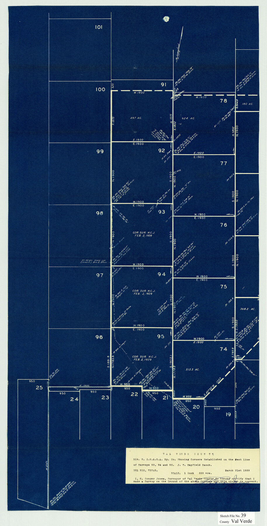
[Sketch of part of Block N, G. H. & S. A. Ry. Co. showing corners established on the west line of surveys 93, 94, and 95 - J.T. Mayfield Ranch northwest from Del Rio]
-
Map/Doc
12581
-
Collection
General Map Collection
-
Object Dates
3/21/1939 (Creation Date)
3/27/1939 (File Date)
-
People and Organizations
H. Conger Jones (Surveyor/Engineer)
-
Counties
Val Verde
-
Subjects
Surveying Sketch File
-
Height x Width
32.0 x 16.2 inches
81.3 x 41.2 cm
-
Medium
blueprint/diazo
-
Scale
1" = 500 varas
-
Features
J.T. Mayfield Ranch
Part of: General Map Collection
Borden County Sketch File 10a

Print $40.00
- Digital $50.00
Borden County Sketch File 10a
Size 21.0 x 37.5 inches
Map/Doc 10935
Leon County Rolled Sketch 9

Print $40.00
- Digital $50.00
Leon County Rolled Sketch 9
1960
Size 50.1 x 35.2 inches
Map/Doc 9430
San Jacinto River and Tributaries, Texas - Survey of 1939

Print $20.00
- Digital $50.00
San Jacinto River and Tributaries, Texas - Survey of 1939
1939
Size 28.0 x 40.3 inches
Map/Doc 60307
Runnels County Sketch File 21A

Print $20.00
Runnels County Sketch File 21A
1886
Size 17.5 x 20.5 inches
Map/Doc 12256
Flight Mission No. CZW-2R, Frame 25, Hardeman County

Print $20.00
- Digital $50.00
Flight Mission No. CZW-2R, Frame 25, Hardeman County
1956
Size 18.7 x 22.4 inches
Map/Doc 85237
Hale County Sketch File 4

Print $20.00
- Digital $50.00
Hale County Sketch File 4
1891
Size 18.8 x 16.4 inches
Map/Doc 11594
Flight Mission No. DCL-6C, Frame 180, Kenedy County

Print $20.00
- Digital $50.00
Flight Mission No. DCL-6C, Frame 180, Kenedy County
1943
Size 18.5 x 22.4 inches
Map/Doc 85992
Trinity River, Crabtree Ferry Sheet

Print $20.00
- Digital $50.00
Trinity River, Crabtree Ferry Sheet
1922
Size 41.9 x 37.8 inches
Map/Doc 65186
Brazoria County Sketch File 14

Print $8.00
- Digital $50.00
Brazoria County Sketch File 14
1892
Size 13.9 x 8.7 inches
Map/Doc 14973
Pecos County Rolled Sketch 95

Print $20.00
- Digital $50.00
Pecos County Rolled Sketch 95
Size 18.6 x 25.9 inches
Map/Doc 7247
Wise County Sketch File 53

Print $12.00
- Digital $50.00
Wise County Sketch File 53
2007
Size 8.5 x 14.0 inches
Map/Doc 87360
Flight Mission No. CGI-3N, Frame 77, Cameron County

Print $20.00
- Digital $50.00
Flight Mission No. CGI-3N, Frame 77, Cameron County
1954
Size 18.6 x 22.2 inches
Map/Doc 84571
You may also like
Flight Mission No. CLL-3N, Frame 45, Willacy County

Print $20.00
- Digital $50.00
Flight Mission No. CLL-3N, Frame 45, Willacy County
1954
Size 18.4 x 22.1 inches
Map/Doc 87103
Pecos County Sketch File 78

Print $6.00
- Digital $50.00
Pecos County Sketch File 78
1943
Size 11.1 x 8.8 inches
Map/Doc 33911
General Highway Map, Marion County, Texas

Print $20.00
General Highway Map, Marion County, Texas
1961
Size 18.2 x 24.6 inches
Map/Doc 79582
Reeves County Sketch File 6

Print $20.00
- Digital $50.00
Reeves County Sketch File 6
Size 17.3 x 28.3 inches
Map/Doc 12242
Flight Mission No. DAG-23K, Frame 22, Matagorda County

Print $20.00
- Digital $50.00
Flight Mission No. DAG-23K, Frame 22, Matagorda County
1953
Size 18.6 x 22.3 inches
Map/Doc 86484

Panorama of the seat of war - Birds eye view of Texas and part of Mexico

Print $20.00
- Digital $50.00
Panorama of the seat of war - Birds eye view of Texas and part of Mexico
1861
Size 24.4 x 31.5 inches
Map/Doc 97250
Flight Mission No. BRA-16M, Frame 140, Jefferson County

Print $20.00
- Digital $50.00
Flight Mission No. BRA-16M, Frame 140, Jefferson County
1953
Size 18.6 x 22.2 inches
Map/Doc 85746
Eastland County Rolled Sketch B

Print $20.00
- Digital $50.00
Eastland County Rolled Sketch B
1893
Size 27.7 x 40.9 inches
Map/Doc 5774
Wharton County Sketch File 26

Print $4.00
- Digital $50.00
Wharton County Sketch File 26
1895
Size 11.0 x 8.8 inches
Map/Doc 39990
Flight Mission No. DCL-4C, Frame 146, Kenedy County

Print $20.00
- Digital $50.00
Flight Mission No. DCL-4C, Frame 146, Kenedy County
1943
Size 18.6 x 22.3 inches
Map/Doc 85824
Loving County Working Sketch 18

Print $40.00
- Digital $50.00
Loving County Working Sketch 18
1978
Size 65.2 x 43.2 inches
Map/Doc 70652