Wise County Sketch File 26b
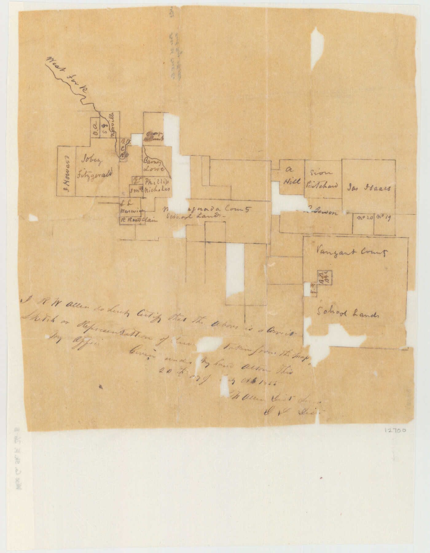
[Sketch of surveys north and west of the Van Zandt County School Land survey southwest from Decatur]
-
Map/Doc
12700
-
Collection
General Map Collection
-
Object Dates
7/20/1855 (Creation Date)
7/31/1855 (File Date)
-
People and Organizations
R.W. Allen (Surveyor/Engineer)
-
Counties
Wise
-
Subjects
Surveying Sketch File
-
Height x Width
13.3 x 19.9 inches
33.8 x 50.6 cm
-
Medium
paper, manuscript
-
Features
West Fork [of Trinity River]
Part of: General Map Collection
Real County Working Sketch 35

Print $20.00
- Digital $50.00
Real County Working Sketch 35
1949
Size 27.7 x 23.6 inches
Map/Doc 71927

Reeves County Working Sketch 16

Print $40.00
- Digital $50.00
Reeves County Working Sketch 16
1961
Size 30.8 x 48.8 inches
Map/Doc 63459
Newton County Working Sketch 27

Print $20.00
- Digital $50.00
Newton County Working Sketch 27
1953
Size 25.9 x 30.0 inches
Map/Doc 71273
Galveston County Working Sketch 24

Print $20.00
- Digital $50.00
Galveston County Working Sketch 24
1939
Size 16.6 x 19.6 inches
Map/Doc 69361
Bowie County Working Sketch 19

Print $20.00
- Digital $50.00
Bowie County Working Sketch 19
1962
Size 23.3 x 17.9 inches
Map/Doc 67423
Harris County Sketch File F

Print $4.00
- Digital $50.00
Harris County Sketch File F
1860
Size 10.1 x 5.1 inches
Map/Doc 25317
Bowie County Working Sketch 23

Print $20.00
- Digital $50.00
Bowie County Working Sketch 23
1969
Size 25.5 x 29.7 inches
Map/Doc 67427
Hill County Sketch File 24a

Print $40.00
- Digital $50.00
Hill County Sketch File 24a
Size 13.2 x 14.3 inches
Map/Doc 26518
Refugio County Sketch File 5

Print $8.00
- Digital $50.00
Refugio County Sketch File 5
1849
Size 12.8 x 8.3 inches
Map/Doc 35245
Bandera County Sketch File 22

Print $4.00
- Digital $50.00
Bandera County Sketch File 22
Size 12.6 x 7.9 inches
Map/Doc 14012
Hockley County Sketch File 19a

Print $20.00
- Digital $50.00
Hockley County Sketch File 19a
1944
Size 15.7 x 25.1 inches
Map/Doc 11776
You may also like
Wilson County Working Sketch 5

Print $20.00
- Digital $50.00
Wilson County Working Sketch 5
1954
Size 32.4 x 33.9 inches
Map/Doc 72585
Val Verde County Working Sketch 100

Print $20.00
- Digital $50.00
Val Verde County Working Sketch 100
1981
Size 22.3 x 32.0 inches
Map/Doc 72235
Flight Mission No. DQO-1K, Frame 117, Galveston County

Print $20.00
- Digital $50.00
Flight Mission No. DQO-1K, Frame 117, Galveston County
1952
Size 18.9 x 22.5 inches
Map/Doc 84995
Hill County Sketch File 17

Print $4.00
- Digital $50.00
Hill County Sketch File 17
1860
Size 12.5 x 8.3 inches
Map/Doc 26484
Plat of South 1/2 of Colorado River Channel in McCulloch Co., Texas from Concho County line down river 34 mile 315 varas

Print $40.00
- Digital $50.00
Plat of South 1/2 of Colorado River Channel in McCulloch Co., Texas from Concho County line down river 34 mile 315 varas
1918
Size 41.1 x 144.3 inches
Map/Doc 76044
Bandera County

Print $40.00
- Digital $50.00
Bandera County
1947
Size 34.2 x 55.3 inches
Map/Doc 95424
General Highway Map, Floyd County, Texas

Print $20.00
General Highway Map, Floyd County, Texas
1961
Size 24.6 x 18.1 inches
Map/Doc 79467
Bowie County Sketch File 9

Print $10.00
- Digital $50.00
Bowie County Sketch File 9
Size 8.1 x 3.9 inches
Map/Doc 14907

Glasscock County

Print $20.00
- Digital $50.00
Glasscock County
1933
Size 46.4 x 38.8 inches
Map/Doc 66838
[Block J and vicinity]
![89949, [Block J and vicinity], Twichell Survey Records](https://historictexasmaps.com/wmedia_w700/maps/89949-1.tif.jpg)
Print $40.00
- Digital $50.00
[Block J and vicinity]
Size 53.3 x 36.9 inches
Map/Doc 89949
Zapata County Rolled Sketch 24

Print $20.00
- Digital $50.00
Zapata County Rolled Sketch 24
Size 38.8 x 28.0 inches
Map/Doc 8318