Blanco County Sketch File 40
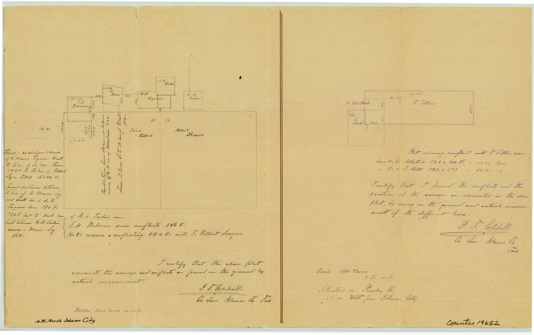
[Two sketches - one area north and one area southwest of Johnson City]
-
Map/Doc
14652
-
Collection
General Map Collection
-
Object Dates
1890/6/2 (File Date)
-
People and Organizations
P.F. Appell (Surveyor/Engineer)
-
Counties
Blanco
-
Subjects
Surveying Sketch File
-
Height x Width
8.9 x 14.1 inches
22.6 x 35.8 cm
-
Medium
paper, manuscript
Part of: General Map Collection
Flight Mission No. BRE-2P, Frame 16, Nueces County

Print $20.00
- Digital $50.00
Flight Mission No. BRE-2P, Frame 16, Nueces County
1956
Size 18.3 x 22.2 inches
Map/Doc 86725
Flight Mission No. CRE-1R, Frame 120, Jackson County

Print $20.00
- Digital $50.00
Flight Mission No. CRE-1R, Frame 120, Jackson County
1956
Size 16.1 x 15.9 inches
Map/Doc 85331
Sketches of Surveys in Montgomery Co.

Print $2.00
- Digital $50.00
Sketches of Surveys in Montgomery Co.
1845
Size 10.2 x 8.0 inches
Map/Doc 69731
Flight Mission No. DQN-5K, Frame 27, Calhoun County

Print $20.00
- Digital $50.00
Flight Mission No. DQN-5K, Frame 27, Calhoun County
1953
Size 18.4 x 22.1 inches
Map/Doc 84378
Sterling County

Print $20.00
- Digital $50.00
Sterling County
1891
Size 23.2 x 17.7 inches
Map/Doc 4056
Trinity River, Boyd Crossing Sheet/Chambers Creek

Print $20.00
- Digital $50.00
Trinity River, Boyd Crossing Sheet/Chambers Creek
1931
Size 17.5 x 43.1 inches
Map/Doc 65238
Menard County Working Sketch 16

Print $40.00
- Digital $50.00
Menard County Working Sketch 16
1946
Size 49.1 x 39.1 inches
Map/Doc 70963
Dallas County Boundary File 4b

Print $12.00
- Digital $50.00
Dallas County Boundary File 4b
Size 10.8 x 8.3 inches
Map/Doc 52154
Edwards County

Print $40.00
- Digital $50.00
Edwards County
1900
Size 47.7 x 59.8 inches
Map/Doc 82082
Wilson County Boundary File 5

Print $20.00
- Digital $50.00
Wilson County Boundary File 5
Size 14.4 x 8.7 inches
Map/Doc 60109
Kinney County Working Sketch 18

Print $40.00
- Digital $50.00
Kinney County Working Sketch 18
1948
Size 56.7 x 40.5 inches
Map/Doc 70200
Dickens County Sketch File H2

Print $4.00
- Digital $50.00
Dickens County Sketch File H2
Size 12.7 x 8.1 inches
Map/Doc 20873
You may also like
Chambers County Rolled Sketch 19

Print $20.00
- Digital $50.00
Chambers County Rolled Sketch 19
Size 39.8 x 44.4 inches
Map/Doc 8588
Comanche County Sketch File 21

Print $20.00
- Digital $50.00
Comanche County Sketch File 21
Size 18.3 x 20.2 inches
Map/Doc 11143
Section 148 Block G Abstract 1639 Cert. 57 Gaines County

Print $20.00
- Digital $50.00
Section 148 Block G Abstract 1639 Cert. 57 Gaines County
Size 13.0 x 13.7 inches
Map/Doc 93228
King County Working Sketch 3

Print $20.00
- Digital $50.00
King County Working Sketch 3
1934
Size 10.4 x 20.1 inches
Map/Doc 70167

Kimble County Sketch File 16

Print $30.00
- Digital $50.00
Kimble County Sketch File 16
1886
Size 8.5 x 7.9 inches
Map/Doc 28942
Map of Potter County

Print $20.00
- Digital $50.00
Map of Potter County
1895
Size 23.6 x 18.6 inches
Map/Doc 4589
Palo Pinto County Working Sketch 27

Print $20.00
- Digital $50.00
Palo Pinto County Working Sketch 27
2006
Map/Doc 83609
Crane County Working Sketch 20

Print $40.00
- Digital $50.00
Crane County Working Sketch 20
1958
Size 61.8 x 38.1 inches
Map/Doc 68297
Stonewall County Working Sketch 3

Print $20.00
- Digital $50.00
Stonewall County Working Sketch 3
1916
Size 22.2 x 17.9 inches
Map/Doc 63997
West Part of Jeff Davis Co.

Print $20.00
- Digital $50.00
West Part of Jeff Davis Co.
1977
Size 36.5 x 47.5 inches
Map/Doc 95545
Flight Mission No. CRE-3R, Frame 42, Jackson County

Print $20.00
- Digital $50.00
Flight Mission No. CRE-3R, Frame 42, Jackson County
1956
Size 18.6 x 22.4 inches
Map/Doc 85389