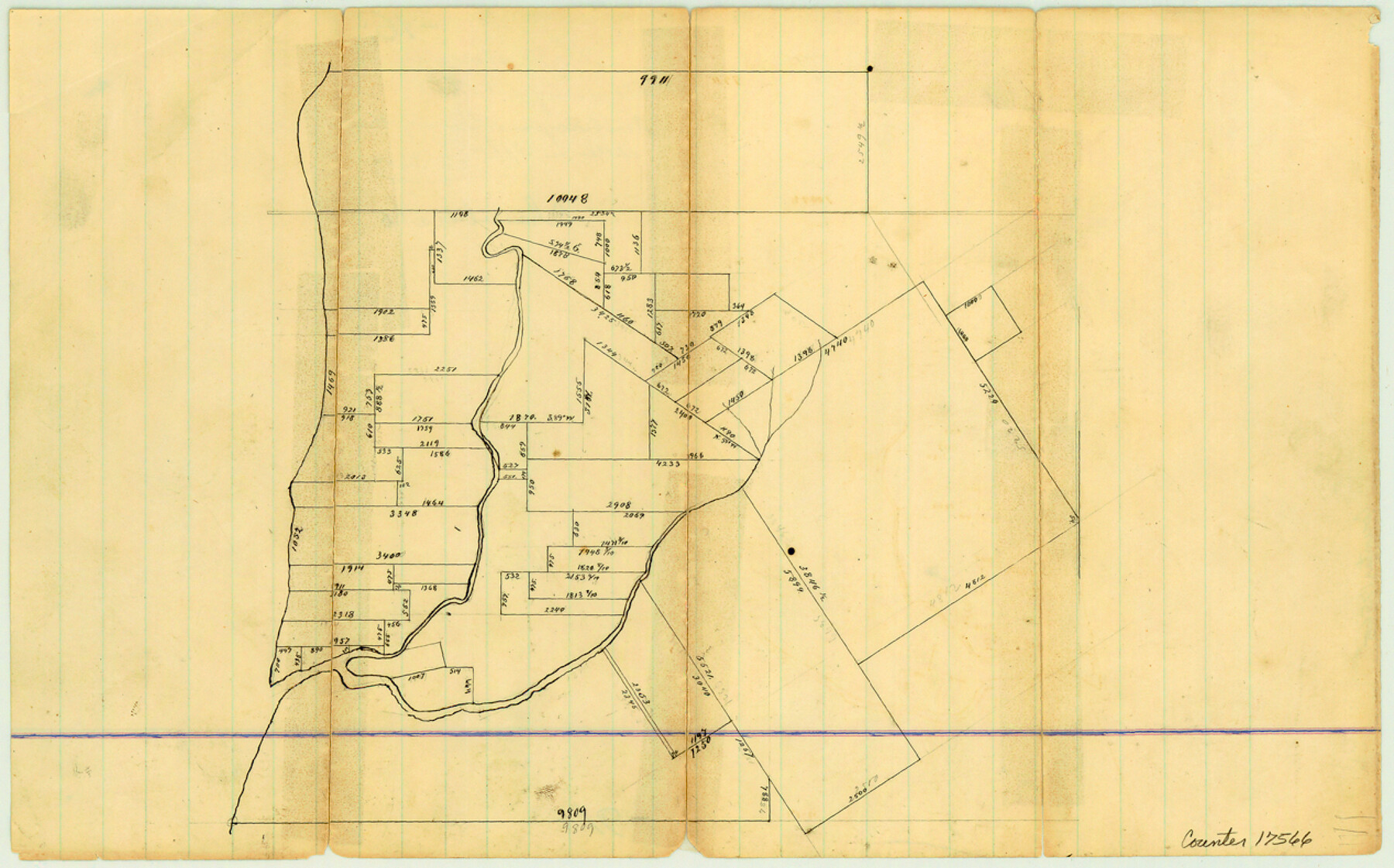
Chambers County Sketch File 16
[Sketch of surveys along Double Bayou and Trinity Bay]
-
Map/Doc
17566
-
Collection
General Map Collection
-
Counties
Chambers
-
Subjects
Surveying Sketch File
-
Height x Width
7.9 x 12.7 inches
20.1 x 32.3 cm
-
Medium
paper, manuscript
-
Features
[Double Bayou]
[Trinity Bayou]
Part of: General Map Collection
Flight Mission No. DQO-12K, Frame 42, Galveston County

Print $20.00
- Digital $50.00
Flight Mission No. DQO-12K, Frame 42, Galveston County
1952
Size 18.6 x 22.3 inches
Map/Doc 85232
Flight Mission No. CRE-3R, Frame 42, Jackson County

Print $20.00
- Digital $50.00
Flight Mission No. CRE-3R, Frame 42, Jackson County
1956
Size 18.6 x 22.4 inches
Map/Doc 85389
Houston County

Print $20.00
- Digital $50.00
Houston County
1888
Size 24.5 x 26.1 inches
Map/Doc 3683
Denton County Working Sketch 18

Print $20.00
- Digital $50.00
Denton County Working Sketch 18
1975
Size 24.1 x 38.8 inches
Map/Doc 68623
Current Miscellaneous File 74

Print $14.00
- Digital $50.00
Current Miscellaneous File 74
1850
Size 11.2 x 8.7 inches
Map/Doc 74181
Taylor County Working Sketch 11

Print $20.00
- Digital $50.00
Taylor County Working Sketch 11
1956
Size 23.0 x 24.4 inches
Map/Doc 69621
Sutton County Sketch File 8

Print $20.00
- Digital $50.00
Sutton County Sketch File 8
1891
Size 24.9 x 31.6 inches
Map/Doc 12379
Webb County Working Sketch 7

Print $20.00
- Digital $50.00
Webb County Working Sketch 7
1909
Size 29.7 x 20.3 inches
Map/Doc 72372
Pecos County Rolled Sketch 139

Print $40.00
- Digital $50.00
Pecos County Rolled Sketch 139
1953
Size 41.0 x 57.4 inches
Map/Doc 9732
Starr County Rolled Sketch 16

Print $20.00
- Digital $50.00
Starr County Rolled Sketch 16
1913
Size 18.6 x 21.9 inches
Map/Doc 7801
Lynn County Boundary File 9

Print $24.00
- Digital $50.00
Lynn County Boundary File 9
Size 11.3 x 8.8 inches
Map/Doc 56657
Floyd County Sketch File 8

Print $40.00
- Digital $50.00
Floyd County Sketch File 8
1878
Map/Doc 93784
You may also like
Tyler County Sketch File 20

Print $6.00
- Digital $50.00
Tyler County Sketch File 20
1851
Size 6.9 x 5.8 inches
Map/Doc 38674
Garza County Boundary File 4

Print $22.00
- Digital $50.00
Garza County Boundary File 4
Size 14.5 x 9.0 inches
Map/Doc 53698
[Bastrop District]
![3131, [Bastrop District], General Map Collection](https://historictexasmaps.com/wmedia_w700/maps/3131.tif.jpg)
Print $40.00
- Digital $50.00
[Bastrop District]
1895
Size 36.5 x 52.0 inches
Map/Doc 3131
Freestone County Working Sketch 18

Print $20.00
- Digital $50.00
Freestone County Working Sketch 18
1980
Size 43.3 x 46.9 inches
Map/Doc 69260
Bandera County Working Sketch 53

Print $20.00
- Digital $50.00
Bandera County Working Sketch 53
1985
Size 34.0 x 36.0 inches
Map/Doc 67649
Harris County Rolled Sketch 66

Print $40.00
- Digital $50.00
Harris County Rolled Sketch 66
1940
Size 36.7 x 51.4 inches
Map/Doc 9129
Kerr County Working Sketch 23

Print $20.00
- Digital $50.00
Kerr County Working Sketch 23
1966
Size 33.4 x 41.0 inches
Map/Doc 70054
Flight Mission No. BRA-16M, Frame 93, Jefferson County

Print $20.00
- Digital $50.00
Flight Mission No. BRA-16M, Frame 93, Jefferson County
1953
Size 18.5 x 22.4 inches
Map/Doc 85705
Kendall County Sketch File 5

Print $4.00
- Digital $50.00
Kendall County Sketch File 5
1854
Size 8.7 x 7.6 inches
Map/Doc 28686
Harris County Boundary File 40

Print $8.00
- Digital $50.00
Harris County Boundary File 40
Size 14.2 x 8.7 inches
Map/Doc 54370
Newton County Sketch File 4b

Print $22.00
- Digital $50.00
Newton County Sketch File 4b
Size 7.6 x 12.2 inches
Map/Doc 32364
Flight Mission No. BQR-13K, Frame 25, Brazoria County

Print $20.00
- Digital $50.00
Flight Mission No. BQR-13K, Frame 25, Brazoria County
1952
Size 18.8 x 22.4 inches
Map/Doc 84073