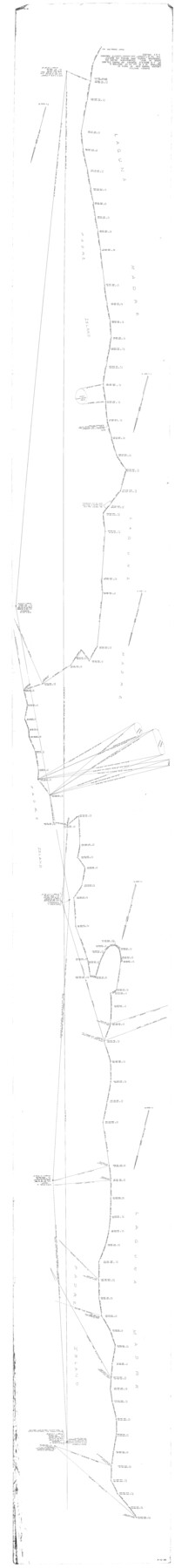
Padre Island
Sketch Showing Parts of Sections 10 and 12 and all of Section 11 of J. S. Boyles' Survey made in 1941
-
Map/Doc
2273
-
Collection
General Map Collection
-
Object Dates
1941 (Creation Date)
-
People and Organizations
Abner G. Trigg (Surveyor/Engineer)
-
Height x Width
241.3 x 30.0 inches
612.9 x 76.2 cm
-
Scale
1" = 500 feet
Part of: General Map Collection
Borden - Garza County Line as agreed upon in the 118th Judicial District Court, Howard County, Texas Case No. 13,023

Print $40.00
- Digital $50.00
Borden - Garza County Line as agreed upon in the 118th Judicial District Court, Howard County, Texas Case No. 13,023
1965
Size 19.0 x 102.2 inches
Map/Doc 1697
Baylor County Aerial Photograph Index Sheet 2

Print $20.00
- Digital $50.00
Baylor County Aerial Photograph Index Sheet 2
1950
Size 22.2 x 15.4 inches
Map/Doc 83664
Liberty County Sketch File 5b

Print $6.00
- Digital $50.00
Liberty County Sketch File 5b
1857
Size 8.0 x 3.5 inches
Map/Doc 29890
Presidio County Sketch File 42

Print $4.00
- Digital $50.00
Presidio County Sketch File 42
1913
Size 10.2 x 8.2 inches
Map/Doc 34518
Armstrong County Boundary File 1 and 1a

Print $10.00
- Digital $50.00
Armstrong County Boundary File 1 and 1a
Size 9.0 x 8.1 inches
Map/Doc 50121
Flight Mission No. DCL-7C, Frame 74, Kenedy County

Print $20.00
- Digital $50.00
Flight Mission No. DCL-7C, Frame 74, Kenedy County
1943
Size 15.4 x 15.1 inches
Map/Doc 86060
Calhoun County Working Sketch 8

Print $20.00
- Digital $50.00
Calhoun County Working Sketch 8
1943
Size 33.9 x 34.8 inches
Map/Doc 67824
Jeff Davis County Rolled Sketch 30

Print $20.00
- Digital $50.00
Jeff Davis County Rolled Sketch 30
Size 35.7 x 29.7 inches
Map/Doc 6378
Coke County Sketch File 34

Print $20.00
- Digital $50.00
Coke County Sketch File 34
1888
Size 17.2 x 21.7 inches
Map/Doc 11116
Palo Pinto County Sketch File 21

Print $20.00
- Digital $50.00
Palo Pinto County Sketch File 21
1896
Size 18.5 x 17.5 inches
Map/Doc 12133
Tom Green County Sketch File 55 1/2

Print $20.00
- Digital $50.00
Tom Green County Sketch File 55 1/2
1886
Size 26.4 x 13.6 inches
Map/Doc 12443
General Chart of the Coast No. XVI - Gulf Coast from Galveston to the Rio Grande

Print $20.00
- Digital $50.00
General Chart of the Coast No. XVI - Gulf Coast from Galveston to the Rio Grande
1883
Size 26.8 x 18.2 inches
Map/Doc 72736
You may also like
Montgomery County Rolled Sketch 43

Print $20.00
- Digital $50.00
Montgomery County Rolled Sketch 43
1971
Size 32.1 x 34.3 inches
Map/Doc 6822
Kendall County Boundary File 2

Print $4.00
- Digital $50.00
Kendall County Boundary File 2
Size 10.2 x 8.2 inches
Map/Doc 55746
Jones County Sketch File 9

Print $22.00
- Digital $50.00
Jones County Sketch File 9
Size 8.3 x 7.5 inches
Map/Doc 28495
Beaumont, Sour Lake and Western Ry. Right of Way and Alignment - Frisco

Print $20.00
- Digital $50.00
Beaumont, Sour Lake and Western Ry. Right of Way and Alignment - Frisco
1910
Size 21.1 x 47.3 inches
Map/Doc 64105
City of San Antonio, Texas

Print $20.00
City of San Antonio, Texas
1889
Size 34.2 x 34.1 inches
Map/Doc 76187
Garza County Sketch File G

Print $8.00
- Digital $50.00
Garza County Sketch File G
1904
Size 14.3 x 8.6 inches
Map/Doc 24026
Upton County Rolled Sketch 22

Print $20.00
- Digital $50.00
Upton County Rolled Sketch 22
Size 21.6 x 27.0 inches
Map/Doc 8073
Armstrong County Sketch File A-9

Print $40.00
- Digital $50.00
Armstrong County Sketch File A-9
1920
Size 13.7 x 35.4 inches
Map/Doc 10851

Pecos County Rolled Sketch 113

Print $20.00
- Digital $50.00
Pecos County Rolled Sketch 113
1942
Size 31.9 x 35.4 inches
Map/Doc 9721
Hemphill County Working Sketch 26

Print $40.00
- Digital $50.00
Hemphill County Working Sketch 26
1974
Size 57.2 x 48.3 inches
Map/Doc 66121
Flight Mission No. CUG-1P, Frame 158, Kleberg County

Print $20.00
- Digital $50.00
Flight Mission No. CUG-1P, Frame 158, Kleberg County
1956
Size 18.5 x 22.3 inches
Map/Doc 86165