Lubbock County Sketch File 9
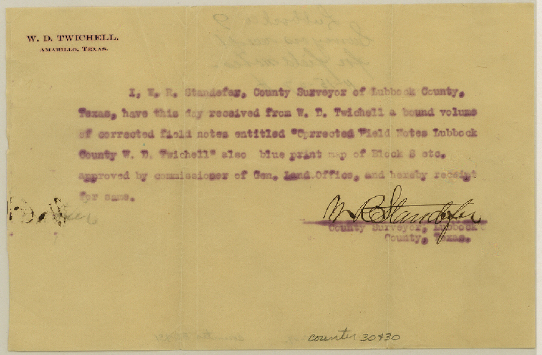
[Receipt for field note books delivered by W. D. Twichell to Lubbock County Surveyor]
-
Map/Doc
30430
-
Collection
General Map Collection
-
Object Dates
11/15/1907 (Creation Date)
-
People and Organizations
W.R. Standefer (Surveyor/Engineer)
W.D. Twichell (Surveyor/Engineer)
-
Counties
Lubbock
-
Subjects
Surveying Sketch File
-
Height x Width
5.7 x 8.7 inches
14.5 x 22.1 cm
-
Medium
paper, print
Part of: General Map Collection
Lamar County Working Sketch 6
![70267, Lamar County Working Sketch 6, General Map Collection](https://historictexasmaps.com/wmedia_w700/maps/70267.tif.jpg)
Print $20.00
- Digital $50.00
Lamar County Working Sketch 6
Size 37.7 x 26.1 inches
Map/Doc 70267
Webb County Sketch File 58
![39846, Webb County Sketch File 58, General Map Collection](https://historictexasmaps.com/wmedia_w700/pdf_converted_jpg/qi_pdf_thumbnail_14973.jpg)
Print $10.00
- Digital $50.00
Webb County Sketch File 58
1942
Size 14.4 x 8.9 inches
Map/Doc 39846
Marion County Rolled Sketch 2
![63912, Marion County Rolled Sketch 2, General Map Collection](https://historictexasmaps.com/wmedia_w700/maps/63912.tif.jpg)
Print $40.00
- Digital $50.00
Marion County Rolled Sketch 2
1954
Size 89.3 x 45.7 inches
Map/Doc 63912
Panola County Sketch File 30
![33505, Panola County Sketch File 30, General Map Collection](https://historictexasmaps.com/wmedia_w700/pdf_converted_jpg/qi_pdf_thumbnail_13493.jpg)
Print $4.00
- Digital $50.00
Panola County Sketch File 30
1944
Size 2.8 x 8.9 inches
Map/Doc 33505
Martin County Rolled Sketch 4
![6665, Martin County Rolled Sketch 4, General Map Collection](https://historictexasmaps.com/wmedia_w700/maps/6665.tif.jpg)
Print $20.00
- Digital $50.00
Martin County Rolled Sketch 4
1908
Size 40.9 x 24.8 inches
Map/Doc 6665
Potter County Boundary File 4b
![58012, Potter County Boundary File 4b, General Map Collection](https://historictexasmaps.com/wmedia_w700/pdf_converted_jpg/qi_pdf_thumbnail_16688.jpg)
Print $20.00
- Digital $50.00
Potter County Boundary File 4b
Size 9.2 x 32.9 inches
Map/Doc 58012
Garza County Working Sketch 2
![63149, Garza County Working Sketch 2, General Map Collection](https://historictexasmaps.com/wmedia_w700/maps/63149.tif.jpg)
Print $20.00
- Digital $50.00
Garza County Working Sketch 2
Size 20.2 x 12.1 inches
Map/Doc 63149
Dickens County Working Sketch 3
![68650, Dickens County Working Sketch 3, General Map Collection](https://historictexasmaps.com/wmedia_w700/maps/68650.tif.jpg)
Print $20.00
- Digital $50.00
Dickens County Working Sketch 3
Size 17.5 x 15.3 inches
Map/Doc 68650
Garza County Rolled Sketch 11 & 11A
![45214, Garza County Rolled Sketch 11 & 11A, General Map Collection](https://historictexasmaps.com/wmedia_w700/pdf_converted_jpg/qi_pdf_thumbnail_15453.jpg)
Print $31.00
- Digital $50.00
Garza County Rolled Sketch 11 & 11A
1915
Size 10.3 x 15.5 inches
Map/Doc 45214
Fannin County Sketch File 22
![22489, Fannin County Sketch File 22, General Map Collection](https://historictexasmaps.com/wmedia_w700/pdf_converted_jpg/qi_pdf_thumbnail_11101.jpg)
Print $6.00
- Digital $50.00
Fannin County Sketch File 22
1883
Size 10.9 x 9.5 inches
Map/Doc 22489
Lavaca County Working Sketch 13
![70366, Lavaca County Working Sketch 13, General Map Collection](https://historictexasmaps.com/wmedia_w700/maps/70366.tif.jpg)
Print $4.00
- Digital $50.00
Lavaca County Working Sketch 13
Size 23.5 x 29.1 inches
Map/Doc 70366
J. De Cordova's Map of the State of Texas Compiled from the records of the General Land Office of the State
![656, J. De Cordova's Map of the State of Texas Compiled from the records of the General Land Office of the State, General Map Collection](https://historictexasmaps.com/wmedia_w700/maps/656.tif.jpg)
Print $20.00
- Digital $50.00
J. De Cordova's Map of the State of Texas Compiled from the records of the General Land Office of the State
1849
Size 34.0 x 31.5 inches
Map/Doc 656
You may also like
Brewster County Rolled Sketch 27
![8474, Brewster County Rolled Sketch 27, General Map Collection](https://historictexasmaps.com/wmedia_w700/maps/8474.tif.jpg)
Print $40.00
- Digital $50.00
Brewster County Rolled Sketch 27
Size 35.1 x 48.8 inches
Map/Doc 8474
[Unorganized County School Land Leagues 284 - 317]
![90856, [Unorganized County School Land Leagues 284 - 317], Twichell Survey Records](https://historictexasmaps.com/wmedia_w700/maps/90856-2.tif.jpg)
Print $20.00
- Digital $50.00
[Unorganized County School Land Leagues 284 - 317]
1902
Size 30.2 x 20.6 inches
Map/Doc 90856
Flight Mission No. BRA-16M, Frame 49, Jefferson County
![85666, Flight Mission No. BRA-16M, Frame 49, Jefferson County, General Map Collection](https://historictexasmaps.com/wmedia_w700/pdf_converted_jpg/qi_pdf_thumbnail_32863.jpg)
Print $20.00
- Digital $50.00
Flight Mission No. BRA-16M, Frame 49, Jefferson County
1953
Size 18.4 x 22.5 inches
Map/Doc 85666
Midland County Sketch File 3
![12081, Midland County Sketch File 3, General Map Collection](https://historictexasmaps.com/wmedia_w700/pdf_converted_jpg/qi_pdf_thumbnail_8425.jpg)
Print $20.00
- Digital $50.00
Midland County Sketch File 3
1886
Size 18.3 x 25.2 inches
Map/Doc 12081
Trinity County Working Sketch 24
![89599, Trinity County Working Sketch 24, General Map Collection](https://historictexasmaps.com/wmedia_w700/maps/89599.tif.jpg)
Print $20.00
- Digital $50.00
Trinity County Working Sketch 24
2010
Size 18.2 x 36.5 inches
Map/Doc 89599
Coleman County Sketch File 31
![10339, Coleman County Sketch File 31, General Map Collection](https://historictexasmaps.com/wmedia_w700/pdf_converted_jpg/qi_pdf_thumbnail_7034.jpg)
Print $20.00
- Digital $50.00
Coleman County Sketch File 31
Size 31.2 x 41.9 inches
Map/Doc 10339
Intracoastal Waterway in Texas - Corpus Christi to Point Isabel including Arroyo Colorado to Mo. Pac. R.R. Bridge Near Harlingen
![61848, Intracoastal Waterway in Texas - Corpus Christi to Point Isabel including Arroyo Colorado to Mo. Pac. R.R. Bridge Near Harlingen, General Map Collection](https://historictexasmaps.com/wmedia_w700/maps/61848.tif.jpg)
Print $20.00
- Digital $50.00
Intracoastal Waterway in Texas - Corpus Christi to Point Isabel including Arroyo Colorado to Mo. Pac. R.R. Bridge Near Harlingen
1933
Size 28.0 x 40.7 inches
Map/Doc 61848
Nacogdoches County Sketch File 11
![32255, Nacogdoches County Sketch File 11, General Map Collection](https://historictexasmaps.com/wmedia_w700/pdf_converted_jpg/qi_pdf_thumbnail_13250.jpg)
Print $2.00
- Digital $50.00
Nacogdoches County Sketch File 11
Size 8.0 x 8.8 inches
Map/Doc 32255
[Movements & Objectives of the 143rd & 144th Infantry & 133rd Machine Gun Battalion on October 8-9, 1918, Appendix E, No. 4]
![94133, [Movements & Objectives of the 143rd & 144th Infantry & 133rd Machine Gun Battalion on October 8-9, 1918, Appendix E, No. 4], Non-GLO Digital Images](https://historictexasmaps.com/wmedia_w700/maps/94133-1.tif.jpg)
Print $20.00
[Movements & Objectives of the 143rd & 144th Infantry & 133rd Machine Gun Battalion on October 8-9, 1918, Appendix E, No. 4]
1918
Size 21.5 x 20.2 inches
Map/Doc 94133
Flight Mission No. DQN-2K, Frame 141, Calhoun County
![84310, Flight Mission No. DQN-2K, Frame 141, Calhoun County, General Map Collection](https://historictexasmaps.com/wmedia_w700/pdf_converted_jpg/qi_pdf_thumbnail_31528.jpg)
Print $20.00
- Digital $50.00
Flight Mission No. DQN-2K, Frame 141, Calhoun County
1953
Size 17.3 x 15.8 inches
Map/Doc 84310
College Heights a Subdivision of Outlots 8-9 and 62, Division B, Austin, Texas
![5055, College Heights a Subdivision of Outlots 8-9 and 62, Division B, Austin, Texas, Maddox Collection](https://historictexasmaps.com/wmedia_w700/maps/5055.tif.jpg)
Print $20.00
- Digital $50.00
College Heights a Subdivision of Outlots 8-9 and 62, Division B, Austin, Texas
Size 18.5 x 14.9 inches
Map/Doc 5055
Flight Mission No. BRA-16M, Frame 61, Jefferson County
![85678, Flight Mission No. BRA-16M, Frame 61, Jefferson County, General Map Collection](https://historictexasmaps.com/wmedia_w700/pdf_converted_jpg/qi_pdf_thumbnail_32875.jpg)
Print $20.00
- Digital $50.00
Flight Mission No. BRA-16M, Frame 61, Jefferson County
1953
Size 18.6 x 22.2 inches
Map/Doc 85678