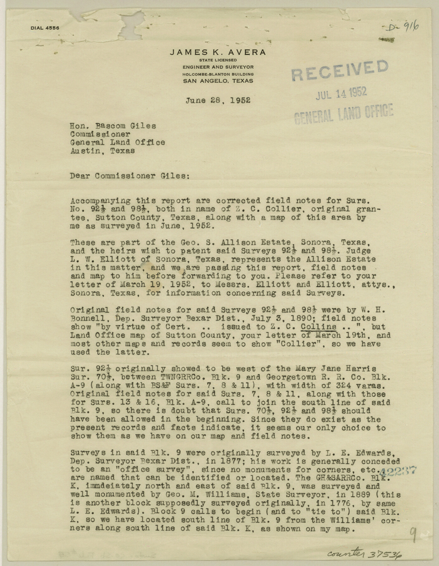
Sutton County Sketch File 55
[Report regarding resurvey of T. W. N. G. RR. Co. Block 9 and Z. C. Collier surveys 92 1/2 and 98 1/2]
-
Map/Doc
37536
-
Collection
General Map Collection
-
Object Dates
6/1952 (Creation Date)
7/14/1952 (File Date)
6/28/1952 (Correspondence Date)
7/3/1890 (Survey Date)
1877 (Survey Date)
1889 (Survey Date)
6/1952 (Survey Date)
-
People and Organizations
James K. Avera (Surveyor/Engineer)
W.H. Bonnell (Surveyor/Engineer)
L.E. Edwards (Surveyor/Engineer)
George M. Williams (Surveyor/Engineer)
Edgar C. Saunders (Surveyor/Engineer)
-
Counties
Sutton
-
Subjects
Surveying Sketch File
-
Height x Width
11.3 x 8.8 inches
28.7 x 22.4 cm
-
Medium
multi-page, multi-format
-
Scale
1" = 1000 varas
-
Features
Sonora
Part of: General Map Collection
Ector County Rolled Sketch 11

Print $20.00
- Digital $50.00
Ector County Rolled Sketch 11
1947
Size 47.5 x 38.8 inches
Map/Doc 8839
Outer Continental Shelf Leasing Maps (Texas Offshore Operations)

Print $20.00
- Digital $50.00
Outer Continental Shelf Leasing Maps (Texas Offshore Operations)
Size 17.3 x 16.7 inches
Map/Doc 75841
Terrell County Rolled Sketch 45

Print $40.00
- Digital $50.00
Terrell County Rolled Sketch 45
1953
Size 33.5 x 51.7 inches
Map/Doc 9991
Wharton County Sketch File 3a

Print $4.00
- Digital $50.00
Wharton County Sketch File 3a
1875
Size 6.8 x 4.6 inches
Map/Doc 39917
[Sketch for Mineral Application 26649-26650 - Sabine River, Harry A. Wolan]
![65566, [Sketch for Mineral Application 26649-26650 - Sabine River, Harry A. Wolan], General Map Collection](https://historictexasmaps.com/wmedia_w700/maps/65566.tif.jpg)
Print $40.00
- Digital $50.00
[Sketch for Mineral Application 26649-26650 - Sabine River, Harry A. Wolan]
Size 72.0 x 36.9 inches
Map/Doc 65566
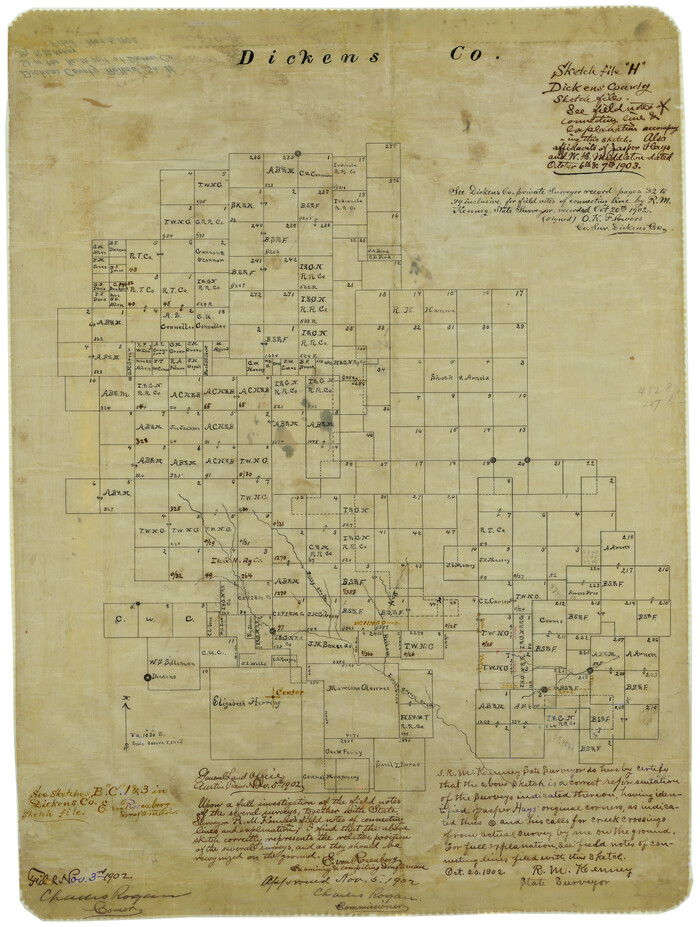
Dickens County Rolled Sketch H
Print $20.00
- Digital $50.00
Dickens County Rolled Sketch H
1902
Size 26.4 x 19.1 inches
Map/Doc 5712
Angelina County Working Sketch 33

Print $20.00
- Digital $50.00
Angelina County Working Sketch 33
1955
Size 22.7 x 24.2 inches
Map/Doc 67116
Navarro County Rolled Sketch 4

Print $20.00
- Digital $50.00
Navarro County Rolled Sketch 4
1953
Size 27.1 x 29.8 inches
Map/Doc 6839
Sabine Pass and mouth of the River Sabine

Print $20.00
- Digital $50.00
Sabine Pass and mouth of the River Sabine
1840
Size 27.0 x 18.3 inches
Map/Doc 72726
Jefferson County Rolled Sketch 3

Print $20.00
- Digital $50.00
Jefferson County Rolled Sketch 3
1909
Size 36.0 x 16.2 inches
Map/Doc 6384
Montague County Working Sketch 24

Print $20.00
- Digital $50.00
Montague County Working Sketch 24
1953
Size 21.9 x 27.6 inches
Map/Doc 71090
Supreme Court of the United States, October Term, 1924, No. 13, Original - The State of Oklahoma, Complainant vs. The State of Texas, Defendant, The United States, Intervener

Print $20.00
- Digital $50.00
Supreme Court of the United States, October Term, 1924, No. 13, Original - The State of Oklahoma, Complainant vs. The State of Texas, Defendant, The United States, Intervener
1924
Size 16.5 x 33.1 inches
Map/Doc 75113
You may also like
[Surveys to the North and West of the Francis Blundell survey containing townsite]
![90884, [Surveys to the North and West of the Francis Blundell survey containing townsite], Twichell Survey Records](https://historictexasmaps.com/wmedia_w700/maps/90884-1.tif.jpg)
Print $20.00
- Digital $50.00
[Surveys to the North and West of the Francis Blundell survey containing townsite]
Size 26.3 x 19.8 inches
Map/Doc 90884

Map of Shackelford County

Print $20.00
- Digital $50.00
Map of Shackelford County
1878
Size 25.0 x 20.2 inches
Map/Doc 4025
Sabine County

Print $20.00
- Digital $50.00
Sabine County
1920
Size 44.6 x 35.1 inches
Map/Doc 16805
Lamar County Working Sketch 7

Print $20.00
- Digital $50.00
Lamar County Working Sketch 7
1964
Size 18.7 x 17.6 inches
Map/Doc 70268
Flight Mission No. DAG-21K, Frame 36, Matagorda County

Print $20.00
- Digital $50.00
Flight Mission No. DAG-21K, Frame 36, Matagorda County
1952
Size 18.5 x 22.3 inches
Map/Doc 86403
Van Zandt County Boundary File 2a

Print $20.00
- Digital $50.00
Van Zandt County Boundary File 2a
Size 20.3 x 20.1 inches
Map/Doc 59649
Fannin County Rolled Sketch 18C

Print $20.00
- Digital $50.00
Fannin County Rolled Sketch 18C
Size 16.0 x 12.9 inches
Map/Doc 5870
Duval County Rolled Sketch 14

Print $20.00
- Digital $50.00
Duval County Rolled Sketch 14
1940
Size 35.8 x 25.9 inches
Map/Doc 5736
Crockett County Rolled Sketch 46C

Print $20.00
- Digital $50.00
Crockett County Rolled Sketch 46C
1954
Size 25.3 x 31.6 inches
Map/Doc 5782
Brooks County Rolled Sketch 11A

Print $20.00
- Digital $50.00
Brooks County Rolled Sketch 11A
1906
Size 18.1 x 24.6 inches
Map/Doc 76060
Right of Way and Track Map of The Missouri, Kansas & Texas Railway of Texas

Print $40.00
- Digital $50.00
Right of Way and Track Map of The Missouri, Kansas & Texas Railway of Texas
1918
Size 25.4 x 75.5 inches
Map/Doc 64533